Buckland
Civil Parish in Hertfordshire East Hertfordshire
England
Buckland
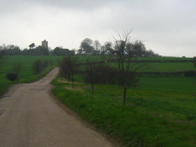
Buckland is a small civil parish located in the county of Hertfordshire, England. Situated approximately 3 miles east of the town of Tring, Buckland encompasses an area of around 4 square miles. The parish is primarily rural, characterized by rolling hills and a tranquil countryside setting.
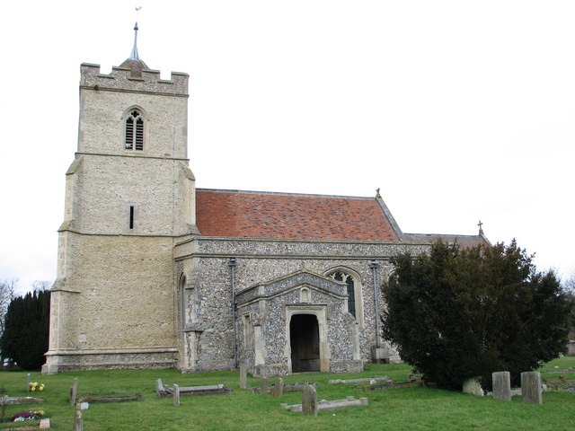
The village of Buckland itself is home to a population of around 500 residents. It is known for its picturesque charm, with a collection of traditional cottages and historic buildings lining its narrow streets. The centerpiece of the village is the 12th-century St. Mary's Church, a Grade II listed building that stands as a testament to the area's rich history.
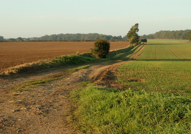
Agriculture has long been an important aspect of Buckland's economy, with farming playing a significant role in the parish's livelihood. The surrounding fields are predominantly used for grazing livestock and cultivating crops, contributing to the area's bucolic landscape.
Despite its small size, Buckland boasts a close-knit community and a range of amenities for its residents. These include a local pub, a village hall, and a primary school, providing a sense of community and convenience for its inhabitants.
Buckland is also surrounded by an abundance of natural beauty, with the nearby Chiltern Hills offering stunning walking trails and panoramic views of the countryside. The area is a haven for outdoor enthusiasts, attracting visitors from far and wide.
Overall, Buckland is a quintessential English village, offering a peaceful and idyllic rural lifestyle, steeped in history and natural beauty.
If you have any feedback on the listing, please let us know in the comments section below.
Buckland Images
Images are sourced within 2km of 51.980805/-0.020127 or Grid Reference TL3633. Thanks to Geograph Open Source API. All images are credited.


Buckland is located at Grid Ref: TL3633 (Lat: 51.980805, Lng: -0.020127)
Administrative County: Hertfordshire
District: East Hertfordshire
Police Authority: Hertfordshire
What 3 Words
///splints.perfect.scale. Near Buntingford, Hertfordshire
Nearby Locations
Related Wikis

Buckland, Hertfordshire
Buckland is a village and civil parish in the East Hertfordshire district of Hertfordshire, England. The village is situated on the A10 road, with the...

St Andrew's Church, Buckland
St Andrew's Church is a redundant Anglican church in the village of Buckland, Hertfordshire, England. It is recorded in the National Heritage List for...

Chipping, Hertfordshire
Chipping is a hamlet in the civil parish of Buckland in the East Hertfordshire district, in the county of Hertfordshire, England. Situated along the A10...

Hawkins Wood
Hawkins Wood is a 10 hectare nature reserve south of Therfield in Hertfordshire. It is managed by the Herts and Middlesex Wildlife Trust.The wood is thought...

Reed, Hertfordshire
Reed is a small village and civil parish in North Hertfordshire. It is situated on a chalk ridge, approximately 3 miles (4.8 km) south of the market town...

Barkway
Barkway is a long-established village and civil parish in the North Hertfordshire district of Hertfordshire, England, about five miles south-east of...

Freman College
Freman College is an upper school and sixth form with academy status in Buntingford, Hertfordshire, England. It was established as Ward Freman School in...

River Quin
The River Quin is a small watercourse which rises near Barkway in north east Hertfordshire, England. The river is fed by a number of sources including...
Nearby Amenities
Located within 500m of 51.980805,-0.020127Have you been to Buckland?
Leave your review of Buckland below (or comments, questions and feedback).