Buckhurst Hill

Civil Parish in Essex Epping Forest

England

Buckhurst Hill

Butler's Retreat, Chingford A coffee shop on the edge of Epping Forest. Listed Grade II. The building on the extreme left is Queen Elizabeth's Hunting Lodge.
Butler's Retreat, Chingford Credit: Chris Allen

Buckhurst Hill is a civil parish located in the county of Essex, England. Situated approximately 12 miles northeast of central London, the area falls within the Epping Forest district. The parish is bordered by Chigwell to the north, Loughton to the west, Woodford Green to the east, and Chingford in the London Borough of Waltham Forest to the south.

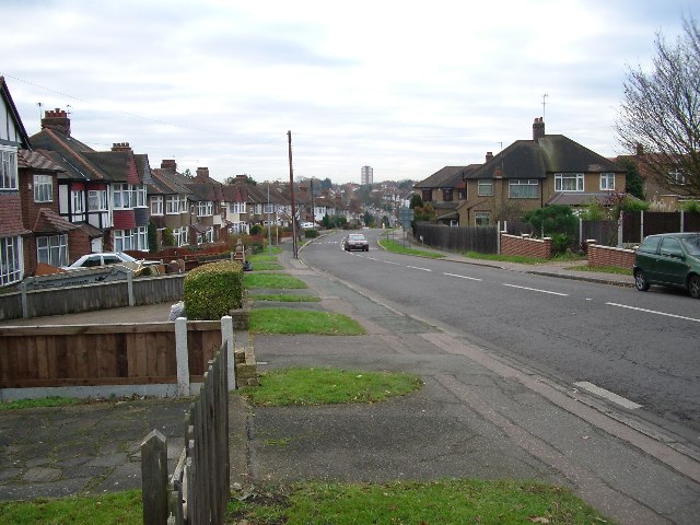
The village of Buckhurst Hill is renowned for its desirable residential area and is often considered one of the most affluent areas in Essex. It is characterized by a mix of housing styles, including Victorian and Edwardian properties, as well as more modern developments. The area is known for its leafy suburban streets and a vibrant community atmosphere.

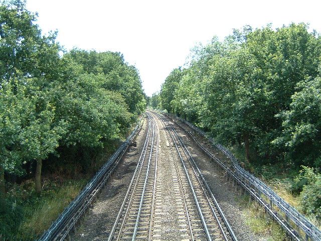
Buckhurst Hill is well-served by transport links, making it an attractive location for commuters. The Central line of the London Underground provides direct access to London, with a journey time of around 30 minutes to Liverpool Street Station. Additionally, several bus routes connect the area to neighboring towns and villages.

The local amenities in Buckhurst Hill are plentiful, with a range of shops, restaurants, and cafes scattered throughout the village. The area boasts a number of green spaces, including Roding Valley Park, a popular spot for leisure activities and picnics. Buckhurst Hill also benefits from excellent schools, making it an attractive location for families.

Overall, Buckhurst Hill offers a picturesque and prosperous living environment, combining the tranquility of suburban life with easy access to the bustling city of London.

If you have any feedback on the listing, please let us know in the comments section below.

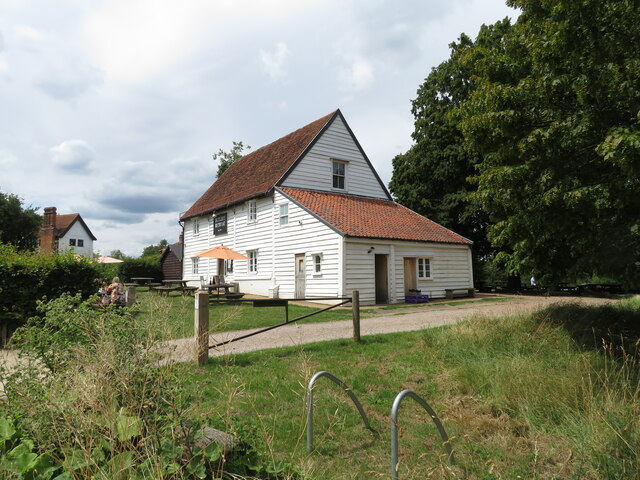
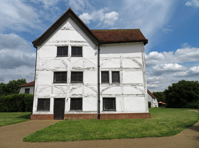
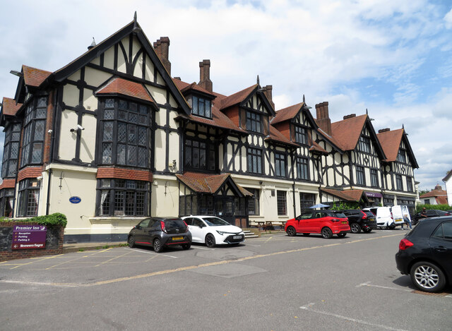
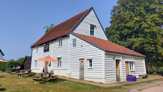
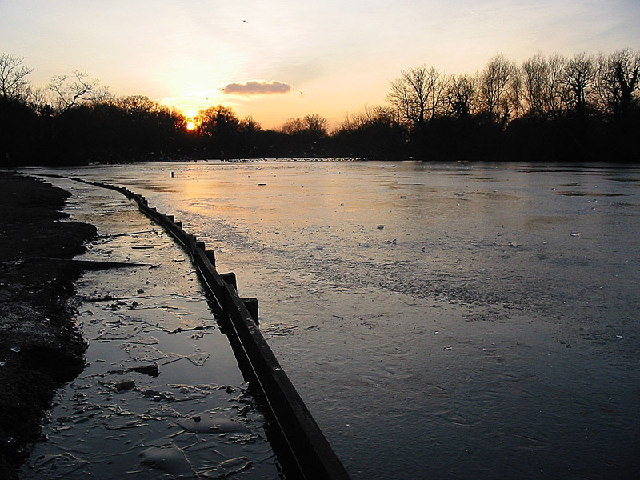
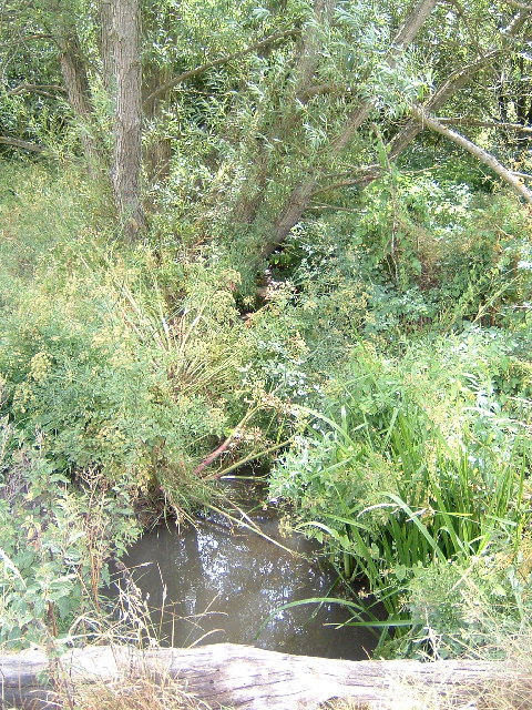
Buckhurst Hill Images

Images are sourced within 2km of 51.627583/0.041236 or Grid Reference TQ4194. Thanks to Geograph Open Source API. All images are credited.

Butler's Retreat, Chingford A coffee shop on the edge of Epping Forest. Listed Grade II. The building on the extreme left is Queen Elizabeth's Hunting Lodge.
Butler's Retreat, Chingford
A coffee shop on the edge of Epping Forest. Listed Grade II. The building on the extreme left is Queen Elizabeth's Hunting Lodge.
Queen Elizabeth's Hunting Lodge, Chingford Now a museum and Listed Grade II*. This is an early 16th century hunting lodge and is also a Scheduled Ancient Monument.
Queen Elizabeth's Hunting Lodge, Chingford
Now a museum and Listed Grade II*. This is an early 16th century hunting lodge and is also a Scheduled Ancient Monument.
Public house and hotel The Royal Forest public house and a Premier Inn are co-located here.
Public house and hotel
The Royal Forest public house and a Premier Inn are co-located here.
Butlers Retreat This restored barn on the edge of Epping Forest is now a cafe.
Butlers Retreat
This restored barn on the edge of Epping Forest is now a cafe.
Connaught Water The construction of this eight-acre ornamental lake started in 1883. It was enlarged in 1893 and the two islands made. Before this transformation, the area consisted of a small swampy pool fed by the drainage from Hill Wood, Fairmead Bottom and Thicket. The aim of the Conservators in the early days was to drain the Forest to improve it for Commoners' cattle and to increase access safely.

The new lake was named after the newly appointed first Ranger of the Forest, the Duke of Connaught. The catchment area of Connaught Water is the woodland and plains northwards to High Beach from where the water is concentrated into two streams entering at the NE and NW corners of the lake.
Connaught Water
The construction of this eight-acre ornamental lake started in 1883. It was enlarged in 1893 and the two islands made. Before this transformation, the area consisted of a small swampy pool fed by the drainage from Hill Wood, Fairmead Bottom and Thicket. The aim of the Conservators in the early days was to drain the Forest to improve it for Commoners' cattle and to increase access safely. The new lake was named after the newly appointed first Ranger of the Forest, the Duke of Connaught. The catchment area of Connaught Water is the woodland and plains northwards to High Beach from where the water is concentrated into two streams entering at the NE and NW corners of the lake.
The River Ching Just about a mile from Chingford I was surprised at how small the river Ching was when I came across it walking section 19 of the London Loop.  It is the river that gives Chingford its name.
The River Ching
Just about a mile from Chingford I was surprised at how small the river Ching was when I came across it walking section 19 of the London Loop. It is the river that gives Chingford its name.
The Central Line looking south towards Buckhurst Hill Halfway up the right side of the grid square.  Taken from the footbridge over the Central Line (where it runs above ground), this was the worst part of my walk along section 19 of the London Loop, the bridge was grey, caged in overhead and covered with graffiti. Just as well I had a small lens as I had to poke it through the mesh.
The Central Line looking south towards Buckhurst Hill
Halfway up the right side of the grid square. Taken from the footbridge over the Central Line (where it runs above ground), this was the worst part of my walk along section 19 of the London Loop, the bridge was grey, caged in overhead and covered with graffiti. Just as well I had a small lens as I had to poke it through the mesh.
Walking the Loop Running west-east across the middle of the grid square.  Part of section 19 of the London Loop.  An ancient cattle drove, probably first used some 2000 years ago but the practice of driving livestock between pastures died out in the 19th century.
Walking the Loop
Running west-east across the middle of the grid square. Part of section 19 of the London Loop. An ancient cattle drove, probably first used some 2000 years ago but the practice of driving livestock between pastures died out in the 19th century.
Knighton Woods Pond Man made pond which was part of the Knighton Estate before being incorporated into Epping Forest
Knighton Woods Pond
Man made pond which was part of the Knighton Estate before being incorporated into Epping Forest
Lords Bushes Pond Pond on the old Knightons estate now part of Epping Forest
Lords Bushes Pond
Pond on the old Knightons estate now part of Epping Forest
Knighton Wood in winter Knighton Wood with the adjacent Lords Bushes forms a small isolated patch of Epping Forest, surrounded by housing.  It was enclosed in the nineteenth century from the forest to form the ornamental gardens of Knighton House, the home of the Buxton family, and returned to the Forest in 1930.
Knighton Wood in winter
Knighton Wood with the adjacent Lords Bushes forms a small isolated patch of Epping Forest, surrounded by housing. It was enclosed in the nineteenth century from the forest to form the ornamental gardens of Knighton House, the home of the Buxton family, and returned to the Forest in 1930.
Kings Avenue, Woodford Green Looking south in Kings Avenue. The car in the centre is crossing the border from the London Borough of Redbridge into Epping Forest District. The tower block in the distance is Tamar Square, adjacent to Woodford tube station.
Kings Avenue, Woodford Green
Looking south in Kings Avenue. The car in the centre is crossing the border from the London Borough of Redbridge into Epping Forest District. The tower block in the distance is Tamar Square, adjacent to Woodford tube station.
All Saints Church, Inmans Row, Woodford Green Looking north across the Green to the church, built 1874. The old A11 (now A104) is immediately to the photographers left.
All Saints Church, Inmans Row, Woodford Green
Looking north across the Green to the church, built 1874. The old A11 (now A104) is immediately to the photographers left.
Roding Valley viaduct Few stretches of the London tube network are as rural as the Woodford to Hainault branch of the Central Line. Here a train crosses the viaduct over the River Roding, not far from Roding Valley station.  This line was built by the Eastern Counties railway in the mid nineteenth century and became part of the Central Line about a hundred years later.
Roding Valley viaduct
Few stretches of the London tube network are as rural as the Woodford to Hainault branch of the Central Line. Here a train crosses the viaduct over the River Roding, not far from Roding Valley station. This line was built by the Eastern Counties railway in the mid nineteenth century and became part of the Central Line about a hundred years later.
M11 Motorway and River Roding, Woodford Bridge Here the M11 (centre and right) runs alongside the River Roding.  The view is looking north from the footbridge which connects Ray Lodge park with the riverside path on the east bank. The blue speck in the centre (by the poplar tree) is the Essex county boundary sign
M11 Motorway and River Roding, Woodford Bridge
Here the M11 (centre and right) runs alongside the River Roding. The view is looking north from the footbridge which connects Ray Lodge park with the riverside path on the east bank. The blue speck in the centre (by the poplar tree) is the Essex county boundary sign
Roding Valley Junction Here the Hainault loop line joins the main Epping branch of the Central Line.  The view is to the south and train is travelling south towards Woodford and London. The branch line to the left leads to Roding Valley station and the viaduct shown in <a href="https://www.geograph.org.uk/gridref/TQ4293">TQ4293</a>, then to Grange Hill, Hainault and Newbury Park, rejoining the main line at Leytonstone.
Roding Valley Junction
Here the Hainault loop line joins the main Epping branch of the Central Line. The view is to the south and train is travelling south towards Woodford and London. The branch line to the left leads to Roding Valley station and the viaduct shown in TQ4293, then to Grange Hill, Hainault and Newbury Park, rejoining the main line at Leytonstone.
Bancroft's School, Woodford Wells Bancroft's was founded by the Drapers Company in 1727 and moved to its present imposing building in 1889. The arch under the red brick tower leads to the quadrangle and chapel.
Bancroft's School, Woodford Wells
Bancroft's was founded by the Drapers Company in 1727 and moved to its present imposing building in 1889. The arch under the red brick tower leads to the quadrangle and chapel.
River Roding and Boating lake, Buckhurst Hill The lake is a flooded gravel pit created during the construction of the nearby M11 motorway and now forming part of a recreational area with walks and sports fields. The view is looking north from the footbridge which is on the London Loop long distance path.
River Roding and Boating lake, Buckhurst Hill
The lake is a flooded gravel pit created during the construction of the nearby M11 motorway and now forming part of a recreational area with walks and sports fields. The view is looking north from the footbridge which is on the London Loop long distance path.
Show me another place!

Buckhurst Hill is located at Grid Ref: TQ4194 (Lat: 51.627583, Lng: 0.041236)

Administrative County: Essex

District: Epping Forest

Police Authority: Essex

What 3 Words

///tall.jobs.sketch. Near Buckhurst Hill, Essex

Related Wikis

Buckhurst Hill West (ward)

Buckhurst Hill West is an electoral ward in Epping Forest, UK and is one of two wards that represent Buckhurst Hill. Buskhurst Hill West has three seats...

Buckhurst Hill tube station

Buckhurst Hill is a London Underground station, in the Epping Forest district of Essex. It is served by the Central line and is between Woodford and Loughton...
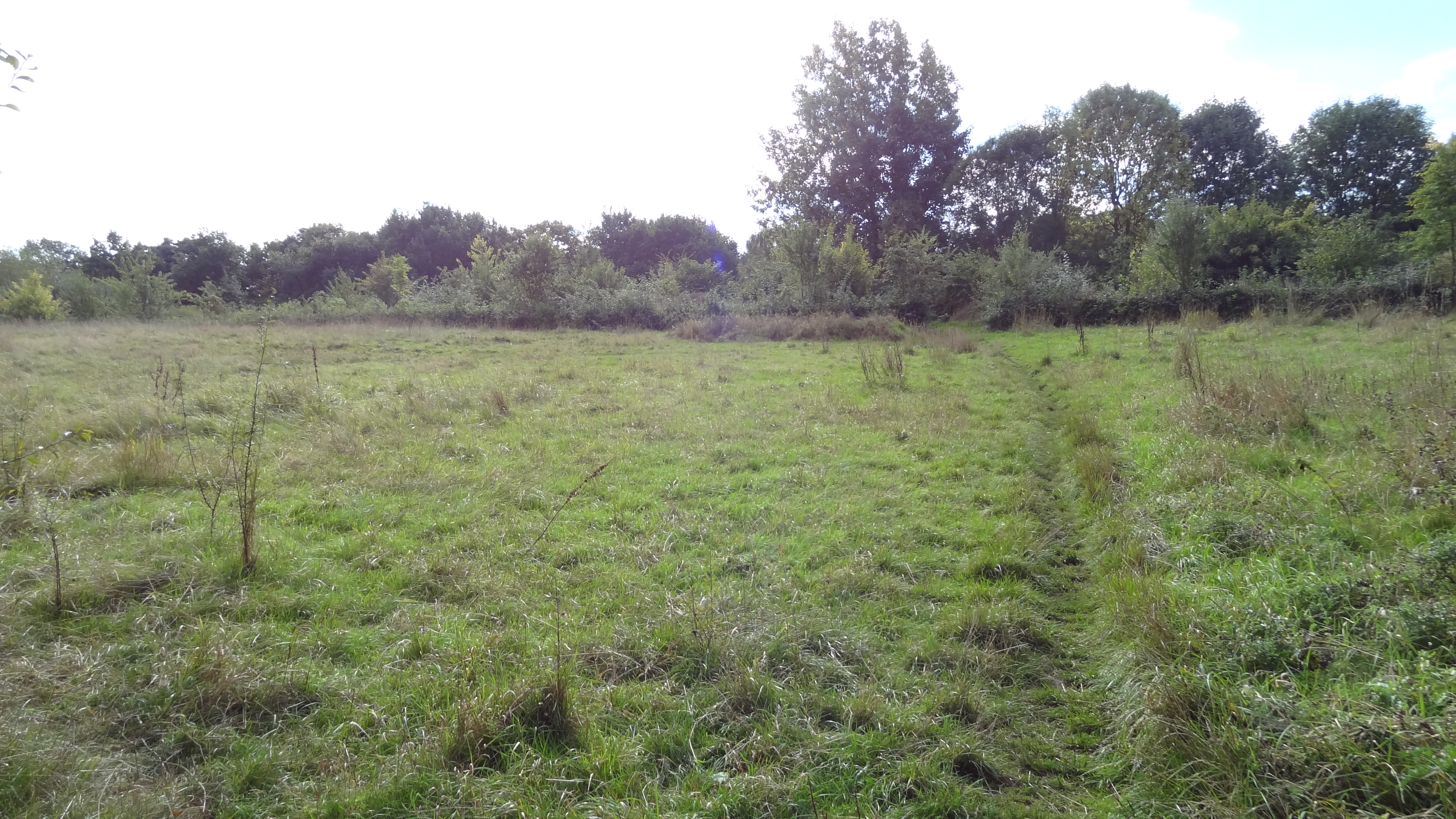
Linder's Field

Linder's Field is a 3.6 hectare Local Nature Reserve in Buckhurst Hill in Essex. It is owned and managed by Epping Forest District Council.Linder's Field...

Braeside School, Buckhurst Hill

Braeside School is an independent school located in Buckhurst Hill in Essex that is part of The Oak-Tree Group of Schools. The school is an all-through...

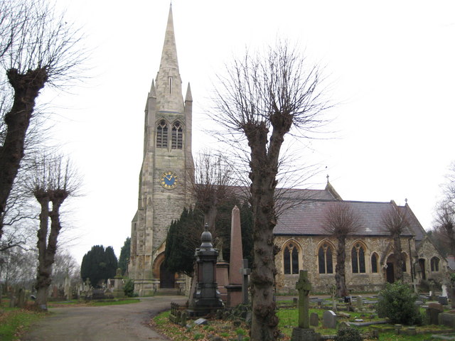
St John the Baptist Church, Buckhurst Hill

St John the Baptist Church, or St John's, is a Church of England parish church in the town of Buckhurst Hill in Essex, England. == History == The church...

Buckhurst Hill

Buckhurst Hill is a suburban village in the Epping Forest district of Essex, England. It is part of the Greater London Urban Area and adjacent to the northern...

Buckhurst Hill East (ward)

Buckhurst Hill East is an electoral ward in Epping Forest, UK and is one of two wards that represent Buckhurst Hill. The present councillors for this ward...

Buckhurst Hill F.C.

Buckhurst Hill Football Club is a football club based in Buckhurst Hill, England. They are currently members of the Essex Senior League and play at Roding...

Nearby Amenities

Located within 500m of 51.627583,0.041236
Buckhurst Hill
Is In District: Epping Forest
Place: town
Population: 11380
Wikidata: Q2684024
Lat/Long: 51.6268617/0.0415283
Mini Roundabout
Direction: clockwise
Lat/Long: 51.6272111/0.0385409
Post Box
Lat/Long: 51.6308577/0.0420224
Post Box
Ref: IG9 71
Lat/Long: 51.625192/0.0460147
Post Box
Created By: Potlatch 0.10f
Lat/Long: 51.6261797/0.0358941
Noexit: yes
Lat/Long: 51.62515/0.0471241
Bus Stop
Hurst Road
Bus: yes
Naptan AtcoCode: 150042017010
Naptan Bearing: S
Naptan CommonName: Hurst Road
Naptan Indicator: Adj
Naptan Landmark: Hurst Road
Naptan NaptanCode: esxatjpd
Naptan Street: Loughton Way
Naptan Verified: no
Public Transport: platform
Shelter: no
Source: naptan_import
Lat/Long: 51.6276638/0.0483656
Bus Stop
The Green
Bus: yes
Naptan AtcoCode: 150042018002
Naptan Bearing: E
Naptan CommonName: The Green
Naptan Crossing: High Road
Naptan Indicator: E-bound
Naptan Landmark: The Green
Naptan NaptanCode: esxatmpm
Naptan Street: Palmerston Road
Naptan Verified: no
Public Transport: platform
Source: naptan_import
Lat/Long: 51.6270523/0.0340895
Bus Stop
Westbury Road
Bus: yes
Naptan AtcoCode: 150042018003
Naptan Bearing: W
Naptan CommonName: Westbury Road
Naptan Crossing: Westbury Road
Naptan Indicator: Adj
Naptan Landmark: Westbury Road
Naptan NaptanCode: esxatmpt
Naptan Street: Palmerston Road
Naptan Verified: no
Public Transport: platform
Shelter: no
Source: naptan_import
Tactile Paving: no
Lat/Long: 51.6271504/0.0381228
Bus Stop
Westbury Road
Bus: yes
Naptan AtcoCode: 150042018004
Naptan Bearing: E
Naptan CommonName: Westbury Road
Naptan Crossing: Westbury Road
Naptan Indicator: Opp
Naptan Landmark: Westbury Road
Naptan NaptanCode: esxatmpw
Naptan Street: Palmerston Road
Naptan Verified: no
Public Transport: platform
Shelter: no
Source: naptan_import
Lat/Long: 51.6272806/0.0393136
Bus Stop
Kings Avenue
Bench: no
Bus: yes
Naptan AtcoCode: 150042018005
Naptan Bearing: W
Naptan CommonName: Kings Avenue
Naptan Crossing: Kings Avenue
Naptan Indicator: Opp
Naptan Landmark: Kings Avenue
Naptan NaptanCode: esxatptd
Naptan Street: Palmerston Road
Naptan Verified: no
Public Transport: platform
Shelter: yes
Source: naptan_import
Tactile Paving: no
Lat/Long: 51.6269893/0.0426191
Bus Stop
Kings Avenue
Bench: no
Bus: yes
Naptan AtcoCode: 150042018006
Naptan Bearing: E
Naptan CommonName: Kings Avenue
Naptan Crossing: Kings Avenue
Naptan Indicator: Adj
Naptan Landmark: Kings Avenue
Naptan NaptanCode: esxatmta
Naptan Street: Palmerston Road
Naptan Verified: no
Public Transport: platform
Shelter: no
Source: naptan_import
Tactile Paving: no
Lat/Long: 51.6270356/0.0441172
Bus Stop
Beatrice Court
Bench: no
Bin: yes
Bus: yes
Lit: yes
Naptan AtcoCode: 150042020001
Naptan Bearing: N
Naptan CommonName: Beatrice Court
Naptan Indicator: Opp
Naptan Landmark: Beatrice Court
Naptan NaptanCode: esxatjpg
Naptan Street: Albert Road
Naptan Verified: no
Public Transport: platform
Shelter: no
Source: naptan_import
Tactile Paving: no
Lat/Long: 51.6266864/0.0479092
Bus Stop
Beatrice Court
Bench: no
Bin: yes
Bus: yes
Lit: yes
Naptan AtcoCode: 150042020002
Naptan Bearing: S
Naptan CommonName: Beatrice Court
Naptan Indicator: Adj
Naptan Landmark: Beatrice Court
Naptan NaptanCode: esxatjpj
Naptan Street: Albert Road
Naptan Verified: no
Public Transport: platform
Shelter: no
Source: naptan_import
Tactile Paving: no
Lat/Long: 51.6257577/0.0478139
Bus Stop
Buckhurst Hill Railway Station
Bench: yes
Bin: yes
Bus: yes
Naptan AtcoCode: 1500IM359
Naptan Bearing: W
Naptan CommonName: Buckhurst Hill Station
Naptan Indicator: o/s
Naptan Landmark: Buckhurst Hill Station
Naptan NaptanCode: esxadapm
Naptan Street: Station Forecourt
Naptan Verified: no
Public Transport: platform
Shelter: yes
Source: naptan_import
Tactile Paving: no
Lat/Long: 51.6264549/0.0461769
Noexit: yes
Lat/Long: 51.6259642/0.040794
Pub
Railway Bar & Grill
Internet Access: wlan
Internet Access Fee: no
Note: name confirmed survey 2013-01-13, used to be "The Railway Tavern"
Old Name: The Railway Tavern
Source: survey
Toilets: yes
Toilets Access: customers
Lat/Long: 51.6252492/0.0462191
Toilets
Lat/Long: 51.6252142/0.0463921
Noexit: yes
Lat/Long: 51.6260328/0.0471471
Buckhurst Hill, Victoria Road
Railway: subway_entrance
Ref: A
Ref GB Tfl Uid: 940GZZLUBKH-1000033-A-VIC-2
Wheelchair: no
Lat/Long: 51.6266017/0.0466061
Shop: convenience
Lat/Long: 51.6250928/0.0469
Library
Buckhurst Hill Library
Operator: Essex County Council
Wikidata: Q53437458
Lat/Long: 51.6261899/0.0364038
Barrier: entrance
Lat/Long: 51.6239247/0.0424193
Toilets
Lat/Long: 51.6260746/0.046936
Give Way
Direction: backward
Lat/Long: 51.6269854/0.0433539
Crossing
Crossing: traffic_signals
Crossing Island: no
Tactile Paving: yes
Lat/Long: 51.6271934/0.038102
Buckhurst Hill
Network: London Underground
Network Wikidata: Q20075
Operator: Transport for London
Public Transport: stop_position
Railway: stop
Subway: yes
Lat/Long: 51.6259566/0.0467946
Buckhurst Hill
Network: London Underground
Network Wikidata: Q20075
Operator: Transport for London
Public Transport: stop_position
Railway: stop
Subway: yes
Lat/Long: 51.6259521/0.046839
Cafe
Costa
Addr City: Buckhurst Hill
Addr Country: GB
Addr Housenumber: 48
Addr Postcode: IG9 5BY
Addr Street: Queens Road
Brand: Costa
Brand Wikidata: Q608845
Cuisine: coffee_shop
Fhrs Id: 553632
Internet Access: wlan
Internet Access Ssid: Costa Free WiFi
Outdoor Seating: yes
Source: survey
Takeaway: yes
Lat/Long: 51.6252452/0.0439936
Fast Food
Express BBQ & Fish bar
Diet Vegan: yes
Diet Vegetarian: yes
Source: survey
Lat/Long: 51.6253868/0.0444442
Cafe
Legends Cafe
Diet Vegetarian: yes
Source: survey
Lat/Long: 51.6251386/0.0451066
Buckhurst Hill
Fare Zone: 5
Line: Central
Naptan AtcoCode: 940GZZLUBKH
Network: London Underground
Network Wikidata: Q20075
Operator: London Underground
Operator Wikidata: Q20075
Platforms: 2
Public Transport: station
Railway: station
Start Date: 1856-08-22
Station: subway
Subway: yes
Wheelchair: yes
Wheelchair Description: Step-free access street to platform
Wikidata: Q999705
Wikimedia Commons: Category:Buckhurst Hill tube station
Wikipedia: en:Buckhurst Hill tube station
Lat/Long: 51.6259439/0.0468161
Cafe
Costa
Brand: Costa
Brand Wikidata: Q608845
Brand Wikipedia: en:Costa Coffee
Cuisine: coffee_shop
Internet Access: wlan
Takeaway: yes
Lat/Long: 51.6255626/0.0454821
Place Of Worship
Buckhurst Hill Baptist Church
Denomination: baptist
Religion: christian
Lat/Long: 51.6269121/0.0425383
Bicycle: no
Description En: Exit towards Queen’s Road. Access to underpass.
Foot: yes
Level: 0
Railway: subway_entrance
Wheelchair: yes
Lat/Long: 51.625611/0.0466051
Bicycle: no
Description En: Exit towards Lower Queen’s Road and Albert Road. Access to underpass.
Foot: yes
Level: 0
Railway: subway_entrance
Wheelchair: yes
Lat/Long: 51.6255431/0.046808
Noexit: yes
Lat/Long: 51.626943/0.0427316
Traffic Signals
Direction: forward
Lat/Long: 51.6269773/0.0481265
Traffic Signals
Direction: backward
Lat/Long: 51.6273338/0.0482114
Traffic Signals
Direction: backward
Lat/Long: 51.6271182/0.0479767
Traffic Signals
Direction: backward
Lat/Long: 51.627139/0.0483951
Give Way
Direction: forward
Lat/Long: 51.6269035/0.0434154
Restaurant
Mr Todiwalla's Petiscos
Addr City: Buckhurst Hill
Addr Housenumber: 75
Addr Postcode: IG9 5BS
Addr Street: Queen's Road
Cuisine: indian;portuguese
Opening Hours: We-Sa 18:00-23:00
Phone: +44 20 8257 0816
Lat/Long: 51.625576/0.0423765
Waste Basket
Waste: dog_excrement
Lat/Long: 51.6307363/0.0420657
Bench
Lat/Long: 51.6304922/0.0418426
Noexit: yes
Lat/Long: 51.6263646/0.0472784
Barrier: entrance
Bicycle: no
Comment: There is an open gate here, providing access to the platform.
Foot: yes
Lat/Long: 51.6251178/0.0466885
Noexit: yes
Lat/Long: 51.626503/0.0477929
Noexit: yes
Lat/Long: 51.6259281/0.0472004
Traffic Calming: choker
Lat/Long: 51.6260004/0.0371083
Traffic Calming: hump
Lat/Long: 51.6264777/0.0357819
Traffic Calming: hump
Lat/Long: 51.6264599/0.0351544
Traffic Calming: hump
Lat/Long: 51.6264323/0.0343645
Give Way
Direction: forward
Lat/Long: 51.6261684/0.0356151
Noexit: yes
Lat/Long: 51.6264079/0.0356757
Give Way
Direction: forward
Lat/Long: 51.6261165/0.0356215
Crossing
Crossing: unmarked
Crossing Island: no
Tactile Paving: yes
Lat/Long: 51.6271103/0.0385094
Traffic Calming: hump
Lat/Long: 51.6265062/0.0365676
Traffic Calming: hump
Lat/Long: 51.6265359/0.0373716
Traffic Calming: hump
Lat/Long: 51.6266414/0.0405772
Traffic Calming: hump
Lat/Long: 51.6266326/0.0393801
Traffic Calming: hump
Lat/Long: 51.6266031/0.038591
Traffic Calming: hump
Lat/Long: 51.6265741/0.0382108
Give Way
Direction: forward
Lat/Long: 51.6266133/0.0383543
Give Way
Direction: forward
Lat/Long: 51.6257113/0.0404311
Noexit: yes
Lat/Long: 51.626001/0.0403716
Traffic Signals
Crossing: no
Traffic Signals: pedestrian_crossing
Traffic Signals Direction: forward
Lat/Long: 51.6271966/0.0381686
Traffic Signals
Crossing: no
Traffic Signals: pedestrian_crossing
Traffic Signals Direction: backward
Lat/Long: 51.6271902/0.0380354
Post Office
Buckhurst Hill Post Office
Addr City: Buckhurst Hill
Addr Housenumber: 167
Addr Postcode: IG9 5AZ
Addr Street: Queens Road
Brand: Post Office
Brand Wikidata: Q1783168
Check Date: 2022‑05‑27
Check Date Opening Hours: 2022‑05‑27
Opening Hours: Mo-Sa 10:00-18:00
Ref Pol Id: 19289
Website: https://www.postoffice.co.uk/branch-finder/1650262/buckhurst-hill
Lat/Long: 51.6262075/0.0363154
Post Office
Queens Road Post Office
Addr City: Buckhurst Hill
Addr Housenumber: 7
Addr Postcode: IG9 5BZ
Addr Street: Queens Road
Brand: Post Office
Brand Wikidata: Q1783168
Check Date: 2022‑05‑27
Check Date Opening Hours: 2022‑05‑27
Opening Hours: Mo-Sa 10:00-18:00
Ref Pol Id: 19421
Website: https://www.postoffice.co.uk/branch-finder/192026x/queens-road
Lat/Long: 51.6252042/0.0461374
Post Box
Operator: Royal Mail
Operator Wikidata: Q638098
Post Box Type: pillar
Lat/Long: 51.6298738/0.0352305
Buckhurst Hill Store
Shop: convenience
Lat/Long: 51.6299316/0.0352956
Post Box
Operator: Royal Mail
Operator Wikidata: Q638098
Post Box Type: pillar
Royal Cypher: EIIR
Royal Cypher Wikidata: Q33102113
Lat/Long: 51.6272789/0.0386099
Crossing
Crossing: traffic_signals
Crossing Island: no
Tactile Paving: yes
Lat/Long: 51.6270023/0.0481326
Crossing
Crossing: traffic_signals
Crossing Island: no
Tactile Paving: yes
Lat/Long: 51.627136/0.0483332
Crossing
Crossing: traffic_signals
Crossing Island: no
Tactile Paving: yes
Lat/Long: 51.6272435/0.0481903
The data included in this document is from www.openstreetmap.org. The data is made available under ODbL.

Have you been to Buckhurst Hill?

Leave your review of Buckhurst Hill below (or comments, questions and feedback).