Common, Broad

Settlement in Worcestershire Wychavon

England

Common, Broad

Keybridge Farm Keybridge Farm is on Doverdale Lane, Doverdale.
Keybridge Farm Credit: Philip Halling

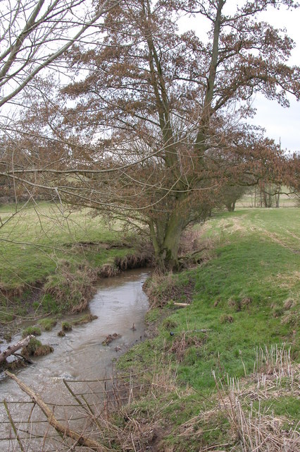
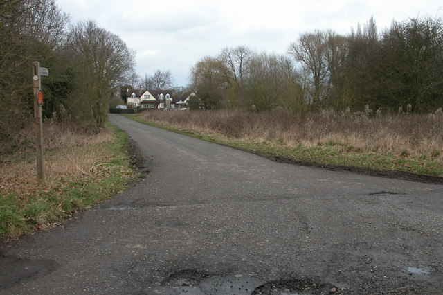
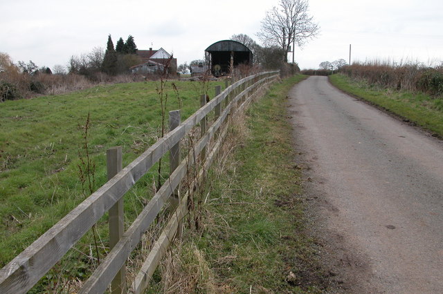
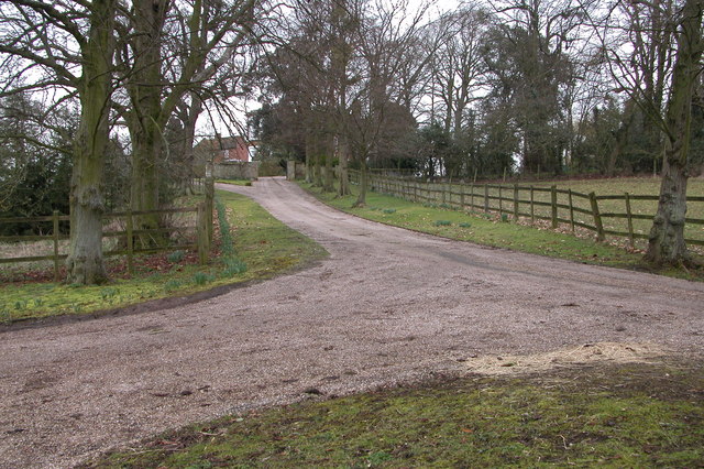
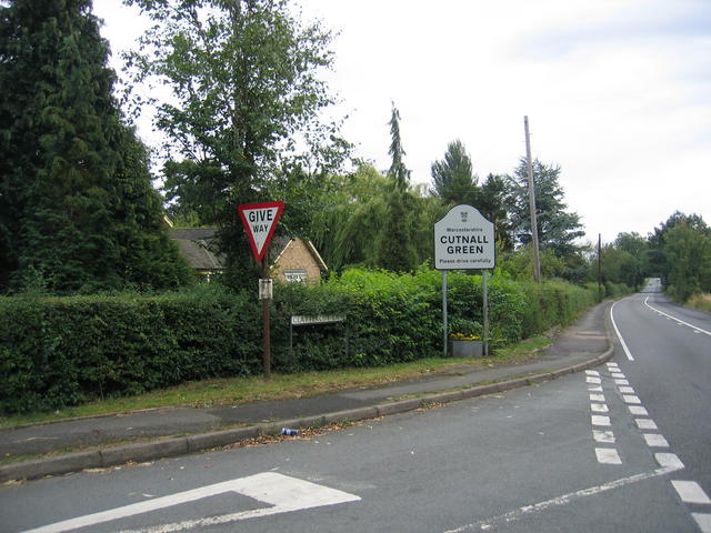
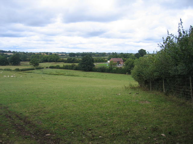
Common, Broad, Worcestershire is a small village located in the county of Worcestershire, England. Situated just three miles southeast of the historic town of Pershore, Common, Broad is nestled in the picturesque countryside of the county, boasting stunning views of rolling hills and lush green fields.

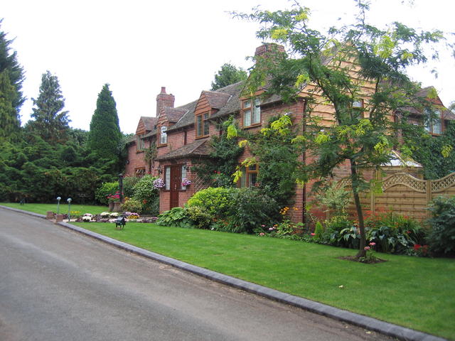
With a population of around 500 residents, Common, Broad is a close-knit community that offers a peaceful and tranquil setting for its inhabitants. The village itself is characterized by its charming, traditional cottages, many of which are built with locally sourced materials, adding to its rustic charm.

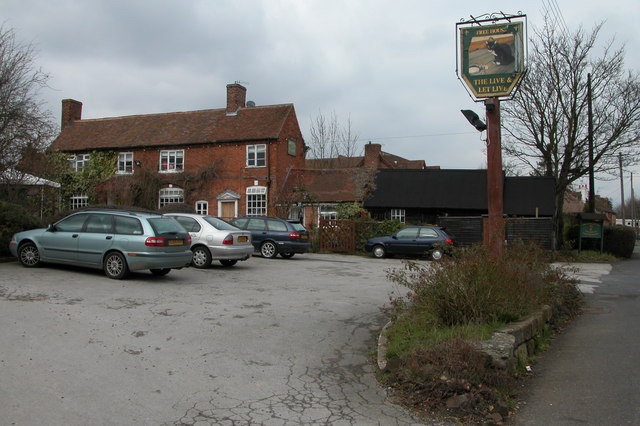
Despite its small size, Common, Broad offers a range of amenities for its residents. The village has a primary school, providing education for local children, and a community center that serves as a hub for various activities and events. Additionally, there is a village pub, The Broad Arms, where locals and visitors can enjoy a pint of locally brewed ale and traditional British cuisine.

Common, Broad is surrounded by beautiful countryside, making it a haven for nature lovers and outdoor enthusiasts. There are numerous walking and cycling paths in the area, allowing residents to explore the surrounding natural beauty. The village is also conveniently located near several historical sites and attractions, including the famous Worcester Cathedral and the historic Pershore Abbey.

Overall, Common, Broad, Worcestershire offers a peaceful and idyllic lifestyle for its residents, with its charming village atmosphere and stunning rural surroundings.

If you have any feedback on the listing, please let us know in the comments section below.

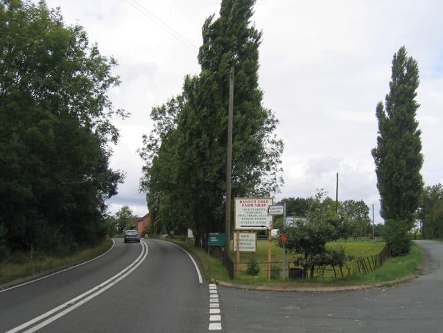
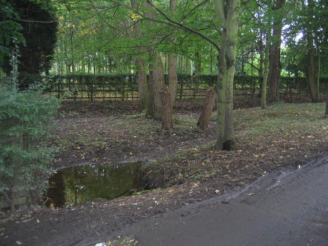
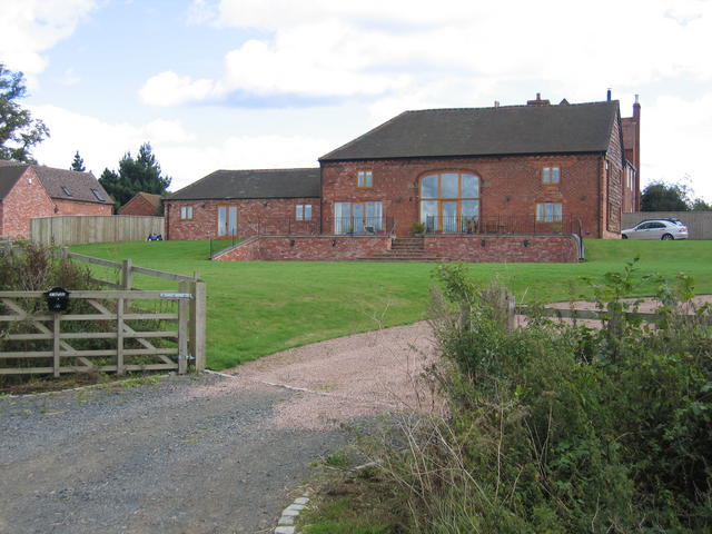
Common, Broad Images

Images are sourced within 2km of 52.305449/-2.178898 or Grid Reference SO8767. Thanks to Geograph Open Source API. All images are credited.

Keybridge Farm Keybridge Farm is on Doverdale Lane, Doverdale.
Keybridge Farm
Keybridge Farm is on Doverdale Lane, Doverdale.
Elmbridge Brook, Elmbridge Here the brook is viewed from the Elmbridge to Cutnall Green road.
Elmbridge Brook, Elmbridge
Here the brook is viewed from the Elmbridge to Cutnall Green road.
Bryan's Green, near Cutnall Green The Monarch's Way follows this road at Bryan's Green.
Bryan's Green, near Cutnall Green
The Monarch's Way follows this road at Bryan's Green.
The Live and Let Live Inn at Cutnall Green
Little Horton Farm, Doverdale
Entrance to Doverdale Manor, Doverdale
Sneadsgreen House, Sneads Green
Lane at Sneads Green Here the road to Sneads Green has just crossed the railway before passing under power cables.
Lane at Sneads Green
Here the road to Sneads Green has just crossed the railway before passing under power cables.
Clattercut Lane junction The interestingly named Clattercut Lane joins the Kidderminster - Droitwich road on the northern edge of Cutnall Green.  Judging by internet searches the name of this lane is unique, however nothing appears to explain the origin of the name.
Clattercut Lane junction
The interestingly named Clattercut Lane joins the Kidderminster - Droitwich road on the northern edge of Cutnall Green. Judging by internet searches the name of this lane is unique, however nothing appears to explain the origin of the name.
Broad Alley A picturesque and well maintained cottage and garden by the lane through Broad Alley.
Broad Alley
A picturesque and well maintained cottage and garden by the lane through Broad Alley.
View from Horton Lane Looking NNW across the square towards Broad Common. The line of trees running across the picture and behind the converted barn marks the route of the line from Worcester to Kidderminster and Stourbridge - originally the Oxford, Worcester and Wolverhampton Railway.
View from Horton Lane
Looking NNW across the square towards Broad Common. The line of trees running across the picture and behind the converted barn marks the route of the line from Worcester to Kidderminster and Stourbridge - originally the Oxford, Worcester and Wolverhampton Railway.
Bannut Tree Bannut Tree Farm is situated in the "v" of the road junction between Clattercut Lane and the Droitwich - Kidderminster Road just to the north of Cutnall Green.
Bannut Tree
Bannut Tree Farm is situated in the "v" of the road junction between Clattercut Lane and the Droitwich - Kidderminster Road just to the north of Cutnall Green.
Drained pond at Broad Alley This muddy patch beside the lane at Broad Alley seem to be the site of a small pond, water feature and probably at one time, a ford.  Judging by the muddy state of the area the whole lot has recently been underwater probably due to flash flooding.  The pond is drained at the moment however.
Drained pond at Broad Alley
This muddy patch beside the lane at Broad Alley seem to be the site of a small pond, water feature and probably at one time, a ford. Judging by the muddy state of the area the whole lot has recently been underwater probably due to flash flooding. The pond is drained at the moment however.
Hampton Farm The farm buildings have now been converted for residential use - seen from public footpath along the farm track.
Hampton Farm
The farm buildings have now been converted for residential use - seen from public footpath along the farm track.
Footpath to Crutch Hill The footpath runs along the farm track at this point.  The twin masts of <a href="https://www.geograph.org.uk/photo/28692">SO9266 : Wychbold and Droitwich Radio</a> can be seen over the tree tops.
Footpath to Crutch Hill
The footpath runs along the farm track at this point. The twin masts of SO9266 : Wychbold and Droitwich Radio can be seen over the tree tops.
View across Elmbridge Brook Looking SE across the square from near Hampton Farm with Elmbdridge brook flowing at the bottom of the dip.
View across Elmbridge Brook
Looking SE across the square from near Hampton Farm with Elmbdridge brook flowing at the bottom of the dip.
OW&WR north of Droitwich Looking along the Oxford, Worcester and Wolverhampton Railway (nicknamed the "Old worse and worse"), today the line from Worcester to Birmingham via Kidderminster.
OW&WR north of Droitwich
Looking along the Oxford, Worcester and Wolverhampton Railway (nicknamed the "Old worse and worse"), today the line from Worcester to Birmingham via Kidderminster.
View towards Fibden Farm Looking north across the recently harvested fields in this square from the path between Hampton Farm and Crutch Hill.
View towards Fibden Farm
Looking north across the recently harvested fields in this square from the path between Hampton Farm and Crutch Hill.
Show me another place!

Common, Broad is located at Grid Ref: SO8767 (Lat: 52.305449, Lng: -2.178898)

Administrative County: Worcestershire

District: Wychavon

Police Authority: West Mercia

What 3 Words

///doses.riders.biked. Near Wychbold, Worcestershire

Nearby Locations

Common, Broad Broad Common

Related Wikis

Cutnall Green Halt railway station

Cutnall Green Halt was a railway station in Worcestershire, England, serving the nearby village of Hampton Lovett on the Oxford, Worcester and Wolverhampton...

Elmley Lovett

Elmley Lovett in Worcestershire, England is a civil parish whose residents' homes are quite loosely clustered east of its Hartlebury Trading Estate, as...

Snead's Green

Snead's Green, sometimes written Sneads Green, is an area of Droitwich Spa, Worcestershire, England.Francis Moule, of Snead's Green House, sold the manorial...

Elmbridge, Worcestershire

Elmbridge is a small community, mainly clustered in a village and forms a civil parish in Worcestershire, England. == Geography == It occupies the top...

Hampton Lovett

Hampton Lovett is a village and civil parish in the Wychavon district of the county of Worcestershire, England. It is just north of Droitwich. The church...

Doverdale

Doverdale is a small village and civil parish in Worcestershire, England, to the west of Droitwich. It has a parish church. Doverdale Manor is one of largest...

Dunhampton

Dunhampton is a village in Worcestershire, England.

Rushock

Rushock is a village and civil parish in the Wyre Forest District of Worcestershire, England. At the 2001 census it had a population of 138. The grave...

Nearby Amenities

Located within 500m of 52.305449,-2.178898
Broad Common
Place: hamlet
Lat/Long: 52.3054705/-2.1808263
Barrier: stile
Foot: yes
Lat/Long: 52.3040232/-2.1724751
Barrier: stile
Foot: yes
Lat/Long: 52.3040531/-2.1723917
Power: pole
Lat/Long: 52.3062683/-2.1724905
Fixme: continue
Lat/Long: 52.3067826/-2.1727138
Barrier: stile
Foot: yes
Lat/Long: 52.3067863/-2.1733762
Barrier: stile
Foot: yes
Lat/Long: 52.3068164/-2.1734256
Barrier: stile
Foot: yes
Lat/Long: 52.3048812/-2.1851667
Barrier: stile
Foot: yes
Lat/Long: 52.3049393/-2.1851036
Barrier: stile
Foot: yes
Lat/Long: 52.3049843/-2.1838456
Crossing: uncontrolled
Railway: crossing
Lat/Long: 52.3051155/-2.1837421
Barrier: stile
Foot: yes
Lat/Long: 52.3054209/-2.1840911
Power: pole
Lat/Long: 52.3061217/-2.1758242
Power: pole
Lat/Long: 52.3068704/-2.1757714
Barrier: stile
Foot: yes
Lat/Long: 52.3069011/-2.1837008
Barrier: stile
Foot: yes
Lat/Long: 52.307022/-2.1837062
Power: pole
Lat/Long: 52.3076097/-2.1757122
Power: pole
Lat/Long: 52.3083515/-2.1756292
Power: pole
Lat/Long: 52.3085935/-2.1767592
Power: pole
Lat/Long: 52.3088887/-2.178061
Power: pole
Lat/Long: 52.3090766/-2.1756058
Power: pole
Lat/Long: 52.3091571/-2.179205
Crossing: uncontrolled
Railway: crossing
Lat/Long: 52.3050822/-2.1837759
Post Box
Collection Times: Mo-Fr 09:45; Sa 09:45
Post Box Type: lamp
Ref: WR9 372
Royal Cypher: EIIR
Royal Cypher Wikidata: Q33102113
Lat/Long: 52.3045704/-2.1743191
Generator Method: photovoltaic
Generator Output Electricity: yes
Generator Source: solar
Generator Type: solar_photovoltaic_panel
Power: generator
Lat/Long: 52.3058441/-2.1800057
Generator Method: photovoltaic
Generator Output Electricity: yes
Generator Source: solar
Generator Type: solar_photovoltaic_panel
Power: generator
Lat/Long: 52.3056978/-2.1803128
Power: pole
Source: bing
Lat/Long: 52.3061892/-2.1746466
Stocking Farm
Power: pole
Ref: 761636
Source: wpd_opendata
Transformer: distribution
Voltage Primary: 11000
Lat/Long: 52.3015141/-2.1823378
Power: pole
Source: bing
Lat/Long: 52.302066/-2.1814929
Power: pole
Source: bing
Lat/Long: 52.3027229/-2.1803154
Power: pole
Source: bing
Lat/Long: 52.3031617/-2.1795496
Power: pole
Source: bing
Lat/Long: 52.3036767/-2.1786886
Power: pole
Source: bing
Lat/Long: 52.3041326/-2.1779457
Power: pole
Source: bing
Lat/Long: 52.3046008/-2.1771598
Power: pole
Source: bing
Lat/Long: 52.3050953/-2.1763256
Power: pole
Source: bing
Lat/Long: 52.3053741/-2.175879
Power: pole
Lat/Long: 52.3035585/-2.1814526
Sewage Disposal Works
Power: pole
Transformer: distribution
Voltage Primary: 11000
Lat/Long: 52.3040998/-2.1822064
The Broads
Power: pole
Transformer: distribution
Voltage Primary: 11000
Lat/Long: 52.3029599/-2.1751615
Power: pole
Lat/Long: 52.30275/-2.1766368
Power: pole
Lat/Long: 52.3032945/-2.1778169
Power: pole
Lat/Long: 52.3046599/-2.1784821
Broad Common
Power: pole
Transformer: distribution
Voltage Primary: 11000
Lat/Long: 52.3057874/-2.179099
Power: pole
Lat/Long: 52.3050945/-2.1789046
The data included in this document is from www.openstreetmap.org. The data is made available under ODbL.

Have you been to Common, Broad?

Leave your review of Common, Broad below (or comments, questions and feedback).