Broughton Hackett

Civil Parish in Worcestershire Wychavon

England

Broughton Hackett

Froxmere Court chimneys All the chimneys on Froxmere Court are different, showing beautiful brickwork.
Froxmere Court chimneys Credit: Liz Stone

Broughton Hackett is a civil parish located in the county of Worcestershire, in the West Midlands region of England. It is situated approximately 4 miles to the east of the city of Worcester. The parish covers an area of around 650 acres and is home to a population of around 400 residents.

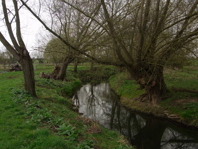
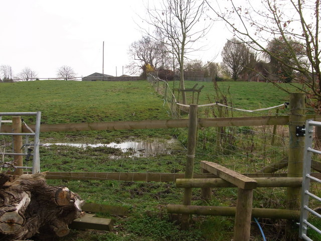
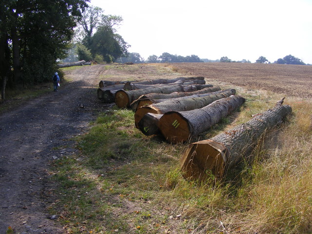
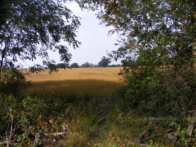
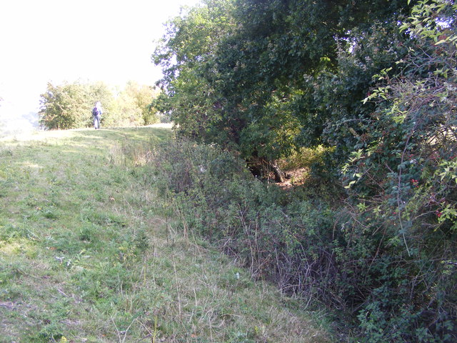
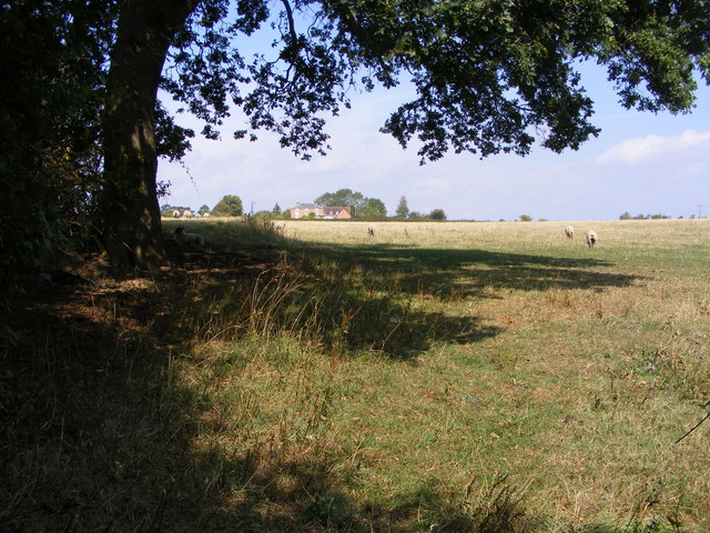
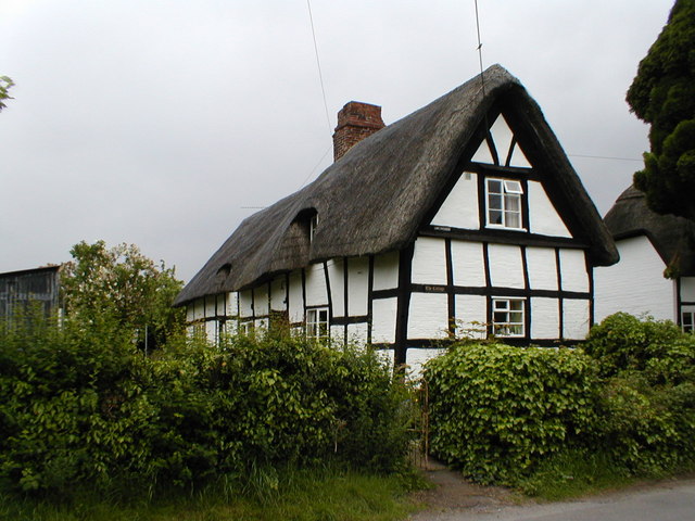
The village of Broughton Hackett is characterized by its picturesque rural setting, surrounded by rolling green fields and farmland. It is a predominantly residential area, with a mix of historic cottages, farmhouses, and newer housing developments. The parish is known for its charming countryside views, peaceful atmosphere, and sense of community.

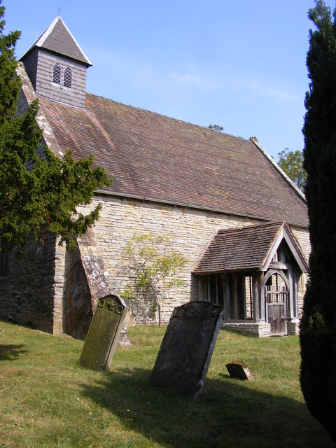
Broughton Hackett is served by a local primary school, providing education for children within the parish and the surrounding areas. The village also has a village hall, which serves as a hub for various community activities and events. Additionally, there is a church, St. Leonard's, which dates back to the 12th century and holds regular services.

The surrounding area offers plenty of opportunities for outdoor activities, with numerous walking and cycling routes crisscrossing the countryside. The nearby River Severn also provides opportunities for boating and fishing.

Overall, Broughton Hackett is a charming and idyllic rural parish, offering a peaceful and picturesque place to live, with convenient access to the nearby city of Worcester and its amenities.

If you have any feedback on the listing, please let us know in the comments section below.

Broughton Hackett Images

Images are sourced within 2km of 52.19007/-2.10835 or Grid Reference SO9254. Thanks to Geograph Open Source API. All images are credited.

Froxmere Court chimneys All the chimneys on Froxmere Court are different, showing beautiful brickwork.
Froxmere Court chimneys
All the chimneys on Froxmere Court are different, showing beautiful brickwork.
Bow Brook below Court Farm Late winter but no floods.
Bow Brook below Court Farm
Late winter but no floods.
Footpath from the farm Boggy area making footpath almost impassable,below Court Farm.
Footpath from the farm
Boggy area making footpath almost impassable,below Court Farm.
Hay bales near Broughton Hackett Hay bales in a field between Broughton Hackett and Bredicot, Thrift Wood can be seen on the hill in the background.
Hay bales near Broughton Hackett
Hay bales in a field between Broughton Hackett and Bredicot, Thrift Wood can be seen on the hill in the background.
The Old Chequers The Pub off Crowle Green road at Crowle, Worcestershire.
The Old Chequers
The Pub off Crowle Green road at Crowle, Worcestershire.
Crowle Green The road junction in Crowle with Netherwood Lane viewed from the pub car park.
Crowle Green
The road junction in Crowle with Netherwood Lane viewed from the pub car park.
Church View The view towards Crowle Church.
Church View
The view towards Crowle Church.
Tree View The view west from Thrift Wood Hill near Crowle.
Tree View
The view west from Thrift Wood Hill near Crowle.
Path to Thrift Wood The Footpath view up hill near Crowle.
Path to Thrift Wood
The Footpath view up hill near Crowle.
Thrift Wood View
Thrift Wood View
Felled Trees The view alongside the footpath near Churchill Wood.
Felled Trees
The view alongside the footpath near Churchill Wood.
Out of the Wood The view from the Marshes Wood near Sneachill.
Out of the Wood
The view from the Marshes Wood near Sneachill.
Churchill Church The view of St Michael Church in the village of Churchill.
Churchill Church
The view of St Michael Church in the village of Churchill.
Moat View The view of the Moat bank at Churchill village.
Moat View
The view of the Moat bank at Churchill village.
Broughton Hackett Church The view of St Leonard's church in the Worcestershire village.
Broughton Hackett Church
The view of St Leonard's church in the Worcestershire village.
Field view The view towards Crowle from the footpath near Broughton Hackett.
Field view
The view towards Crowle from the footpath near Broughton Hackett.
Pub Footpath The footpath in Crowle near The Old Chequers Pub.
Pub Footpath
The footpath in Crowle near The Old Chequers Pub.
Thrift Wood Hill The view down the hill side near Crowle.
Thrift Wood Hill
The view down the hill side near Crowle.
Show me another place!

Broughton Hackett is located at Grid Ref: SO9254 (Lat: 52.19007, Lng: -2.10835)

Administrative County: Worcestershire

District: Wychavon

Police Authority: West Mercia

What 3 Words

///afterglow.curry.euphoric. Near Kington, Worcestershire

Related Wikis

Broughton Hackett

Broughton Hackett is a village and civil parish in the Wychavon district of the county of Worcestershire, England. It is about 5 miles east of the city...

Churchill, Wychavon

Churchill or Churchill by Spetchley is a village and civil parish 4 miles (6.4 km) from Worcester, in the Wychavon district, in the county of Worcestershire...

St Michael's Church, Churchill

St Michael's Church is a redundant Anglican church in the village of Churchill in Oswaldslow, Worcestershire, England. It is recorded in the National...

Crowle, Worcestershire

Crowle (rhymes with coal) is a village in Worcestershire, England situated 4 miles (6.4 km) east of the City of Worcester. Crowle is known for its Church...

Upton Snodsbury

Upton Snodsbury is a village in Worcestershire, England, United Kingdom, located five miles east of Worcester just off the A422 road. It is surrounded...

St John the Baptist, White Ladies Aston

St John the Baptist is a church in White Ladies Aston, Worcestershire, England. It has been designated as a Grade II* listed building by Historic England...

A422 road

The A422 is an "A" road for east–west journeys in south central England, connecting the county towns of Bedford and Worcester by way of Milton Keynes,...

Bredicot railway station

Bredicot railway station served the village of Bredicot, Worcestershire, England, from 1845 to 1855 on the Birmingham and Gloucester Railway. == History... ==

Nearby Amenities

Located within 500m of 52.19007,-2.10835
Pub
The March Hare Inn
Addr City: Worcester
Addr Place: Broughton Hackett
Addr Postcode: WR7 4BE
Lat/Long: 52.1874768/-2.1120792
Broughton Hackett
Place: village
Wikidata: Q1905842
Wikipedia: en:Broughton Hackett
Lat/Long: 52.1887902/-2.1122999
March Hare Inn
Naptan AtcoCode: 2000G053600
Naptan Bearing: SW
Naptan BusStopType: CUS
Naptan CommonName: March Hare Inn
Naptan Indicator: Adj
Naptan Landmark: March Hare Inn
Naptan NaptanCode: wocdwtma
Naptan Street: A422
Naptan Verified: no
Source: naptan_import
Lat/Long: 52.1875869/-2.111829
March Hare Inn
Naptan AtcoCode: 2000G053601
Naptan Bearing: NE
Naptan BusStopType: CUS
Naptan CommonName: March Hare Inn
Naptan Indicator: Opp
Naptan Landmark: March Hare Inn
Naptan NaptanCode: wocdwtmd
Naptan Street: A422
Naptan Verified: no
Source: naptan_import
Lat/Long: 52.1877217/-2.1119171
Telephone Box
Naptan AtcoCode: 2000G323350
Naptan Bearing: W
Naptan BusStopType: CUS
Naptan CommonName: Telephone Box
Naptan Crossing: A422
Naptan Indicator: Opp
Naptan Landmark: Telephone Box
Naptan NaptanCode: wocgmdwt
Naptan Street: Manor Cottages
Naptan Verified: no
Source: naptan_import
Lat/Long: 52.1884075/-2.1092565
The Croft
Naptan AtcoCode: 2000G323351
Naptan Bearing: E
Naptan BusStopType: CUS
Naptan CommonName: The Croft
Naptan Crossing: The Croft
Naptan Indicator: Adj
Naptan NaptanCode: wocgmgad
Naptan Street: Manor Cottages
Naptan Verified: no
Source: naptan_import
Lat/Long: 52.1886207/-2.1119925
North Farm
Naptan AtcoCode: 2000G323352
Naptan Bearing: NW
Naptan BusStopType: CUS
Naptan CommonName: North Farm
Naptan Crossing: The Croft
Naptan Indicator: Adj
Naptan NaptanCode: wocgmgag
Naptan Street: The Croft
Naptan Verified: no
Source: naptan_import
Lat/Long: 52.1887191/-2.112534
Telephone Box
Naptan AtcoCode: 2000G675025
Naptan Bearing: E
Naptan BusStopType: CUS
Naptan CommonName: Telephone Box
Naptan Indicator: Adj
Naptan Landmark: A422 Layby Phone Box
Naptan NaptanCode: wocgadtd
Naptan Street: A422
Naptan Verified: no
Source: naptan_import
Lat/Long: 52.188579/-2.1084963
Power: pole
Lat/Long: 52.1868745/-2.1100207
Broughton Hackett Hop Picker
Power: pole
Transformer: distribution
Voltage Primary: 11000
Lat/Long: 52.1867571/-2.1091777
Power: pole
Lat/Long: 52.1865887/-2.107908
The March Hare
Power: pole
Transformer: distribution
Voltage Primary: 11000
Lat/Long: 52.1871096/-2.1117226
Power: pole
Lat/Long: 52.1861204/-2.1072957
Power: pole
Lat/Long: 52.186982/-2.1107848
Power: pole
Lat/Long: 52.1900673/-2.1099203
Barrier: kissing_gate
Foot: yes
Lat/Long: 52.1905242/-2.1097439
Power: pole
Lat/Long: 52.1935795/-2.1121439
Power: pole
Lat/Long: 52.1905641/-2.1033528
Power: pole
Lat/Long: 52.1912592/-2.110671
Power: pole
Lat/Long: 52.1907545/-2.1072773
Power: pole
Lat/Long: 52.1896051/-2.1096305
Power: pole
Lat/Long: 52.1927617/-2.1116297
Power: pole
Lat/Long: 52.1894551/-2.1112705
Power: pole
Lat/Long: 52.1906236/-2.104662
Power: pole
Lat/Long: 52.1905246/-2.110203
Power: pole
Lat/Long: 52.1906596/-2.1085098
Post Box
Collection Times: Mo-Fr 17:30; Sa 10:15
Post Box Type: lamp
Ref: WR7 39
Royal Cypher: EIIR
Royal Cypher Wikidata: Q33102113
Lat/Long: 52.1887261/-2.1123633
Power: pole
Lat/Long: 52.1902988/-2.1021168
Barrier: kissing_gate
Foot: yes
Lat/Long: 52.1894452/-2.1112094
Power: pole
Lat/Long: 52.1895312/-2.1104426
Fircone Farm South
Power: pole
Transformer: distribution
Voltage Primary: 11000
Lat/Long: 52.1920542/-2.1111718
Power: pole
Lat/Long: 52.1906831/-2.105924
Broughton Hackett Church
Power: pole
Transformer: distribution
Voltage Primary: 11000
Lat/Long: 52.1893898/-2.1120035
Power: pole
Lat/Long: 52.1916775/-2.1142633
Power: pole
Lat/Long: 52.1915575/-2.1126191
Power: pole
Lat/Long: 52.1917515/-2.1120814
Broughton Hackett
Power: pole
Transformer: distribution
Voltage Primary: 11000
Lat/Long: 52.1887252/-2.1090733
Power: pole
Lat/Long: 52.1906585/-2.1054024
Power: pole
Lat/Long: 52.1896394/-2.1056306
Power: pole
Lat/Long: 52.1883741/-2.1059284
Power: pole
Lat/Long: 52.1880584/-2.1060088
Power: pole
Lat/Long: 52.1872929/-2.1064889
The data included in this document is from www.openstreetmap.org. The data is made available under ODbL.

Have you been to Broughton Hackett?

Leave your review of Broughton Hackett below (or comments, questions and feedback).