Brough Sowerby

Civil Parish in Westmorland Eden

England

Brough Sowerby

Footbridge over River Belah at Field Head
Footbridge over River Belah at Field Head Credit: John H Darch

Brough Sowerby is a civil parish located in the county of Westmorland, in the northwestern part of England. It is situated in the Eden district, near the town of Kirkby Stephen. The parish covers an area of approximately 6 square miles and has a population of around 200 people.

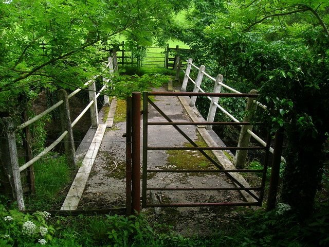
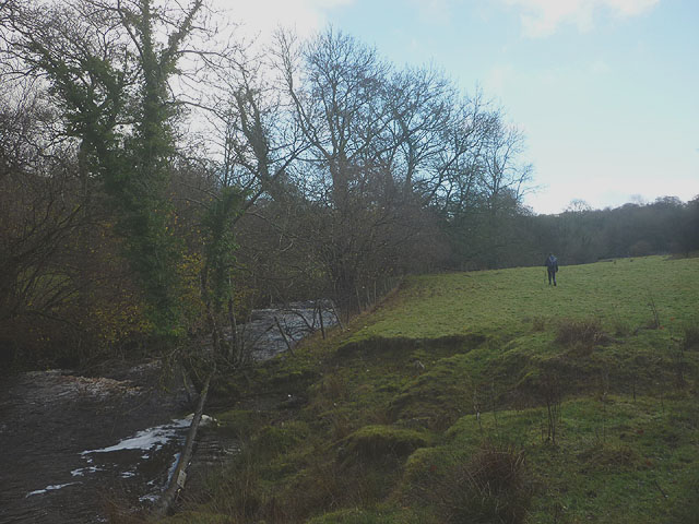
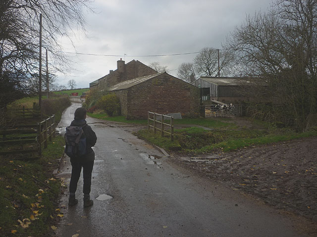
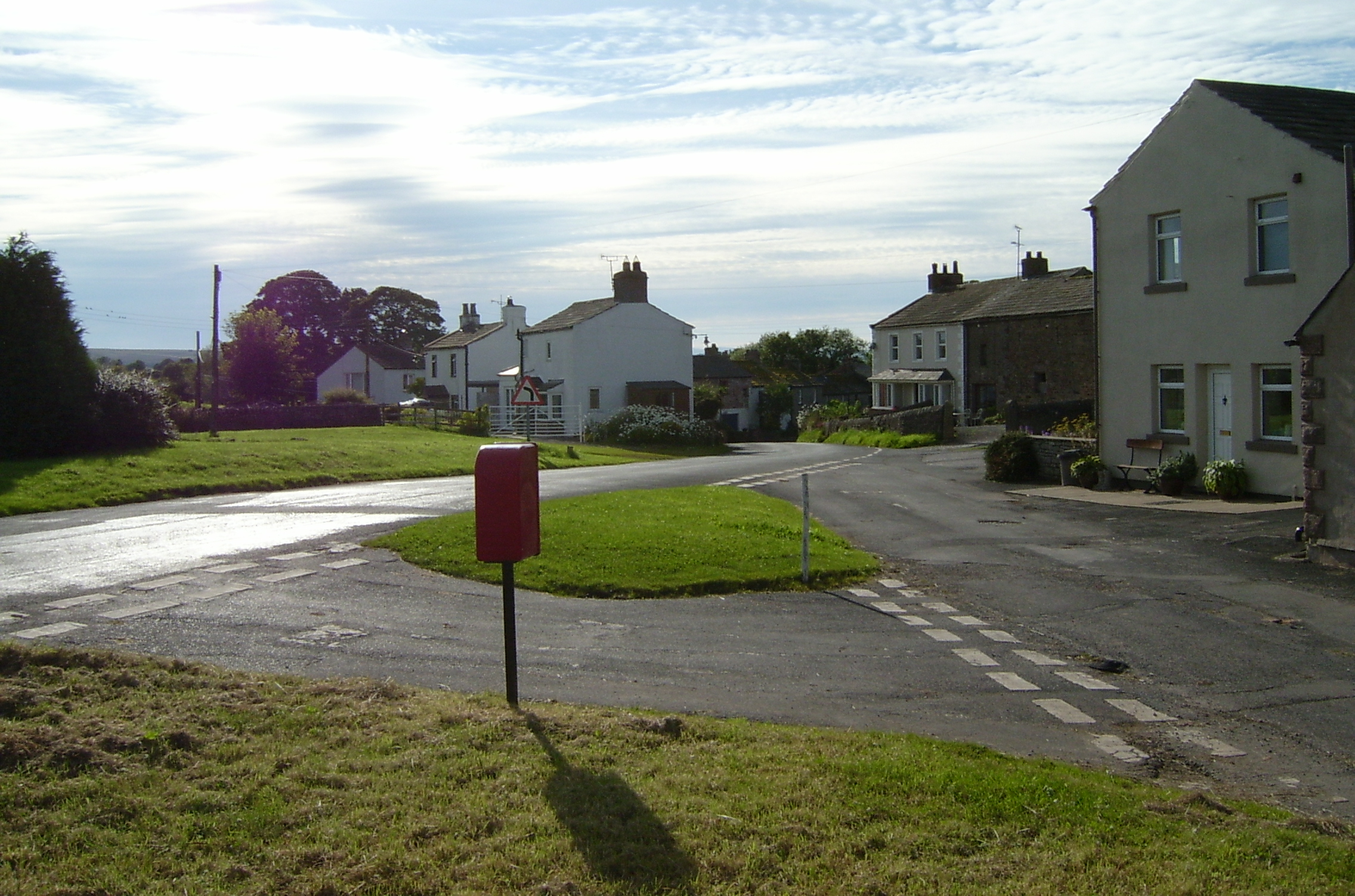
The village of Brough Sowerby is the main settlement within the parish. It is a small and picturesque village, with a rural charm and a close-knit community. The village is surrounded by beautiful countryside, with rolling hills and open fields, offering stunning views of the surrounding landscape.

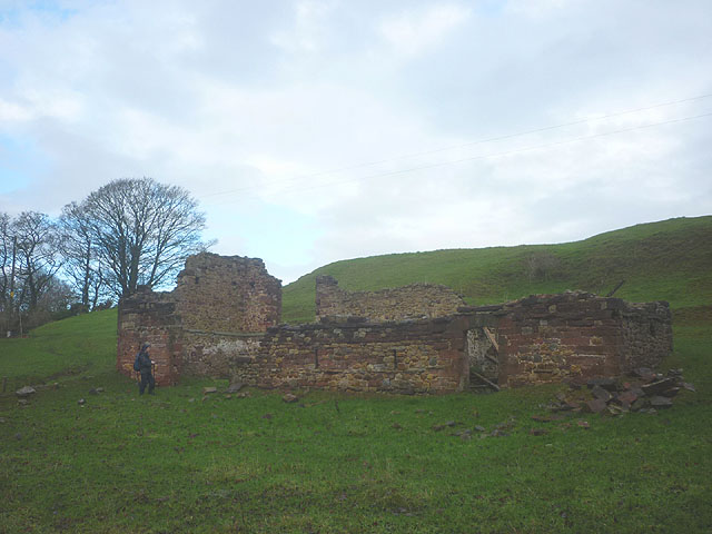
Historically, Brough Sowerby was an agricultural community, and farming still plays a significant role in the local economy. The village is known for its traditional stone-built houses, many of which date back several centuries and add to the village's character and charm.

Brough Sowerby is also home to the historic St. Michael's Church, which is a prominent feature within the village. The church dates back to the 12th century and is a Grade II listed building. It is a place of worship for the local community and also attracts visitors who appreciate its architectural and historical significance.

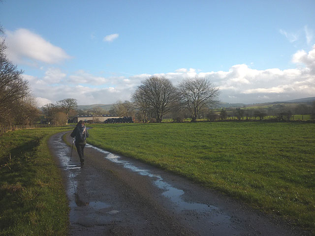
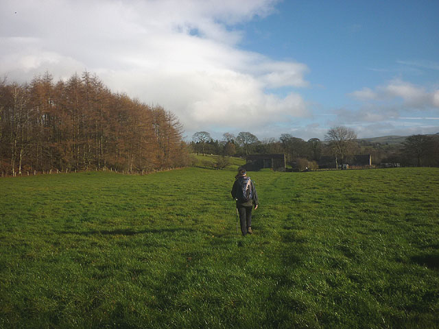
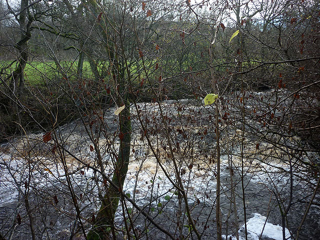
The parish provides a peaceful and idyllic setting, offering a tranquil escape from the bustle of city life. It is popular with walkers and nature enthusiasts who come to explore the surrounding countryside and enjoy the serene beauty of the area.

If you have any feedback on the listing, please let us know in the comments section below.

Brough Sowerby Images

Images are sourced within 2km of 54.509681/-2.303889 or Grid Reference NY8012. Thanks to Geograph Open Source API. All images are credited.

Footbridge over River Belah at Field Head
Farm track from Field Head
A66 east of Brough The A66 is a major road in northern England running from near Middlesbrough to Workington. The section between Scotch Corner and Penrith is a Trans-Pennine route between the A1 and M6, following an old Roman Road.
Wikipedia: <span class="nowrap"><a title="http://en.wikipedia.org/wiki/A66_road" rel="nofollow ugc noopener" href="http://en.wikipedia.org/wiki/A66_road">Link</a><img style="margin-left:2px;" alt="External link" title="External link - shift click to open in new window" src="https://s1.geograph.org.uk/img/external.png" width="10" height="10"/></span>
A66 east of Brough
The A66 is a major road in northern England running from near Middlesbrough to Workington. The section between Scotch Corner and Penrith is a Trans-Pennine route between the A1 and M6, following an old Roman Road. Wikipedia: LinkExternal link
Ordnance Survey Cut Mark This mark can be found on a gatepost beside the road to Limes Head.
For more detail see : <span class="nowrap"><a title="http://www.bench-marks.org.uk/bm43338" rel="nofollow ugc noopener" href="http://www.bench-marks.org.uk/bm43338">Link</a><img style="margin-left:2px;" alt="External link" title="External link - shift click to open in new window" src="https://s1.geograph.org.uk/img/external.png" width="10" height="10"/></span>
Ordnance Survey Cut Mark
This mark can be found on a gatepost beside the road to Limes Head. For more detail see : LinkExternal link
A66 approaching Brough The A66 is a major road in northern England running from near Middlesbrough to Workington. The section between Scotch Corner and Penrith is a Trans-Pennine route between the A1 and M6, following an old Roman Road.
Wikipedia: <span class="nowrap"><a title="http://en.wikipedia.org/wiki/A66_road" rel="nofollow ugc noopener" href="http://en.wikipedia.org/wiki/A66_road">Link</a><img style="margin-left:2px;" alt="External link" title="External link - shift click to open in new window" src="https://s1.geograph.org.uk/img/external.png" width="10" height="10"/></span>
A66 approaching Brough
The A66 is a major road in northern England running from near Middlesbrough to Workington. The section between Scotch Corner and Penrith is a Trans-Pennine route between the A1 and M6, following an old Roman Road. Wikipedia: LinkExternal link
Layby on the A66 nearing Brough turnoff
Ford at Powbrand Sike This ford on the Powbrand Sike is found adjacent to the road.
Ford at Powbrand Sike
This ford on the Powbrand Sike is found adjacent to the road.
Ruined barn above the Belah A substantial building which used to have two floors. Large blocks of local sandstone were used with large cobbles probably gotten from the river and nearby fields for infill.
Ruined barn above the Belah
A substantial building which used to have two floors. Large blocks of local sandstone were used with large cobbles probably gotten from the river and nearby fields for infill.
Bridleway approaching Bloan Farm Also the farm access track.
Bridleway approaching Bloan Farm
Also the farm access track.
Bridleway approaching Field Head Heading for the footbridge that crosses the River Belah.
Bridleway approaching Field Head
Heading for the footbridge that crosses the River Belah.
Footpath by the Belah An unmarked route heads through pastureland beside the swiftly flowing river to Oxenthwaite Bridge.
Footpath by the Belah
An unmarked route heads through pastureland beside the swiftly flowing river to Oxenthwaite Bridge.
Waterfall on the River Belah Beside the public footpath but difficult to see clearly through the trees and with a drop to the river side.
Waterfall on the River Belah
Beside the public footpath but difficult to see clearly through the trees and with a drop to the river side.
Redgate Farm Note the calves tethered to the gate (which is not red).
Redgate Farm
Note the calves tethered to the gate (which is not red).
Pivot bench mark, Redgate Farm A bit weathered. At an altitude of 197.678m asl.
Pivot bench mark, Redgate Farm
A bit weathered. At an altitude of 197.678m asl.
Redgate Lane through Rookby
Bridleway at Seldomin A short bridleway cutting off a road loop. The sun is lighting up the limestone escarpments to the north of Brough.
Bridleway at Seldomin
A short bridleway cutting off a road loop. The sun is lighting up the limestone escarpments to the north of Brough.
Boundary stone by the Belah (1) There are several (possibly three) stones on the north bank of the river. A second one can be seen beyond. They sit on the parish boundary of Brough Sowerby and Kaber. The boundary in this vicinity sometimes follows the centre of the river but in several places deviates from it to the north into what would 'naturally' be Brough Sowerby territory.
Boundary stone by the Belah (1)
There are several (possibly three) stones on the north bank of the river. A second one can be seen beyond. They sit on the parish boundary of Brough Sowerby and Kaber. The boundary in this vicinity sometimes follows the centre of the river but in several places deviates from it to the north into what would 'naturally' be Brough Sowerby territory.
Boundary stone by the Belah (2) There are several (possibly three) stones on the north bank of the river. This is visible behind <a href="https://www.geograph.org.uk/photo/4258511">NY8012 : Boundary stone by the Belah (1)</a>. They sit on the parish boundary of Brough Sowerby and Kaber. The boundary in this vicinity sometimes follows the centre of the river but in several places deviates from it to the north into what would 'naturally' be Brough Sowerby territory.
Boundary stone by the Belah (2)
There are several (possibly three) stones on the north bank of the river. This is visible behind NY8012 : Boundary stone by the Belah (1). They sit on the parish boundary of Brough Sowerby and Kaber. The boundary in this vicinity sometimes follows the centre of the river but in several places deviates from it to the north into what would 'naturally' be Brough Sowerby territory.
Show me another place!

Brough Sowerby is located at Grid Ref: NY8012 (Lat: 54.509681, Lng: -2.303889)

Administrative County: Cumbria

District: Eden

Police Authority: Cumbria

What 3 Words

///structure.libraries.shirts. Near Kirkby Stephen, Cumbria

Related Wikis

Brough Sowerby

Brough Sowerby is a village and civil parish in the Eden district of Cumbria, England. It is located 22.3 miles south east of the town Penrith. According...

Kaber, Cumbria

Kaber is a village and civil parish in the Eden District of Cumbria, England. == Location and topography == The village is located about 2 miles (3.2 km...
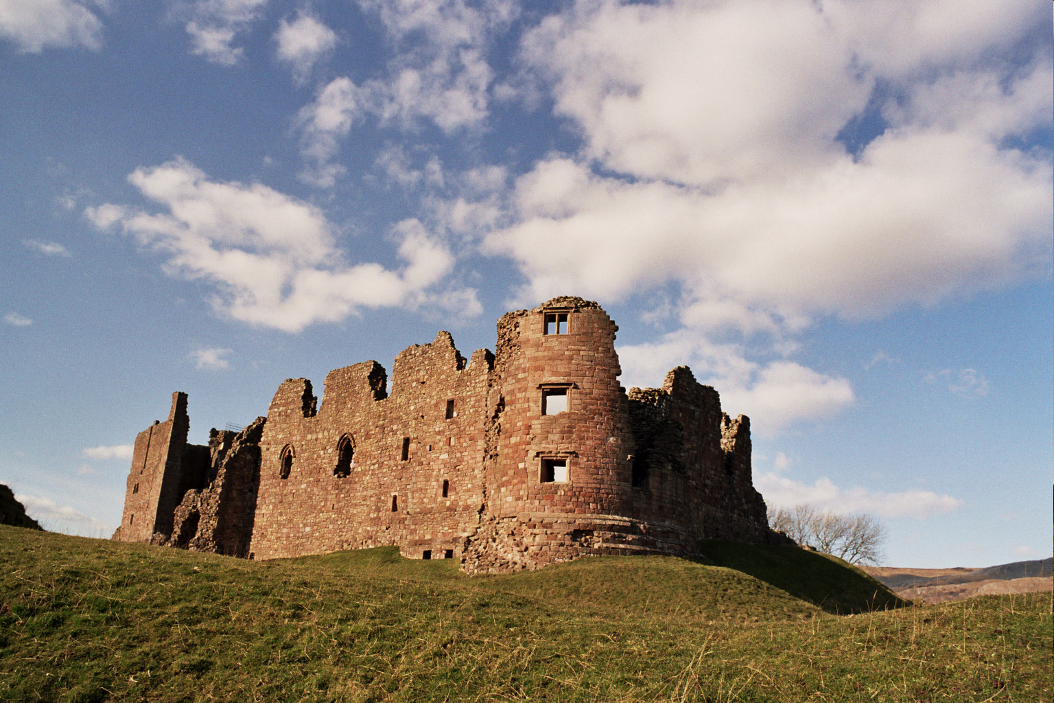
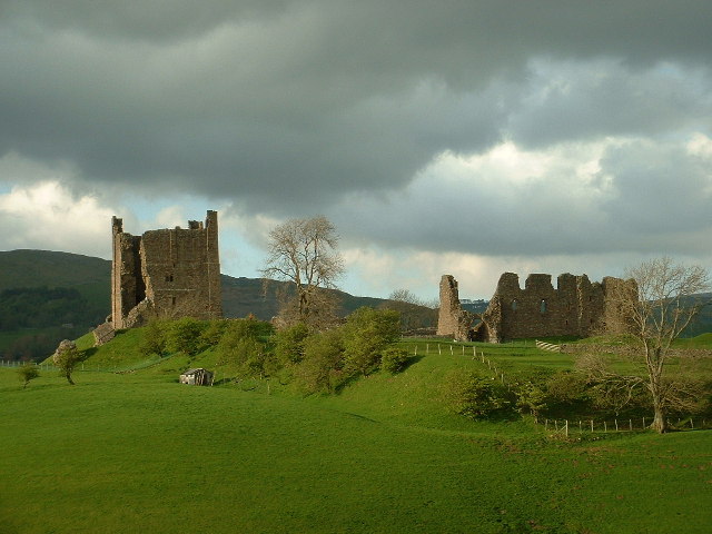
Brough Castle

Brough Castle is a ruined castle in the village of Brough, Cumbria, England. The castle was built by William Rufus around 1092 within the old Roman fort...

Brough, Cumbria

Brough (), sometimes known as Brough under Stainmore, is a village and civil parish in the Westmorland and Furness unitary authority of Cumbria, England...

Verterae

Verterae was a Roman fort in the modern-day village of Brough, Cumbria, England. Occupied between the 1st and 5th centuries AD, it protected a key Roman...

Helbeck

Helbeck is a settlement and civil parish near the village of Brough, in the Eden district, in the county of Cumbria, England. There is a wood called Helbeck...

Winton, Cumbria

Winton is a village and civil parish in the Eden District of Cumbria, England. It is 2.9 miles (4.7 km) south of Brough, and 1.6 miles (2.6 km) north of...

River Belah

The River Belah is a river in the county of Cumbria in England. Its name derives from the Old English word Belge and means the "Roaring River".The Belah...

Nearby Amenities

Located within 500m of 54.509681,-2.303889
Whitrigg
Place: locality
Lat/Long: 54.5075598/-2.2982967
Man Made: mast
Tower Type: communication
Lat/Long: 54.5135801/-2.3025227
Power: pole
Lat/Long: 54.5070203/-2.309365
Power: pole
Lat/Long: 54.5068974/-2.3077653
Power: pole
Lat/Long: 54.5067757/-2.3062744
Power: pole
Lat/Long: 54.5066563/-2.3048961
Power: pole
Lat/Long: 54.5067539/-2.3031877
Power: pole
Lat/Long: 54.506871/-2.3013606
Power: pole
Lat/Long: 54.5069422/-2.3001149
Power: pole
Lat/Long: 54.50691/-2.2983551
Power: pole
Lat/Long: 54.5116937/-2.3106621
Power: pole
Lat/Long: 54.5114148/-2.3092285
Power: pole
Lat/Long: 54.5110612/-2.3074094
Power: pole
Lat/Long: 54.5101463/-2.3078997
Power: pole
Lat/Long: 54.5092153/-2.3083268
Power: pole
Lat/Long: 54.5085322/-2.3083822
Power: pole
Lat/Long: 54.5076723/-2.3083486
The data included in this document is from www.openstreetmap.org. The data is made available under ODbL.

Have you been to Brough Sowerby?

Leave your review of Brough Sowerby below (or comments, questions and feedback).