Bromyard and Winslow
Civil Parish in Herefordshire
England
Bromyard and Winslow

Bromyard and Winslow is a civil parish located in the county of Herefordshire, England. Situated in the West Midlands region, the parish covers an area of approximately 13.5 square kilometers and is home to a population of around 3,000 residents.
The parish is made up of two main settlements, Bromyard and Winslow. Bromyard, the larger of the two, is a market town that dates back to the medieval period. It is known for its picturesque rural setting and charming historic buildings, including the Grade I listed St. Peter's Church. The town also boasts a range of amenities and services, such as shops, pubs, and restaurants, making it a popular destination for both residents and visitors.
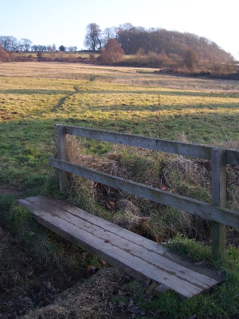
Winslow, on the other hand, is a smaller village located to the northeast of Bromyard. It offers a more tranquil and rural atmosphere, surrounded by beautiful countryside and farmland. The village is characterized by its traditional architecture, with many timber-framed houses and cottages still standing.
Both Bromyard and Winslow are well-connected to the wider region, with good road links to nearby towns and cities. The parish also benefits from a range of community facilities, including primary schools, sports clubs, and community centers.
Overall, Bromyard and Winslow, Herefordshire, offer a blend of historic charm, natural beauty, and community spirit, making it an attractive place to live or visit for those seeking a peaceful and picturesque location in the heart of rural England.
If you have any feedback on the listing, please let us know in the comments section below.
Bromyard and Winslow Images
Images are sourced within 2km of 52.196419/-2.519851 or Grid Reference SO6455. Thanks to Geograph Open Source API. All images are credited.


Bromyard and Winslow is located at Grid Ref: SO6455 (Lat: 52.196419, Lng: -2.519851)
Unitary Authority: County of Herefordshire
Police Authority: West Mercia
What 3 Words
///ambushed.ladders.homeward. Near Bromyard, Herefordshire
Nearby Locations
Related Wikis

Bromyard
Bromyard is a town in the parish of Bromyard and Winslow, in Herefordshire, England, in the valley of the River Frome. It is near the county border with...

Queen Elizabeth High School, Bromyard
Queen Elizabeth High School is a high school with academy status situated in Herefordshire, on the outskirts of Bromyard. The school meets the educational...
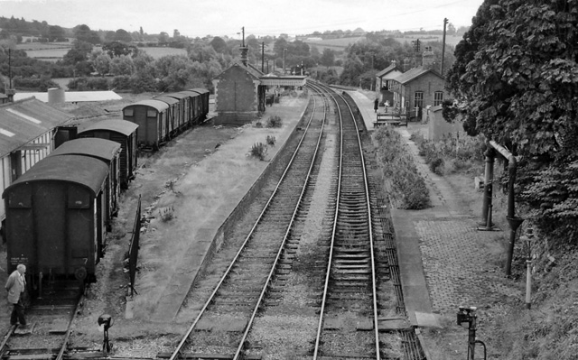
Bromyard railway station
Bromyard railway station was a station in Bromyard, Herefordshire, England. The station was opened on 22 October 1877 and closed after the last train on...
Bromyard Town F.C.
Bromyard Town Football Club is a football club based in Bromyard, Herefordshire, England. They are currently members of the West Midlands (Regional) League...

Norton, Herefordshire
Norton is a civil parish in north-east Herefordshire, England, and is approximately 14 miles (23 km) north-east from the city and county town of Hereford...
Bromyard Downs
Bromyard Downs is an area of registered common land, and a scattered settlement, just outside the town of Bromyard in Herefordshire, England. The 114 hectares...

Rowden Mill railway station
Rowden Mill railway station was a railway station located on the Worcester, Bromyard and Leominster Railway in England. == Opening == Opened as part of...

Avenbury
Avenbury is a civil parish in Herefordshire, England. It is on the A465, just south of Bromyard, and by the River Frome. The population of this parish...
Nearby Amenities
Located within 500m of 52.196419,-2.519851Have you been to Bromyard and Winslow?
Leave your review of Bromyard and Winslow below (or comments, questions and feedback).