Brockdish

Civil Parish in Norfolk South Norfolk

England

Brockdish

Converted Mill, Syleham  Old textile mill, converted into dwellings.
Converted Mill, Syleham Credit: Roger Jones

Brockdish is a civil parish located in Norfolk, England. It is situated approximately 4 miles south of the town of Diss and about 20 miles west of Norwich. The village lies on the banks of the River Waveney, which forms the border between Norfolk and Suffolk.

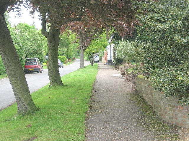
Brockdish is a small village with a population of around 400 residents. It is known for its picturesque rural setting, with rolling fields and charming countryside views. The village features a mix of traditional brick and thatched-roof cottages, as well as some newer residential developments.

The village has a rich history, with evidence of human settlement dating back to the Roman period. It was mentioned in the Domesday Book of 1086 as "Brochedis," and has since played a significant role in the agricultural industry of the region.

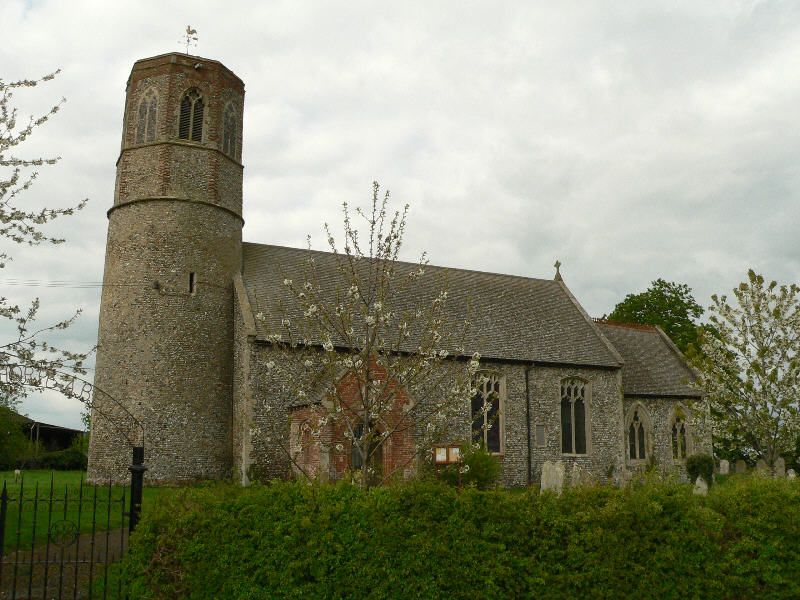
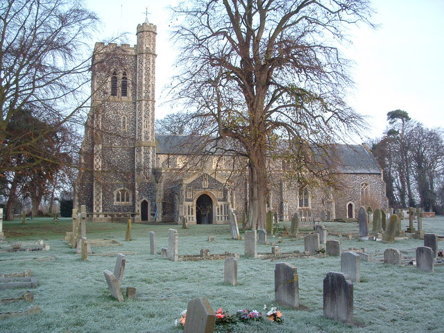
Today, Brockdish offers a range of amenities for its residents and visitors. It has a village hall that hosts various community events and activities, a primary school, a church, and a local pub. The village is also well-connected, with bus services operating to nearby towns and villages.

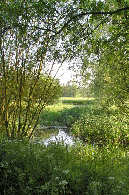
The surrounding area offers plenty of opportunities for outdoor pursuits, with the River Waveney providing opportunities for boating and fishing. The village is also surrounded by beautiful countryside, making it an ideal location for walking and cycling enthusiasts.

In summary, Brockdish is a small and picturesque village in Norfolk, offering a peaceful and idyllic setting for residents and visitors alike.

If you have any feedback on the listing, please let us know in the comments section below.

Brockdish Images

Images are sourced within 2km of 52.372586/1.22896 or Grid Reference TM1979. Thanks to Geograph Open Source API. All images are credited.

Converted Mill, Syleham  Old textile mill, converted into dwellings.
Converted Mill, Syleham
Old textile mill, converted into dwellings.
A143 east at turning for The Street to Brockdish
St.Peter And St.Paul Brockdish The church of St.Peter and St.Paul Brockdish Norfolk on a frosty morning.
<span class="nowrap"><a title="http://www.norfolkchurches.co.uk/brockdish/brockdish.htm" rel="nofollow ugc noopener" href="http://www.norfolkchurches.co.uk/brockdish/brockdish.htm">Link</a><img style="margin-left:2px;" alt="External link" title="External link - shift click to open in new window" src="https://s1.geograph.org.uk/img/external.png" width="10" height="10"/></span>
St.Peter And St.Paul Brockdish
The church of St.Peter and St.Paul Brockdish Norfolk on a frosty morning. LinkExternal link
'The Old Kings Head' inn The road was the original A.143 that ran through Brockdish village.
'The Old Kings Head' inn
The road was the original A.143 that ran through Brockdish village.
Cottages at Syleham This view is at the end of Wingfield road. The notice board, just to the left of the cottages, stands at the start of a track that leads to Syleham parish church.
Cottages at Syleham
This view is at the end of Wingfield road. The notice board, just to the left of the cottages, stands at the start of a track that leads to Syleham parish church.
The Street, Brockdish Much quieter and safer since the village was by-passed.
The Street, Brockdish
Much quieter and safer since the village was by-passed.
The Ford, Brockdish There is an alternative route when the ford is high.
The Ford, Brockdish
There is an alternative route when the ford is high.
The Brook, Brockdish The brook, the beck or the stream.
The Brook, Brockdish
The brook, the beck or the stream.
Grove Road, Brockdish
Syleham Church
Syleham Church
View of Water Meadows from Syleham Church
View of Brockdish Village Brockdish, Norfolk is situated in the Waveney Valley, close to the river.  The River Waveney forms the county boundary between Norfolk and Suffolk.  This view is taken from the Suffolk side of the river, part-way up the valley side.
View of Brockdish Village
Brockdish, Norfolk is situated in the Waveney Valley, close to the river. The River Waveney forms the county boundary between Norfolk and Suffolk. This view is taken from the Suffolk side of the river, part-way up the valley side.
St Peter & St Paul, Brockdish, Norfolk
St Peter & St Paul, Brockdish, Norfolk - Doorway
St Peter & St Paul, Brockdish, Norfolk - Font
St Peter & St Paul, Brockdish, Norfolk - East end
St Peter & St Paul, Brockdish, Norfolk - Chancel
Show me another place!

Brockdish is located at Grid Ref: TM1979 (Lat: 52.372586, Lng: 1.22896)

Administrative County: Norfolk

District: South Norfolk

Police Authority: Norfolk

What 3 Words

///hats.streaking.plodded. Near Dickleburgh, Norfolk

Related Wikis

Thorpe Abbotts

Thorpe Abbotts is a village and (as Thorpe Abbots) a former civil parish, now in the parish of Brockdish, in the South Norfolk district, in the county...

Brockdish

Brockdish is a village and civil parish in the South Norfolk district of Norfolk, England. The village is situated on the River Waveney (south of which...

100th Bomb Group Memorial Museum

The 100th Bomb Group Memorial Museum, located in the original control tower and other remaining buildings of the RAF Thorpe Abbotts airfield east of Diss...

River Dove, Suffolk

The River Dove is a river in the county of Suffolk. It is a tributary of the River Waveney starting near Bacton going through Eye to the Waveney. ��2...

Nearby Amenities

Located within 500m of 52.372586,1.22896
Barrier: cycle_barrier
Foot: yes
Material: wood
Lat/Long: 52.3688816/1.2328261
Give Way
Lat/Long: 52.3721108/1.2217363
Bench
Backrest: yes
Material: wood
Seats: 3
Lat/Long: 52.3722256/1.2217707
Historic: yes
Man Made: water_well
Pump: manual
Wikidata: Q26592754
Lat/Long: 52.3722721/1.2218253
Bench
Backrest: yes
Material: wood
Seats: 3
Lat/Long: 52.3722709/1.2218689
Bench
Backrest: yes
Material: wood
Seats: 3
Lat/Long: 52.3722913/1.2217585
Thorpe Abbotts
Place: hamlet
Lat/Long: 52.372492/1.2218101
Give Way
Lat/Long: 52.3723956/1.2216905
Give Way
Lat/Long: 52.372317/1.2220156
Waste Basket
Source: survey
Waste: dog_excrement
Lat/Long: 52.3721382/1.2242097
Waste Basket
Waste: dog_excrement
Lat/Long: 52.372204/1.2217908
Power: pole
Lat/Long: 52.3718378/1.2309703
Power: pole
Lat/Long: 52.371813/1.232451
Power: pole
Lat/Long: 52.3717959/1.2334781
Power: pole
Lat/Long: 52.3717782/1.2345321
Power: pole
Lat/Long: 52.37176/1.2356199
The data included in this document is from www.openstreetmap.org. The data is made available under ODbL.

Have you been to Brockdish?

Leave your review of Brockdish below (or comments, questions and feedback).