Brinkley

Civil Parish in Cambridgeshire East Cambridgeshire

England

Brinkley

Weston Colville: St Mary - from the east "About 1825 much was rebuilt, especially tower and chancel. The building is characterised by the rare effect of flint in a kind of grey brick framing" (Nikolaus Pevsner).
Weston Colville: St Mary - from the east Credit: John Sutton

Brinkley is a civil parish located in the county of Cambridgeshire, England. It is situated approximately 12 miles east of the city of Cambridge. The parish covers an area of around 4 square miles and is home to a population of approximately 300 residents.

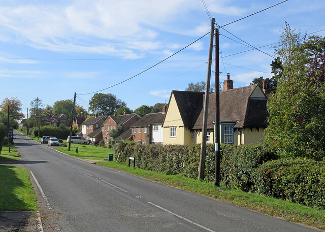
The village of Brinkley is nestled in the heart of the picturesque Cambridgeshire countryside, surrounded by rolling hills and lush green fields. It is a quintessential English village with a charming, rural atmosphere. The village is characterized by its traditional thatched cottages and historic buildings, which add to its unique character.

Brinkley is well-connected to nearby towns and cities, with good road links to Cambridge and Newmarket. The village is also served by a regular bus service, providing easy access to surrounding areas. Despite its rural location, Brinkley benefits from being within close proximity to amenities, including shops, schools, and healthcare facilities, in nearby villages and towns.

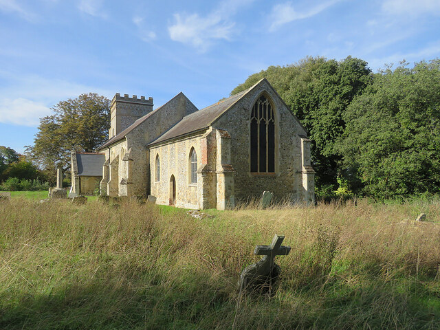
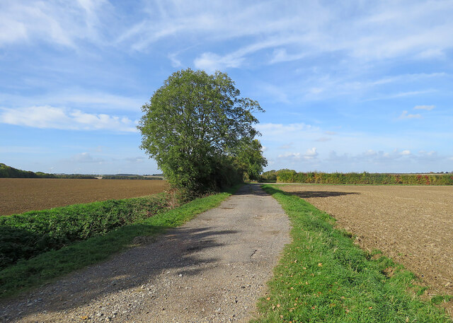
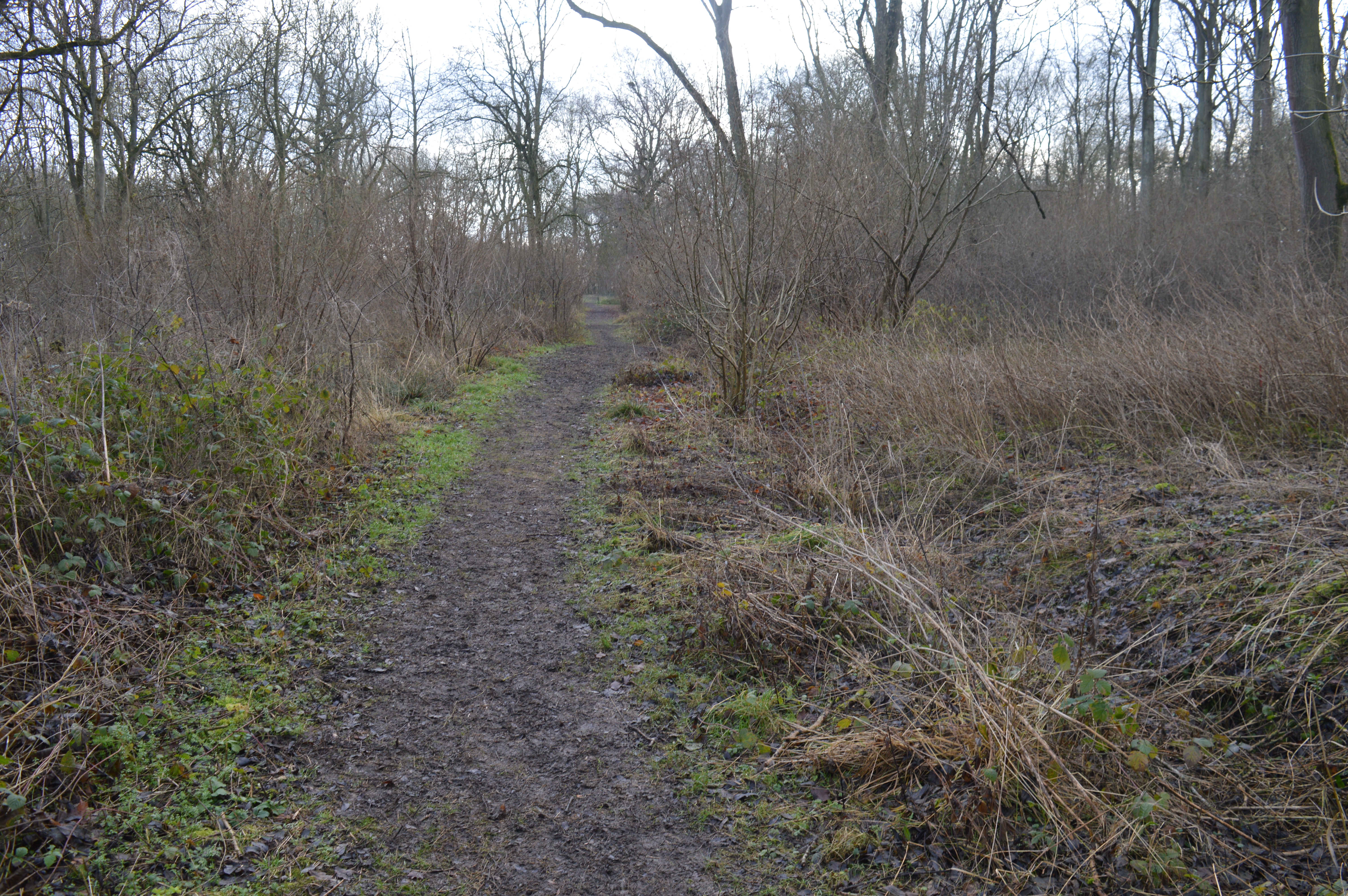
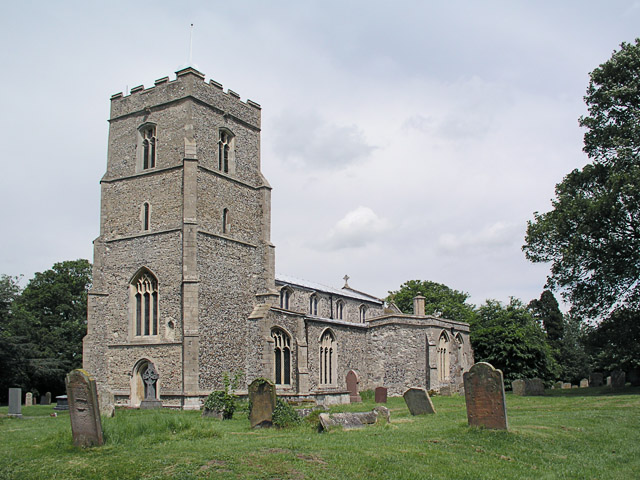
The parish is surrounded by beautiful natural landscapes, making it an ideal location for outdoor enthusiasts. There are several walking and cycling routes that pass through the area, allowing residents and visitors to explore the stunning countryside. The village also boasts a picturesque church, St. Mary's, which dates back to the 12th century and is a popular landmark in the area.

Overall, Brinkley offers a tranquil and idyllic setting for those seeking a peaceful rural lifestyle, while still providing easy access to the amenities of nearby towns and cities.

If you have any feedback on the listing, please let us know in the comments section below.

Brinkley Images

Images are sourced within 2km of 52.170841/0.363762 or Grid Reference TL6155. Thanks to Geograph Open Source API. All images are credited.

Weston Colville: St Mary - from the east "About 1825 much was rebuilt, especially tower and chancel. The building is characterised by the rare effect of flint in a kind of grey brick framing" (Nikolaus Pevsner).
Weston Colville: St Mary - from the east
"About 1825 much was rebuilt, especially tower and chancel. The building is characterised by the rare effect of flint in a kind of grey brick framing" (Nikolaus Pevsner).
Weston Colville: houses on Brinkley Road A fine October morning.
Weston Colville: houses on Brinkley Road
A fine October morning.
Bridleway to Grange Road The start of a track which ends at the road from Weston Colville to Dullingham, a mile and a half away.
Bridleway to Grange Road
The start of a track which ends at the road from Weston Colville to Dullingham, a mile and a half away.
Towards Weston Colville on Brinkley Road This is the winding B1052, between Willingham Green and Weston Colville, photographed on a bright October morning.
Towards Weston Colville on Brinkley Road
This is the winding B1052, between Willingham Green and Weston Colville, photographed on a bright October morning.
Cottages at Willingham Green A hamlet between Weston Colville and Brinkley (ahead) in the gentle hills of East Cambridgeshire.
Cottages at Willingham Green
A hamlet between Weston Colville and Brinkley (ahead) in the gentle hills of East Cambridgeshire.
Willingham Green Road This is a hamlet in East Cambridgeshire. The road leads to Carlton and on into Suffolk.
Willingham Green Road
This is a hamlet in East Cambridgeshire. The road leads to Carlton and on into Suffolk.
The start of a footpath at Willingham Green This is part of a complex network of footpaths linking Carlton, Brinkley and Weston Green.
The start of a footpath at Willingham Green
This is part of a complex network of footpaths linking Carlton, Brinkley and Weston Green.
A crossroads on Brinkley Road Brinkley to the left, Six Mile Bottom and Cambridge to the right, Weston Colville and (not very directly) Balsham straight ahead. The road behind the camera runs to Dullingham.
A crossroads on Brinkley Road
Brinkley to the left, Six Mile Bottom and Cambridge to the right, Weston Colville and (not very directly) Balsham straight ahead. The road behind the camera runs to Dullingham.
North-west from Westley Waterless Straight on for Westley Bottom.
North-west from Westley Waterless
Straight on for Westley Bottom.
Westley Waterless: water shortage After the drought summer of 2022 the water level looks low in the pond on Church Lane.

For comparison: <a href="https://www.geograph.org.uk/photo/3276200">TL6156 : Westley Waterless: Church Lane and pond</a> (2012).
Westley Waterless: water shortage
After the drought summer of 2022 the water level looks low in the pond on Church Lane. For comparison: TL6156 : Westley Waterless: Church Lane and pond (2012).
Westley Waterless: St Mary - restoration Two men were working on the bellcote - one on the lead, the other painting the louvres. The spirelet replaced a round tower which collapsed in 1855.

Inside are two exquisite 14th-century brasses: <a href="https://www.geograph.org.uk/photo/3276297">TL6156 : Westley Waterless: brass of Sir John Creke (detail)</a> and <a href="https://www.geograph.org.uk/photo/3276294">TL6156 : Westley Waterless: brass of Lady Creke (detail)</a>.
Westley Waterless: St Mary - restoration
Two men were working on the bellcote - one on the lead, the other painting the louvres. The spirelet replaced a round tower which collapsed in 1855. Inside are two exquisite 14th-century brasses: TL6156 : Westley Waterless: brass of Sir John Creke (detail) and TL6156 : Westley Waterless: brass of Lady Creke (detail).
Westley Waterless: building work A new house on Main Road
Westley Waterless: building work
A new house on Main Road
Converted water tower near Burrough Green A house on the B1061 between Dullingham and Brinkley.
Converted water tower near Burrough Green
A house on the B1061 between Dullingham and Brinkley.
Burrough End: the B1052 near the Westley Waterless turn <a href="https://www.geograph.org.uk/photo/3276486">TL6255 : Nearing Burrough End</a> is a winter view from the other side of the road, taken nearly ten years before.
Burrough End: the B1052 near the Westley Waterless turn
TL6255 : Nearing Burrough End is a winter view from the other side of the road, taken nearly ten years before.
On the B1052 Dullingham Road Nearing Fern Cottage, between Brinkley and Burrough End, on a sparkling October morning.
On the B1052 Dullingham Road
Nearing Fern Cottage, between Brinkley and Burrough End, on a sparkling October morning.
Brinkley: autumn sunlight The fine trees form an avenue to Brinkley Hall. <a href="https://www.geograph.org.uk/photo/3275507">TL6254 : Brinkley: winter sunlight</a> is a closer view, taken almost ten years before.
Brinkley: autumn sunlight
The fine trees form an avenue to Brinkley Hall. TL6254 : Brinkley: winter sunlight is a closer view, taken almost ten years before.
Footpath to Westley Waterless Taken from the side of the road from Six Mile Bottom to Brinkley (right) on a cloudless October morning.
Footpath to Westley Waterless
Taken from the side of the road from Six Mile Bottom to Brinkley (right) on a cloudless October morning.
The eastern edge of Brinkley Wood At over 350ft, the hills of East Cambridgeshire are a lot higher than much of the rest of the county. Big fields and large plantations typify the area.
The eastern edge of Brinkley Wood
At over 350ft, the hills of East Cambridgeshire are a lot higher than much of the rest of the county. Big fields and large plantations typify the area.
Show me another place!

Brinkley is located at Grid Ref: TL6155 (Lat: 52.170841, Lng: 0.363762)

Administrative County: Cambridgeshire

District: East Cambridgeshire

Police Authority: Cambridgeshire

What 3 Words

///lows.disbelief.blows. Near Balsham, Cambridgeshire

Nearby Locations

Brinkley Wood Brinkley

Related Wikis

Westley Waterless

Westley Waterless is a small village and civil parish in East Cambridgeshire, England, 5 miles south west of Newmarket. == History == The parish of Westley...

Brinkley, Cambridgeshire

Brinkley is a small village in Cambridgeshire, England. It is situated about 15 miles east of Cambridge and 5 miles south of Newmarket, the horse racing...

Weston Colville

Weston Colville is a village in South Cambridgeshire, 10 miles southeast of Cambridge and 6 miles south of Newmarket, close to the border with Suffolk...

Park Wood, Cambridgeshire

Park Wood is an 8.1-hectare (20-acre) biological Site of Special Scientific Interest east of Brinkley in Cambridgeshire.This is woodland of the wet ash/maple...

Lower Wood

Lower Wood is a 9 hectare nature reserve east of Weston Colville in Cambridgeshire. It is managed by the Wildlife Trust for Bedfordshire, Cambridgeshire...

Burrough Green

Burrough Green is a village and parish in Cambridgeshire, England. The population of the village at the 2011 census was 378. The soil is various; subsoil...

West Wratting

West Wratting is a village and civil parish 10 miles southeast of Cambridge in Cambridgeshire. At 390 feet (120 m) above sea level, it can claim to be...

Dullingham

Dullingham is a small village and civil parish in East Cambridgeshire, England. It is situated 4 miles (6 km) south of Newmarket and 14 miles (23 km) east...

Nearby Amenities

Located within 500m of 52.170841,0.363762
Power: pole
Lat/Long: 52.166378/0.3630848
The data included in this document is from www.openstreetmap.org. The data is made available under ODbL.

Have you been to Brinkley?

Leave your review of Brinkley below (or comments, questions and feedback).