Campden, Broad

Settlement in Gloucestershire Cotswold

England

Campden, Broad

Old Market Hall Chipping Campden
Old Market Hall Credit: Anthony O'Neil

Campden, Broad is a charming village located in the Cotswold district of Gloucestershire, England. With a population of around 1,000 residents, it exudes a peaceful and idyllic countryside atmosphere. Nestled amidst rolling hills and picturesque landscapes, Campden, Broad is often hailed as one of the most beautiful villages in the Cotswolds.

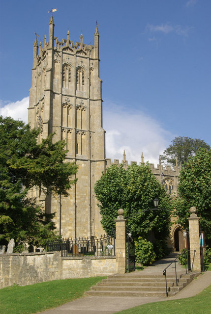
The village is renowned for its stunning architecture, predominantly showcasing traditional Cotswold stone buildings. The historic St. Michael and All Angels Church, dating back to the 12th century, stands as a prominent landmark, attracting visitors with its intricate architectural details and rich history.

Campden, Broad offers a range of amenities to residents and visitors alike. The village boasts several quaint shops, charming cafes, and traditional pubs, where one can immerse themselves in the warm and welcoming community spirit. The local market square, known as the "Bitterne Market Hall," is a hub of activity, hosting regular markets and events throughout the year.

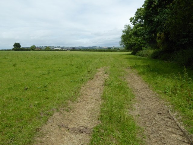
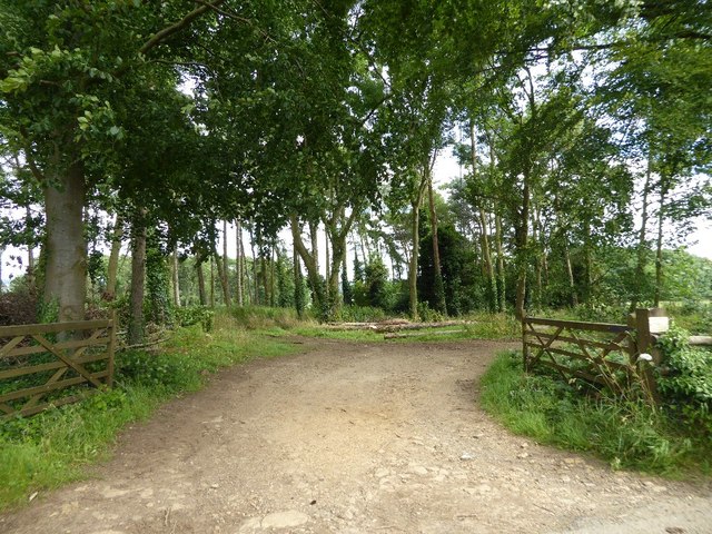
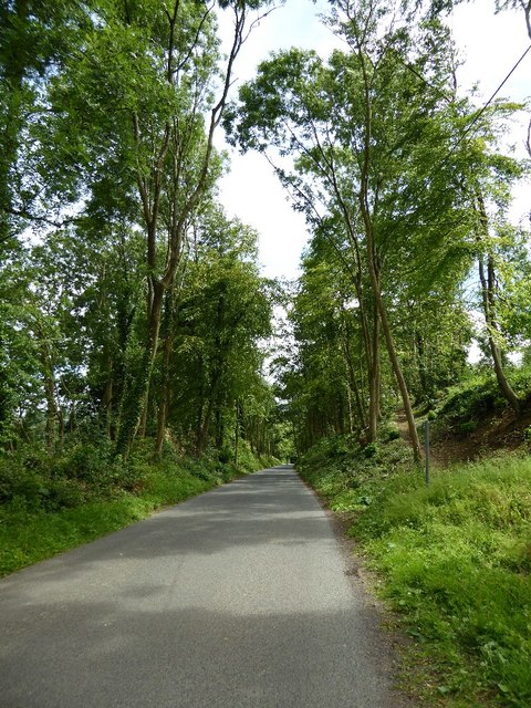
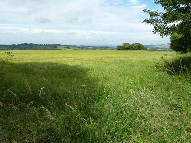
Nature enthusiasts will find themselves in paradise in Campden, Broad, with an abundance of walking and cycling trails to explore. The surrounding countryside offers breathtaking views and the opportunity to observe local wildlife in its natural habitat. The nearby Cotswold Way, a renowned long-distance trail, provides a fantastic opportunity to experience the area's beauty.

Overall, Campden, Broad is a quintessential English village, offering a tranquil escape from the hustle and bustle of city life. Its stunning architecture, vibrant community, and natural beauty make it a must-visit destination for anyone seeking an authentic Cotswold experience.

If you have any feedback on the listing, please let us know in the comments section below.

Campden, Broad Images

Images are sourced within 2km of 52.038977/-1.774721 or Grid Reference SP1537. Thanks to Geograph Open Source API. All images are credited.

Old Market Hall Chipping Campden
Old Market Hall
Chipping Campden
View over Chipping Campden From the churchyard
View over Chipping Campden
From the churchyard
Chipping Campden High Street
Park Road, Chipping Campden
Field near Grey stone Farm A bridleway follows the hedgerow to the right of this field near GreyStone Farm which can be seen by the hedge to the left.
Field near Grey stone Farm
A bridleway follows the hedgerow to the right of this field near GreyStone Farm which can be seen by the hedge to the left.
Woodland belt at Northwick Park Entrance to a woodland belt beside a country road passing Northwick Park, near Blockley.
Woodland belt at Northwick Park
Entrance to a woodland belt beside a country road passing Northwick Park, near Blockley.
Road passing through Beech Plantation Road passing through Beech Plantation in Northwick Park.
Road passing through Beech Plantation
Road passing through Beech Plantation in Northwick Park.
Barley in a Cotswold landscape
Farmland above Chipping Campden
Altar frontals, Chipping Campden Church In the church of St. James the Great, the only complete pre-Reformation set of medieval hangings in the country. This very small section depicts the Assumption of the Virgin Mary.
Altar frontals, Chipping Campden Church
In the church of St. James the Great, the only complete pre-Reformation set of medieval hangings in the country. This very small section depicts the Assumption of the Virgin Mary.
Churchyard, St. James the Great Church, Chipping Campden
East Banqueting House, Chipping Campden The remains of the Jacobean Old Manor House, a Grade II listed building that is now used as holiday accommodation. The surrounding field is the Coneygree, National Trust land bought in 1934. The name is derived from Conyger, meaning rabbit warren. Artificial warrens were constructed to provide homes for the rabbits and food for the landowners' tables.
East Banqueting House, Chipping Campden
The remains of the Jacobean Old Manor House, a Grade II listed building that is now used as holiday accommodation. The surrounding field is the Coneygree, National Trust land bought in 1934. The name is derived from Conyger, meaning rabbit warren. Artificial warrens were constructed to provide homes for the rabbits and food for the landowners' tables.
National Trust sign on a wall in Chipping Campden The Coneygree, National Trust land bought in 1934. The name is derived from Conyger, meaning rabbit warren. Artificial warrens were constructed to provide homes for the rabbits and food for the landowners' tables.
National Trust sign on a wall in Chipping Campden
The Coneygree, National Trust land bought in 1934. The name is derived from Conyger, meaning rabbit warren. Artificial warrens were constructed to provide homes for the rabbits and food for the landowners' tables.
High Street, Chipping Campden
Grevel's House, High Street, Chipping Campden The part of the house on the left is 14C and it has been extended in the 16C and later. The left gable is 16C in style, and has a sundial. The next one is in Perpendicular style, and has a pair of gargoyles. The gable to the right has 17C windows. The interior plan is of the 16C type. The house is listed, Grade I, and this information has been taken from the listing details.
Grevel's House, High Street, Chipping Campden
The part of the house on the left is 14C and it has been extended in the 16C and later. The left gable is 16C in style, and has a sundial. The next one is in Perpendicular style, and has a pair of gargoyles. The gable to the right has 17C windows. The interior plan is of the 16C type. The house is listed, Grade I, and this information has been taken from the listing details.
Chipping Campden, St. James Church
Chipping Campden, St. James Church: The Cotswold Tower softened by thin pilaster strips
Show me another place!

Campden, Broad is located at Grid Ref: SP1537 (Lat: 52.038977, Lng: -1.774721)

Administrative County: Gloucestershire

District: Cotswold

Police Authority: Gloucestershire

What 3 Words

///reference.funnels.else. Near Chipping Campden, Gloucestershire

Related Wikis

Broad Campden

Broad Campden is a small village in Gloucestershire, England, with a church and pub, and notable for its beauty and fine walking trails. == History... ==

Guild and School of Handicraft

The Guild and School of Handicraft was established in 1888 in London, later moving to Chipping Campden in Gloucestershire, England, as a community of artists...

Chipping Campden Town Hall

Chipping Campden Town Hall is a municipal building in the High Street, Chipping Campden, Gloucestershire, England. The building, which is the meeting place...

Chipping Campden

Chipping Campden is a market town in the Cotswold district of Gloucestershire, England. It is notable for its terraced High Street, dating from the 14th...

North Cotswold Community Radio

North Cotswold Community Radio is a non-profit community internet radio station serving primarily the North Cotswolds and the surrounding area in west...

Church of St James, Chipping Campden

The Anglican Church of St James at Chipping Campden in the Cotswold District of Gloucestershire, England was built in the 15th century incorporating an...

Chipping Campden School

Chipping Campden School is a non-selective secondary school and sixth form with academy status located in Chipping Campden, in the English county of Gloucestershire...

Northwick Park, Gloucestershire

Northwick Park is a residential estate and business centre near Blockley in Gloucestershire, England. The estate is built in the grounds of the former...

Nearby Amenities

Located within 500m of 52.038977,-1.774721
Broad Campden
Is In Country: United Kingdom
Is In Country Code: GB
Is In County: Gloucestershire
Place: village
Wikidata: Q4971857
Wikipedia: en:Broad Campden
Lat/Long: 52.038163/-1.7692917
Barrier: stile
Source: survey
Lat/Long: 52.0354883/-1.7753422
Bus Stop
Bakers' Arms
Bus: yes
Naptan AtcoCode: 1600GL711
Naptan Bearing: NW
Naptan CommonName: Bakers' Arms
Naptan Indicator: Opp
Naptan NaptanCode: glogdtda
Naptan Street: Main Street
Naptan Verified: no
Public Transport: platform
Source: naptan_import
Lat/Long: 52.0388017/-1.7719533
Bus Stop
Bakers' Arms
Bus: yes
Naptan AtcoCode: 1600GL712
Naptan Bearing: SE
Naptan CommonName: Bakers' Arms
Naptan NaptanCode: glogdtdj
Naptan Street: Main Street
Naptan Verified: no
Public Transport: platform
Source: naptan_import
Lat/Long: 52.0387375/-1.7717393
Natural: peak
Lat/Long: 52.0421051/-1.7719973
Telephone
Defibrillator
Booth: K6
Covered: booth
Defibrillator Location: inside red phone box, Broad Campden
Emergency: defibrillator
Man Made: telephone_box
Old Phone: +44 1386 840265
Lat/Long: 52.0396501/-1.7726848
Post Box
Post Box Mounting: brick_pillar
Post Box Type: wall
Royal Cypher: GVIR
Royal Cypher Wikidata: Q33102169
Lat/Long: 52.0396662/-1.7726968
Power: pole
Lat/Long: 52.0396233/-1.7688914
Broad Campden
Power: pole
Transformer: distribution
Voltage Primary: 11000
Lat/Long: 52.0388607/-1.7691012
Power: pole
Lat/Long: 52.0403328/-1.7686325
Broad Campden Caravan Site
Power: pole
Transformer: distribution
Voltage Primary: 11000
Lat/Long: 52.0412257/-1.7759684
Power: pole
Lat/Long: 52.041884/-1.7748613
Power: pole
Lat/Long: 52.0416007/-1.7733599
Power: pole
Lat/Long: 52.0413557/-1.7720483
Campden Road
Power: pole
Transformer: distribution
Voltage Primary: 11000
Lat/Long: 52.0405006/-1.7725667
Power: pole
Lat/Long: 52.040824/-1.7717814
Power: pole
Lat/Long: 52.0411519/-1.7709842
Power: pole
Lat/Long: 52.0410946/-1.7694546
Power: pole
Lat/Long: 52.0410529/-1.7683308
The data included in this document is from www.openstreetmap.org. The data is made available under ODbL.

Have you been to Campden, Broad?

Leave your review of Campden, Broad below (or comments, questions and feedback).