Bridge
Civil Parish in Kent Canterbury
England
Bridge
Bridge is a civil parish located in the district of Dover in the county of Kent, England. Situated approximately 5 miles south-east of Canterbury, Bridge covers an area of 10.45 square kilometers and is home to a population of around 3,500 residents.
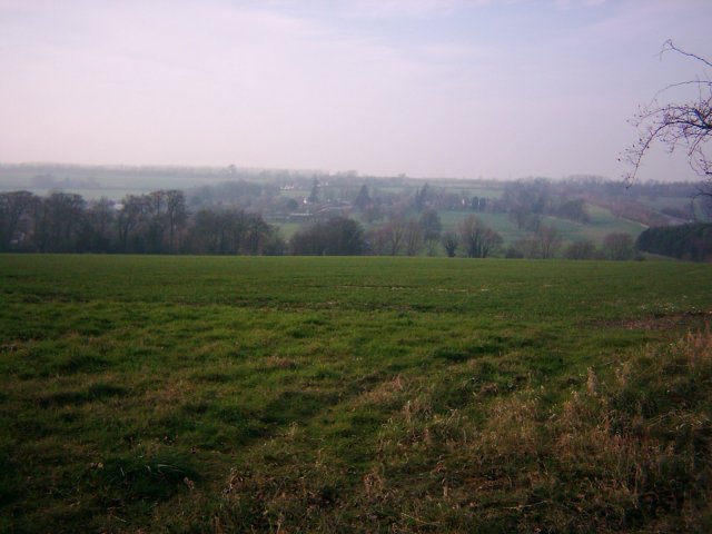
The village of Bridge is nestled in the picturesque countryside of the Kent Downs, an Area of Outstanding Natural Beauty. The parish is predominantly residential, with a mix of traditional cottages and more modern properties. The village center is characterized by its charming village green, which is surrounded by a selection of local amenities such as shops, pubs, and a primary school.
The area boasts a rich history, with evidence of settlements dating back to the Roman era. The historic Bridge Place, a manor house dating back to the 15th century, is a prominent landmark in the parish. The nearby Patrixbourne Church, St. Mary's, is also worth a visit. It is a Grade I listed building, known for its impressive architecture and stunning stained glass windows.
Bridge is well connected to nearby towns and cities, with good transport links. The A2 road runs through the parish, providing easy access to Canterbury, Dover, and London. The village is also served by regular bus services.
The countryside surrounding Bridge offers plenty of opportunities for outdoor activities, with numerous footpaths and bridleways for walking, cycling, and horse riding. The village also hosts various community events throughout the year, including the popular Bridge Flower Show, which showcases local horticultural talent.
Overall, Bridge is a charming and historic village that provides a peaceful and picturesque place to live, while still being within reach of nearby towns and amenities.
If you have any feedback on the listing, please let us know in the comments section below.
Bridge Images
Images are sourced within 2km of 51.245813/1.113554 or Grid Reference TR1754. Thanks to Geograph Open Source API. All images are credited.


Bridge is located at Grid Ref: TR1754 (Lat: 51.245813, Lng: 1.113554)
Administrative County: Kent
District: Canterbury
Police Authority: Kent
What 3 Words
///flop.insurers.defectors. Near Bridge, Kent
Nearby Locations
Related Wikis

Bridge railway station
Bridge was a station on the Elham Valley Railway. It opened in 1889 and closed to passengers in 1940 and freight in 1947. == History == The station opened...

Bridge, Kent
Bridge is a village and civil parish near Canterbury in Kent, South East England. Bridge village is in the Nailbourne valley in a rural setting on the...
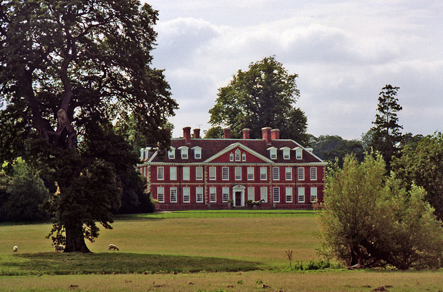
Bourne Park House
Bourne Park House is a Queen Anne style country house on Bourne Park Road, between Bishopsbourne and Bridge near Canterbury in Kent. Built in 1701, it...

Bourne Paddock
Bourne Paddock was a cricket ground at Bourne Park House, the seat of Sir Horatio Mann, at Bishopsbourne around 4 miles (6.4 km) south-east of Canterbury...

Nackington
Nackington is an English village and former civil parish, now in the parish of Lower Hardres and Nackington, south of Canterbury in the Canterbury district...

Patrixbourne Priory
Patrixbourne Priory was a priory in Kent, England. == References ==

Patrixbourne
Patrixbourne is a village and former civil parish, now in the parish of Bekesbourne-with-Patrixbourne, in the Canterbury district in Kent, England. It...

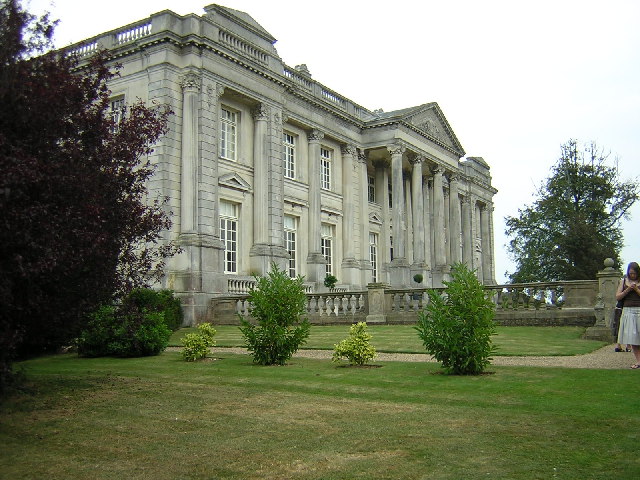
Higham Park
Higham Park is a Grade II* listed neoclassical style house and gardens, located at Bridge, Kent, 3 miles (4.8 km) south of Canterbury. == History... ==
Nearby Amenities
Located within 500m of 51.245813,1.113554Have you been to Bridge?
Leave your review of Bridge below (or comments, questions and feedback).