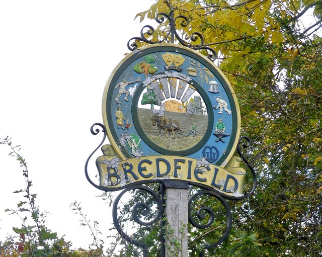
Bredfield

Civil Parish in Suffolk East Suffolk

England

Bredfield

New Road, Melton
New Road, Melton Credit: Christopher Hilton

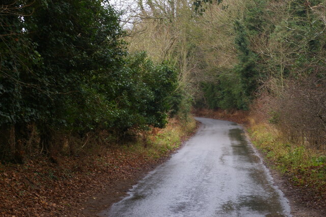
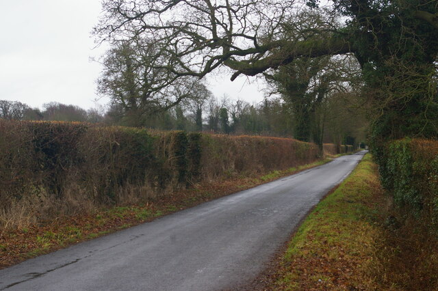
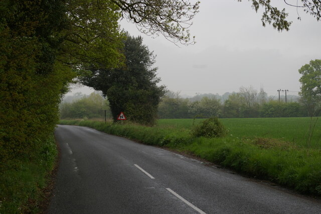
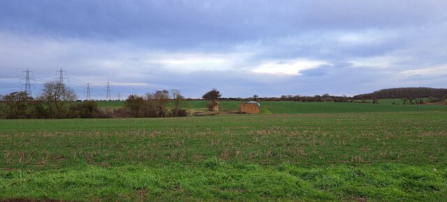
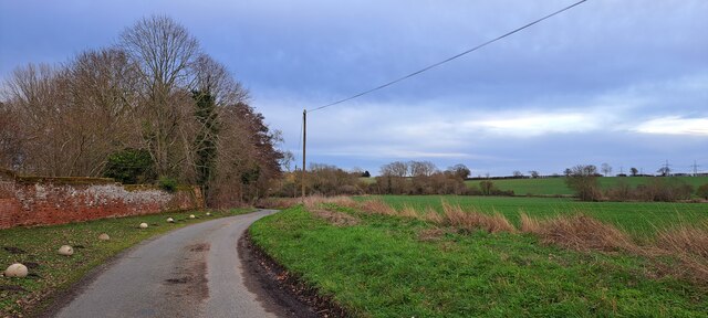
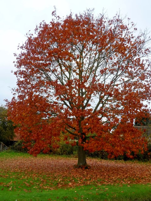
Bredfield is a civil parish located in the county of Suffolk, in the eastern part of England. Situated about 2.5 miles east of the town of Woodbridge, Bredfield covers an area of approximately 4.27 square miles. The parish is primarily a rural area, characterized by its picturesque countryside scenery and charming village atmosphere.

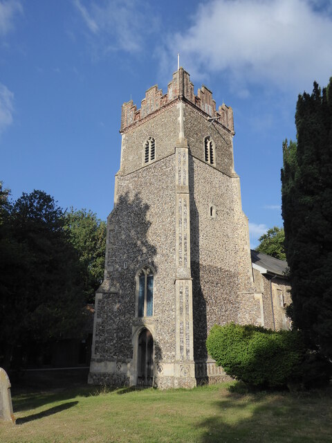
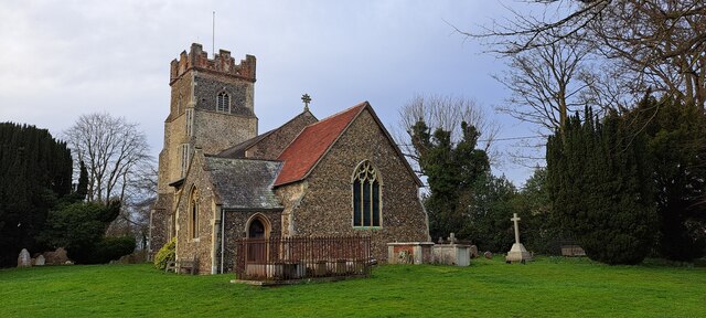
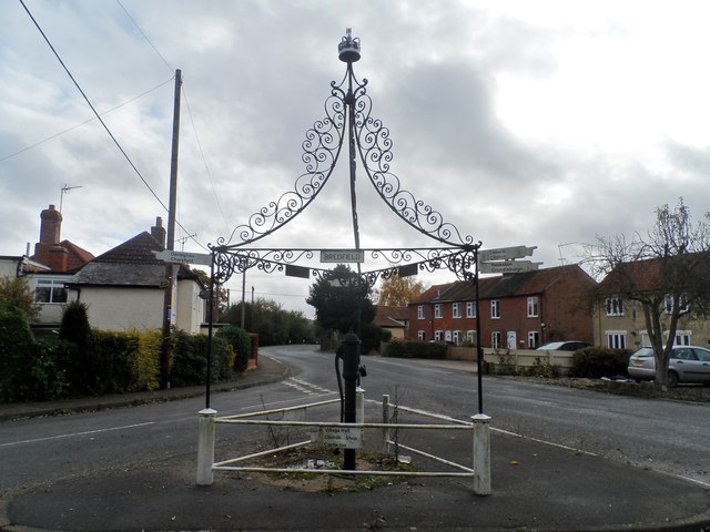
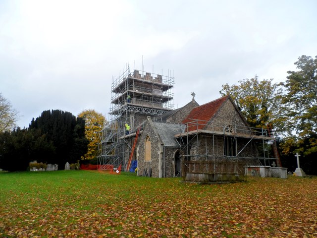
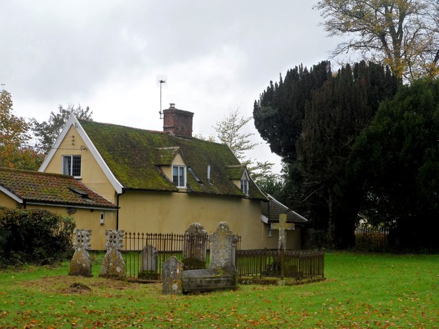
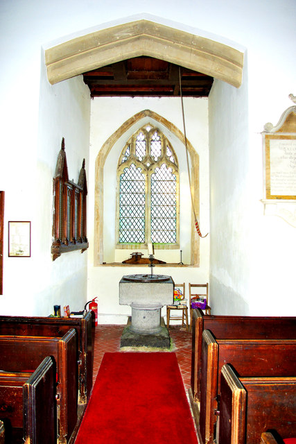
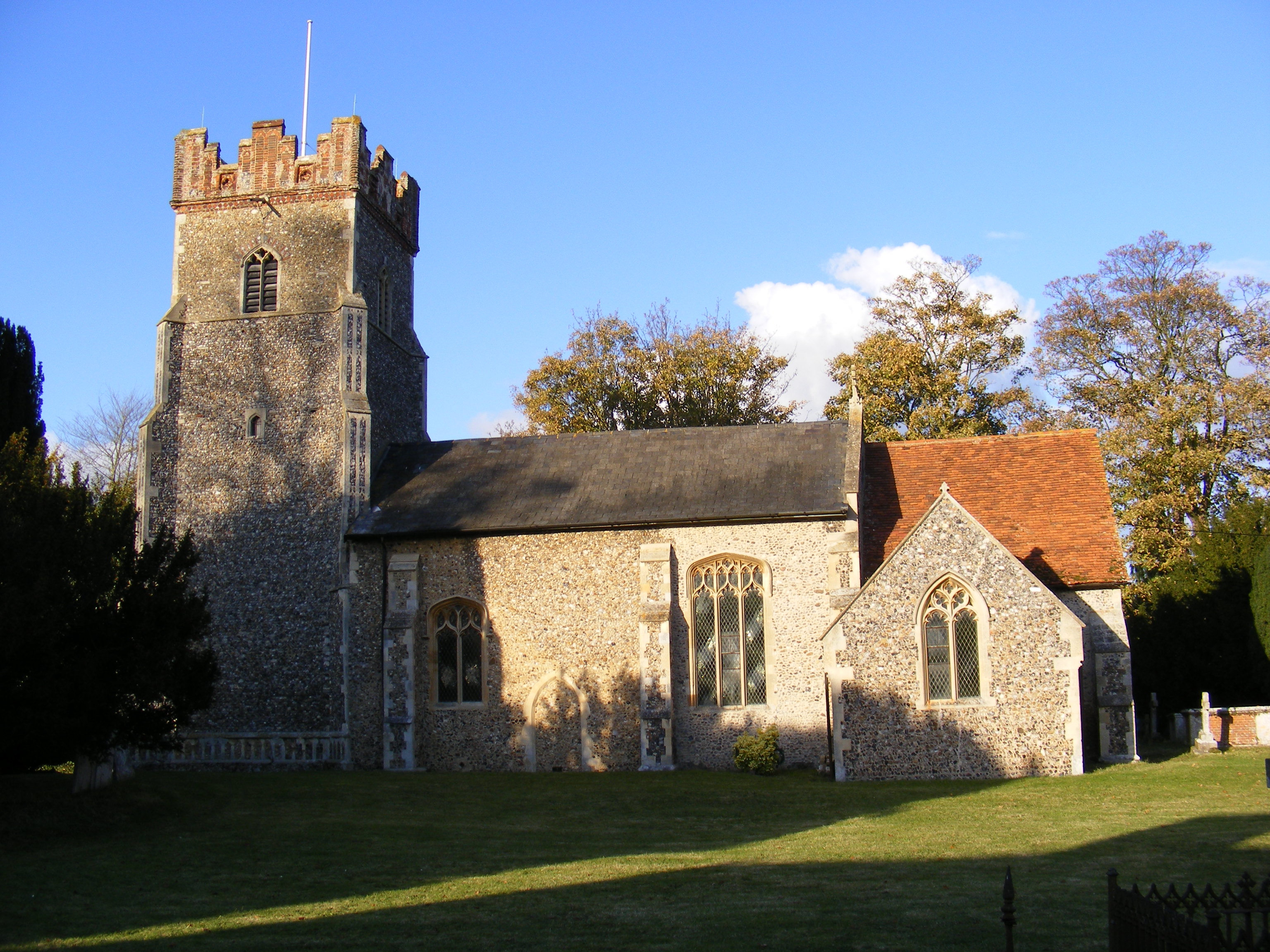
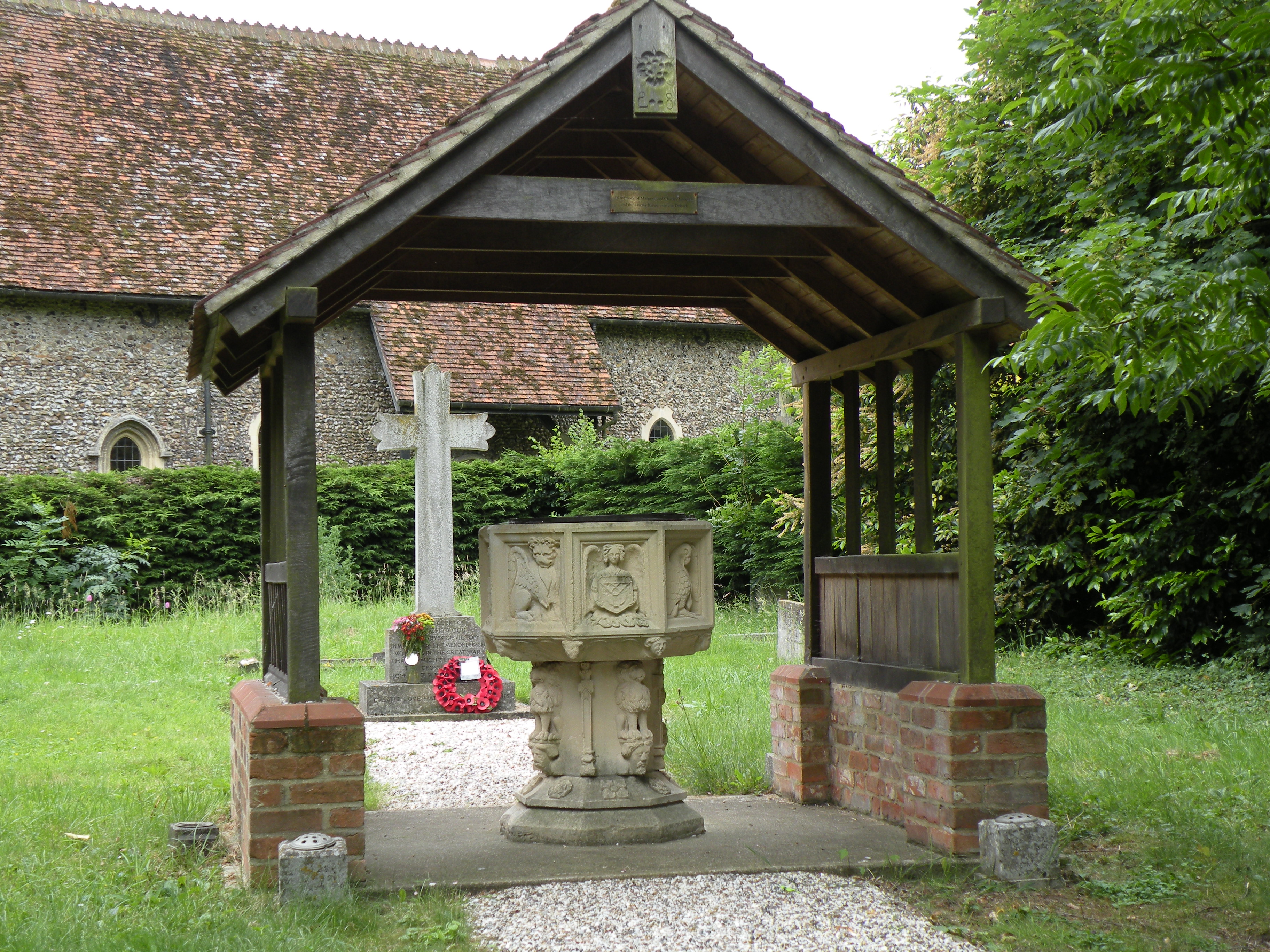
The village of Bredfield itself is home to a small population of around 400 residents. It is known for its quaint, traditional cottages and historic buildings, including the Grade II listed Church of St. Andrew, which dates back to the 14th century. The church is a prominent landmark in the area and holds regular services for the local community.

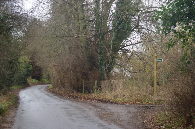
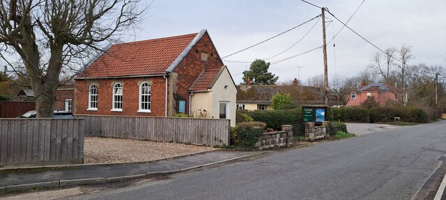
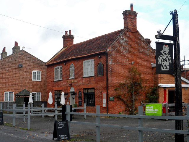
In terms of amenities, Bredfield offers a range of facilities to its residents. These include a primary school, a village hall that hosts various community events, and a pub called The Castle Inn, which serves as a social hub for locals and visitors alike. The village also boasts several footpaths and bridleways, making it an attractive destination for outdoor enthusiasts and nature lovers.

Bredfield enjoys a strong sense of community spirit, with various organizations and clubs that cater to the interests of residents. These include sports clubs, gardening societies, and social groups that contribute to the vibrant social fabric of the parish.

Overall, Bredfield is a charming and peaceful civil parish, offering its residents a picturesque rural lifestyle while still being within easy reach of nearby towns and amenities.

If you have any feedback on the listing, please let us know in the comments section below.

Bredfield Images

Images are sourced within 2km of 52.126949/1.310939 or Grid Reference TM2652. Thanks to Geograph Open Source API. All images are credited.

New Road, Melton
New Road, Melton
New Road, Melton
New Road, Melton
Saddlemakers' Lane, Melton
Bredfield, St Andrew
Lane leading into Bredfield from the south
Bredfield chapel
Bredfield chapel
St Andrew's church, Bredfield
Fields northeast of Bredfield
Lane south of Dallinghoo
Pump and signs at crossroads
The Castle pub, Bredfield Built in early C19. See <span class="nowrap"><a title="http://www.britishlistedbuildings.co.uk/en-285409-castle-public-house-bredfield-suffolk#.VpV2jfmLTIU" rel="nofollow ugc noopener" href="http://www.britishlistedbuildings.co.uk/en-285409-castle-public-house-bredfield-suffolk#.VpV2jfmLTIU">Link</a><img style="margin-left:2px;" alt="External link" title="External link - shift click to open in new window" src="https://s1.geograph.org.uk/img/external.png" width="10" height="10"/></span> for entry in British Listed Buildings
The Castle pub, Bredfield
Built in early C19. See LinkExternal link for entry in British Listed Buildings
St Andrew's, Bredfield The earliest parts of the church are C14.
St Andrew's, Bredfield
The earliest parts of the church are C14.
Cottage and graveyard, Bredfield
Bredfield, village sign
Tree at crossroads near Bredfield Seems to be an ornamental species.
Tree at crossroads near Bredfield
Seems to be an ornamental species.
Church of St Michael and All Angels, Boulge A glimpse through the bare winter branches of the Tudor (early 16th century) brick tower and the restored Victorian roof and south gable of this small church on the estate of the vanished Boulge Hall.  A number of old chairs quietly moulder away in front of the hedgerow. <span class="nowrap"><a title="http://www.suffolkchurches.co.uk/boulge.html" rel="nofollow ugc noopener" href="http://www.suffolkchurches.co.uk/boulge.html">Link</a><img style="margin-left:2px;" alt="External link" title="External link - shift click to open in new window" src="https://s1.geograph.org.uk/img/external.png" width="10" height="10"/></span>
Church of St Michael and All Angels, Boulge
A glimpse through the bare winter branches of the Tudor (early 16th century) brick tower and the restored Victorian roof and south gable of this small church on the estate of the vanished Boulge Hall. A number of old chairs quietly moulder away in front of the hedgerow. LinkExternal link
Interior looking east, St Michael & All Angels, Boulge An almost entirely Victorian interior.  The church was completely restored and enlarged in two phases between 1858 and 1867 at the expense of the local squire John Purcell FitzGerald, father of the poet, the architects being William and Edward Habershon.  The east window of 1901 is by Clayton & Bell and depicts the Resurrection.  The marble reredos, showing the Agnus Dei,  was copied in 1913 from a 5th-century sarcophagus at Ravenna.  The organ was built by Norman & Beard in 1895.
Interior looking east, St Michael & All Angels, Boulge
An almost entirely Victorian interior. The church was completely restored and enlarged in two phases between 1858 and 1867 at the expense of the local squire John Purcell FitzGerald, father of the poet, the architects being William and Edward Habershon. The east window of 1901 is by Clayton & Bell and depicts the Resurrection. The marble reredos, showing the Agnus Dei, was copied in 1913 from a 5th-century sarcophagus at Ravenna. The organ was built by Norman & Beard in 1895.
Interior looking west, St Michael & All Angels, Boulge Under the Tudor tower stands the massive square font.  Originally thought to be of Purbeck marble, it has more recently been identified as Tournai stone quarried from the banks of the Scheldt (Escaut) in Wallonia.  It is one of only ten such examples in English churches (another is not far away at St Peter's, Ipswich).  On the south wall of the tower are 19th-century boards with the Lord's Prayer, Creed and Commandments, formerly forming a reredos and removed here in 1913 when the present marble reredos was installed.  The rope is for tolling Boulge's only remaining bell, cast at Colchester in 1626 for Mickfield church in <a href="https://www.geograph.org.uk/gridref/TM1361">TM1361</a> and relocated here when that church was made redundant, to replace the cracked bell cast in 1700, the sole survivor of an original ring of three - the other two were sold in 1821 to raise funds for repairs. <span class="nowrap"><a title="http://www.suffolkchurches.co.uk/boulge.html" rel="nofollow ugc noopener" href="http://www.suffolkchurches.co.uk/boulge.html">Link</a><img style="margin-left:2px;" alt="External link" title="External link - shift click to open in new window" src="https://s1.geograph.org.uk/img/external.png" width="10" height="10"/></span>
Interior looking west, St Michael & All Angels, Boulge
Under the Tudor tower stands the massive square font. Originally thought to be of Purbeck marble, it has more recently been identified as Tournai stone quarried from the banks of the Scheldt (Escaut) in Wallonia. It is one of only ten such examples in English churches (another is not far away at St Peter's, Ipswich). On the south wall of the tower are 19th-century boards with the Lord's Prayer, Creed and Commandments, formerly forming a reredos and removed here in 1913 when the present marble reredos was installed. The rope is for tolling Boulge's only remaining bell, cast at Colchester in 1626 for Mickfield church in TM1361 and relocated here when that church was made redundant, to replace the cracked bell cast in 1700, the sole survivor of an original ring of three - the other two were sold in 1821 to raise funds for repairs. LinkExternal link
Show me another place!

Bredfield is located at Grid Ref: TM2652 (Lat: 52.126949, Lng: 1.310939)

Administrative County: Suffolk

District: East Suffolk

Police Authority: Suffolk

What 3 Words

///swarm.reported.polite. Near Woodbridge, Suffolk

Nearby Locations

Bredfield Bredfield

Related Wikis

Bredfield

Bredfield is a small village and civil parish in the English county of Suffolk. It is situated just off the A12, two miles north of Woodbridge. Another...

Foxburrow Farm

Foxburrow Farm is a 67 hectare nature reserve north of Melton in Suffolk. It is managed by the Suffolk Wildlife Trust.Part of this site is a working farm...

Boulge

Boulge is a hamlet and civil parish in the East Suffolk district of Suffolk, England. It is about 3 miles (5 km) north of Woodbridge. The population remained...
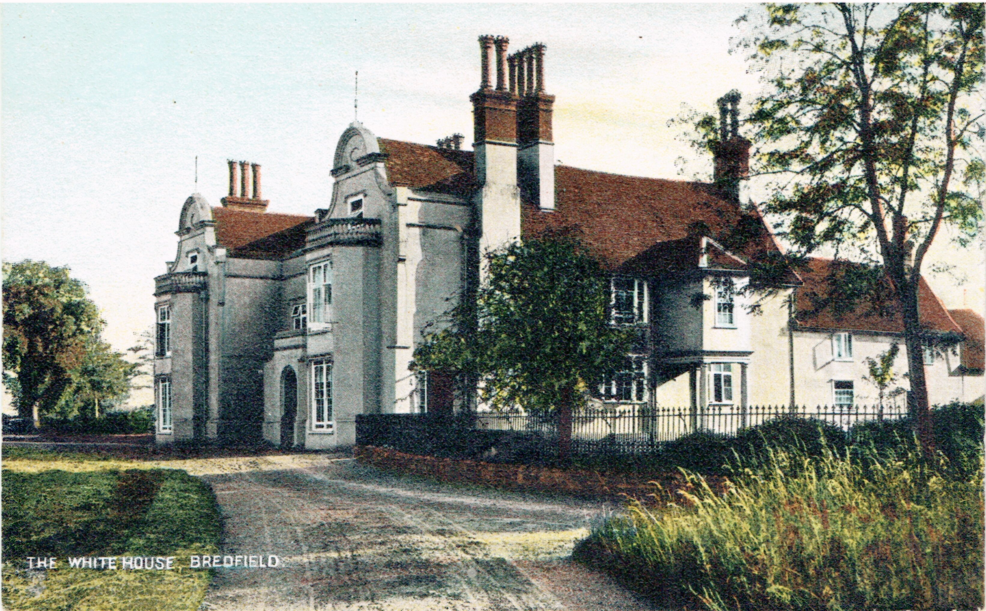
Bredfield House

Bredfield House (or White House as it was also known) was a now-demolished country house situated in the village of Bredfield, around 2 miles north of...

Debach

Debach is a small village about four miles northwest of Woodbridge, Suffolk, UK. == History == At the time of the Domesday Book, 1086, it was called Debenbeis...

St Audry's Hospital

St Audry's Hospital was a psychiatric hospital in Melton, Suffolk, England. == History == The facility has its origins in a house of industry which was...

Dallinghoo

Dallinghoo is a village about three miles (5 km) north of Woodbridge, Suffolk, England. == Location == Dallinghoo is formed from Church Road to the west...

Manor of Byng

The Manor of Byng is a former manorial estate located in the county of Suffolk, UK. The manor house is the 16th-century Byng Hall. The manor is located...

Nearby Amenities

Located within 500m of 52.126949,1.310939
Bredfield
Place: village
Wikidata: Q2753548
Wikipedia: en:Bredfield
Lat/Long: 52.1271941/1.3135325
Bus Stop
Chapel
Naptan AtcoCode: 390060308
Naptan Bearing: N
Naptan CommonName: Chapel
Naptan Indicator: adj
Naptan Landmark: Chapel
Naptan NaptanCode: sufgpgag
Naptan Street: Woodbridge Road
Naptan Verified: no
Public Transport: platform
Source: naptan_import
Lat/Long: 52.1227947/1.3088389
Bus Stop
Chapel
Naptan AtcoCode: 390060309
Naptan Bearing: S
Naptan BusStopType: CUS
Naptan CommonName: Chapel
Naptan Indicator: opp
Naptan Landmark: Chapel
Naptan NaptanCode: sufgpgaj
Naptan Street: Woodbridge Road
Naptan Verified: no
Source: naptan_import
Lat/Long: 52.1228267/1.3087247
Bus Stop
The Castle
Bus: yes
Naptan AtcoCode: 390060310
Naptan Bearing: S
Naptan BusStopType: CUS
Naptan CommonName: The Castle
Naptan Indicator: adj
Naptan Landmark: The Castle
Naptan NaptanCode: sufgpgam
Naptan Street: The Street
Naptan Verified: no
Public Transport: platform
Source: naptan_import
Lat/Long: 52.1278576/1.31417
Bus Stop
The Castle
Bus: yes
Naptan AtcoCode: 390060311
Naptan Bearing: N
Naptan BusStopType: CUS
Naptan CommonName: The Castle
Naptan Indicator: opp
Naptan Landmark: The Castle
Naptan NaptanCode: sufgpgap
Naptan Street: The Street
Naptan Verified: no
Public Transport: platform
Source: naptan_import
Lat/Long: 52.1278266/1.3139923
The Castle
Was Amenity: pub
Wikidata: Q26478571
Lat/Long: 52.128197/1.3146641
Post Box
Collection Times: Mo-Fr 16:30; Sa 10:00
Post Box Type: pillar
Ref: IP13 6272
Royal Cypher: EIIR
Royal Cypher Wikidata: Q33102113
Lat/Long: 52.1300049/1.3135716
Power: pole
Lat/Long: 52.1242788/1.3160178
Power: pole
Lat/Long: 52.1256851/1.316278
Power: pole
Lat/Long: 52.126818/1.3164979
Power: pole
Lat/Long: 52.1276857/1.3173321
The data included in this document is from www.openstreetmap.org. The data is made available under ODbL.

Have you been to Bredfield?

Leave your review of Bredfield below (or comments, questions and feedback).