Brearton

Civil Parish in Yorkshire Harrogate

England

Brearton

Farnham/Copgrove Green Lane This bench mark is cut into the old stone wall on the west side of the green lane which runs to/from Farnham and Copgrove.
Farnham/Copgrove Green Lane Credit: Mel Towler

Brearton is a small civil parish located in the Harrogate district of North Yorkshire, England. Situated approximately 5 miles north of the town of Knaresborough, the parish encompasses a total area of about 3.5 square miles. It is bordered by the parishes of Arkendale, Coneythorpe, Goldsborough, and Staveley.

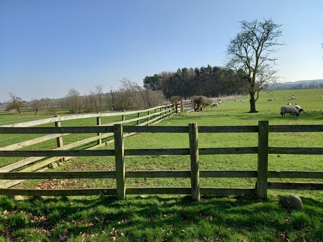
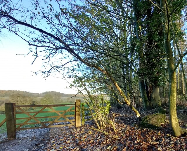
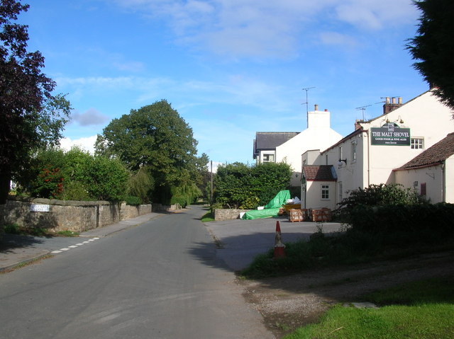
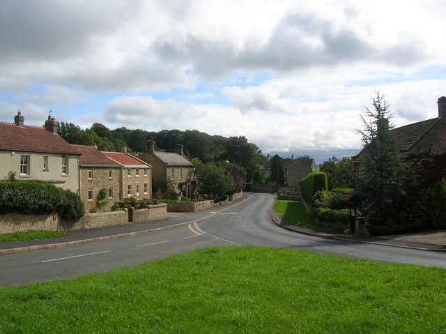
The village of Brearton itself is small and rural, with a population of around 200 people. It is characterized by its charming countryside setting, surrounded by rolling hills and farmland. The village is known for its idyllic views and tranquil atmosphere, making it a popular destination for those seeking a peaceful retreat.

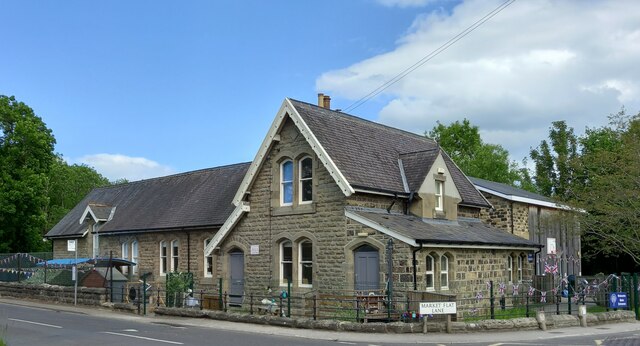
Brearton is home to a number of historic buildings, including the Grade II listed St. Thomas a Becket Church, which dates back to the 12th century. The church features a striking Norman doorway and a beautiful stained glass window.

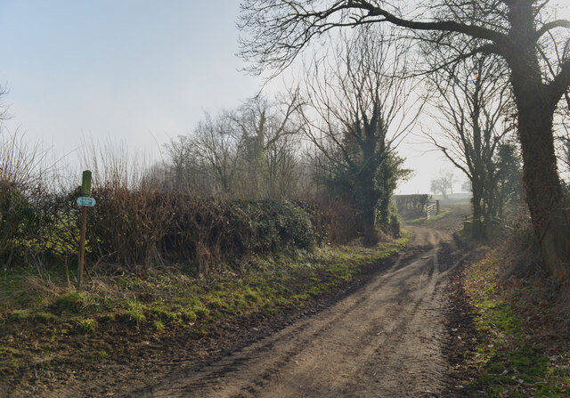
The parish is well-connected to nearby towns and villages by road, with the A59 passing through the area. This provides easy access to larger towns such as Harrogate, which is approximately 8 miles away, and Leeds, which is around 20 miles away.

Brearton offers a range of amenities for its residents, including a village hall, a primary school, and a local pub. The surrounding countryside also provides ample opportunities for outdoor activities such as walking, cycling, and horse riding.

Overall, Brearton is a picturesque and close-knit community that offers a peaceful rural lifestyle in the heart of Yorkshire.

If you have any feedback on the listing, please let us know in the comments section below.

Brearton Images

Images are sourced within 2km of 54.045021/-1.506634 or Grid Reference SE3261. Thanks to Geograph Open Source API. All images are credited.

Farnham/Copgrove Green Lane This bench mark is cut into the old stone wall on the west side of the green lane which runs to/from Farnham and Copgrove.
Farnham/Copgrove Green Lane
This bench mark is cut into the old stone wall on the west side of the green lane which runs to/from Farnham and Copgrove.
Farnham/Copgrove Green Lane A wider angle showing Green Lane and the track northwards, and the old stone wall on the west side of the lane. There is a bench mark cut into the  1st stone course of the wall along this stretch.
Farnham/Copgrove Green Lane
A wider angle showing Green Lane and the track northwards, and the old stone wall on the west side of the lane. There is a bench mark cut into the 1st stone course of the wall along this stretch.
Brearton, St John's church The benchmark is cut into a north-west face of the church.
Brearton, St John's church
The benchmark is cut into a north-west face of the church.
Brearton, St John's church There is a benchmark cut into the north-west face of the church.
Brearton, St John's church
There is a benchmark cut into the north-west face of the church.
Brearton, Warren Lane According to the OS benchmark database there was a benchmark cut into a stone on the roadside wall on the north side of the lane. The wall has gone, and the cutmark has been destroyed.
Brearton, Warren Lane
According to the OS benchmark database there was a benchmark cut into a stone on the roadside wall on the north side of the lane. The wall has gone, and the cutmark has been destroyed.
Brearton, Warren Lane According to the OS benchmark database one of the gateposts in this field entrance had a benchmark cut into the face. Today there are no gateposts, and no gate and the benchmark has been destroyed.
Brearton, Warren Lane
According to the OS benchmark database one of the gateposts in this field entrance had a benchmark cut into the face. Today there are no gateposts, and no gate and the benchmark has been destroyed.
Brearton, Warren Lane According to the OS benchmark database there was a small building stood in the corner of this field with a benchmark cut into the north-west face. The building has been demolished and the benchmark destroyed.
Brearton, Warren Lane
According to the OS benchmark database there was a small building stood in the corner of this field with a benchmark cut into the north-west face. The building has been demolished and the benchmark destroyed.
Brearton, Green Lane According to the OS benchmark database there is a benchmark cut into a lower stone on this stretch of wall. The wall remains intact and having cleared some of the growth around the wall base no mark was found.
Brearton, Green Lane
According to the OS benchmark database there is a benchmark cut into a lower stone on this stretch of wall. The wall remains intact and having cleared some of the growth around the wall base no mark was found.
Lingerfield school The benchmark is cut on the north-west facing wall, below a tap and to the right of the door on the left.
Lingerfield school
The benchmark is cut on the north-west facing wall, below a tap and to the right of the door on the left.
Lingerfield school There is a benchmark cut intothe north-west facing wall, below a tap and to the right of the grey door on the left.
Lingerfield school
There is a benchmark cut intothe north-west facing wall, below a tap and to the right of the grey door on the left.
South Stainley, old track to Stainley Mill According to the OS benchmark database there is a rivet benchmark cut into a rock on the west of the old track. Only 1 rock found and despite trying to clear the moss no cutmark was found.
South Stainley, old track to Stainley Mill
According to the OS benchmark database there is a rivet benchmark cut into a rock on the west of the old track. Only 1 rock found and despite trying to clear the moss no cutmark was found.
South Stainley, old track to Stainley Mill The pivot benchmark is cut into a rock within a wooded area to the north of the old track. The area is known as Luptons Bank.
South Stainley, old track to Stainley Mill
The pivot benchmark is cut into a rock within a wooded area to the north of the old track. The area is known as Luptons Bank.
South Stainley, Luptons Bank There is a pivot benchmark cut into the rock within the wooded area to the north of the old track and known as Luptons Bank.
South Stainley, Luptons Bank
There is a pivot benchmark cut into the rock within the wooded area to the north of the old track and known as Luptons Bank.
Farnham to/from Copgrove green lane The benchmark is cut into the trackside wall of the green lane. The wall is virtually rubble in places, and to find and expose the mark needed plenty of scraping and digging to rid the undergrowth and broken wall stones. A great find!
Farnham to/from Copgrove green lane
The benchmark is cut into the trackside wall of the green lane. The wall is virtually rubble in places, and to find and expose the mark needed plenty of scraping and digging to rid the undergrowth and broken wall stones. A great find!
Farnham to/from Copgrove green lane There is a benchmark cut into the trackside wall of the green lane. The wall is virtually rubble in places, and to find and expose the mark needed plenty of scraping and digging to rid the undergrowth and broken wall stones. A great find!
Farnham to/from Copgrove green lane
There is a benchmark cut into the trackside wall of the green lane. The wall is virtually rubble in places, and to find and expose the mark needed plenty of scraping and digging to rid the undergrowth and broken wall stones. A great find!
Low Moor Lane, Brearton
Track to Lingerfield from Low Moor Lane, Brearton
Low Moor Lane, Brearton
Show me another place!

Brearton is located at Grid Ref: SE3261 (Lat: 54.045021, Lng: -1.506634)

Division: West Riding

Administrative County: North Yorkshire

District: Harrogate

Police Authority: North Yorkshire

What 3 Words

///wider.imply.encrusted. Near Knaresborough, North Yorkshire

Related Wikis

Brearton

Brearton is a village and civil parish in the Harrogate borough of North Yorkshire, England, situated about 3 miles (4.8 km) north of Knaresborough. The...

Farnham Mires

Farnham Mires is a Site of Special Scientific Interest, or SSSI, to the east of the village of Farnham, North Yorkshire, England. It consists of a spring...

Scotton, Harrogate

Scotton is a small village and civil parish in the Harrogate district of North Yorkshire, England with a population of 524 in the 2001 census, increasing...

Nidd Hall

Nidd Hall was a 19th-century country house, now a hotel, in the village of Nidd, North Yorkshire, England. It is a Grade II listed building. It is constructed...

Nidd

Nidd is a small village and civil parish in the Harrogate district of North Yorkshire, England. The population of the village taken at the 2011 census...

Nidd Bridge railway station

Nidd Bridge railway station served the village of Nidd, North Yorkshire, England from 1848 to 1964 on the Leeds-Northallerton Railway. == History == The...

Burton Leonard

Burton Leonard is a village and civil parish in the Harrogate district of North Yorkshire, England, and approximately 7 miles (11 km) south from Ripon...

Farnham, North Yorkshire

Farnham is a village and civil parish in the Harrogate district of North Yorkshire, England. It is situated 2 miles (3.2 km) north of Knaresborough....

Nearby Amenities

Located within 500m of 54.045021,-1.506634
Brearton
Is In: UK,England,Yorkshire,North Yorkshire
Place: hamlet
Lat/Long: 54.044574/-1.5074186
Post Box
Post Box Type: wall
Source: survey
Lat/Long: 54.0437347/-1.5099677
Give Way
Direction: forward
Lat/Long: 54.0443303/-1.5080188
Guide Type: intermediary
Guidepost Type: route_marker;PROW
Image: https://map.atownsend.org.uk/tmp/166359.jpg
Information: guidepost
Tourism: information
Lat/Long: 54.0411925/-1.5037384
The data included in this document is from www.openstreetmap.org. The data is made available under ODbL.

Have you been to Brearton?

Leave your review of Brearton below (or comments, questions and feedback).