Bramshill

Civil Parish in Hampshire Hart

England

Bramshill

Pasture, Mattingley Fields at Steven's Farm in Hazeley. A public footpath passes through the smaller gate.
Pasture, Mattingley Credit: Andrew Smith

Bramshill is a civil parish located in the county of Hampshire, England. It is situated approximately 5 miles northeast of the town of Hook and 10 miles southwest of the town of Reading. The parish covers a total area of around 1,900 acres and is home to a population of approximately 200 people.

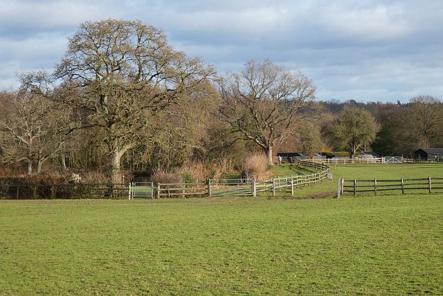
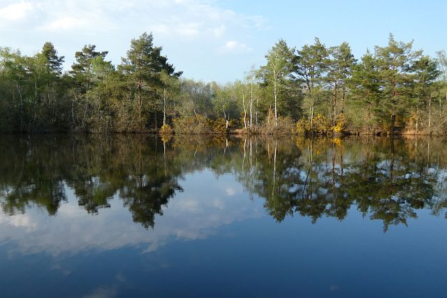
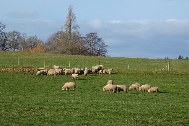
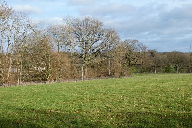
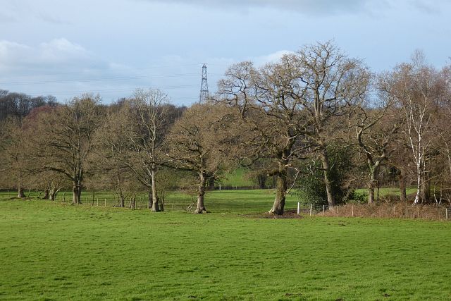
The village of Bramshill is known for its picturesque and rural setting, surrounded by beautiful countryside and woodland areas. It is primarily a residential area, with a small number of amenities including a village hall and a local pub.

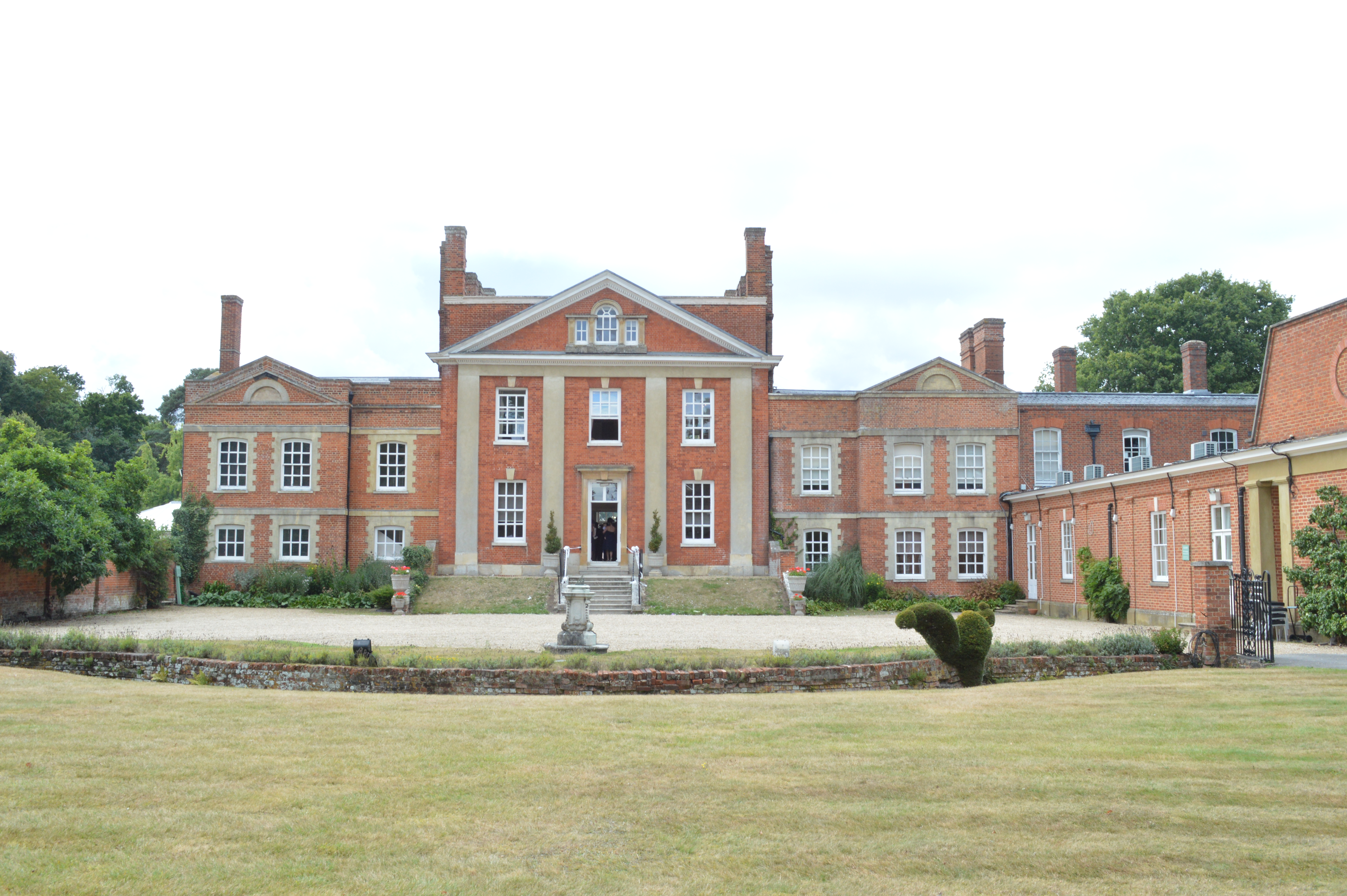
One of the notable features of Bramshill is the historic Bramshill House, a Grade I listed Jacobean mansion. The house was built in the early 17th century and is known for its impressive architecture and extensive grounds. Bramshill House has served various purposes throughout its history, including as a training college for the police force and as a venue for conferences and events.

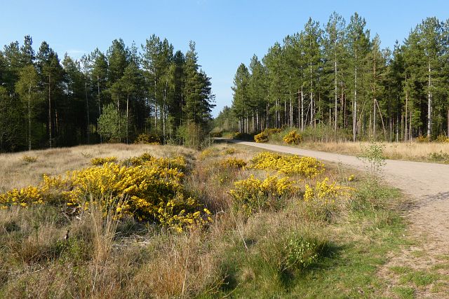
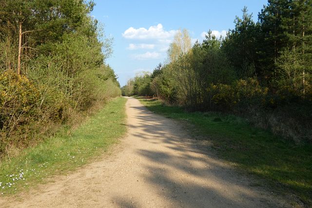
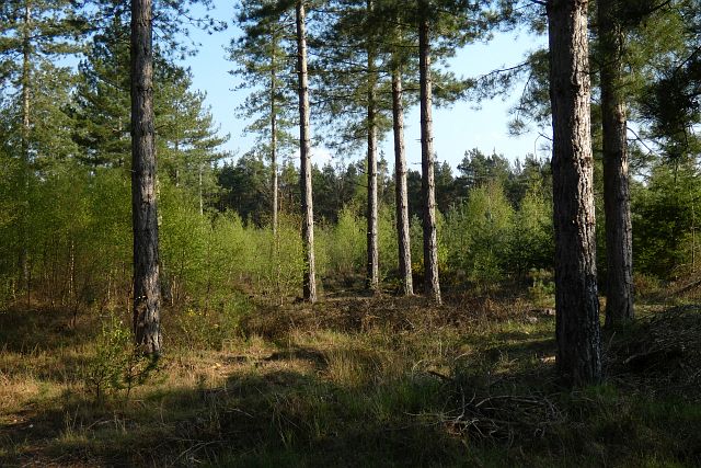
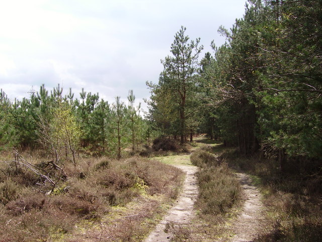
The parish of Bramshill offers plenty of opportunities for outdoor activities, such as walking, cycling, and horse riding, with numerous footpaths and bridleways crisscrossing the surrounding countryside. The area is also home to a variety of wildlife, including deer, foxes, and various bird species.

Overall, Bramshill is a charming and peaceful civil parish, known for its natural beauty, historic architecture, and rural character. It provides a tranquil escape from the nearby towns and cities while still offering easy access to amenities and transport links.

If you have any feedback on the listing, please let us know in the comments section below.

Bramshill Images

Images are sourced within 2km of 51.344672/-0.919466 or Grid Reference SU7561. Thanks to Geograph Open Source API. All images are credited.

Pasture, Mattingley Fields at Steven's Farm in Hazeley. A public footpath passes through the smaller gate.
Pasture, Mattingley
Fields at Steven's Farm in Hazeley. A public footpath passes through the smaller gate.
St Neots Road Presumably named after the school along here.
St Neots Road
Presumably named after the school along here.
Lower Common, Eversley There are houses on the northern side of the road, whilst it is mostly woodland to the south.
Lower Common, Eversley
There are houses on the northern side of the road, whilst it is mostly woodland to the south.
Track and forestry, Bramshill A sandy track towards the north of Bramshill Plantation.
Track and forestry, Bramshill
A sandy track towards the north of Bramshill Plantation.
Track and forestry, Bramshill A track headed north in the western part of Bramshill Plantation.
Track and forestry, Bramshill
A track headed north in the western part of Bramshill Plantation.
Track and forestry, Bramshill A track headed due east in the southern part of Bramshill Plantation.
Track and forestry, Bramshill
A track headed due east in the southern part of Bramshill Plantation.
Forestry, Bramshill Mature pines towards the south of Bramshill Plantation.
Forestry, Bramshill
Mature pines towards the south of Bramshill Plantation.
Forestry, Bramshill Mature pines in the western part of Heath Warren Wood.
Forestry, Bramshill
Mature pines in the western part of Heath Warren Wood.
Pond and woodland, Bramshill One of the pools passed by a bridleway to the west of Heath Warren.
Pond and woodland, Bramshill
One of the pools passed by a bridleway to the west of Heath Warren.
Farmland, Heckfield The sheep had just been relocated to this field from a neighbouring riverside field.
Farmland, Heckfield
The sheep had just been relocated to this field from a neighbouring riverside field.
Pasture, Heckfield A field descending towards the River Whitewater.
Pasture, Heckfield
A field descending towards the River Whitewater.
Pastures, Bramshill The southwestern corner of Netherclifts Copse and fields descending to the River Hart.
Pastures, Bramshill
The southwestern corner of Netherclifts Copse and fields descending to the River Hart.
Bramshill Road  Towards Bramshill.
Bramshill Road
Towards Bramshill.
Bramshill Road  Towards the B3011.
Bramshill Road
Towards the B3011.
Woodland beside Bramshill Road
Bramshill Road towards Bramshill
Cattle near the River Whitewater
The River Whitewater, Heckfield Bridge
Show me another place!

Bramshill is located at Grid Ref: SU7561 (Lat: 51.344672, Lng: -0.919466)

Administrative County: Hampshire

District: Hart

Police Authority: Hampshire

What 3 Words

///stirs.pipes.protects. Near Eversley, Hampshire

Nearby Locations

Bramshill

Related Wikis

Bramshill

Bramshill is a civil parish in the English county of Hampshire. Its name has become synonymous with the Police Staff College, Bramshill located in Bramshill...

Bramshill SSSI

Bramshill is a 673.3-hectare (1,664-acre) biological Site of Special Scientific Interest near Bramshill, northeast of Basingstoke in Hampshire. It is part...
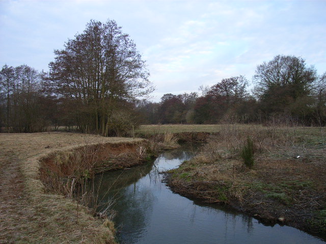
River Hart

The River Hart is a tributary of the River Whitewater in north Hampshire, England. It rises at Ashley Head spring in Crondall and flows north to meet the...

Police Staff College, Bramshill

The Police Staff College, Bramshill, Bramshill House, Bramshill, (near Hook) Hampshire, England, was until 2015 the principal police staff training establishment...

Bramshill House

Bramshill House, in Bramshill, northeast Hampshire, England, is one of the largest and most important Jacobean prodigy house mansions in England. It was...

Lower Common

Lower Common is a village in the civil parish of Eversley in the district of Hart in Hampshire, England. Its nearest town is Yateley, approximately 3.1...

Hazeley

Hazeley is a village in the Hart District in Hampshire, England. It is 2.5 miles (3 km) away from Hartley Wintney and comes under the parish of Mattingley...

Warbrook House Hotel, Eversley

Warbrook House is a building of historical significance and is listed as Grade I in the English Heritage Register. It was built in 1724 by the architect...

Nearby Amenities

Located within 500m of 51.344672,-0.919466
Bramshill
Is In: Hampshire, England, UK
Place: hamlet
Source: npe
Lat/Long: 51.3444153/-0.9241809
Power: tower
Source: bing
Lat/Long: 51.3433136/-0.9243932
Power: tower
Source: bing
Lat/Long: 51.3443536/-0.919157
Power: tower
Source: bing
Lat/Long: 51.3452416/-0.9146612
Moor Place Farm
Historic: manor
Landuse: farm
Note Retag: CS #48756035
Source: OS_OpenData_StreetView
Lat/Long: 51.3406091/-0.919386
The Old Plough
Addr Housename: The Old Plough
Building: residential
Source: OS OpenData StreetView
Lat/Long: 51.3429583/-0.9192362
Keepers Cottage
Addr Housename: Keepers Cottage
Building: residential
Source: OS OpenData StreetView
Lat/Long: 51.3427573/-0.9194508
Building: barn
Source: Bing
Lat/Long: 51.3405252/-0.9197567
Building: barn
Source: Bing
Lat/Long: 51.3403575/-0.9214143
Give Way
Source: Bing
Lat/Long: 51.3433188/-0.9188584
Give Way
Source: Bing
Lat/Long: 51.3451185/-0.9221526
The data included in this document is from www.openstreetmap.org. The data is made available under ODbL.

Have you been to Bramshill?

Leave your review of Bramshill below (or comments, questions and feedback).