Bradmore

Civil Parish in Nottinghamshire Rushcliffe

England

Bradmore

Looking towards Nottingham Recreating this 'First' for the square <a title="https://www.geograph.org.uk/photo/129959" href="https://www.geograph.org.uk/photo/129959">Link</a>
Looking towards Nottingham Credit: Alan Murray-Rust

Bradmore is a civil parish located in the county of Nottinghamshire, England. Situated approximately 6 miles south of Nottingham city center, Bradmore is a small and picturesque village with a population of around 300 people.

The village is known for its rural charm and peaceful atmosphere. It is surrounded by lush green fields and countryside, providing a tranquil setting for residents and visitors alike. The village is predominantly residential, with a mix of traditional cottages and more modern houses.

Bradmore has a close-knit community, with a strong sense of community spirit. The village has a local pub, The Nottingham Arms, which serves as a social hub for residents. There is also a village hall that hosts various community events and activities throughout the year.

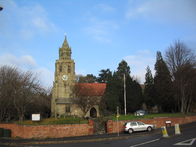
One of the notable features of Bradmore is its historic church, St. Mary's Church, which dates back to the 12th century. The church is a Grade I listed building and is known for its beautiful architecture and stained glass windows.

The village is well-connected to nearby towns and cities by road, with the A60 running through the village, providing easy access to Nottingham and Loughborough. Public transportation is also available, with regular bus services connecting Bradmore to neighboring areas.

Overall, Bradmore is a charming and picturesque village, offering a peaceful and rural lifestyle to its residents while being within reach of larger urban centers.

If you have any feedback on the listing, please let us know in the comments section below.
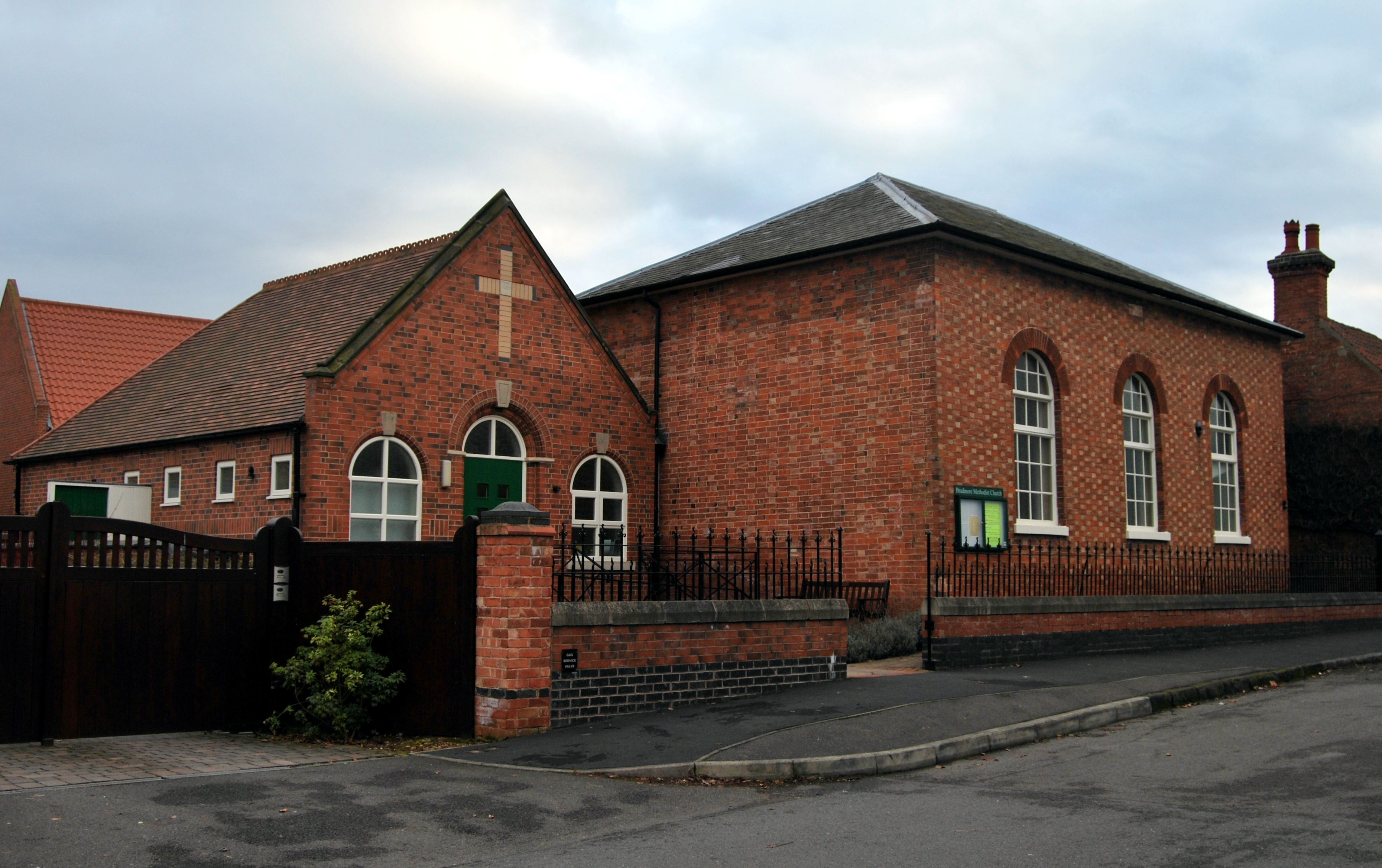
Bradmore Images

Images are sourced within 2km of 52.878186/-1.122391 or Grid Reference SK5931. Thanks to Geograph Open Source API. All images are credited.

Looking towards Nottingham Recreating this 'First' for the square <a title="https://www.geograph.org.uk/photo/129959" href="https://www.geograph.org.uk/photo/129959">Link</a>
Looking towards Nottingham
Recreating this 'First' for the square Link
Why the wheelie bins? The track only leads to the small plantation in the background, where there are no buildings.
Why the wheelie bins?
The track only leads to the small plantation in the background, where there are no buildings.
The view down Blackcliffe Hill Bradmore Lane heading towards Bradmore village.
The view down Blackcliffe Hill
Bradmore Lane heading towards Bradmore village.
Private, Nature reserve – Rancliffe Wood The Rushcliffe Wildlife website comments on Rancliffe Wood as follows:
"Understood to have been clear-felled during World War 1, it is now largely old coppiced Sycamore, but the ground flora indicates more ancient origins with Dog's Mercury widespread. There is a sign saying "Nature Reserve" but it is in fact not managed well in this regard.”

The term 'reserve' is more likely to relate to the rearing of game birds. The wood is also apparently used for paintballing although there is no indication of this at the gate.
Private, Nature reserve – Rancliffe Wood
The Rushcliffe Wildlife website comments on Rancliffe Wood as follows: "Understood to have been clear-felled during World War 1, it is now largely old coppiced Sycamore, but the ground flora indicates more ancient origins with Dog's Mercury widespread. There is a sign saying "Nature Reserve" but it is in fact not managed well in this regard.” The term 'reserve' is more likely to relate to the rearing of game birds. The wood is also apparently used for paintballing although there is no indication of this at the gate.
Bench Mark, Wheatcroft Farm, Keyworth See <a title="https://www.geograph.org.uk/photo/7119716" href="https://www.geograph.org.uk/photo/7119716">Link</a> for location.
Bench Mark, Wheatcroft Farm, Keyworth
See Link for location.
Barn at Wheatcroft Farm, Keyworth There is a benchmark <a title="https://www.geograph.org.uk/photo/7119715" href="https://www.geograph.org.uk/photo/7119715">Link</a> on the brickwork to the right of the blue drainpipe.
Barn at Wheatcroft Farm, Keyworth
There is a benchmark Link on the brickwork to the right of the blue drainpipe.
Contractor's compound, Keyworth Part of the substantial housing development under the name 'Keyworth Rise' on the western end of the village. The planning application refers to 221 dwellings.
Contractor's compound, Keyworth
Part of the substantial housing development under the name 'Keyworth Rise' on the western end of the village. The planning application refers to 221 dwellings.
Road to Keyworth sewage treatment works Recreating this 'First' for the square <a title="https://www.geograph.org.uk/photo/237116" href="https://www.geograph.org.uk/photo/237116">Link</a>
Road to Keyworth sewage treatment works
Recreating this 'First' for the square Link
Keyworth Rise housing development With the now obligatory attenuation pond for surface run-off in the foreground.
Keyworth Rise housing development
With the now obligatory attenuation pond for surface run-off in the foreground.
Tyler Drive, Keyworth The main access into the new Keyworth Rise housing development.
Tyler Drive, Keyworth
The main access into the new Keyworth Rise housing development.
Bench Mark, 64 Bunny Lane, Keyworth See <a title="https://www.geograph.org.uk/photo/7119737" href="https://www.geograph.org.uk/photo/7119737">Link</a> for location.
Bench Mark, 64 Bunny Lane, Keyworth
See Link for location.
Bunnylane Cottages, Keyworth This group of cottages was built in the late 19th centuries at some distance from the then edge of the village, only being joined to the village in the mid 20th century when the more distant housing in the view was developed. A feature of the row is the ornate cast iron railings along the property frontage.

There is a benchmark <a title="https://www.geograph.org.uk/photo/7119734" href="https://www.geograph.org.uk/photo/7119734">Link</a> on the side of the house at this end of the row.
Bunnylane Cottages, Keyworth
This group of cottages was built in the late 19th centuries at some distance from the then edge of the village, only being joined to the village in the mid 20th century when the more distant housing in the view was developed. A feature of the row is the ornate cast iron railings along the property frontage. There is a benchmark Link on the side of the house at this end of the row.
Park Avenue, Keyworth Early post-WW2 housing development.
Park Avenue, Keyworth
Early post-WW2 housing development.
Park Avenue East, Keyworth Early post-WW2 council housing development.
Park Avenue East, Keyworth
Early post-WW2 council housing development.
Debdale Lane, Keyworth Recreating this 'First' for the square <a title="https://www.geograph.org.uk/photo/235553" href="https://www.geograph.org.uk/photo/235553">Link</a> . Surprisingly, the security fencing is now lower than it used to be!
Debdale Lane, Keyworth
Recreating this 'First' for the square Link . Surprisingly, the security fencing is now lower than it used to be!
Farm track off Bradmore Lane
Icy field entrance, Blackcliffe Hill
Autumn sown crop, Blackcliffe Hill
Show me another place!

Bradmore is located at Grid Ref: SK5931 (Lat: 52.878186, Lng: -1.122391)

Administrative County: Nottinghamshire

District: Rushcliffe

Police Authority: Nottinghamshire

What 3 Words

///snow.salon.stroke. Near Keyworth, Nottinghamshire

Nearby Locations

Bradmore

Related Wikis

Bradmore, Nottinghamshire

Bradmore is a village and civil parish in the Rushcliffe district of Nottinghamshire with a population in 2001 of 320 rising slightly to 328 at the 2011...

Vision Express

Vision Express is a British company established in 1988 that sells spectacles, sunglasses and contact lenses. == History == The company opened its first...

St Peter's Church, Flawford

St Peter's Church was a Church of England church in Flawford, Nottinghamshire. == History == The church is famous for the discovery of three Nottingham...

Bunny Hall

Bunny Hall is a 21,438 square feet (1,991.7 m2) grade I listed country house in Bunny, Nottinghamshire. The house was originally an Elizabethan red brick...

Bunny, Nottinghamshire

Bunny is a village and civil parish located in the Rushcliffe borough of Nottinghamshire, England. The parish has a population of around 600, measured...

St Mary's Church, Bunny

St Mary's Church, Bunny is a Grade I listed parish church in the Church of England in Bunny, Nottinghamshire. == History == The present church dates from...

Keyworth

Keyworth () is a large village of Nottinghamshire, England. It is located about 6 miles (11 km) southeast of the centre of Nottingham. It sits on a small...

Church of St Mary Magdalene, Keyworth

The Church of St. Mary Magdalene is a Grade-I listed church located in Keyworth, Nottinghamshire, England. == Description == The church dates from the...

Related Videos

Bunny Adventures in Nottinghamshire: Exploring the Charming Countryside

Immerse yourself in the breathtaking natural beauty of Bunny, Nottinghamshire, as we embark on a mesmerising journey through ...

Rushcliffe Country Park in Ruddington - A Walk with Mike Wilcox

A Walk into Ruddington, Nottingham, UK on a Spring, March Morning for a few hours with Mike Wilcox. Stay Safe/Stay ...

Nearby Amenities

Located within 500m of 52.878186,-1.122391
The data included in this document is from www.openstreetmap.org. The data is made available under ODbL.

Have you been to Bradmore?

Leave your review of Bradmore below (or comments, questions and feedback).