Bradley

Civil Parish in Staffordshire Stafford

England

Bradley

Track and footpath Track and public right of way off Bigwood Lane
Track and footpath Credit: P Gaskell

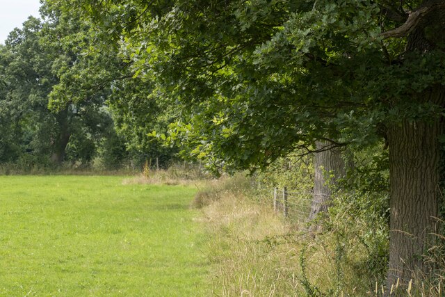
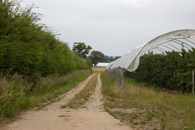
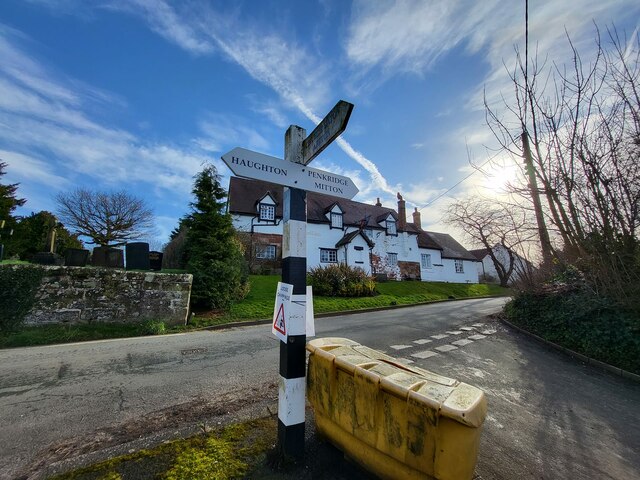
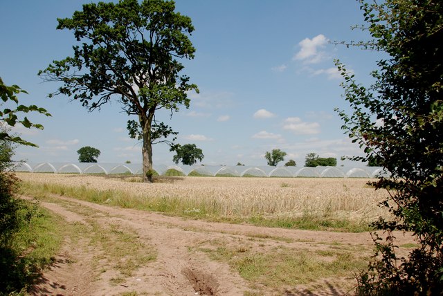
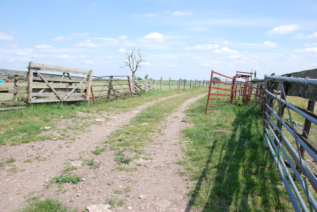
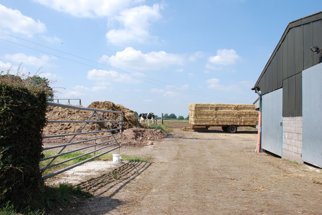
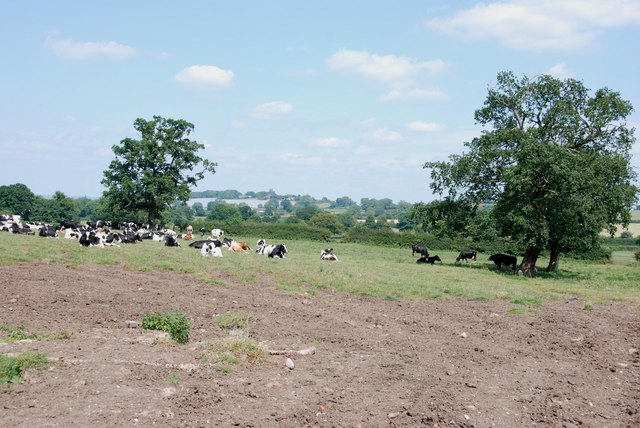
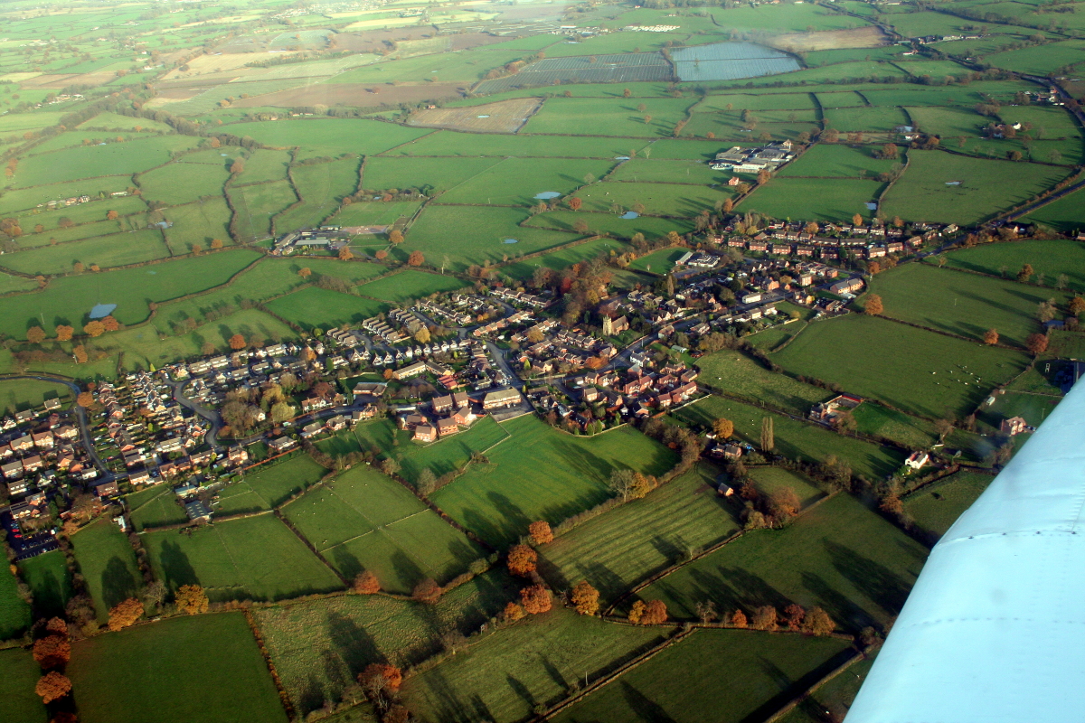
Bradley is a civil parish located in the county of Staffordshire, England. Situated approximately 4 miles north of the town of Stafford, it covers an area of about 8 square miles. The parish is predominantly rural, with open fields and farmland making up the majority of its landscape.

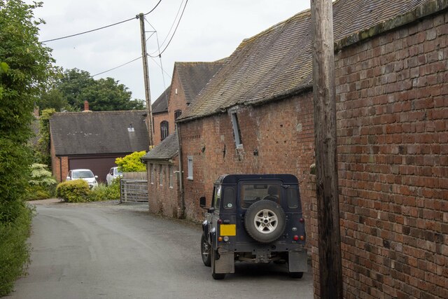
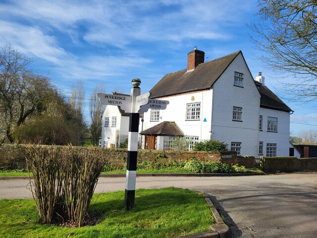
The village of Bradley itself is small and peaceful, with a population of around 300 residents. It is characterized by a mix of traditional stone cottages and modern houses, giving it a charming and homely atmosphere. The village is centered around St. Mary's Church, a beautiful 12th-century building that serves as a focal point for the community.

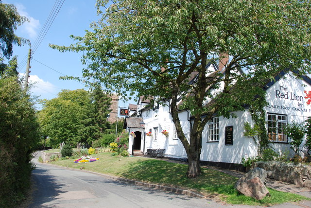
Despite its small size, Bradley boasts several amenities for its residents. These include a primary school, a village hall, and a pub. The primary school provides education to local children, while the village hall serves as a venue for various community events and activities. The pub, known as The Old Smithy, offers a cozy atmosphere and is a popular spot for locals and visitors alike.

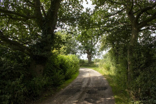
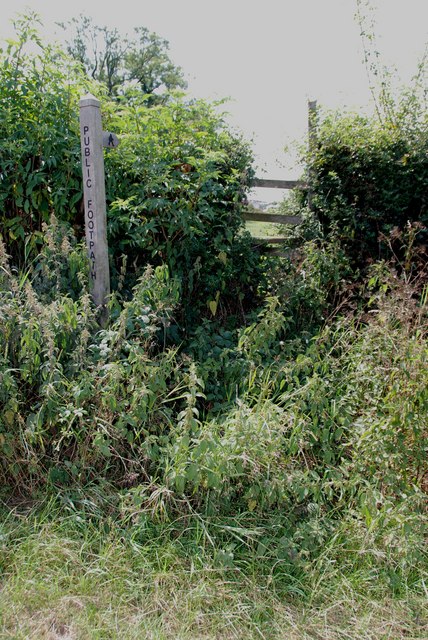
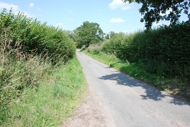
The surrounding countryside of Bradley is known for its natural beauty, with rolling hills and picturesque views. It provides ample opportunities for outdoor activities such as walking, cycling, and horse riding. Additionally, the parish is well-connected to nearby towns and cities, with good transport links allowing for easy access to amenities and services.

Overall, Bradley, Staffordshire is a charming and welcoming civil parish that offers a peaceful rural lifestyle with easy access to essential amenities and beautiful natural surroundings.

If you have any feedback on the listing, please let us know in the comments section below.
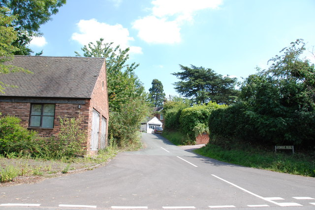
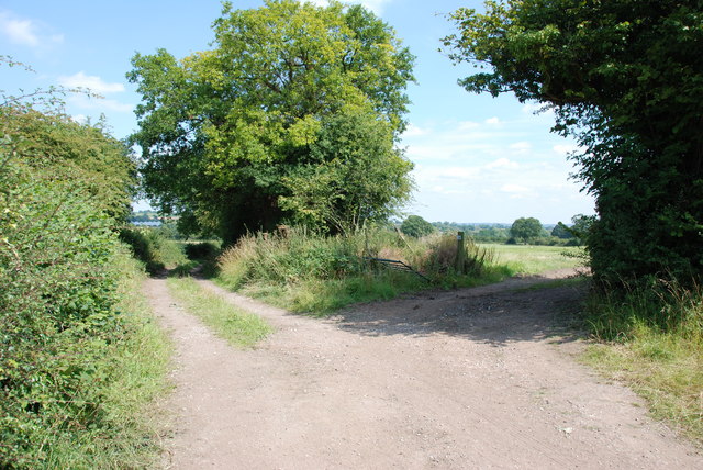
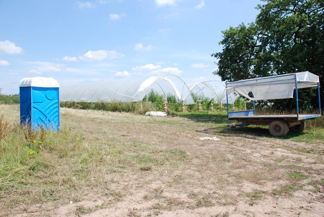
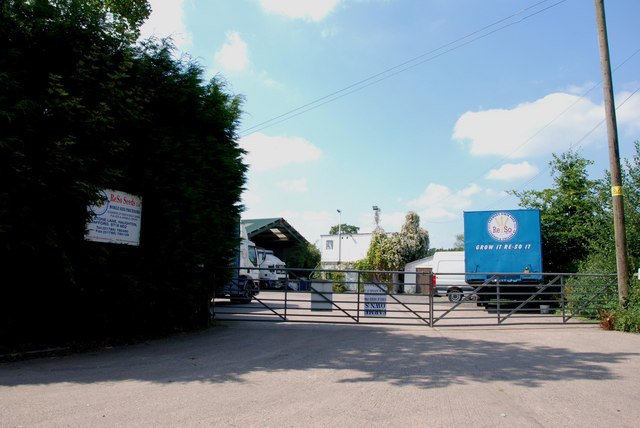
Bradley Images

Images are sourced within 2km of 52.758295/-2.186364 or Grid Reference SJ8717. Thanks to Geograph Open Source API. All images are credited.

Track and footpath Track and public right of way off Bigwood Lane
Track and footpath
Track and public right of way off Bigwood Lane
Wells Farm
Wells Farm
Hedgerow and field Hedgerow and field on Shredicote Lane
Hedgerow and field
Hedgerow and field on Shredicote Lane
Hedgerow and polytunnel Hedgerow and polytunnel on Mitton Road
Hedgerow and polytunnel
Hedgerow and polytunnel on Mitton Road
Direction Sign – Signpost on Barton Lane, Bradley Located in the centre of the junction of Barton Lane and Almshouse Croft in Bradley parish. 3 arms and pyramid top. 

Milestone Society National ID: ST_SJ8718
Direction Sign – Signpost on Barton Lane, Bradley
Located in the centre of the junction of Barton Lane and Almshouse Croft in Bradley parish. 3 arms and pyramid top. Milestone Society National ID: ST_SJ8718
Direction Sign – Signpost on Chapel Lane in Bradley Located on the north side of the Y junction of Chapel Lane and Almshouse Croft in Bradley parish. 3 arms and ball finial. 

Milestone Society National ID: ST_SJ8717
Direction Sign – Signpost on Chapel Lane in Bradley
Located on the north side of the Y junction of Chapel Lane and Almshouse Croft in Bradley parish. 3 arms and ball finial. Milestone Society National ID: ST_SJ8717
Entrance to Priory Bungalow
Looking over Wheat Field to More Pollytunnels
Holding area with Cattle Crush
Forge Rise, Bradley
Forge Rise, Bradley
The Red Lion Inn, Bradley This looks a really special Inn from the outside, with the church in the background. Didn't have time to go in, so have put a link to Express & Star review.

<span class="nowrap"><a title="http://www.expressandstar.com/lifestyle/food/2010/10/25/meal-review-of-the-red-lion-bradley-stafford-st18-2dz/" rel="nofollow ugc noopener" href="http://www.expressandstar.com/lifestyle/food/2010/10/25/meal-review-of-the-red-lion-bradley-stafford-st18-2dz/">Link</a><img style="margin-left:2px;" alt="External link" title="External link - shift click to open in new window" src="https://s1.geograph.org.uk/img/external.png" width="10" height="10"/></span>
The Red Lion Inn, Bradley
This looks a really special Inn from the outside, with the church in the background. Didn't have time to go in, so have put a link to Express & Star review. LinkExternal link
Farmtrack & Field, Bradley
Trailer, Polytunnels and Loo, Littywood Unlike a lot of the other Polytunnels in the area, these ones are growing Raspberries, but I wouldn't like to pick them as they are full of nettles.
Trailer, Polytunnels and Loo, Littywood
Unlike a lot of the other Polytunnels in the area, these ones are growing Raspberries, but I wouldn't like to pick them as they are full of nettles.
Straw, Cows and Dung. The Complete Cycle The new straw is used for bedding for the cattle, soiled straw is taken out as dung, the dung is put on the land to feed the next crops, and so the years roll by.
Straw, Cows and Dung. The Complete Cycle
The new straw is used for bedding for the cattle, soiled straw is taken out as dung, the dung is put on the land to feed the next crops, and so the years roll by.
Footpath, Upper Haughton House It doesn't look as if this stile has much use.
Footpath, Upper Haughton House
It doesn't look as if this stile has much use.
Field of Cows, Upper Haughton House Farm
ReSo Seeds Ltd If a farmer wants to use the seed that was harvested on his farm, instead of buying new seed, this company takes a special lorry to the farm, which will clean the seed and put any dressing on that is needed.
ReSo Seeds Ltd
If a farmer wants to use the seed that was harvested on his farm, instead of buying new seed, this company takes a special lorry to the farm, which will clean the seed and put any dressing on that is needed.
Alstone Lane, near Haughton This is quite a narrow lane, fortunately I picked better weather than John M.
Alstone Lane, near Haughton
This is quite a narrow lane, fortunately I picked better weather than John M.
Show me another place!

Bradley is located at Grid Ref: SJ8717 (Lat: 52.758295, Lng: -2.186364)

Administrative County: Staffordshire

District: Stafford

Police Authority: Staffordshire

What 3 Words

///leathers.geese.oppose. Near Gnosall, Staffordshire

Nearby Locations

Bradley

Related Wikis

Bradley, Staffordshire

Bradley is a village and civil parish in Staffordshire, England. The population of the civil parish at the 2011 census was 513. It is located close to...

Allimore Green

Allimore Green is a small hamlet in Staffordshire, England, 1 mile north-east of Church Eaton. It is the location of a Site of Special Scientific Interest...

Church Eaton

Church Eaton is a village and civil parish in Staffordshire some 6 miles (10 km) southwest of Stafford, 6 miles (10 km) northwest of Penkridge and 4 miles...

Apeton

Apeton is a hamlet in Staffordshire in the West Midlands region of England. It is located 5+1⁄2 miles (8.9 km) southwest of Stafford, in the civil parish...

Brazenhill

Brazenhill is rural area immediately north of the village of Haughton in Staffordshire, England. It is effectively defined by Brazenhill Lane which is...

Haughton, Staffordshire

Haughton is a village in Staffordshire, England, approximately 4 miles outside and to the west of the county town of Stafford. It lies on the A518 between...

Levedale

Levedale is a small somewhat elongated English village situated some 4 miles southwest of Stafford, 2 miles northwest of Penkridge and a mile west of Dunston...

Coppenhall

Coppenhall is a small settlement in Staffordshire, England. Coppenhall lies 2 kilometres (1 mi) southwest of Stafford and 4 miles (6.4 km) NNW of Penkridge...

Nearby Amenities

Located within 500m of 52.758295,-2.186364
Bus Stop
Village Hall
Naptan AtcoCode: 3800C700800
Naptan Bearing: NE
Naptan CommonName: Village Hall
Naptan Indicator: Adj
Naptan Landmark: Village Hall
Naptan Street: Church Lane
Naptan Verified: no
Public Transport: platform
Source: naptan_import
Lat/Long: 52.760045/-2.1804484
Bus Stop
Village Hall
Naptan AtcoCode: 3800C700801
Naptan Bearing: SW
Naptan BusStopType: CUS
Naptan CommonName: Village Hall
Naptan Indicator: Opp
Naptan Landmark: Village Hall
Naptan Street: Church Lane
Naptan Verified: no
Public Transport: platform
Source: naptan_import
Lat/Long: 52.7600094/-2.1802408
Pub
The Red Lion
Addr Postcode: ST18 9DZ
Fhrs Id: 1195759
Website: https://www.redlionbradley.co.uk
Lat/Long: 52.7594295/-2.1798043
The data included in this document is from www.openstreetmap.org. The data is made available under ODbL.

Have you been to Bradley?

Leave your review of Bradley below (or comments, questions and feedback).