Bradford

Civil Parish in Devon Torridge

England

Bradford

Bovacott Lane A minor road leading north from the A3072 past the farm at Bovacott
Bovacott Lane Credit: David Smith

Bradford is a civil parish located in the county of Devon, England. Situated in the South West region of the country, it falls within the area of West Devon District. The parish covers an area of approximately 12.3 square kilometers and is home to a population of around 400 residents.

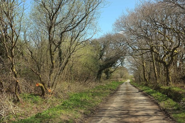
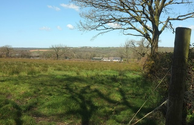
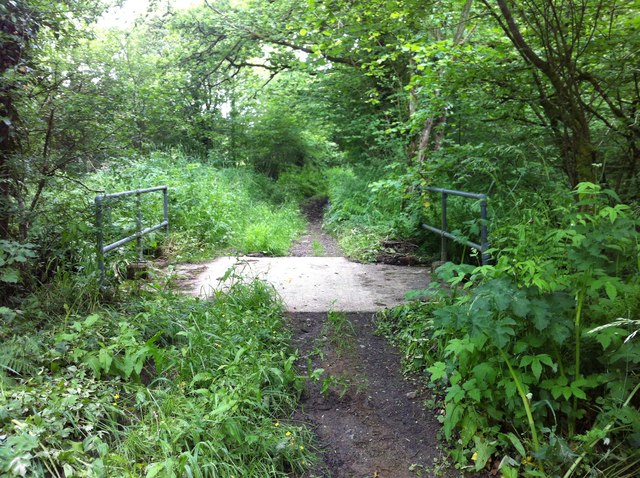
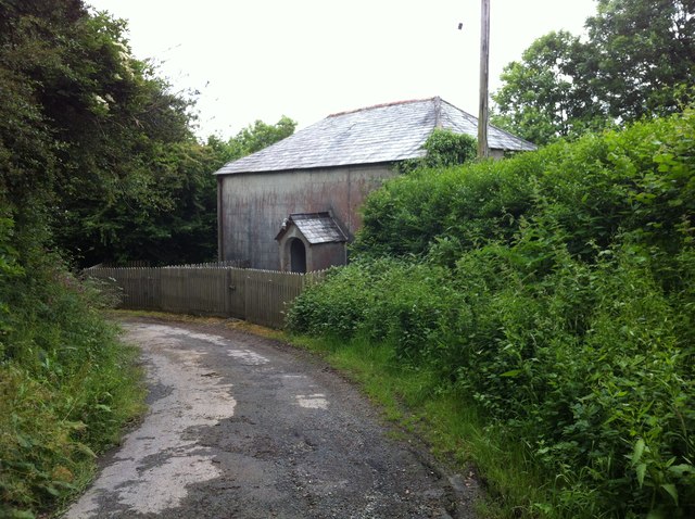
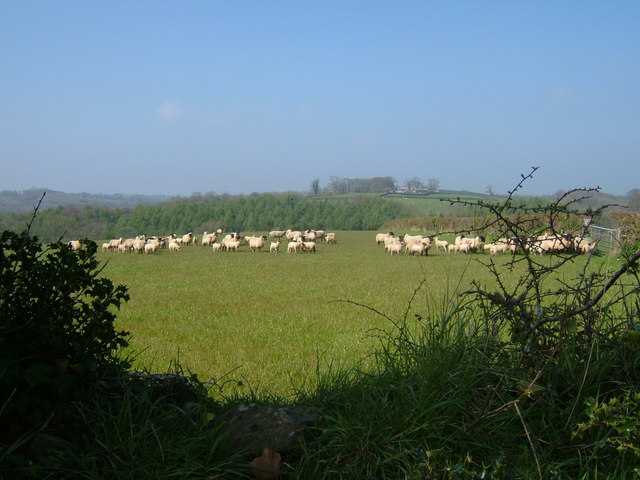
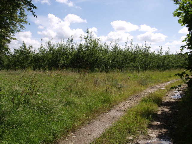
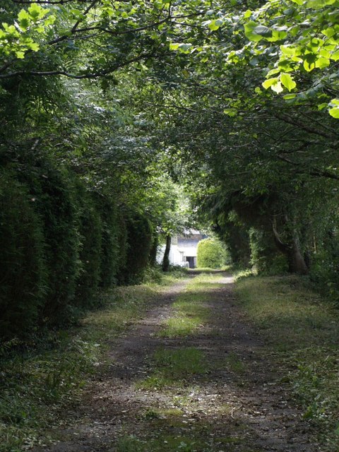
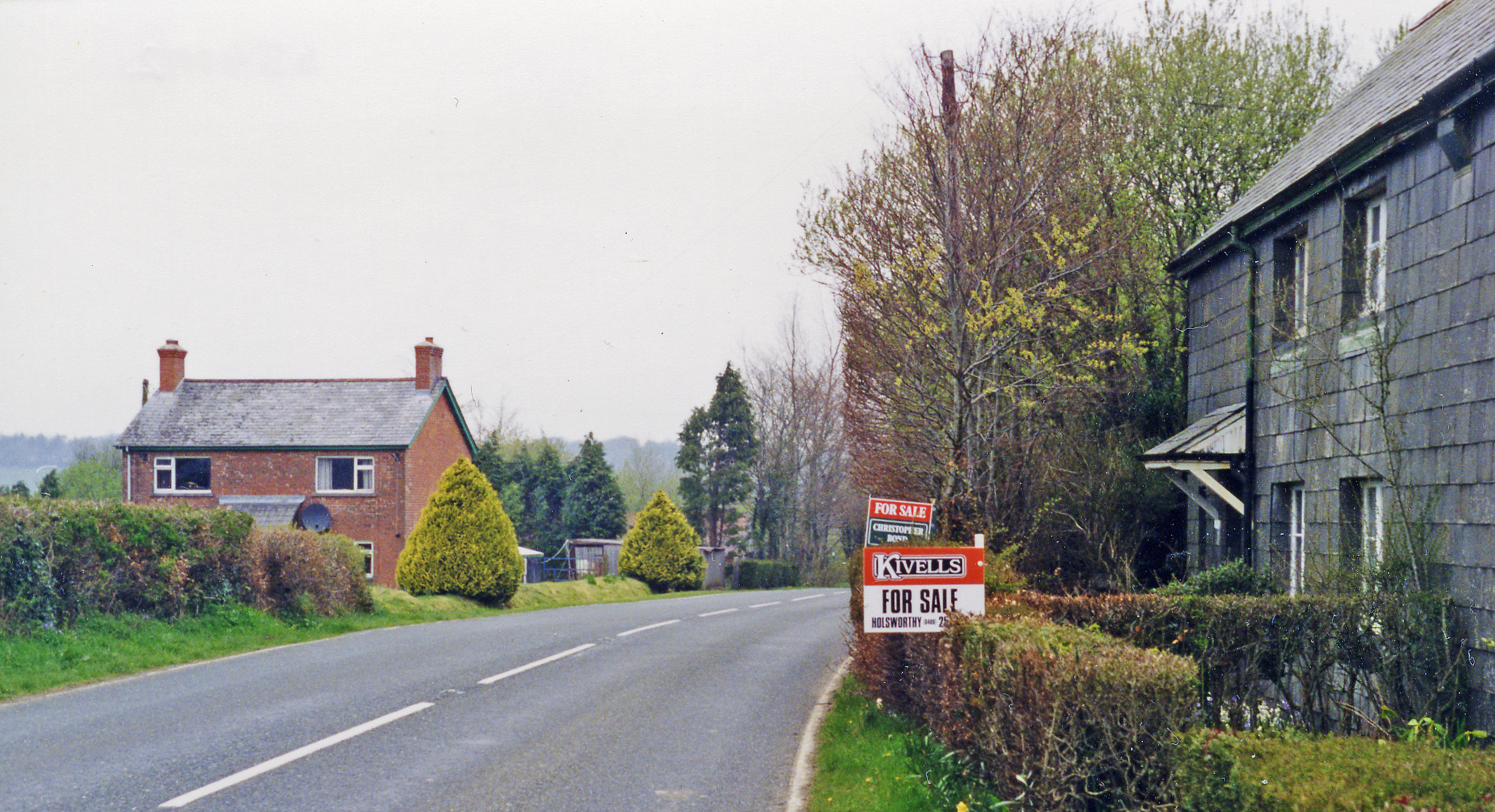
The village of Bradford is set in a picturesque rural landscape, characterized by rolling hills, lush green fields, and charming countryside views. It is surrounded by several other small villages and hamlets, such as Hatherleigh and Holsworthy, which contribute to the close-knit rural community atmosphere.

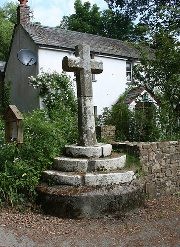
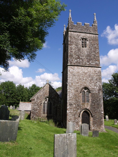
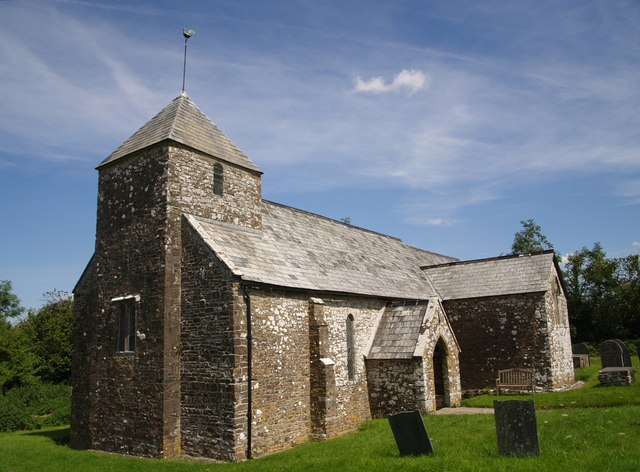
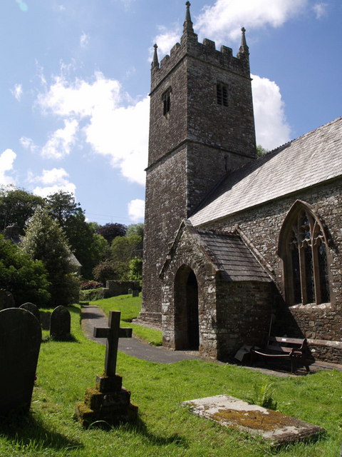
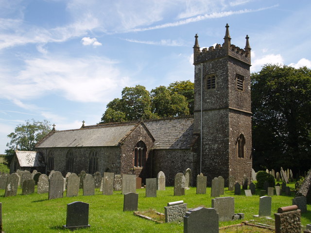
The village is known for its historic roots, with evidence of human settlement dating back to the Iron Age. The parish church, dedicated to St. Peter and St. Paul, is an impressive architectural landmark that stands as a testament to the village's long history.

Agriculture plays a significant role in the local economy, with farming and livestock rearing being common occupations for the residents. The village also benefits from a few small businesses, including local shops, pubs, and cafes that cater to both residents and visitors.

Bradford offers a peaceful and tranquil lifestyle, attracting those seeking a slower pace of life and a close connection to the natural environment. The village's proximity to Dartmoor National Park provides ample opportunities for outdoor activities, such as hiking, cycling, and horseback riding.

Overall, Bradford, Devon, is a quaint and picturesque civil parish that offers a charming rural lifestyle, rich in history and natural beauty.

If you have any feedback on the listing, please let us know in the comments section below.

Bradford Images

Images are sourced within 2km of 50.827837/-4.24809 or Grid Reference SS4105. Thanks to Geograph Open Source API. All images are credited.

Bovacott Lane A minor road leading north from the A3072 past the farm at Bovacott
Bovacott Lane
A minor road leading north from the A3072 past the farm at Bovacott
A3072 passing Bradford House
Bickford Arms inn at Brandis Corner
Lane to Cookbury Passing a small patch of woodland near Westway Farm, and followed by NCN3.
Lane to Cookbury
Passing a small patch of woodland near Westway Farm, and followed by NCN3.
Lane near Cookbury A fairly straight lane towards Ley Cross, heading towards a bridge across a tributary of the Waldon.
Lane near Cookbury
A fairly straight lane towards Ley Cross, heading towards a bridge across a tributary of the Waldon.
Field near Cookbury Rushy pastures typify this area. This is looking left from where <a href="https://www.geograph.org.uk/photo/4920240">SS4006 : Lane near Cookbury</a> was taken.
Field near Cookbury
Rushy pastures typify this area. This is looking left from where SS4006 : Lane near Cookbury was taken.
House near Cookbury From the same spot as <a href="https://www.geograph.org.uk/photo/4925678">SS4006 : Field near Cookbury</a>, looking right, parallel to the lane shown in <a href="https://www.geograph.org.uk/photo/4920240">SS4006 : Lane near Cookbury</a>.
House near Cookbury
From the same spot as SS4006 : Field near Cookbury, looking right, parallel to the lane shown in SS4006 : Lane near Cookbury.
Carriage drive to Dunsland Climbing towards the site of Dunsland House along the carriage drive from the Cookbury turning off the Brandis Corner to Holemoor road.  The carriage drive has seen little vehicular use and no maintenance in the 50 years since the house was destroyed, and is a good illustration of how tarred roads eventually revert to nature without continual repair.
Carriage drive to Dunsland
Climbing towards the site of Dunsland House along the carriage drive from the Cookbury turning off the Brandis Corner to Holemoor road. The carriage drive has seen little vehicular use and no maintenance in the 50 years since the house was destroyed, and is a good illustration of how tarred roads eventually revert to nature without continual repair.
Green lane bridge Sturdy if functional concrete replacement bridge over a tributary of the River Torridge, on the green lane between Cookbury and Bradford.  Apart from a susceptibility to flooding, the lane is in remarkably good condition for an unsurfaced, unclassified county road.
Green lane bridge
Sturdy if functional concrete replacement bridge over a tributary of the River Torridge, on the green lane between Cookbury and Bradford. Apart from a susceptibility to flooding, the lane is in remarkably good condition for an unsurfaced, unclassified county road.
Non-conformist chapel at Cookbury
Ford at Holemoor This ford beside Hole Farm at Holemoor is marked by what looks to be a "home made" depth gauge.
Ford at Holemoor
This ford beside Hole Farm at Holemoor is marked by what looks to be a "home made" depth gauge.
Old Wayside Cross in Bradford Village, Devon Bradford Village Cross, old shaft in a new cross, by the UC road, in parish of Bradford (Torridge District), junction with lane down to the church, on roadway beside garden wall.

Scheduled Monument. List Entry Number: 1013729
<span class="nowrap"><a title="https://historicengland.org.uk/listing/the-list/list-entry/1013729" rel="nofollow ugc noopener" href="https://historicengland.org.uk/listing/the-list/list-entry/1013729">Link</a><img style="margin-left:2px;" alt="External link" title="External link - shift click to open in new window" src="https://s1.geograph.org.uk/img/external.png" width="10" height="10"/></span>

Surveyed

Milestone Society National ID: DVTR_BRA.
Old Wayside Cross in Bradford Village, Devon
Bradford Village Cross, old shaft in a new cross, by the UC road, in parish of Bradford (Torridge District), junction with lane down to the church, on roadway beside garden wall. Scheduled Monument. List Entry Number: 1013729 LinkExternal link Surveyed Milestone Society National ID: DVTR_BRA.
Old Direction Sign - Signpost by Lana Cross, Bradford parish Pyramid cap finial - 3 arms; Devon DCC pyramid with name by the UC road, in parish of Bradford (Torridge District), Lana Cross, by road to Bradford church.

Surveyed

Milestone Society National ID: DV_SS4206
Old Direction Sign - Signpost by Lana Cross, Bradford parish
Pyramid cap finial - 3 arms; Devon DCC pyramid with name by the UC road, in parish of Bradford (Torridge District), Lana Cross, by road to Bradford church. Surveyed Milestone Society National ID: DV_SS4206
Farmland Towards Lashbrook
All Saints Church, Bradford The tower is 14th century, although the pinnacles were among the features renewed in the C19.
All Saints Church, Bradford
The tower is 14th century, although the pinnacles were among the features renewed in the C19.
Orchard, Bradford One of a pair of young orchards close to the lane through the hamlet.
Orchard, Bradford
One of a pair of young orchards close to the lane through the hamlet.
West Bradford The farm is at the end of a shady track leading off the lane from Bradford to Holemoor.
West Bradford
The farm is at the end of a shady track leading off the lane from Bradford to Holemoor.
Lane to Priestacott A long shady stretch of lane climbs gently into the hamlet from the Torridge valley.
Lane to Priestacott
A long shady stretch of lane climbs gently into the hamlet from the Torridge valley.
Show me another place!

Bradford is located at Grid Ref: SS4105 (Lat: 50.827837, Lng: -4.24809)

Administrative County: Devon

District: Torridge

Police Authority: Devon & Cornwall

What 3 Words

///unzipped.famous.third. Near Holsworthy, Devon

Nearby Locations

Bramble Wood Bradford

Related Wikis

Dunsland

Dunsland is a historic manor and former house in the parish of Bradford (or Cookbury) near Holsworthy in Devon, England. It was successively home to the...

Cookbury

Cookbury is a village and civil parish in the local government district of Torridge, Devon, England. The parish, which lies about five miles east of the...

Bradford, Devon

Bradford is a village and civil parish in the local government district of Torridge, Devon, England. The parish, which lies about six miles east of the...

Okehampton–Bude line

The Okehampton–Bude line was a railway line built to serve Holsworthy in Devon, and Bude on the Cornish coast near the Devon border in England. The line...

Dunsland Cross railway station

Dunsland Cross was a railway station on the Bude Branch that closed in 1966. Dunsland Cross station in the parish of Holsworthy was 6 miles East of the...

Brandis Corner

Brandis Corner is a village on the A3072 within the civil parish of Holsworthy in Devon, England. In the Cornish dialect, a brandis is a three-legged stool...

Shebbear

Shebbear (; SHEB-eer) is a village and civil parish in the Torridge district in Devon, England. It was once itself centre of the Shebbear hundred. In 2001...

Thornbury, Devon

Thornbury is a small village and civil parish in the local government district of Torridge, Devon, England. The parish, which lies about five miles (8...

Nearby Amenities

Located within 500m of 50.827837,-4.24809
Middlecott Cross
Junction: yes
Lat/Long: 50.8290772/-4.2521728
Post Box
Post Box Mounting: brick_pillar
Post Box Type: wall
Ref: EX22 144
Royal Cypher: VR
Royal Cypher Wikidata: Q33102356
Lat/Long: 50.8248158/-4.2504805
Holemoor Cross
Junction: yes
Lat/Long: 50.8289932/-4.2415583
Direction: WSW
Generator Method: photovoltaic
Generator Output Electricity: yes
Generator Solar Modules: 16
Generator Source: solar
Generator Type: solar_photovoltaic_panel
Location: roof
Power: generator
Lat/Long: 50.8253084/-4.2443185
Holemoor
Place: hamlet
Lat/Long: 50.8290341/-4.2412369
The data included in this document is from www.openstreetmap.org. The data is made available under ODbL.

Have you been to Bradford?

Leave your review of Bradford below (or comments, questions and feedback).