Brackenfield

Civil Parish in Derbyshire North East Derbyshire

England

Brackenfield

Path south from Ravensnest Tor This is the point at which the path emerges from the woodland and you get a view, or you would if it were not a wet misty day.
Path south from Ravensnest Tor Credit: Bill Boaden

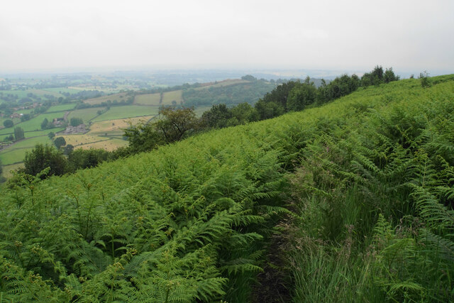
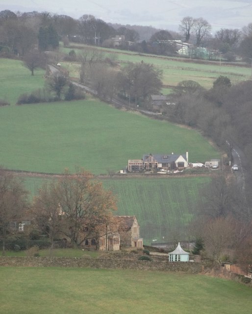
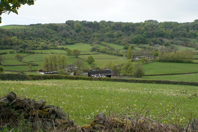
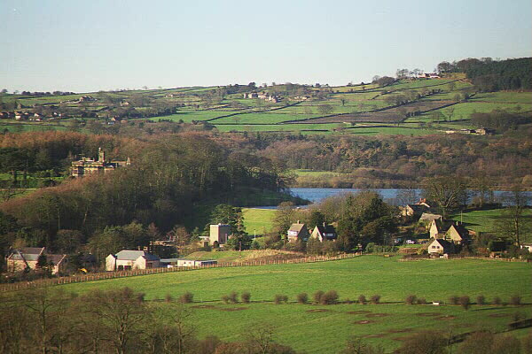
Brackenfield is a small civil parish located in the county of Derbyshire, England. Situated in the Amber Valley district, it covers an area of approximately 2.5 square kilometers. The village is nestled within the picturesque Derbyshire Dales, surrounded by rolling hills and lush green countryside.

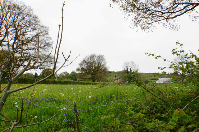
Brackenfield is a close-knit community, with a population of around 300 residents. The village boasts a tranquil and peaceful atmosphere, making it an ideal place for those seeking a rural lifestyle. The parish is predominantly residential, with a scattering of farms and agricultural land.

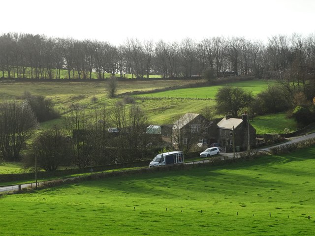
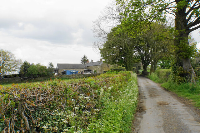
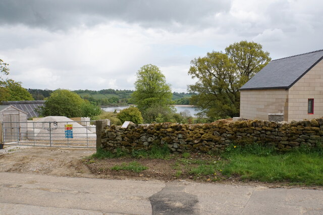
The village itself is characterized by its charming traditional cottages and stone-built houses. Many of the properties date back to the 18th and 19th centuries, adding to the area's historic charm. Brackenfield also benefits from a beautiful church, St. James Church, which stands as a focal point in the village.

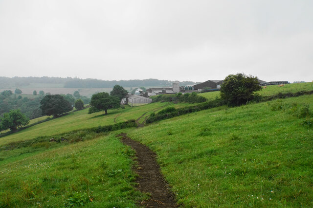
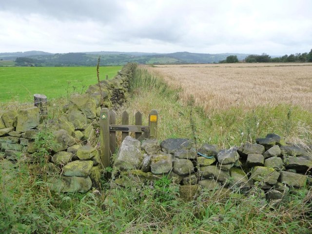
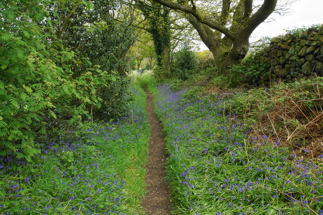
Despite its small size, Brackenfield offers a range of amenities for its residents. These include a local primary school, providing education for children aged 4-11, and a village hall that serves as a hub for community events and gatherings. Additionally, there are several footpaths and bridleways that allow residents and visitors to explore the surrounding countryside and enjoy the natural beauty of the area.

Overall, Brackenfield is a peaceful and picturesque civil parish in Derbyshire, offering a tranquil lifestyle amidst the stunning landscapes of the Derbyshire Dales.

If you have any feedback on the listing, please let us know in the comments section below.

Brackenfield Images

Images are sourced within 2km of 53.129405/-1.469687 or Grid Reference SK3559. Thanks to Geograph Open Source API. All images are credited.

Path south from Ravensnest Tor This is the point at which the path emerges from the woodland and you get a view, or you would if it were not a wet misty day.
Path south from Ravensnest Tor
This is the point at which the path emerges from the woodland and you get a view, or you would if it were not a wet misty day.
Butterley Top Farm Situated on top of the edge. Visibility is not so good on this wet day.
Butterley Top Farm
Situated on top of the edge. Visibility is not so good on this wet day.
A view of Butterley
A view of Butterley
View to Ashover Hay From Highoredish Ridge
View to Ashover Hay
From Highoredish Ridge
Cattle grazing, Butterley
Minor road, Butterley Heading north west towards Amber Hill.
Minor road, Butterley
Heading north west towards Amber Hill.
Ridge of farmland, west of Butterley Climbing up to 285 metres above sea level.
Ridge of farmland, west of Butterley
Climbing up to 285 metres above sea level.
View across a valley to Butterley Top Farm Looking east.
View across a valley to Butterley Top Farm
Looking east.
Barley field, south of Poorlots Quarry Looking westwards.
Barley field, south of Poorlots Quarry
Looking westwards.
Public footpath to Knabhall Lane Running west from an anonymous lane, along the south side of a barley field.
Public footpath to Knabhall Lane
Running west from an anonymous lane, along the south side of a barley field.
Old Milestone by the B6014, Butterley, opposite Reservoir Farm Old Milestone by the B6014, opposite Reservoir Farm, Butterley, on bank in front of stone wall, North side of road. Standing stone of old well opposite.

Inscription once read:- : (Mansfield / 13) :   

Milestone Society National ID: DE_STTY03
Old Milestone by the B6014, Butterley, opposite Reservoir Farm
Old Milestone by the B6014, opposite Reservoir Farm, Butterley, on bank in front of stone wall, North side of road. Standing stone of old well opposite. Inscription once read:- : (Mansfield / 13) : Milestone Society National ID: DE_STTY03
Farmland around Greenfield Farm Set in a valley between Ravensnest Tor and Ashover Hay.
Farmland around Greenfield Farm
Set in a valley between Ravensnest Tor and Ashover Hay.
Stonerows Lane A section of the lane with high hedgerows, not allowing much of a view.
Stonerows Lane
A section of the lane with high hedgerows, not allowing much of a view.
Ashover Hay Looking uphill from Stonerows Lane, with the hilltop visible, though the view is slightly inhibited by the steep bank above the lane.
Ashover Hay
Looking uphill from Stonerows Lane, with the hilltop visible, though the view is slightly inhibited by the steep bank above the lane.
Stonerows Lane Passing Stonerows Farm on the left.
Stonerows Lane
Passing Stonerows Farm on the left.
Field of wheat above Woolley There is a small glimpse of Ogston Reservoir down below.
Field of wheat above Woolley
There is a small glimpse of Ogston Reservoir down below.
Footpath to Woolley This part of the path is lined by bluebells. Not in view here, but the path also passes a lot of greater stichwort.
Footpath to Woolley
This part of the path is lined by bluebells. Not in view here, but the path also passes a lot of greater stichwort.
New development near Yew Tree Farm A new house is being built. Ogston Reservoir can be seen in the background.
New development near Yew Tree Farm
A new house is being built. Ogston Reservoir can be seen in the background.
Show me another place!

Brackenfield is located at Grid Ref: SK3559 (Lat: 53.129405, Lng: -1.469687)

Administrative County: Derbyshire

District: North East Derbyshire

Police Authority: Derbyshire

What 3 Words

///edicts.sensitive.liberated. Near Tansley, Derbyshire

Nearby Locations

Nuttall Wood Brackenfield

Related Wikis

Mathersgrave

Mathersgrave is a hamlet in Derbyshire, England. It consists of three houses on Mathers Grave Lane. This lane runs between the A615 Matlock road and School...

Brackenfield

Brackenfield is a village and civil parish in the North East Derbyshire district of Derbyshire, England. The population of the civil parish as of the 2011...

Milltown Methodist Church

Milltown Methodist Church (known alternatively as Milltown Chapel, Milltown Primitive Methodist Chapel and Ashover Hay Primitive Methodist Chapel) is a...

Wessington

Wessington is a village and civil parish in the English county of Derbyshire. The population of the civil parish at the 2011 census was 576. It is in the...

Woolley railway station

Woolley railway station was a small station on the Ashover Light Railway and it served the small village of Woolley Moor in North East Derbyshire, England...

Ashover Light Railway

The Ashover Light Railway was a 1 ft 11+1⁄2 in (597 mm) narrow gauge railway in Derbyshire, England that connected Clay Cross and Ashover. It was built...

Wheatcroft, Derbyshire

Wheatcroft is a small hamlet in the hills of Amber Valley, near Crich, Derbyshire, England. Wheatcroft has no shop or church and while it once had a chapel...

Ogston Hall

Ogston Hall is a privately owned 18th-century country house situated at Brackenfield, near Alfreton, Derbyshire. It is a Grade II* listed building. A building...

Nearby Amenities

Located within 500m of 53.129405,-1.469687
Barrier: stile
Lat/Long: 53.1306638/-1.4706359
Barrier: stile
Lat/Long: 53.1279472/-1.4739688
Barrier: stile
Ele: 280.1076660
Steps: 3
Stile: wall
Lat/Long: 53.1290566/-1.4753444
Ele: 278.9061279
Lat/Long: 53.1288765/-1.4749975
Barrier: stile
Ele: 271.4559326
Steps: 2
Stile: wall
Lat/Long: 53.1281546/-1.4746596
Natural: water
Lat/Long: 53.1319123/-1.4715751
Bench
Lat/Long: 53.1320765/-1.4720149
Bench
Lat/Long: 53.1323275/-1.4730482
Bench
Lat/Long: 53.1325351/-1.4735438
Bench
Lat/Long: 53.1316742/-1.4709689
Ele: 282
Lat/Long: 53.132128/-1.4725676
Barrier: stile
Ele: 282.9915771
Steps: 2
Stile: wall
Lat/Long: 53.1320029/-1.4726544
Ele: 278
Lat/Long: 53.1314456/-1.4708455
Ele: 276
Lat/Long: 53.1316727/-1.470868
Ele: 274
Lat/Long: 53.1318115/-1.4709387
Ele: 275.0609131
Lat/Long: 53.1319478/-1.4715221
Ele: 277
Lat/Long: 53.1321294/-1.4719762
Ele: 281
Lat/Long: 53.1323468/-1.473032
Ele: 279.8673096
Lat/Long: 53.1325659/-1.4735089
Barrier: stile
Steps: 3
Stile: wall
Lat/Long: 53.1312916/-1.4634559
Ele: 219.7854004
Lat/Long: 53.1313116/-1.4639896
Barrier: stile
Ele: 232.0421143
Steps: 2
Stile: wall
Lat/Long: 53.1313292/-1.4648006
Barrier: stile
Ele: 256.7958984
Steps: 2
Stile: stepover
Lat/Long: 53.1314798/-1.4660508
Barrier: stile
Ele: 257.9975586
Steps: 2
Stile: wall
Lat/Long: 53.1319649/-1.4692319
Ele: 257.7573242
Lat/Long: 53.1319938/-1.4693073
Ele: 256
Lat/Long: 53.131514/-1.4659723
Ele: 250.3070068
Lat/Long: 53.1294891/-1.466508
Ele: 228
Lat/Long: 53.1299546/-1.464945
Ele: 233
Lat/Long: 53.1313716/-1.4648135
Barrier: stile
Ele: 260.1605225
Steps: 2
Stile: stepover
Lat/Long: 53.1322849/-1.4710518
Ele: 261.1218262
Lat/Long: 53.132282/-1.47118
Ele: 264
Lat/Long: 53.1294239/-1.4677721
Ele: 249
Lat/Long: 53.1294556/-1.4665106
Ele: 253
Lat/Long: 53.1294174/-1.4668156
Ele: 268.5720215
Lat/Long: 53.1297198/-1.4681913
Barrier: stile
Steps: 2
Stile: wall
Lat/Long: 53.1297309/-1.4682362
Barrier: stile
Ele: 215.4595947
Material: wood
Steps: 2
Stile: stepover
Lat/Long: 53.1300246/-1.4636334
Barrier: stile
Ele: 228.4372559
Steps: 2
Stile: stepover
Lat/Long: 53.1300472/-1.4650514
Ele: 235
Lat/Long: 53.1299068/-1.4656104
Trinity Chapel
Historic: ruins
Source Name: Sign on gate
Wikidata: Q17642118
Lat/Long: 53.1301359/-1.4656845
Ele: 259
Lat/Long: 53.1292904/-1.4673649
Bus Stop
Bus: yes
Ele: 219.0000000
Public Transport: platform
Lat/Long: 53.126764/-1.4638786
Passing Place
Lat/Long: 53.1256153/-1.4658598
Bench
Lat/Long: 53.1293237/-1.4673305
Bench
Lat/Long: 53.1294843/-1.4665185
Description: Radio mast GB3IN Amateur Radio Repeater 145.6375MHz @ 71.9Hz
Man Made: tower
Tower Type: communication
Lat/Long: 53.1313262/-1.4718377
Bench
Lat/Long: 53.1312506/-1.4696809
Generator Method: wind_turbine
Generator Source: wind
Power: generator
Lat/Long: 53.1312741/-1.4729704
Access: no
Barrier: stile
Foot: yes
Material: stone
Stile: stepover
Lat/Long: 53.1323159/-1.4702923
Barrier: stile
Ele: 281.5496826
Steps: 1
Stile: wall
Lat/Long: 53.1292128/-1.4756886
The data included in this document is from www.openstreetmap.org. The data is made available under ODbL.

Have you been to Brackenfield?

Leave your review of Brackenfield below (or comments, questions and feedback).