Bletchingley

Civil Parish in Surrey Tandridge

England

Bletchingley

Coldharbour Farm now a private house
Coldharbour Farm Credit: Roger W Haworth

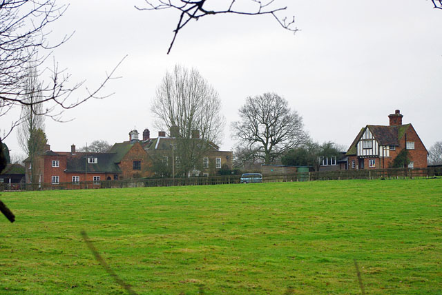
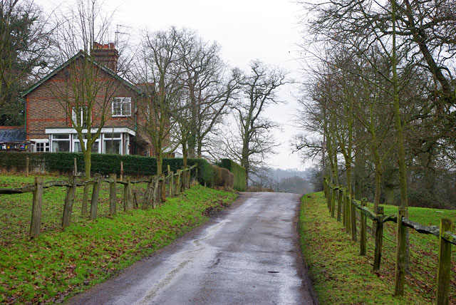
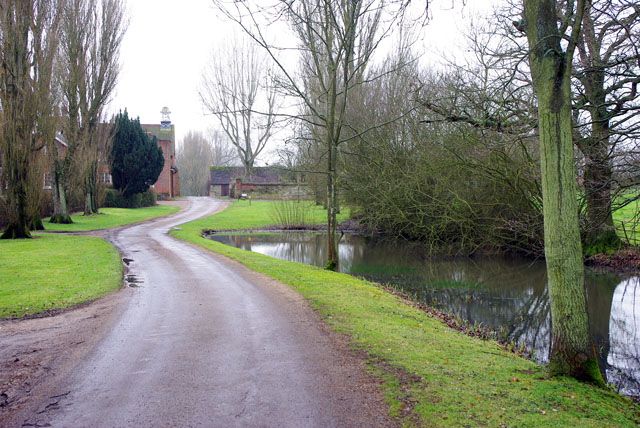
Bletchingley is a civil parish situated in the county of Surrey, England. It is located approximately 22 miles south of London and falls under the jurisdiction of the Tandridge District Council. The village is surrounded by picturesque countryside and is known for its historic charm and rural character.

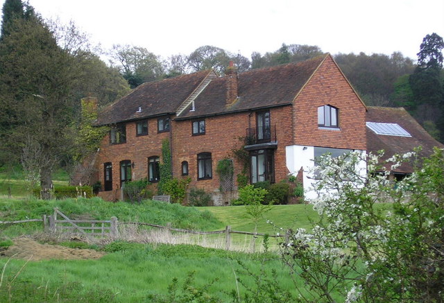
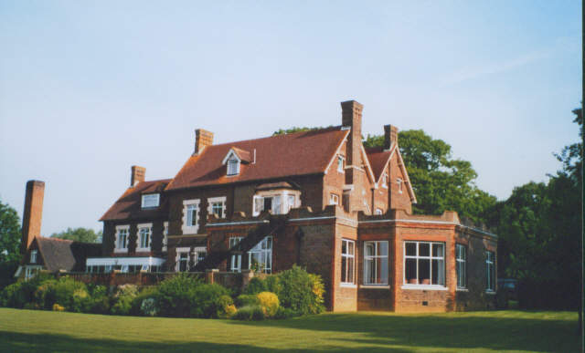
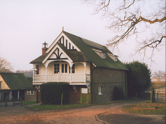
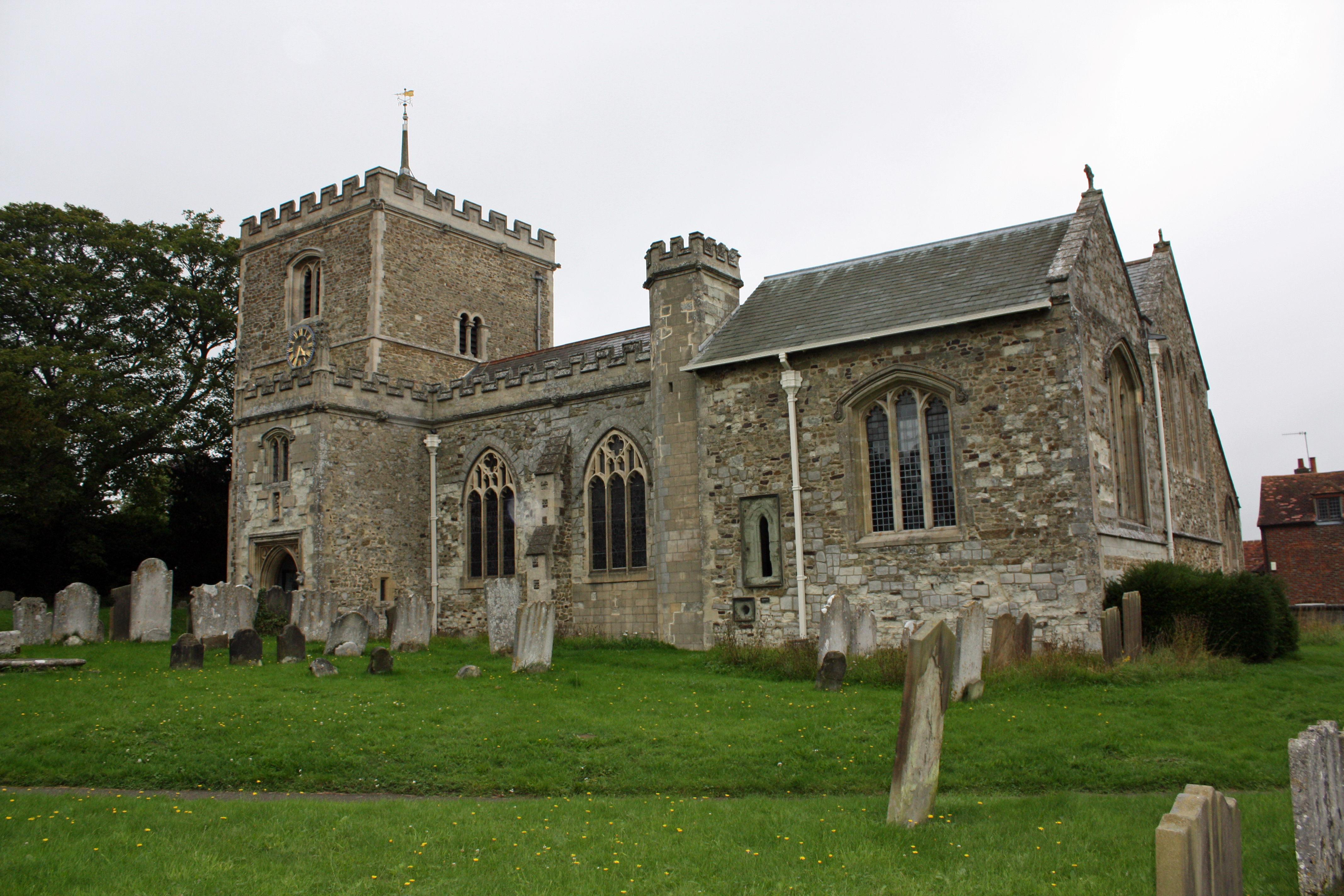
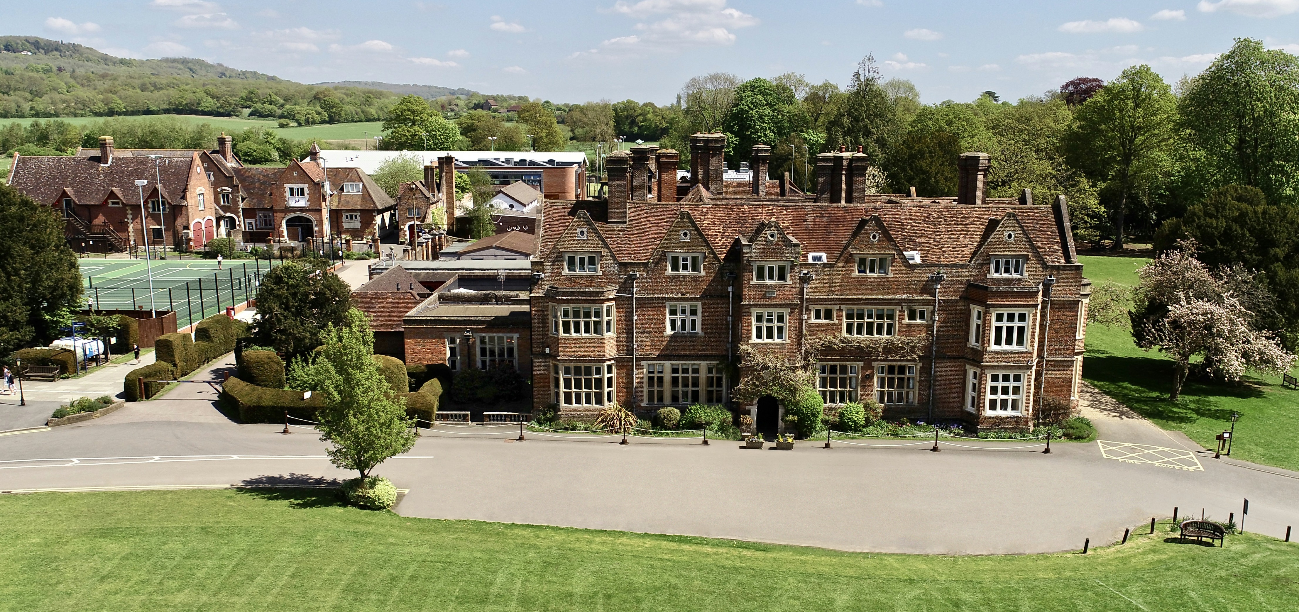
Bletchingley has a rich history dating back to the medieval times, with several well-preserved buildings and landmarks that showcase its heritage. The village has a Grade I listed church called St. Mary's Church, which dates back to the 11th century and is renowned for its impressive architecture. Additionally, there are several timber-framed houses and cottages that add to the village's quaint appeal.

The village center of Bletchingley offers a range of amenities and services to its residents and visitors. There are a few local shops, including a post office, a grocery store, and a few independent businesses. The village also boasts several pubs and restaurants, which serve as popular gathering spots for locals and tourists alike.

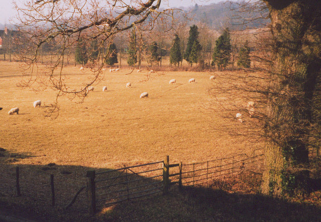
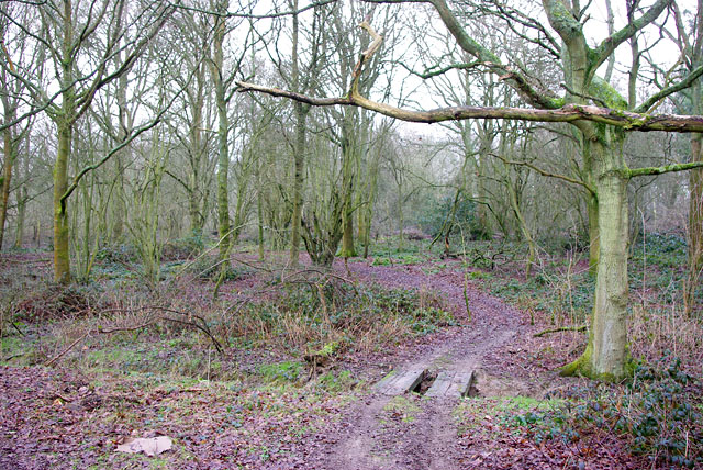
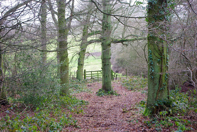
Bletchingley is surrounded by beautiful countryside, making it an ideal location for outdoor enthusiasts. The area offers numerous walking and cycling routes, allowing visitors to explore the scenic landscapes and enjoy the tranquility of the surroundings. The village is also home to a cricket club, providing recreational opportunities for sports enthusiasts.

Overall, Bletchingley is a charming and historic village that offers a peaceful and picturesque setting, making it an attractive place to live or visit for those seeking a blend of rural tranquility and convenient access to nearby towns and cities.

If you have any feedback on the listing, please let us know in the comments section below.

Bletchingley Images

Images are sourced within 2km of 51.23752/-0.095317 or Grid Reference TQ3350. Thanks to Geograph Open Source API. All images are credited.

Coldharbour Farm now a private house
Coldharbour Farm
now a private house
from bridge in Outwood Lane Unlikely though it may seem this, the Redhill to Tonbridge Line <span class="nowrap"><a title="http://en.wikipedia.org/wiki/Redhill_to_Tonbridge_Line" rel="nofollow ugc noopener" href="http://en.wikipedia.org/wiki/Redhill_to_Tonbridge_Line">Link</a><img style="margin-left:2px;" alt="External link" title="External link - shift click to open in new window" src="https://s1.geograph.org.uk/img/external.png" width="10" height="10"/></span> , was part of the first rail route from London to Dover. The planners were not interested in serving the settlements en route so it takes a remarkably straight route. The Bletchingley Tunnel can be seen in the background - see <a href="https://www.geograph.org.uk/photo/206453">TQ3348 : Air shaft of Bletchingley Tunnel</a>.
from bridge in Outwood Lane
Unlikely though it may seem this, the Redhill to Tonbridge Line LinkExternal link , was part of the first rail route from London to Dover. The planners were not interested in serving the settlements en route so it takes a remarkably straight route. The Bletchingley Tunnel can be seen in the background - see TQ3348 : Air shaft of Bletchingley Tunnel.
St Mark's Foundation A private chapel at South Park Farm, listed grade II and occasionally used for public services.
St Mark's Foundation
A private chapel at South Park Farm, listed grade II and occasionally used for public services.
Wychcroft Retreat House Anglican Diocese of Southwark Retreat House used for residential training and quiet days
Wychcroft Retreat House
Anglican Diocese of Southwark Retreat House used for residential training and quiet days
Beside Outwood Lane A lone and rather sick tree in the park land south of Bletchingley
Beside Outwood Lane
A lone and rather sick tree in the park land south of Bletchingley
Air shaft of Bletchingley Tunnel When the Bletchingley railway tunnel <span class="nowrap"><a title="http://en.wikipedia.org/wiki/Redhill_to_Tonbridge_Line" rel="nofollow ugc noopener" href="http://en.wikipedia.org/wiki/Redhill_to_Tonbridge_Line">Link</a><img style="margin-left:2px;" alt="External link" title="External link - shift click to open in new window" src="https://s1.geograph.org.uk/img/external.png" width="10" height="10"/></span> was made in the 1830s trains were steam powered and slow by today's standards. Although the tunnel is just over a kilometre long, eleven air shafts were provided to vent the smoke. This is Shaft No. 2. The tunnel can be seen in <a href="https://www.geograph.org.uk/photo/174476">TQ3248 : from bridge in Outwood Lane</a>.
Air shaft of Bletchingley Tunnel
When the Bletchingley railway tunnel LinkExternal link was made in the 1830s trains were steam powered and slow by today's standards. Although the tunnel is just over a kilometre long, eleven air shafts were provided to vent the smoke. This is Shaft No. 2. The tunnel can be seen in TQ3248 : from bridge in Outwood Lane.
The chapel at Wychcroft An unusual private chapel, dedicated to the People of God, part of the Southwark diocesan retreat house and training centre.
The chapel at Wychcroft
An unusual private chapel, dedicated to the People of God, part of the Southwark diocesan retreat house and training centre.
Sheep grazing at Wychcroft A pastoral scene near Bletchingley.
Sheep grazing at Wychcroft
A pastoral scene near Bletchingley.
Bletchingley 3 natural gas well Inside the small enclosure, seen through the gates to the larger area. Currently operated by Star Energy.
Bletchingley 3 natural gas well
Inside the small enclosure, seen through the gates to the larger area. Currently operated by Star Energy.
Parkgate Cottages Just beyond the cottages is the start of a bridleway heading east.
Parkgate Cottages
Just beyond the cottages is the start of a bridleway heading east.
Track into woods Branching north from the public bridleway into Crookedfield Shaw is a track used by a quad bike or similar - probably a gamekeeper's route.
Track into woods
Branching north from the public bridleway into Crookedfield Shaw is a track used by a quad bike or similar - probably a gamekeeper's route.
Path out of the wood Branching south from the track used as a public bridleway, this private path into the field has not merited such a big gate for a long time.
Path out of the wood
Branching south from the track used as a public bridleway, this private path into the field has not merited such a big gate for a long time.
South Park Farm Something more than a farm, there is a chapel in the complex.
South Park Farm
Something more than a farm, there is a chapel in the complex.
Cottages on drive to South Park Farm Just over the crest is the drive entrance where the public bridleway along the drive finishes and the public road, South Park Lane, starts.
Cottages on drive to South Park Farm
Just over the crest is the drive entrance where the public bridleway along the drive finishes and the public road, South Park Lane, starts.
Approach to South Park The chapel is prominent ahead.
Approach to South Park
The chapel is prominent ahead.
Pond,  Bransland Wood A recently cleaned and opened out pond on National Trust property.  They have posted a placard explaining how the dredging deposits, currently rather unsightly, will be reseeded with grass in the spring.
Pond, Bransland Wood
A recently cleaned and opened out pond on National Trust property. They have posted a placard explaining how the dredging deposits, currently rather unsightly, will be reseeded with grass in the spring.
M23 runoff pond A secluded spot accessed from Coopers Hill Road. The M23 is on an embankment on the right. The pond is lightly iced after a cold night.
M23 runoff pond
A secluded spot accessed from Coopers Hill Road. The M23 is on an embankment on the right. The pond is lightly iced after a cold night.
Trees in a cutting The cutting is the western approaches to the Godstone Tunnel.
Trees in a cutting
The cutting is the western approaches to the Godstone Tunnel.
Show me another place!

Bletchingley is located at Grid Ref: TQ3350 (Lat: 51.23752, Lng: -0.095317)

Administrative County: Surrey

District: Tandridge

Police Authority: Surrey

What 3 Words

///glory.oval.press. Near Bletchingley, Surrey

Related Wikis

Bletchingley

Bletchingley (historically "Blechingley") is a village in Surrey, England. It is on the A25 road to the east of Redhill and to the west of Godstone, has...
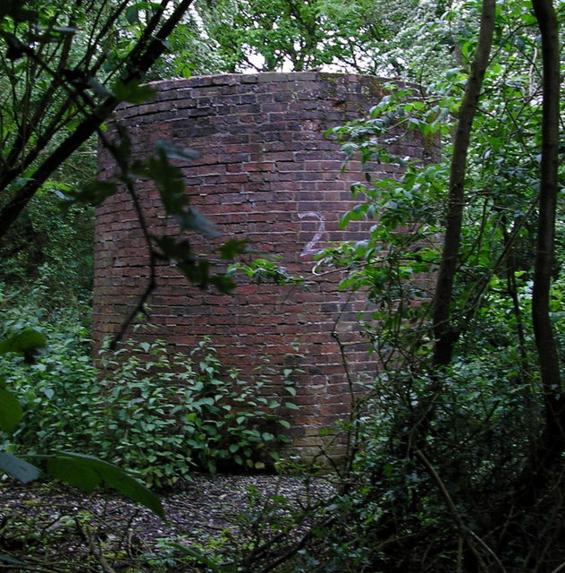
Bletchingley Castle

Bletchingley Castle is a ruined castle and set of earthworks partly occupied by three buildings. The Scheduled Ancient Monument is directly beside the...

Graeme Hendrey Wood

Graeme Hendrey Wood is a 10-hectare (25-acre) nature reserve east of Bletchingley in Surrey. It is managed by the Surrey Wildlife Trust.This former sand...

Tilburstow Hill

Tilburstow Hill is a 9-hectare (22-acre) nature reserve south-east of Godstone in Surrey. It is managed by the Surrey Wildlife Trust.This is a semi-natural...

The Hawthorns School

The Hawthorns School is an independent preparatory school for boys and girls aged 2 years to 13 years in Bletchingley, Surrey, England. The headmaster...

Brewing Industry Research Foundation

The Brewing Industry Research Foundation is now part of Campden BRI, a research association serving all sectors of the food and drink industry. The Brewing...

Kitchen Copse

Kitchen Copse is a 7-hectare (17-acre) nature reserve north of Bletchingley in Surrey. It is managed by the Surrey Wildlife Trust.This ancient semi-natural...

1929 Luft Hansa Junkers G 24 crash

The 1929 Luft Hansa Junkers G.24 crash occurred on 6 November 1929 when a Junkers G 24 of Luft Hansa crashed at Godstone, Surrey, United Kingdom while...

Nearby Amenities

Located within 500m of 51.23752,-0.095317
Bletchingley
Place: village
Source: npe
Lat/Long: 51.2402688/-0.100084
Post Box
Note: missing plaque on 2011-03-21
Operator: Royal Mail
Ref: RH1 215
Lat/Long: 51.2400911/-0.0930234
Bus Stop
White Hart
Bench: yes
Bus: yes
Naptan AtcoCode: 40004410073B
Naptan Bearing: W
Naptan CommonName: White Hart
Naptan Indicator: adj
Naptan Landmark: Whyte Hart
Naptan NaptanCode: surdmtaw
Naptan Street: High Street
Naptan Verified: yes
Public Transport: platform
Shelter: yes
Source: naptan_import
Wheelchair: limited
Lat/Long: 51.2406494/-0.1001781
Bus Stop
Rabies Heath Road
Bench: yes
Bin: yes
Naptan AtcoCode: 40004410074A
Naptan Bearing: E
Naptan CommonName: Rabies Heath Road
Naptan Indicator: Just after
Naptan Landmark: Rabies Heath Road
Naptan NaptanCode: surdmtda
Naptan Street: Godstone Road
Naptan Verified: yes
Public Transport: platform
Shelter: yes
Source: naptan_import
Wheelchair: yes
Wheelchair Description: Step-free to stop opposite at island refuge to west.
Lat/Long: 51.2407266/-0.09146
Bus Stop
Rabies Heath Road
Naptan AtcoCode: 40004410074B
Naptan Bearing: W
Naptan CommonName: Rabies Heath Road
Naptan Indicator: adj
Naptan Landmark: Rabies Heath Road
Naptan NaptanCode: surdmtdg
Naptan Street: Godstone Road
Naptan Verified: yes
Public Transport: platform
Shelter: yes
Source: naptan_import
Wheelchair: yes
Wheelchair Description: Step-free to stop opposite via island refuge
Lat/Long: 51.2401326/-0.093189
Crossing
Crossing: unmarked
Crossing Island: no
Crossing Markings: no
Kerb: lowered
Note: very uneven kerb stones on east side, footway flush with roadway to west for ~100m
Tactile Paving: no
Wheelchair: limited
Lat/Long: 51.2407085/-0.0992034
Man Made: mast
Tower Type: communication
Lat/Long: 51.2347673/-0.0936743
Barrier: cycle_barrier
Lat/Long: 51.2378862/-0.096898
Bench
Backrest: no
Seats: 3
Lat/Long: 51.240374/-0.0978134
Bench
Backrest: no
Seats: 3
Lat/Long: 51.2404176/-0.097765
Village Stores
Shop: convenience
Lat/Long: 51.2407982/-0.0994762
Cafe
Lamingtons
Addr City: Bletchingley
Addr Housenumber: 25
Addr Street: High Street
Shop: gift
Lat/Long: 51.2405692/-0.100364
Restaurant
India Village
Addr City: Redhill
Addr County: Surrey
Addr District: Bletchingley
Addr Housenumber: 2
Addr Postcode: RH1 4PP
Addr Street: Coneybury
Cuisine: indian
Lat/Long: 51.2397072/-0.0935082
Coneybury Store
Addr City: Redhill
Addr District: Bletchingly
Addr Housenumber: 1A
Addr Street: Coneybury
Atm: yes
Atm Fee: yes
Shop: convenience
Lat/Long: 51.2397571/-0.0934258
Bench
Backrest: yes
Seats: 3
Lat/Long: 51.2403303/-0.0970933
Barrier: kissing_gate
Lat/Long: 51.2404988/-0.0977636
Barrier: kissing_gate
Lat/Long: 51.2375829/-0.096028
Waste Basket
Waste: trash
Lat/Long: 51.2384548/-0.0928014
Waste Basket
Waste: dog_excrement
Lat/Long: 51.2368231/-0.1001249
Waste Basket
Waste: trash
Lat/Long: 51.2408895/-0.0995475
Bench
Backrest: no
Seats: 3
Lat/Long: 51.2403085/-0.0978658
Leisure: picnic_table
Source: gps
Lat/Long: 51.2394/-0.0971711
Leisure: picnic_table
Source: gps
Lat/Long: 51.2393614/-0.0972623
Leisure: picnic_table
Source: gps
Lat/Long: 51.2394319/-0.0972247
Leisure: picnic_table
Source: gps
Lat/Long: 51.2394135/-0.0973266
Waste Basket
Waste: dog_excrement
Lat/Long: 51.2390356/-0.0966802
Telephone
Booth: K6
Covered: booth
Listed Status: Grade II
Lat/Long: 51.2408325/-0.0996357
The data included in this document is from www.openstreetmap.org. The data is made available under ODbL.

Have you been to Bletchingley?

Leave your review of Bletchingley below (or comments, questions and feedback).