Blennerhasset and Torpenhow

Civil Parish in Cumberland Allerdale

England

Blennerhasset and Torpenhow

Rough grazing on slope of Whittas Park Whittas Park is an area of roughly vegetated ground north-west from Binsey in the north-western Lake District. Binsey lies to the left side of the image with the Skiddaw group of mountains to the right.
Rough grazing on slope of Whittas Park Credit: Trevor Littlewood

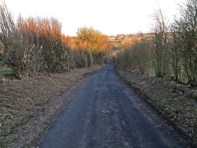
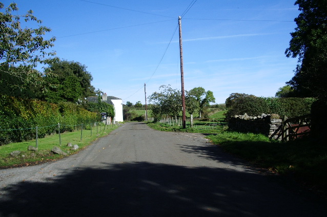
Blennerhasset and Torpenhow is a civil parish located in the county of Cumberland, in the northwestern region of England. Situated near the Solway Firth, the parish covers an area of approximately 12 square kilometers and is home to a population of around 500 residents.

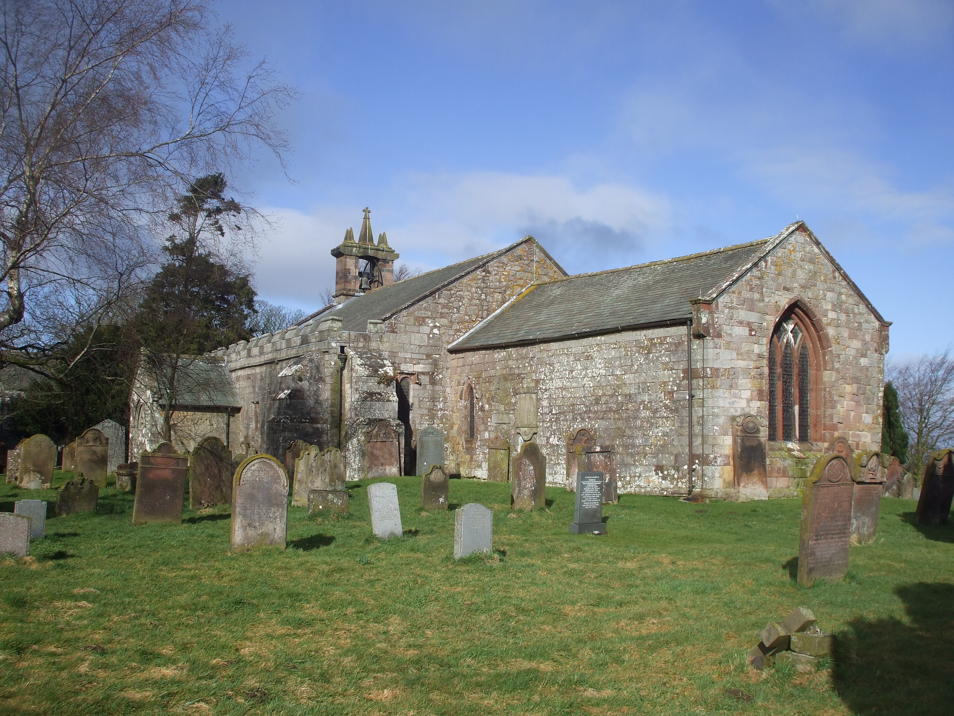
Blennerhasset, the larger of the two villages within the parish, is nestled on the banks of the River Ellen. Its charming rural setting offers picturesque views of the surrounding countryside. The village is known for its well-preserved historic buildings, including the St. John the Baptist Church, which dates back to the 12th century.

Torpenhow, the smaller village, is located a few kilometers northeast of Blennerhasset. Its name is derived from the Old Norse language, meaning "hill of Thor." The village boasts a rich history, with evidence of human settlement dating back to prehistoric times. Torpenhow Hill, the highest point in the area, offers panoramic views of the nearby Lake District and the Solway Firth.

The economy of Blennerhasset and Torpenhow is primarily centered around agriculture, with farms dotting the landscape. The fertile soil and favorable climate make it a suitable area for crop cultivation and livestock farming. The parish also attracts some tourism due to its tranquil rural setting and proximity to the beautiful Lake District National Park.

Overall, Blennerhasset and Torpenhow offer a peaceful and idyllic countryside experience, with a strong sense of community and a rich historical heritage.

If you have any feedback on the listing, please let us know in the comments section below.

Blennerhasset and Torpenhow Images

Images are sourced within 2km of 54.726657/-3.247374 or Grid Reference NY1937. Thanks to Geograph Open Source API. All images are credited.

Rough grazing on slope of Whittas Park Whittas Park is an area of roughly vegetated ground north-west from Binsey in the north-western Lake District. Binsey lies to the left side of the image with the Skiddaw group of mountains to the right.
Rough grazing on slope of Whittas Park
Whittas Park is an area of roughly vegetated ground north-west from Binsey in the north-western Lake District. Binsey lies to the left side of the image with the Skiddaw group of mountains to the right.
Farm lane near to Whitrigg The lane which is also initially a bridleway lies to the west of the small village of Whitrigg.
Farm lane near to Whitrigg
The lane which is also initially a bridleway lies to the west of the small village of Whitrigg.
Field with Binsey beyond The field lies on the west side of a minor road close to the low hill, Caer Mote.
Field with Binsey beyond
The field lies on the west side of a minor road close to the low hill, Caer Mote.
The track to Whitrigg
Bird House Farm
Bird House Farm
Footpath from Whitrigg to Torpenhow This path crosses various grazing fields and will bring you out near to Torpenhow.  The photo is taken from where the path joins the Whitrigg to Ireby road.
Footpath from Whitrigg to Torpenhow
This path crosses various grazing fields and will bring you out near to Torpenhow. The photo is taken from where the path joins the Whitrigg to Ireby road.
Road from Whitrigg to Snittlegarth or Ireby This is the single track lane from Whitrigg towards Ireby.
Road from Whitrigg to Snittlegarth or Ireby
This is the single track lane from Whitrigg towards Ireby.
View of the distant fells from the Whitrigg to Ireby road
Binsey from the Whitrigg Ireby Road Binsey is the main hill visible here.
Binsey from the Whitrigg Ireby Road
Binsey is the main hill visible here.
Grassed lane and footpath The footpath along a green lane, Battery Lonning, crosses a grassy ridge of farmland between the villages of Bothel and Whitrigg, the view being towards the latter.
Grassed lane and footpath
The footpath along a green lane, Battery Lonning, crosses a grassy ridge of farmland between the villages of Bothel and Whitrigg, the view being towards the latter.
Grassy slope near to 'The Battery' The Battery is an earthwork along the ridge, Caer Mote; it's behind the camera position. Binsey and Skiddaw are the distant hills.
Grassy slope near to 'The Battery'
The Battery is an earthwork along the ridge, Caer Mote; it's behind the camera position. Binsey and Skiddaw are the distant hills.
A591 passing Lowmoor The A591 heading towards Keswick. Binsey is the hill at the left side of the image. The cream coloured flowers at the left side of the road are meadowsweet - Filipendula ulmaria.
A591 passing Lowmoor
The A591 heading towards Keswick. Binsey is the hill at the left side of the image. The cream coloured flowers at the left side of the road are meadowsweet - Filipendula ulmaria.
Beginning of footpath to Bothel A minor road connects the villages Torpenhow (pronounced Trepenna) and Bothel. From this location a footpath leaves that road to enter the field heading to Bothel; it soon turns sharply to the right to approach the village.
Beginning of footpath to Bothel
A minor road connects the villages Torpenhow (pronounced Trepenna) and Bothel. From this location a footpath leaves that road to enter the field heading to Bothel; it soon turns sharply to the right to approach the village.
Field on south side of Bothel to Torpenhow road Agricultural land lies beyond the gate, it rises to a location named on OS maps as Borrowscale; beyond there the rise continues more gradually to reach Caer Mote.
Field on south side of Bothel to Torpenhow road
Agricultural land lies beyond the gate, it rises to a location named on OS maps as Borrowscale; beyond there the rise continues more gradually to reach Caer Mote.
Farmland north-east of Bothel I sometimes wonder what farmers did before the invention of plastic sheeting?
Farmland north-east of Bothel
I sometimes wonder what farmers did before the invention of plastic sheeting?
View from Footpath next to A591 Close to the Lake District boundary to the north.
View from Footpath next to A591
Close to the Lake District boundary to the north.
Duck Pond at Keswick Lodge Retreat
Skiddaw View Caravan Park That's Skiddaw in the middle of the view.
Skiddaw View Caravan Park
That's Skiddaw in the middle of the view.
Show me another place!

Blennerhasset and Torpenhow is located at Grid Ref: NY1937 (Lat: 54.726657, Lng: -3.247374)

Administrative County: Cumbria

District: Allerdale

Police Authority: Cumbria

What 3 Words

///stretcher.curable.linguists. Near Aspatria, Cumbria

Related Wikis

Caer Mote

Caer Mote is a hill of 289 metres (948 ft) in the north of the English Lake District near Bothel, Cumbria. Its summit lies just outside the boundary of...

Bothel, Cumbria

Bothel is a small village in Cumbria, England. Bothel was historically within Cumberland. == Location == It is situated just off the main A595 road, 18...

Bothel and Threapland

Bothel and Threapland is a civil parish in Cumbria, England, just outside the Lake District National Park. According to the 2001 census, it had a population...

St Michael's Church, Torpenhow

St Michael's Church is in the civil parish of Blennerhasset and Torpenhow, Cumbria, England. It is an active Anglican church in the deanery of Derwent...

Blennerhasset and Torpenhow

Blennerhasset and Torpenhow (locally and ) is a civil parish in Cumbria, England. According to the 2001 census it had a population of 437, reducing to...

Sunderland, Cumbria

Sunderland is a hamlet and former civil parish, within the Lake District National Park, now in the parish of Blindcrake in the Allerdale district of the...

Bewaldeth and Snittlegarth

Bewaldeth and Snittlegarth is a civil parish in Cumbria, England, historically part of Cumberland. It lies north of Bassenthwaite Lake, in the Lake District...

Ireby Old Church

Ireby Old Church is a redundant Anglican church, of which only the chancel remains. It stands in an isolated position 1 mile (2 km) to the west of the...

Nearby Amenities

Located within 500m of 54.726657,-3.247374
Ele: 285.0
Historic: beacon
Man Made: survey_point
Source: NPE
Lat/Long: 54.7278559/-3.2503932
Caer Mote
Ele: 289
Natural: peak
Wikidata: Q5016874
Lat/Long: 54.7225579/-3.2484371
Caer Mot
Description: Name is from "The District of the Lakes", John Otley, 1827
Ele: 285
Natural: peak
Old Name: Moutay
Lat/Long: 54.7276662/-3.2502293
Stanger Hill Copper Mine
Abandoned: yes
Historic: mine_shaft
Man Made: mineshaft
Resource: copper
Lat/Long: 54.7272901/-3.2421845
The data included in this document is from www.openstreetmap.org. The data is made available under ODbL.

Have you been to Blennerhasset and Torpenhow?

Leave your review of Blennerhasset and Torpenhow below (or comments, questions and feedback).