Bledington

Civil Parish in Gloucestershire Cotswold

England

Bledington

Lower Farm From the path from Icomb looking to a new Lower Farm
Lower Farm Credit: Shaun Ferguson

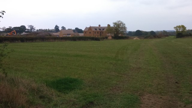
Bledington is a civil parish located in the county of Gloucestershire, England. Situated in the Cotswold District, it covers an area of approximately 5 square miles, offering a picturesque rural setting. The village itself is nestled in the Evenlode Valley, surrounded by rolling hills and stunning countryside.

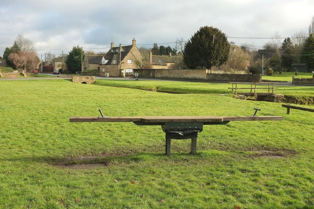
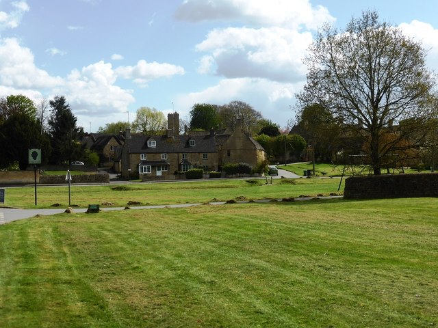
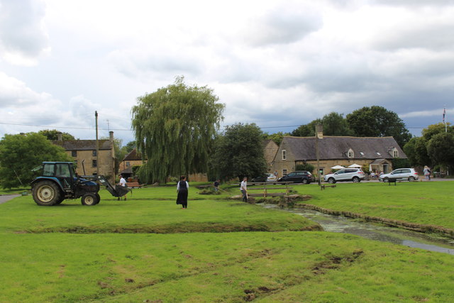
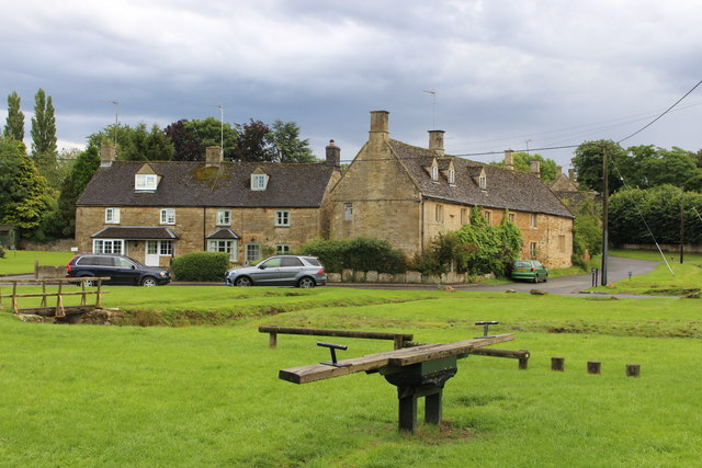
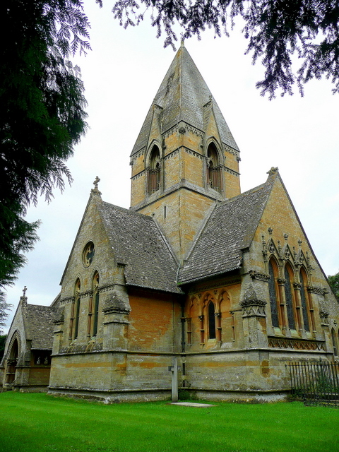
Bledington is a small and tight-knit community with a population of around 400 people. The village is renowned for its charming and quintessentially English architecture, featuring beautiful stone cottages and historic buildings. St Leonard's Church, dating back to the 12th century, is a prominent landmark in the area, adding to the village's historical character.

The village is home to a vibrant community spirit, with various activities and events bringing residents together. The annual Bledington Music Festival is a popular highlight, attracting visitors from near and far. Additionally, the village has a primary school, a village hall, and a local pub, providing essential amenities for its residents.

Surrounded by idyllic countryside, Bledington offers ample opportunities for outdoor activities and exploration. The nearby River Evenlode is a popular spot for fishing and leisurely walks. The Cotswolds, an Area of Outstanding Natural Beauty, is within easy reach, offering scenic trails, charming villages, and stunning landscapes.

Bledington's central location provides convenient access to other nearby towns and cities. Chipping Norton, a vibrant market town, is just a short drive away, offering a range of shopping, dining, and entertainment options.

Overall, Bledington is a tranquil and picturesque village that boasts a strong sense of community, a rich history, and breathtaking natural surroundings.

If you have any feedback on the listing, please let us know in the comments section below.

Bledington Images

Images are sourced within 2km of 51.908476/-1.653614 or Grid Reference SP2323. Thanks to Geograph Open Source API. All images are credited.

Lower Farm From the path from Icomb looking to a new Lower Farm
Lower Farm
From the path from Icomb looking to a new Lower Farm
Green, Bledington With a see-saw in the foreground. See also <a title="https://www.geograph.org.uk/search.php?i=68988796" href="https://www.geograph.org.uk/search.php?i=68988796">Link</a> .
Green, Bledington
With a see-saw in the foreground. See also Link .
Green, Bledington Looking left from where <a href="https://www.geograph.org.uk/photo/5269082">SP2422 : Green, Bledington</a> was taken, showing the swings and seat. Partly obscured by a conifer in the background is the listed Gilberts Farmhouse <span class="nowrap"><a title="https://www.historicengland.org.uk/listing/the-list/list-entry/1089814" rel="nofollow ugc noopener" href="https://www.historicengland.org.uk/listing/the-list/list-entry/1089814">Link</a><img style="margin-left:2px;" alt="External link" title="External link - shift click to open in new window" src="https://s1.geograph.org.uk/img/external.png" width="10" height="10"/></span> .
Green, Bledington
Looking left from where SP2422 : Green, Bledington was taken, showing the swings and seat. Partly obscured by a conifer in the background is the listed Gilberts Farmhouse LinkExternal link .
Station Road, Kingham Followed by NCN442, and actually leading from an operating station unlike most "Station Roads" in villages. The red sign indicates the Mill House Hotel, off to the right.
Station Road, Kingham
Followed by NCN442, and actually leading from an operating station unlike most "Station Roads" in villages. The red sign indicates the Mill House Hotel, off to the right.
Bledington village green
The road through Foscot
Kingham station, 2000 View NW, towards Worcester etc. on the ex-GWR London - Oxford - Worcester main line. Fifty and more years ago, this was a junction of some importance: at the north end, to the right there was a branch to Chipping Norton (closed 3/12/62, goods 7/9/64), being the root of a line through to King's Sutton (for Banbury) closed 4/12/51); to the west (left) a branch went via Bourton-on-the-Water and Andoversford to Cheltenham, lasting until 15/10/62 (goods to Bourton, 7/9/64). Until 12/10/53 a bridge, subsequently demolished, across the main line allowed through running avoiding Kingham station.  (Cf.<a href="https://www.geograph.org.uk/photo/550655">SP2522 : Kingham railway station</a> and others).
Kingham station, 2000
View NW, towards Worcester etc. on the ex-GWR London - Oxford - Worcester main line. Fifty and more years ago, this was a junction of some importance: at the north end, to the right there was a branch to Chipping Norton (closed 3/12/62, goods 7/9/64), being the root of a line through to King's Sutton (for Banbury) closed 4/12/51); to the west (left) a branch went via Bourton-on-the-Water and Andoversford to Cheltenham, lasting until 15/10/62 (goods to Bourton, 7/9/64). Until 12/10/53 a bridge, subsequently demolished, across the main line allowed through running avoiding Kingham station. (Cf.SP2522 : Kingham railway station and others).
Clearing the stream at Bledington
The old see-saw on Bledington green
A train from London arriving at Kingham The direct rail link to London is a big benefit, reflected in the need for a large car park relative to the size of the village.
A train from London arriving at Kingham
The direct rail link to London is a big benefit, reflected in the need for a large car park relative to the size of the village.
Kingham railway station A train from Hereford to London is currently stopped at the station.
Kingham railway station
A train from Hereford to London is currently stopped at the station.
St Andrew's Church, Kingham In a parish with Churchill and Daylesford.
St Andrew's Church, Kingham
In a parish with Churchill and Daylesford.
Cattle by the Evenlode The River Evenlode flows through the flat farmland between Kingham and Bledington.
Cattle by the Evenlode
The River Evenlode flows through the flat farmland between Kingham and Bledington.
Footpath to Bledington Crossing the fields between Kingham and Bledington.
Footpath to Bledington
Crossing the fields between Kingham and Bledington.
Route of a former railway There is now a farm track on the route which once ran between Cheltenham and Banbury.
Route of a former railway
There is now a farm track on the route which once ran between Cheltenham and Banbury.
Footpath to Bledington The path here crosses a small tributary of the River Evenlode.
Footpath to Bledington
The path here crosses a small tributary of the River Evenlode.
Chapel Street, Bledington Farm buildings are an integral part of the village.
Chapel Street, Bledington
Farm buildings are an integral part of the village.
Village green at Bledington Part of a very large green. It is bisected by drainage, so you need to take care when visiting the Kings Head, in view ahead.
Village green at Bledington
Part of a very large green. It is bisected by drainage, so you need to take care when visiting the Kings Head, in view ahead.
Show me another place!

Bledington is located at Grid Ref: SP2323 (Lat: 51.908476, Lng: -1.653614)

Administrative County: Gloucestershire

District: Cotswold

Police Authority: Gloucestershire

What 3 Words

///speedily.supported.momentous. Near Stow on the Wold, Gloucestershire

Nearby Locations

Pebbly Hill Bledington

Related Wikis

Bledington

Bledington is a village and civil parish in the Cotswold district of Gloucestershire, England, about four miles southeast of Stow-on-the-Wold and six miles...

Church of St Leonard, Bledington

The Anglican Church of St Leonard at Bledington in the Cotswold District of Gloucestershire, England, was built in 12th century. It is a grade I listed...

Foscot, Oxfordshire

Foscot is a hamlet in the Cotswolds in the Evenlode valley. It falls within Idbury civil parish, in the West Oxfordshire District, about 5 miles (8.0 km...

Kingham railway station

Kingham railway station in Oxfordshire, England, is between the Oxfordshire village of Kingham and the Gloucestershire village of Bledington, to which...

Bould

Bould is a hamlet in Idbury civil parish, Oxfordshire, about 4.5 miles (7.2 km) southeast of Stow-on-the-Wold in neighbouring Gloucestershire. == External... ==

Church of St Peter, Daylesford

The Anglican Church of St Peter at Daylesford in the Cotswold District of Gloucestershire, England was rebuilt in 1860. It is a grade I listed building...

Daylesford, Gloucestershire

Daylesford is a small, privately owned village and former civil parish, now in the parish of Adlestrop, in the Cotswold district, in the county of Gloucestershire...

Church of St Mary, Icomb

The Anglican Church of St Mary at Icomb in the Cotswold District of Gloucestershire, England was built in the 15th century. It is a grade I listed building...

Nearby Amenities

Located within 500m of 51.908476,-1.653614
Power: pole
Source: Bing
Lat/Long: 51.909335/-1.6562693
Power: pole
Source: Bing
Lat/Long: 51.9104634/-1.657326
Power: pole
Source: Bing
Lat/Long: 51.9092638/-1.6538955
Power: pole
Source: Bing
Lat/Long: 51.9088898/-1.6527314
Power: pole
Source: Bing
Lat/Long: 51.9096328/-1.6551025
Power: pole
Source: Bing
Lat/Long: 51.9080873/-1.6502316
Power: pole
Source: Bing
Lat/Long: 51.9075164/-1.6560869
Power: pole
Source: Bing
Lat/Long: 51.9070548/-1.6468547
Power: pole
Source: Bing
Lat/Long: 51.907078/-1.6561754
Power: pole
Source: Bing
Lat/Long: 51.9108936/-1.6585518
Power: pole
Source: Bing
Lat/Long: 51.9073575/-1.6479142
Power: pole
Source: Bing
Lat/Long: 51.9100415/-1.6561942
Power: pole
Source: Bing
Lat/Long: 51.9084943/-1.6514654
Power: pole
Source: Bing
Lat/Long: 51.907753/-1.6490514
Power: pole
Lat/Long: 51.9079939/-1.6566449
The data included in this document is from www.openstreetmap.org. The data is made available under ODbL.

Have you been to Bledington?

Leave your review of Bledington below (or comments, questions and feedback).