Blackawton

Civil Parish in Devon South Hams

England

Blackawton

Field near Broadley Farm A track leaves the lane between Bow and Pruston Barton to run past a tree and down into the valley of a tributary of the Gara. All very dry during the drought.
Field near Broadley Farm Credit: Derek Harper

Blackawton is a civil parish located in the South Hams district of Devon, England. Situated in the picturesque countryside, it is nestled in the southern part of the county, approximately 12 miles west of the city of Dartmouth. The parish covers an area of about 2,000 acres and is home to a population of around 800 residents.

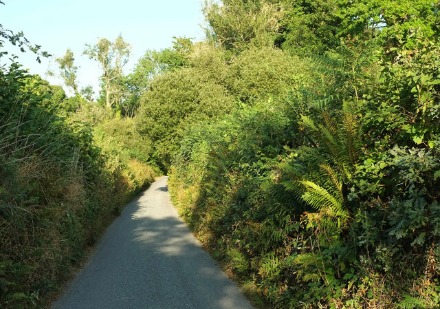
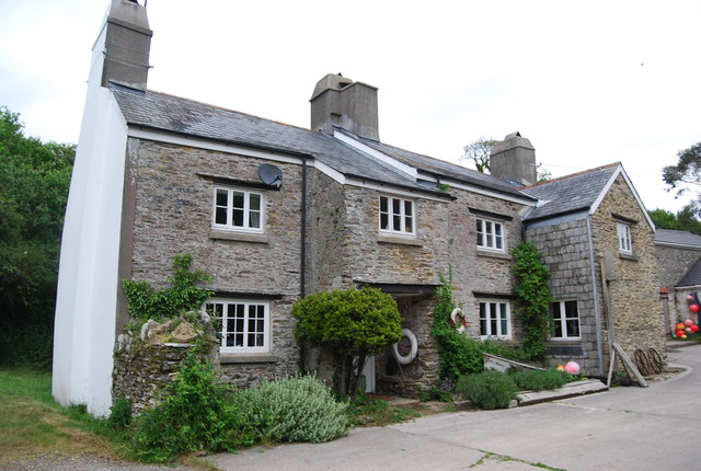
The village of Blackawton is the main settlement within the parish. It is a charming and historic village, characterized by its traditional thatched-roof cottages and narrow lanes. The centerpiece of the village is the 14th-century St. Michael's Church, known for its ancient oak screen, medieval wall paintings, and beautiful stained glass windows.

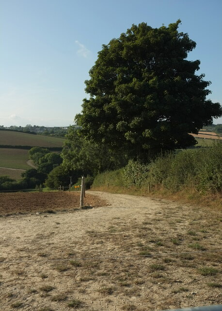
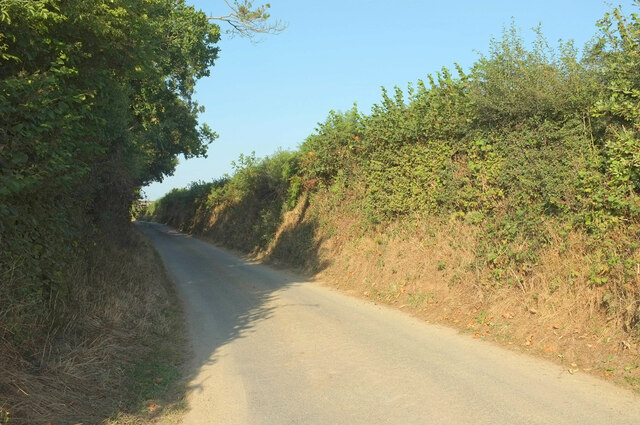
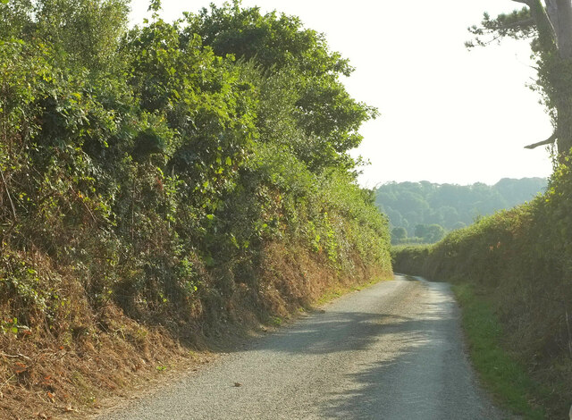
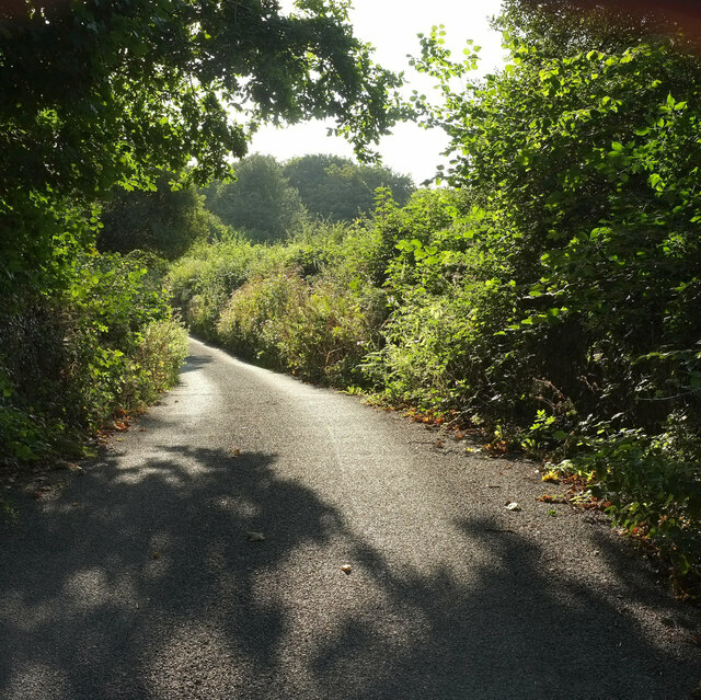
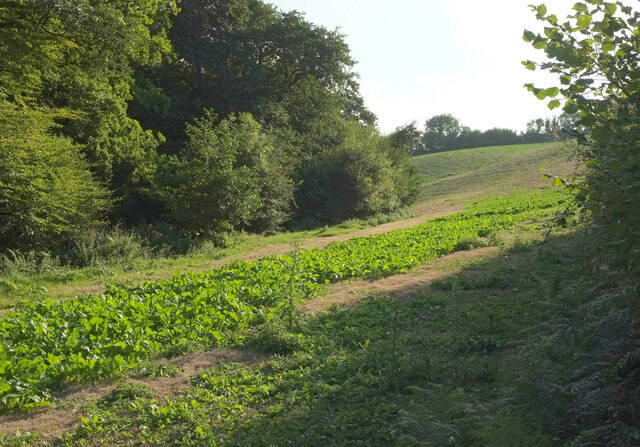
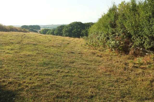
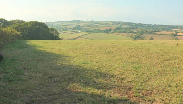
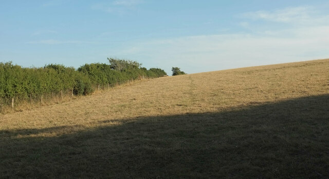
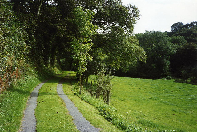
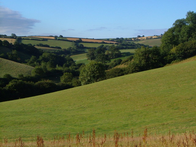
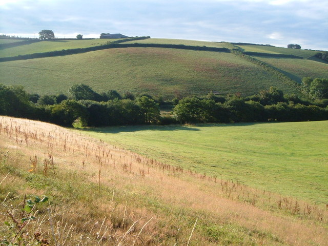
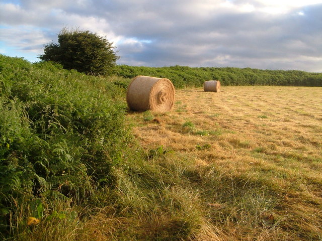
The parish is surrounded by rolling hills, lush farmland, and dense woodland, making it an ideal location for outdoor enthusiasts. The River Dart, a popular spot for fishing, winds its way through the parish, offering opportunities for boating and other water activities.

Blackawton has a strong sense of community and is home to several amenities and services, including a primary school, a village shop, and a pub. The village also hosts various community events throughout the year, including a popular annual worm charming festival.

Overall, Blackawton is a picturesque and tranquil parish, offering residents and visitors alike a true taste of rural Devonshire charm. Its beautiful landscape, rich history, and strong community spirit make it a desirable place to live or visit.

If you have any feedback on the listing, please let us know in the comments section below.

Blackawton Images

Images are sourced within 2km of 50.343978/-3.681637 or Grid Reference SX8050. Thanks to Geograph Open Source API. All images are credited.

Field near Broadley Farm A track leaves the lane between Bow and Pruston Barton to run past a tree and down into the valley of a tributary of the Gara. All very dry during the drought.
Field near Broadley Farm
A track leaves the lane between Bow and Pruston Barton to run past a tree and down into the valley of a tributary of the Gara. All very dry during the drought.
Lane near Pruston Barton Looking right from <a href="https://www.geograph.org.uk/photo/7269513">SX8149 : Field near Broadley Farm</a> up the lane from Bow.
Lane near Pruston Barton
Looking right from SX8149 : Field near Broadley Farm up the lane from Bow.
Lane to Bow Looking left from <a href="https://www.geograph.org.uk/photo/7269513">SX8149 : Field near Broadley Farm</a> and therefore in the opposite direction to <a href="https://www.geograph.org.uk/photo/7273889">SX8149 : Lane near Pruston Barton</a>.
Lane to Bow
Looking left from SX8149 : Field near Broadley Farm and therefore in the opposite direction to SX8149 : Lane near Pruston Barton.
Lane from Millcombe Very close to The Gara on the right, and just crossing one of its many small tribuatries, this lane to Pasture Cross carries NCN28.
Lane from Millcombe
Very close to The Gara on the right, and just crossing one of its many small tribuatries, this lane to Pasture Cross carries NCN28.
Field west of Millcombe Seen from the lane shown in <a href="https://www.geograph.org.uk/photo/1323743">SX7949 : Lane to Millcombe</a>. The trees on the left are alongside a tributary of The Gara.
Field west of Millcombe
Seen from the lane shown in SX7949 : Lane to Millcombe. The trees on the left are alongside a tributary of The Gara.
Lane to Millcombe Looking right from <a href="https://www.geograph.org.uk/photo/7273915">SX7949 : Field west of Millcombe</a>, along the lane shown at <a title="https://www.geograph.org.uk/gridref/SX7949?centi=SX799498&nl=1" href="https://www.geograph.org.uk/gridref/SX7949?centi=SX799498&nl=1">Link</a> .
Lane to Millcombe
Looking right from SX7949 : Field west of Millcombe, along the lane shown at Link .
Field west of Seccombe Farm From the lane between Millcombe and Pasture Cross. A small triangular wood adjoins the field.
Field west of Seccombe Farm
From the lane between Millcombe and Pasture Cross. A small triangular wood adjoins the field.
Field west of Seccombe Farm The field east of <a href="https://www.geograph.org.uk/photo/7274267">SX7849 : Field west of Seccombe Farm</a>, with the same triangular wood now on the left, and a good view to the masts at Stanborough.
Field west of Seccombe Farm
The field east of SX7849 : Field west of Seccombe Farm, with the same triangular wood now on the left, and a good view to the masts at Stanborough.
Field west of Larcombe Farm On the other side of the lane from <a href="https://www.geograph.org.uk/photo/7274267">SX7849 : Field west of Seccombe Farm</a> and <a href="https://www.geograph.org.uk/photo/7274290">SX7849 : Field west of Seccombe Farm</a>.
Field west of Larcombe Farm
Blackawton: near Millcombe A drive doubling as a public footpath runs from/to Washwalk in the Gara valley
Blackawton: near Millcombe
A drive doubling as a public footpath runs from/to Washwalk in the Gara valley
Gara valley below Woodford Interlocking spurs partly obscured by trees as the Gara valley heads away from the camera. Taken from the stretch of lane between Woodford and Hutcherleigh Turn.
Gara valley below Woodford
Interlocking spurs partly obscured by trees as the Gara valley heads away from the camera. Taken from the stretch of lane between Woodford and Hutcherleigh Turn.
Wood Farm A farm with converted outbuildings in a tributary valley of the Gara, close to Woodford. On the right is Higher Wood Farm. Seen from the footpath between Woodford and Bowden that climbs the ridge between this valley and the Gara.
Wood Farm
A farm with converted outbuildings in a tributary valley of the Gara, close to Woodford. On the right is Higher Wood Farm. Seen from the footpath between Woodford and Bowden that climbs the ridge between this valley and the Gara.
Edge of small wood near Ritson This is where the footpath from Ritson to Wood Farm used to emerge from a small wood as it crossed a stream. But the footpath has now moved down into the valley behind.
Edge of small wood near Ritson
This is where the footpath from Ritson to Wood Farm used to emerge from a small wood as it crossed a stream. But the footpath has now moved down into the valley behind.
Gara valley below Woodford Similar to <a href="https://www.geograph.org.uk/photo/210428">SX7950 : Gara valley below Woodford</a>, but covering the area slightly upstream, with the morning sun (7:49) catching the terracettes on the fields opposite.
Gara valley below Woodford
Similar to SX7950 : Gara valley below Woodford, but covering the area slightly upstream, with the morning sun (7:49) catching the terracettes on the fields opposite.
Woodford A hamlet on the Gara west of Blackawton.
Woodford
A hamlet on the Gara west of Blackawton.
Woodford Looking the opposite way to <a href="https://www.geograph.org.uk/photo/210590">SX7950 : Woodford</a> ie up the hill out of the hamlet. The footpath on the left follows the Gara valley downstream towards Millcombe.
Woodford
Looking the opposite way to SX7950 : Woodford ie up the hill out of the hamlet. The footpath on the left follows the Gara valley downstream towards Millcombe.
By Woodford Bridge This meadow by the lane at Woodford forms a triangle between the Gara and a tributary stream. Himalayan Balsam much in evidence.
By Woodford Bridge
This meadow by the lane at Woodford forms a triangle between the Gara and a tributary stream. Himalayan Balsam much in evidence.
Footpath from Woodford The footpath north of Woodford up the west side of the Gara valley to Bowden begins by climbing up this track; picturesque but overgrown and steep.
Footpath from Woodford
The footpath north of Woodford up the west side of the Gara valley to Bowden begins by climbing up this track; picturesque but overgrown and steep.
Show me another place!

Blackawton is located at Grid Ref: SX8050 (Lat: 50.343978, Lng: -3.681637)

Administrative County: Devon

District: South Hams

Police Authority: Devon & Cornwall

What 3 Words

///career.rejoins.nurse. Near Dartmouth, Devon

Nearby Locations

Blackawton Blackawton

Related Wikis

Blackawton

Blackawton is a village and civil parish in the South Hams district of Devon, England. According to the 2001 census, it had a population of 647. Blackawton...

Woodlands Family Theme Park

Woodlands Family Theme Park is an all-weather family amusement park and falconry display on the A3122 road, 5 miles from Dartmouth, in South Devon, England...

Allaleigh

Allaleigh is a village in Devon, England.

Abbotsleigh, Devon

Abbotsleigh is a hamlet in the county of Devon, England. Abbotsleigh is in the civil parish of Blackawton, within the district council of South Hams in...

Halwell Camp

Halwell Camp is an Iron Age hill fort situated close to the village of Halwell in Devon, England. The fort is situated on a pass between two hilltops to...

Stanborough

Stanborough is the site of an Iron Age hill fort near the village of Halwell, south of Totnes, Devon, England. The fort is situated on a promontory on...

Burlestone

Burlestone is a village in Devon, England. == References ==

Halwell and Moreleigh

Halwell and Moreleigh is a civil parish in the South Hams district, in the county of Devon, England. It comprises the villages of Halwell and Moreleigh...

Nearby Amenities

Located within 500m of 50.343978,-3.681637
Blackawton
Is In: Devon, England, UK
Place: village
Source: npe
Lat/Long: 50.3458217/-3.6813804
Disused Amenity: post_box
Note: Post box no longer in use. No longer in Royal Mail database (2021) and although still in situ has been painted over. It was formerly known as TQ9 100. This status is visible in 24 Aug 2020 Mapillary image (https://www.mapillary.com/app/?pKey=1120467951797
Post Box Mounting: building
Post Box Type: wall
Ref: TQ9 100
Royal Cypher: GVIR
Source: survey;streetlevel imagery;aerial imagery
Lat/Long: 50.3452772/-3.6815062
Post Office
Blackawton Post Office
Addr City: Blackawton
Addr Postcode: TQ9 7BG
Addr Street: Main Street
Opening Hours: Mo-Sa 09:00-13:00
Ref Pol Id: 108720
Source: pol_branch_list_2020‑11‑13
Lat/Long: 50.3452593/-3.6814128
Recycling
Lat/Long: 50.3439807/-3.6825505
Generator Method: photovoltaic
Generator Output Electricity: yes
Generator Source: solar
Generator Type: solar_photovoltaic_panel
Location: roof
Power: generator
Lat/Long: 50.3459143/-3.6828917
Generator Method: photovoltaic
Generator Output Electricity: yes
Generator Source: solar
Generator Type: solar_photovoltaic_panel
Location: roof
Power: generator
Lat/Long: 50.345928/-3.6827951
Generator Method: photovoltaic
Generator Output Electricity: yes
Generator Source: solar
Generator Type: solar_photovoltaic_panel
Location: roof
Power: generator
Lat/Long: 50.346023/-3.6809149
Generator Method: photovoltaic
Generator Output Electricity: yes
Generator Source: solar
Generator Type: solar_photovoltaic_panel
Location: roof
Power: generator
Lat/Long: 50.3459733/-3.6810329
Generator Method: photovoltaic
Generator Output Electricity: yes
Generator Source: solar
Generator Type: solar_photovoltaic_panel
Location: roof
Power: generator
Lat/Long: 50.3462309/-3.6804669
Generator Method: photovoltaic
Generator Output Electricity: yes
Generator Source: solar
Generator Type: solar_photovoltaic_panel
Location: roof
Power: generator
Lat/Long: 50.3462498/-3.6803972
Generator Method: photovoltaic
Generator Output Electricity: yes
Generator Source: solar
Generator Type: solar_photovoltaic_panel
Location: roof
Power: generator
Lat/Long: 50.3465998/-3.679736
Generator Method: photovoltaic
Generator Output Electricity: yes
Generator Source: solar
Generator Type: solar_photovoltaic_panel
Location: roof
Power: generator
Lat/Long: 50.3466126/-3.6796824
Generator Method: photovoltaic
Generator Output Electricity: yes
Generator Source: solar
Generator Type: solar_photovoltaic_panel
Location: roof
Power: generator
Lat/Long: 50.346753/-3.680589
Generator Method: photovoltaic
Generator Output Electricity: yes
Generator Source: solar
Generator Type: solar_photovoltaic_panel
Location: roof
Power: generator
Lat/Long: 50.3464312/-3.6795671
Generator Method: photovoltaic
Generator Output Electricity: yes
Generator Source: solar
Generator Type: solar_photovoltaic_panel
Location: roof
Power: generator
Lat/Long: 50.3464517/-3.679437
Generator Method: photovoltaic
Generator Output Electricity: yes
Generator Source: solar
Generator Type: solar_photovoltaic_panel
Location: roof
Power: generator
Lat/Long: 50.3464047/-3.678631
Generator Method: photovoltaic
Generator Output Electricity: yes
Generator Source: solar
Generator Type: solar_photovoltaic_panel
Location: roof
Power: generator
Lat/Long: 50.3470594/-3.6768151
Generator Method: photovoltaic
Generator Output Electricity: yes
Generator Source: solar
Generator Type: solar_photovoltaic_panel
Location: roof
Power: generator
Lat/Long: 50.3440576/-3.6820092
Generator Method: photovoltaic
Generator Output Electricity: yes
Generator Source: solar
Generator Type: solar_photovoltaic_panel
Location: roof
Power: generator
Lat/Long: 50.344394/-3.6826784
Generator Method: photovoltaic
Generator Output Electricity: yes
Generator Source: solar
Generator Type: solar_photovoltaic_panel
Location: roof
Power: generator
Lat/Long: 50.3443606/-3.6825819
Generator Method: photovoltaic
Generator Output Electricity: yes
Generator Source: solar
Generator Type: solar_photovoltaic_panel
Location: roof
Power: generator
Lat/Long: 50.3443426/-3.6824786
Generator Method: photovoltaic
Generator Output Electricity: yes
Generator Source: solar
Generator Type: solar_photovoltaic_panel
Location: roof
Power: generator
Lat/Long: 50.3443572/-3.6823364
Generator Method: photovoltaic
Generator Output Electricity: yes
Generator Source: solar
Generator Type: solar_photovoltaic_panel
Location: roof
Power: generator
Lat/Long: 50.3445309/-3.6826824
Generator Method: photovoltaic
Generator Output Electricity: yes
Generator Source: solar
Generator Type: solar_photovoltaic_panel
Location: roof
Power: generator
Lat/Long: 50.3445746/-3.6828434
Generator Method: photovoltaic
Generator Output Electricity: yes
Generator Source: solar
Generator Type: solar_photovoltaic_panel
Location: roof
Power: generator
Lat/Long: 50.3449092/-3.6825027
Generator Method: photovoltaic
Generator Output Electricity: yes
Generator Source: solar
Generator Type: solar_photovoltaic_panel
Location: roof
Power: generator
Lat/Long: 50.344934/-3.6824558
Generator Method: photovoltaic
Generator Output Electricity: yes
Generator Source: solar
Generator Type: solar_photovoltaic_panel
Location: roof
Power: generator
Lat/Long: 50.3450804/-3.6824102
Generator Method: photovoltaic
Generator Output Electricity: yes
Generator Source: solar
Generator Type: solar_photovoltaic_panel
Location: roof
Power: generator
Lat/Long: 50.3452695/-3.6827616
Generator Method: photovoltaic
Generator Output Electricity: yes
Generator Source: solar
Generator Type: solar_photovoltaic_panel
Location: roof
Power: generator
Lat/Long: 50.3455476/-3.6821044
Generator Method: photovoltaic
Generator Output Electricity: yes
Generator Source: solar
Generator Type: solar_photovoltaic_panel
Location: roof
Power: generator
Lat/Long: 50.3479602/-3.6831155
Generator Method: photovoltaic
Generator Output Electricity: yes
Generator Source: solar
Generator Type: solar_photovoltaic_panel
Location: roof
Power: generator
Lat/Long: 50.3442502/-3.6843158
Generator Method: photovoltaic
Generator Output Electricity: yes
Generator Source: solar
Generator Type: solar_photovoltaic_panel
Location: roof
Power: generator
Lat/Long: 50.3442759/-3.6843976
Generator Method: photovoltaic
Generator Output Electricity: yes
Generator Source: solar
Generator Type: solar_photovoltaic_panel
Location: roof
Power: generator
Lat/Long: 50.3430204/-3.681521
Generator Method: photovoltaic
Generator Output Electricity: yes
Generator Source: solar
Generator Type: solar_photovoltaic_panel
Location: roof
Power: generator
Lat/Long: 50.344958/-3.6812514
Generator Method: photovoltaic
Generator Output Electricity: yes
Generator Source: solar
Generator Type: solar_photovoltaic_panel
Location: roof
Power: generator
Lat/Long: 50.3449503/-3.6812085
Generator Method: photovoltaic
Generator Output Electricity: yes
Generator Source: solar
Generator Type: solar_photovoltaic_panel
Location: roof
Power: generator
Lat/Long: 50.3469958/-3.6772375
Power: pole
Lat/Long: 50.3455997/-3.6872512
Power: pole
Lat/Long: 50.346015/-3.6849697
Power: pole
Lat/Long: 50.3466423/-3.6836845
Power: pole
Lat/Long: 50.3473736/-3.6823462
Power: pole
Lat/Long: 50.3478026/-3.6808824
Power: pole
Lat/Long: 50.3481294/-3.6795755
Power: pole
Lat/Long: 50.3474232/-3.6821278
Post Box
Brand: Royal Mail
Brand Wikidata: Q638098
Brand Wikipedia: en:Royal Mail
Collection Times: Mo-Fr 16:30; Sa 11:45; Su off
Drive Through: no
Operator: Royal Mail
Operator Wikidata: Q638098
Post Box Design: 2010_pattern
Post Box Mounting: pier
Post Box Type: lamp
Ref: TQ9 112
Royal Cypher: EIIR
Royal Cypher Wikidata: Q33102113
Source: survey;streetlevel imagery;aerial imagery
Lat/Long: 50.3466221/-3.6793387
Defibrillator
Emergency: defibrillator
Lat/Long: 50.3462016/-3.6807233
The data included in this document is from www.openstreetmap.org. The data is made available under ODbL.

Have you been to Blackawton?

Leave your review of Blackawton below (or comments, questions and feedback).