Bisley-with-Lypiatt

Civil Parish in Gloucestershire Stroud

England

Bisley-with-Lypiatt

Lane to Througham Slad One of many such dead-end lanes in the Cotswolds.
Lane to Througham Slad Credit: Jonathan Billinger

Bisley-with-Lypiatt is a civil parish located in the county of Gloucestershire, England. It is situated in the Cotswold District, approximately 10 miles southwest of the town of Stroud. The parish covers an area of around 11 square miles and is home to a population of around 2,500 residents.

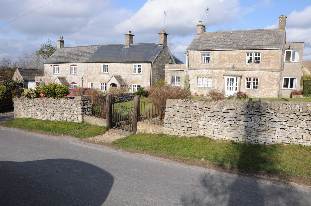
The parish is comprised of two main settlements: Bisley and Lypiatt. Bisley, the larger of the two, is a picturesque village nestled in the beautiful Cotswold Hills. It is known for its charming traditional stone cottages, historic buildings, and scenic countryside views. The village has a primary school, a village hall, and a church, providing essential amenities for its residents.

Lypiatt, on the other hand, is a smaller hamlet located to the northeast of Bisley. It is surrounded by rolling hills and offers a more rural setting. Lypiatt Manor, a Grade I listed manor house, is a prominent landmark in the area and adds to the historical significance of the parish.

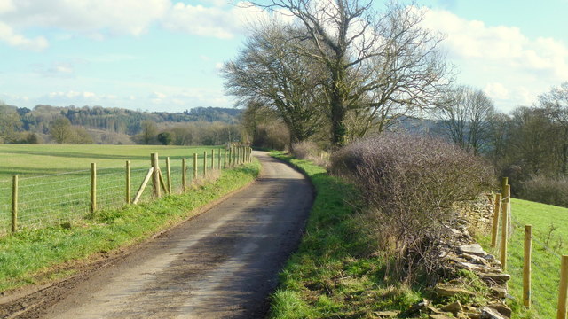
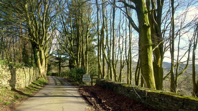
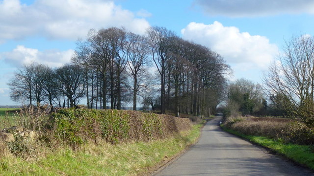
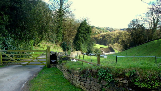
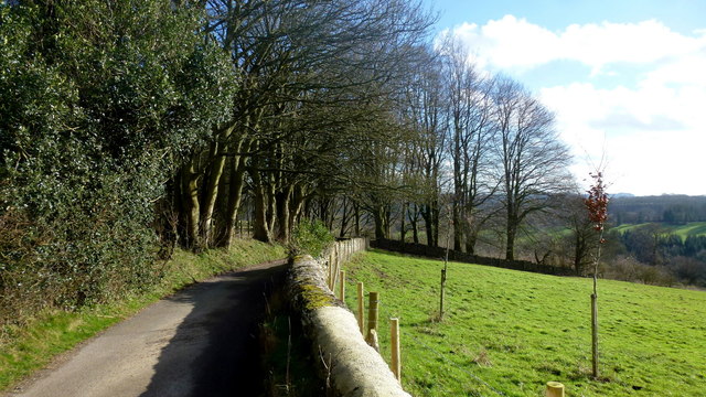
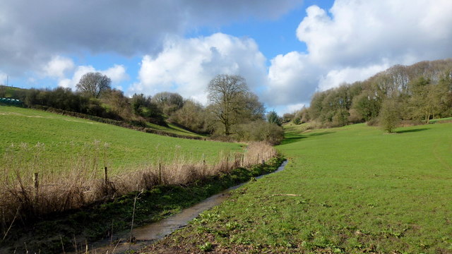
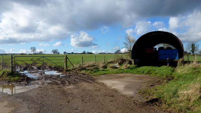
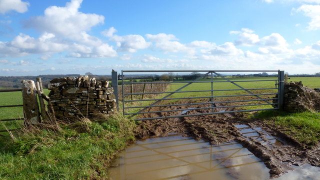
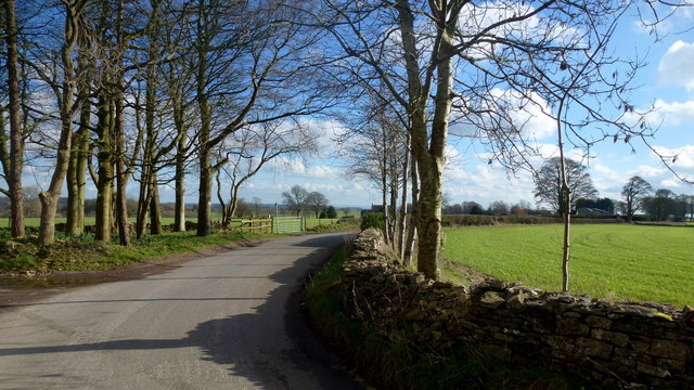
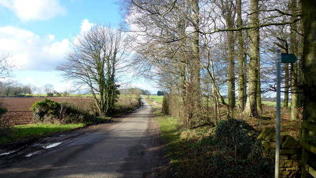
The landscape of Bisley-with-Lypiatt is characterized by its natural beauty, with lush green fields, woodlands, and streams. It attracts nature enthusiasts and hikers who appreciate the tranquil surroundings and the opportunity to explore the Cotswold Area of Outstanding Natural Beauty.

Overall, Bisley-with-Lypiatt is a picturesque civil parish that offers its residents a peaceful rural lifestyle, rich history, and beautiful natural surroundings.

If you have any feedback on the listing, please let us know in the comments section below.

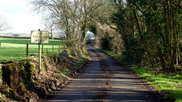
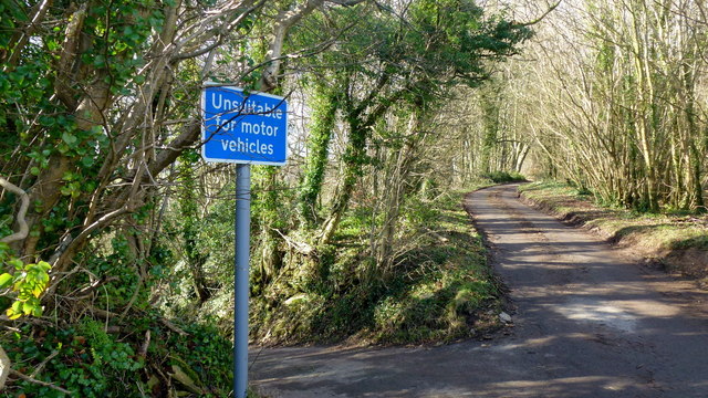
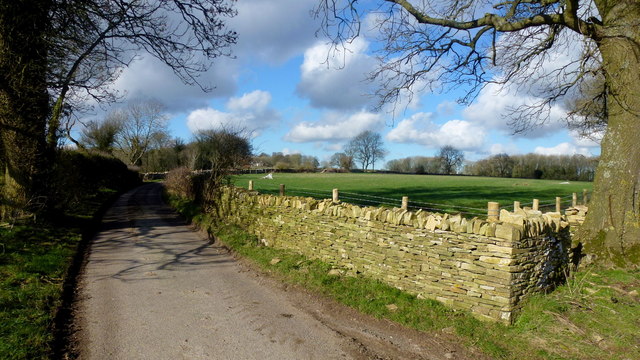
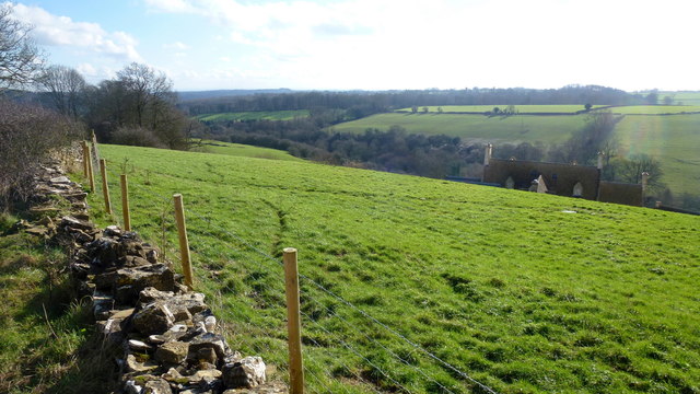
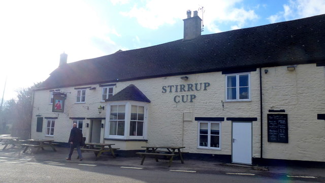
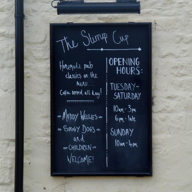
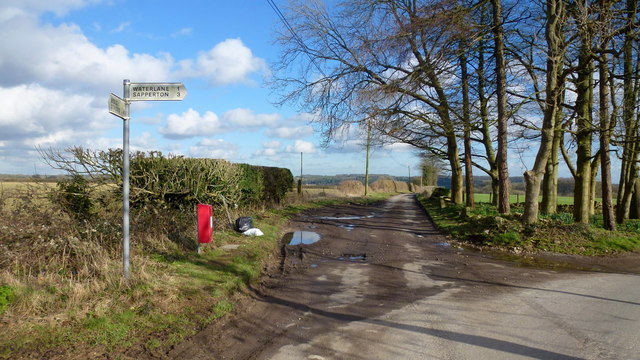
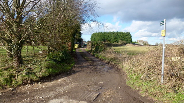
Bisley-with-Lypiatt Images

Images are sourced within 2km of 51.750476/-2.134456 or Grid Reference SO9005. Thanks to Geograph Open Source API. All images are credited.

Lane to Througham Slad One of many such dead-end lanes in the Cotswolds.
Lane to Througham Slad
One of many such dead-end lanes in the Cotswolds.
The end of the lane at Througham Slad Manor According to OS mapping, the public road appears to carry on another 100m or so from this point. However our country landowners would seem to annex a bit of public property by just putting up a PRIVATE sign with NO TURNING BEYOND THIS POINT to drive home the message. No change in road surface though.
I didn't take the car any further.
The end of the lane at Througham Slad Manor
According to OS mapping, the public road appears to carry on another 100m or so from this point. However our country landowners would seem to annex a bit of public property by just putting up a PRIVATE sign with NO TURNING BEYOND THIS POINT to drive home the message. No change in road surface though. I didn't take the car any further.
Limekiln Lane, 1 Heading south-east towards Waterlane. The beech copse surrounds Bisley long barrow.
It's the time of year when beech trees look black against a sunny winter sky.
Limekiln Lane, 1
Heading south-east towards Waterlane. The beech copse surrounds Bisley long barrow. It's the time of year when beech trees look black against a sunny winter sky.
Entrance to Watercombe House Set in a secluded Cotswold valley.
Entrance to Watercombe House
Set in a secluded Cotswold valley.
No Through Road to Througham Slad The lane boasts a pre-Worboys sign.
No Through Road to Througham Slad
The lane boasts a pre-Worboys sign.
Unsuitable? I beg to differ; I was able to use this steep, narrow lane without any trouble.
Unsuitable?
I beg to differ; I was able to use this steep, narrow lane without any trouble.
Lane from Througham Slad Nice bit of new-build drystone walling here.
Lane from Througham Slad
Nice bit of new-build drystone walling here.
View over Jones Slad Farm Cotswolds house with a fine southerly aspect.
View over Jones Slad Farm
Cotswolds house with a fine southerly aspect.
Approaching Througham Slad Winter sunlight glints off the shiny grey bark of the beeches.
Approaching Througham Slad
Winter sunlight glints off the shiny grey bark of the beeches.
Cotswolds stream by Calfway Farm This winter stream in full flow feeds the Holy Brook and the River Frome to become part of the Greater Stroud drainage basin.
Cotswolds stream by Calfway Farm
This winter stream in full flow feeds the Holy Brook and the River Frome to become part of the Greater Stroud drainage basin.
Small agricultural structure North of Calfway Lane, Bisley.
Small agricultural structure
North of Calfway Lane, Bisley.
Young cereal field near Bisley Typical Cotswold view in late winter.
Young cereal field near Bisley
Typical Cotswold view in late winter.
The Stirrup Cup, Bisley Walker-friendly pub at the north end of the village.
The Stirrup Cup, Bisley
Walker-friendly pub at the north end of the village.
Notice on the Stirrup Cup Not unfriendly to outdoor-types!
Notice on the Stirrup Cup
Not unfriendly to outdoor-types!
Hayhedge Lane, Bisley The lane leads a to dead end at Battlescombe. Right is Limekiln Lane.
Hayhedge Lane, Bisley
The lane leads a to dead end at Battlescombe. Right is Limekiln Lane.
Track and footpath to Bisley Leading north-west from the lane junction in <a href="https://www.geograph.org.uk/photo/5013309">SO9005 : Hayhedge Lane, Bisley</a>.
Track and footpath to Bisley
Leading north-west from the lane junction in SO9005 : Hayhedge Lane, Bisley.
Limekiln Lane Looking south-east from Hayhedge Lane, Bisley.
Limekiln Lane
Looking south-east from Hayhedge Lane, Bisley.
Limekiln Lane, 2 The opposite view to <a href="https://www.geograph.org.uk/photo/4824246">SO9105 : Limekiln Lane, 1</a>.
Limekiln Lane, 2
The opposite view to SO9105 : Limekiln Lane, 1.
Show me another place!

Bisley-with-Lypiatt is located at Grid Ref: SO9005 (Lat: 51.750476, Lng: -2.134456)

Administrative County: Gloucestershire

District: Stroud

Police Authority: Gloucestershire

What 3 Words

///relate.appoints.apron. Near Chalford, Gloucestershire

Related Wikis

Bisley, Gloucestershire

Bisley is a village and former civil parish, now in the parish of Bisley-with-Lypiatt, in the Stroud district, in Gloucestershire, England, about 4 miles...

Lypiatt

Lypiatt is a small village and former civil parish, now in the parish of Miserden, in the Stroud district, in Gloucestershire, England, approximately 4...

Bisley-with-Lypiatt

Bisley-with-Lypiatt is a civil parish in the Stroud district of Gloucestershire, England. It had a population of 2350 in 2019. It includes Bisley, Lypiatt...

Battlescombe

Battlescombe is an area in the village of Bisley in Gloucestershire, England. == References ==

Juniper Hill, Edgeworth

Juniper Hill, Edgeworth (SO928058 and SO928064) is an 11.25-hectare (27.8-acre) biological Site of Special Scientific Interest in Gloucestershire, notified...

Lypiatt Park

Lypiatt Park is a medieval and Tudor manor house with notable nineteenth-century additions in the parish of Bisley, near Stroud, in Gloucestershire, England...

Eastcombe, Gloucestershire

Eastcombe is a village in Stroud District in Gloucestershire, England. The Parish Church is called Eastcombe: St Augustine and served the parish of Bussage...

Thomas Keble School

Thomas Keble School is a mixed secondary school located in Eastcombe in the English county of Gloucestershire. The school is named after Thomas Keble,...

Nearby Amenities

Located within 500m of 51.750476,-2.134456
Pub
Stirrup Cup
Addr City: Bisley
Addr Country: GB
Addr Postcode: GL6 7BL
Addr Street: Cheltenham Road
Air Conditioning: no
Fhrs Id: 1045845
Indoor Seating: yes
Outdoor Seating: yes
Lat/Long: 51.7533152/-2.1395182
Barrier: kissing_gate
Lat/Long: 51.7521444/-2.1366181
Bus Stop
Holloway Cottage
Naptan AtcoCode: 1600GLS185
Naptan Bearing: SE
Naptan CommonName: Holloway Cottage
Naptan NaptanCode: glodmtat
Naptan Street: Holloway Rd
Naptan Verified: no
Source: naptan_import
Lat/Long: 51.7470813/-2.1376077
Holloway Cottage
Naptan AtcoCode: 1600GLS186
Naptan Bearing: NW
Naptan BusStopType: CUS
Naptan CommonName: Holloway Cottage
Naptan Indicator: Opp
Naptan NaptanCode: glodmtap
Naptan Street: Holloway Rd
Naptan Verified: no
Source: naptan_import
Lat/Long: 51.7470722/-2.1377236
Barrier: lytch_gate
Lat/Long: 51.7520089/-2.1404012
Barrier: kissing_gate
Lat/Long: 51.7510819/-2.1347162
Barrier: kissing_gate
Lat/Long: 51.749914/-2.1309828
Barrier: chicane
Lat/Long: 51.752874/-2.1392906
Barrier: kissing_gate
Lat/Long: 51.7529905/-2.1380688
Barrier: chicane
Lat/Long: 51.75293/-2.1392065
Barrier: chicane
Lat/Long: 51.752871/-2.1394243
Barrier: bollard
Vehicle: no
Lat/Long: 51.7528336/-2.1397233
Seven Wells
Addr City: Bisley
Addr Postcode: GL6 7AF
Addr Street: Wells Road
Alt Name: Bisley Wells
Drinking Water: no
Natural: spring
Website: https://megalithic.co.uk/article.php?sid=8251
Lat/Long: 51.7510499/-2.1406027
Post Box
Collection Times: Mo-Fr 16:15; Sa 11:00
Fixme: check ref -- location is outside GL5 postal district
Post Box Type: wall
Ref: GL5 92
Royal Cypher: EIIR
Royal Cypher Wikidata: Q33102113
Lat/Long: 51.7527305/-2.1394467
Barrier: stile
Lat/Long: 51.7470606/-2.1378202
Sports Pavillion
Addr City: Bisley
Addr Postcode: GL6 7BA
Addr Street: Van Der Breen Street
Building: public
Leisure: sports_centre
Sport: multi
Lat/Long: 51.7532962/-2.1370658
Bus Stop
Stirrup Cup
Bus: yes
Naptan AtcoCode: 1600GL466
Naptan Bearing: NW
Naptan CommonName: Stirrup Cup
Naptan Indicator: o/s
Naptan NaptanCode: glodmpwp
Naptan Street: Cheltenham Road
Naptan Verified: no
Public Transport: platform
Lat/Long: 51.7534457/-2.1395367
Post Office
George Stores, Post Office and Tea Room
Addr City: Bisley
Addr Housename: George Stores
Addr Postcode: GL6 7BA
Addr Street: High Street
Shop: yes
Lat/Long: 51.7527325/-2.1393941
Power: pole
Lat/Long: 51.7500441/-2.13727
Power: pole
Lat/Long: 51.7515535/-2.1372673
Power: pole
Lat/Long: 51.7521828/-2.1373639
Material: wood
Power: pole
Lat/Long: 51.752832/-2.1374497
Bisley War Memorial
Historic: memorial
Inscription: To the glory of God and to the memory of the men of Bisley who gave their lives serving the King in the years of our Lord 1914-1919.
Material: stone
Memorial: war_memorial
Source: survey
Wikidata: Q26673009
Lat/Long: 51.7535071/-2.1394213
The data included in this document is from www.openstreetmap.org. The data is made available under ODbL.

Have you been to Bisley-with-Lypiatt?

Leave your review of Bisley-with-Lypiatt below (or comments, questions and feedback).