Bishop's Cleeve

Civil Parish in Gloucestershire Tewkesbury

England

Bishop's Cleeve

Bishop's Cleeve Church - St Michael's & All Angels
Bishop's Cleeve Church - St Michael's & All Angels Credit: William J Bagshaw

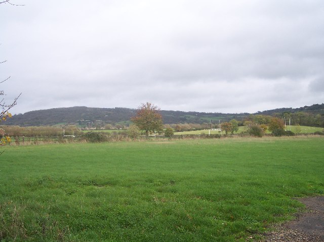
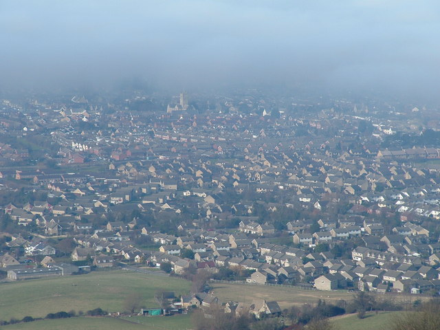
Bishop's Cleeve is a civil parish located in the county of Gloucestershire, England. It is situated about four miles northeast of Cheltenham, a popular spa town, and is nestled in the picturesque landscape of the Cotswold Hills. The parish covers an area of approximately 5.5 square miles and has a population of around 10,000.

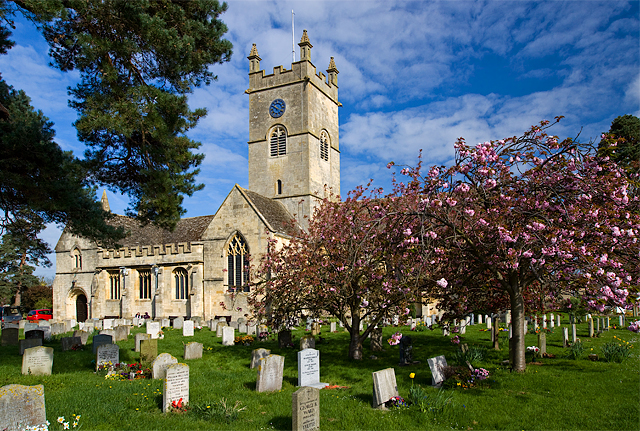
Bishop's Cleeve is a vibrant and thriving community with a rich history dating back to Roman times. It was once an important market town and a center for the wool trade, as evidenced by the historic buildings and architecture that still stand today. The village is home to several notable landmarks, including the medieval St. Michael and All Angels Church, which dates back to the 12th century.

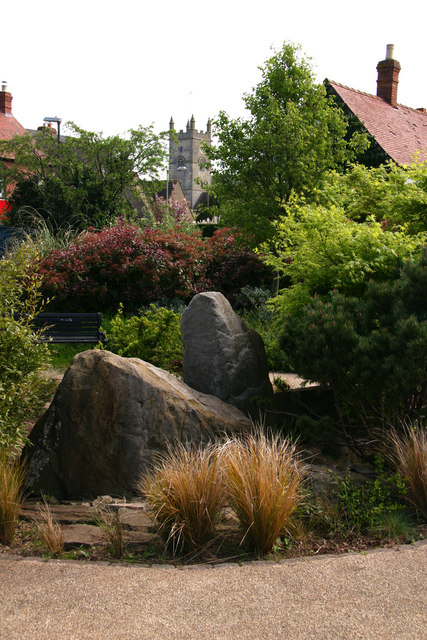
Today, Bishop's Cleeve has evolved into a popular residential area with a range of amenities and services for its residents. The village boasts a variety of shops, pubs, and restaurants, catering to both local needs and visitors alike. It also offers a range of recreational facilities, such as sports clubs, parks, and green spaces, providing opportunities for outdoor activities and relaxation.

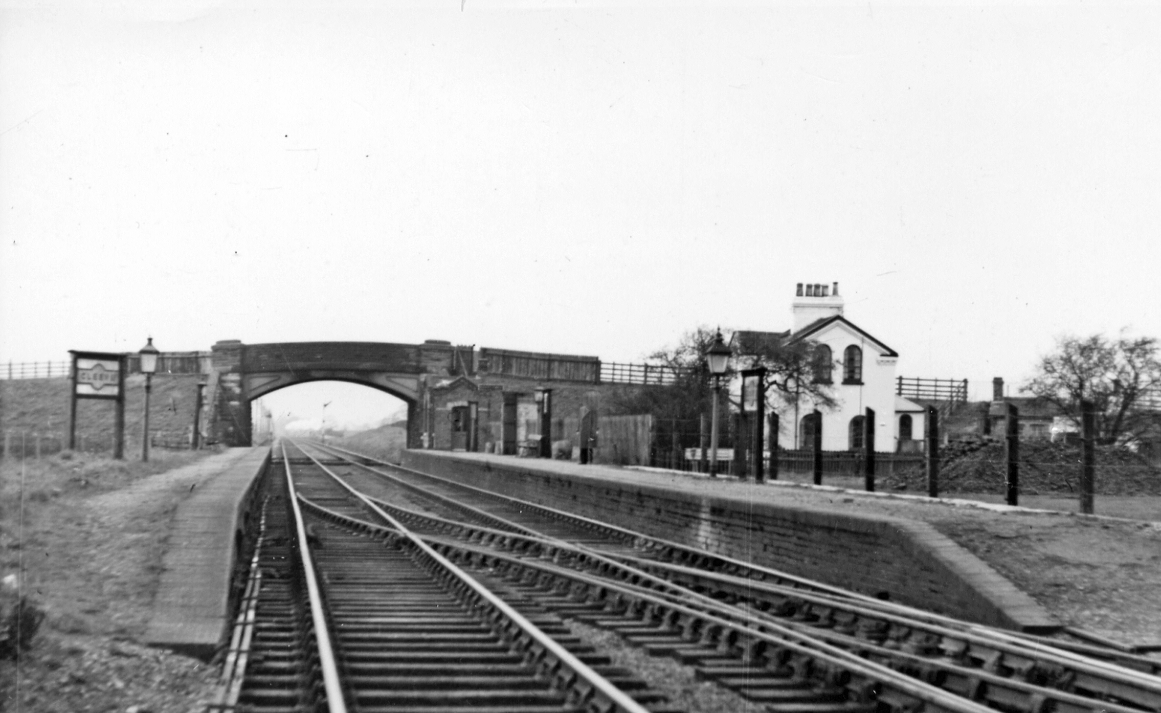
The parish benefits from excellent transport links, with easy access to major roads such as the A435 and A46, making it well-connected to nearby towns and cities. Public transportation is also readily available, ensuring convenient travel options for residents and visitors.

Bishop's Cleeve is known for its strong sense of community and hosts various events and festivals throughout the year, including the annual Bishop's Cleeve Festival, which celebrates the village's heritage and culture. With its idyllic countryside setting, rich history, and modern amenities, Bishop's Cleeve offers a desirable place to live and visit in Gloucestershire.

If you have any feedback on the listing, please let us know in the comments section below.

Bishop's Cleeve Images

Images are sourced within 2km of 51.945457/-2.074923 or Grid Reference SO9427. Thanks to Geograph Open Source API. All images are credited.

Bishop's Cleeve Church - St Michael's & All Angels
Brockhampton Level Crossing The Swindon (village) to Brockhampton Road crosses the Cheltenham to Birmingham railway line.
Brockhampton Level Crossing
The Swindon (village) to Brockhampton Road crosses the Cheltenham to Birmingham railway line.
Pedestrian Railway Crossing, Brockhampton On the Old LMS west coast line from Bristol to Birmingham.
Pedestrian Railway Crossing, Brockhampton
On the Old LMS west coast line from Bristol to Birmingham.
Eeyores Place, Brockhampton A lovely half-timbered thatched cottage on the Brockhampton to Southam road.
Eeyores Place, Brockhampton
A lovely half-timbered thatched cottage on the Brockhampton to Southam road.
Rugby Pitches, Bishop's Cleeve Looking north east with Nottingham Hill in the background.
Rugby Pitches, Bishop's Cleeve
Looking north east with Nottingham Hill in the background.
Tithe Barn Village Hall, Bishop's Cleeve In the centre of this ever expanding village opposite Cleeve Hall.
Tithe Barn Village Hall, Bishop's Cleeve
In the centre of this ever expanding village opposite Cleeve Hall.
Bishop's Cleeve Business Park Off the road from Bishop's Cleeve to Stoke Orchard.
Bishop's Cleeve Business Park
Off the road from Bishop's Cleeve to Stoke Orchard.
Nortenham Allotments, Bishop's Cleeve On the outside of the new by-pass close to Dean Farm. The original allotment site is ready for infill development.
Nortenham Allotments, Bishop's Cleeve
On the outside of the new by-pass close to Dean Farm. The original allotment site is ready for infill development.
"The Nurseries", bishop's Cleeve Modern infill between the old village centre and the by-pass. Bishop's Cleeve must have increased its size tenfold in a few decades with many estates similar to this one.
"The Nurseries", bishop's Cleeve
Modern infill between the old village centre and the by-pass. Bishop's Cleeve must have increased its size tenfold in a few decades with many estates similar to this one.
Cheltenham to Birmingham Train Heading north. Viewed from the bridge carrying the Stoke Orchard to Bishop's Cleeve Road.
Cheltenham to Birmingham Train
Heading north. Viewed from the bridge carrying the Stoke Orchard to Bishop's Cleeve Road.
Site of Cleeve Station Taken from the Stoke Road railway bridge looking south towards Cheltenham.
The Midlands Railway opened in 1840 and the station in 1843.
The station closed for passengers on the 2nd February 1950 and wholly in 1960.
All that remains is the Station Master's house.
The railway bridge was originally a timber truss on stone abutments, but replaced in 1885 with new stone abutments (and parapets) and cast iron arches.
The current concrete construction dates from the 1960s.
Site of Cleeve Station
Taken from the Stoke Road railway bridge looking south towards Cheltenham. The Midlands Railway opened in 1840 and the station in 1843. The station closed for passengers on the 2nd February 1950 and wholly in 1960. All that remains is the Station Master's house. The railway bridge was originally a timber truss on stone abutments, but replaced in 1885 with new stone abutments (and parapets) and cast iron arches. The current concrete construction dates from the 1960s.
Wingmoor Farm Refuse Tip, Stoke Orchard Entrance to the site off the main road. also the way to the Cheltenham District Clay Club - clay pigeons.
Wingmoor Farm Refuse Tip, Stoke Orchard
Entrance to the site off the main road. also the way to the Cheltenham District Clay Club - clay pigeons.
A Field Full of Sheep, Bishop's Cleeve Looking west north west over rough pasture land very close to one of the many housing estates in this ever expanding "village". How soon before all this is under tarmac, lawns and double glazing? A wonderful view of the complete range of the Malvern Hills.
A Field Full of Sheep, Bishop's Cleeve
Looking west north west over rough pasture land very close to one of the many housing estates in this ever expanding "village". How soon before all this is under tarmac, lawns and double glazing? A wonderful view of the complete range of the Malvern Hills.
St. Michael & All Angel's Church, Bishop's Cleeve
Leisure garden in centre of Bishop's Cleeve
Gotherington Lane, Bishop's Cleeve Looking south to the start of the village with the church tower in the background
Gotherington Lane, Bishop's Cleeve
Looking south to the start of the village with the church tower in the background
Homelands farm buildings with Oxenton hill beyond Fields may soon be built on.
Homelands farm buildings with Oxenton hill beyond
Fields may soon be built on.
Old barn near Dean Farm View across the fields towards the old barn at Dean Farm.  Taken on footpath leading from Little Acorns
Old barn near Dean Farm
View across the fields towards the old barn at Dean Farm. Taken on footpath leading from Little Acorns
Show me another place!

Bishop's Cleeve is located at Grid Ref: SO9427 (Lat: 51.945457, Lng: -2.074923)

Administrative County: Gloucestershire

District: Tewkesbury

Police Authority: Gloucestershire

What 3 Words

///dating.sleeps.hugs. Near Bishops Cleeve, Gloucestershire

Nearby Locations

Bishop's Cleeve

Related Wikis

Related Videos

Giving up our TRAVEL dreams... || Lets answer your questions!

We had so many questions and we wanted to answer them all. So this is 48 minutes of reality and soul searching to answer your ...

Nearby Amenities

Located within 500m of 51.945457,-2.074923
Traffic Signals
Bicycle: yes
Crossing: traffic_signals
Crossing Ref: toucan
Foot: yes
Lat/Long: 51.9472739/-2.0725147
Barrier: bollard
Foot: yes
Lat/Long: 51.9472622/-2.0723094
Post Box
Operator: Royal Mail
Operator Wikidata: Q638098
Postal Code: GL52
Ref: GL52 234
Lat/Long: 51.9471114/-2.0699531
Post Box
Operator: Royal Mail
Operator Wikidata: Q638098
Postal Code: GL52
Ref: GL52 235
Lat/Long: 51.9455652/-2.0690803
Barrier: bollard
Foot: yes
Lat/Long: 51.9472855/-2.0727199
Post Box
Operator: Royal Mail
Operator Wikidata: Q638098
Postal Code: GL52
Ref: GL52 373
Lat/Long: 51.9468803/-2.0802259
Bus Stop
The Grange Zurich Grounds
Bus: yes
Naptan AtcoCode: 1600GL1740
Naptan Bearing: E
Naptan CommonName: The Grange Zurich Grounds
Naptan NaptanCode: glodtjaw
Naptan PlusbusZoneRef: CHLTNHM
Naptan Street: Off Bypass A435
Naptan Verified: no
Public Transport: platform
Source: naptan_import
Lat/Long: 51.9418834/-2.0715118
Bus Stop
Haycroft Close
Bus: yes
Naptan AtcoCode: 1600GLA597
Naptan Bearing: W
Naptan CommonName: Haycroft Close
Naptan NaptanCode: glodtjpt
Naptan PlusbusZoneRef: CHLTNHM
Naptan Street: Voxwell Ln
Naptan Verified: no
Public Transport: platform
Source: naptan_import
Lat/Long: 51.9454781/-2.0691652
Bus Stop
Sweetbriar Close
Bus: yes
Naptan AtcoCode: 1600GLA599
Naptan Bearing: W
Naptan CommonName: Sweetbriar Close
Naptan Indicator: opp
Naptan NaptanCode: glodtjam
Naptan PlusbusZoneRef: CHLTNHM
Naptan Street: Voxwell Lane
Naptan Verified: no
Public Transport: platform
Source: naptan_import
Lat/Long: 51.9456391/-2.0711114
Bus Stop
Kingsclere Drive
Bus: yes
Naptan AtcoCode: 1600GLA600
Naptan Bearing: E
Naptan CommonName: Kingsclere Drive
Naptan Indicator: opp
Naptan NaptanCode: glodtjaj
Naptan PlusbusZoneRef: CHLTNHM
Naptan Street: Voxwell Lane
Naptan Verified: no
Public Transport: platform
Source: naptan_import
Lat/Long: 51.9456497/-2.0702169
Bus Stop
Stoke Rd
Bus: yes
Naptan AtcoCode: 1600GLA601
Naptan Bearing: N
Naptan CommonName: Stoke Rd
Naptan Indicator: Opp
Naptan NaptanCode: glodtgtm
Naptan PlusbusZoneRef: CHLTNHM
Naptan Street: Bypass A435
Naptan Verified: no
Public Transport: platform
Shelter: yes
Source: naptan_import
Lat/Long: 51.9476886/-2.0726201
Bus Stop
Stoke Road
Bus: yes
Naptan AtcoCode: 1600GLA602
Naptan Bearing: S
Naptan CommonName: Stoke Road
Naptan Indicator: nr
Naptan NaptanCode: glodtgwd
Naptan PlusbusZoneRef: CHLTNHM
Naptan Street: Bypass A435
Naptan Verified: no
Public Transport: platform
Shelter: no
Source: naptan_import
Lat/Long: 51.9470372/-2.07246
Bus Stop
The Grange Zurich
Bus: yes
Naptan AtcoCode: 1600GLA885
Naptan Bearing: N
Naptan CommonName: The Grange Zurich
Naptan Indicator: Opp
Naptan NaptanCode: gloagagp
Naptan PlusbusZoneRef: CHLTNHM
Naptan Street: Bypass A435
Naptan Verified: no
Public Transport: platform
Source: naptan_import
Lat/Long: 51.9422663/-2.0725208
Location Transition: yes
Power: pole
Lat/Long: 51.944255/-2.0728527
Power: pole
Lat/Long: 51.9439193/-2.0734669
Power: pole
Lat/Long: 51.9430976/-2.0734254
Location Transition: yes
Power: pole
Lat/Long: 51.9414375/-2.0734307
Power: pole
Lat/Long: 51.9453693/-2.078535
Power: pole
Lat/Long: 51.9447146/-2.0793289
Power: pole
Lat/Long: 51.9440003/-2.0801389
Crossing
Lat/Long: 51.9413384/-2.072144
Crossing
Crossing Island: yes
Lat/Long: 51.9457614/-2.0721828
Crossing
Crossing Island: yes
Lat/Long: 51.942972/-2.0722641
Addr City: Cheltenham
Addr Postcode: GL52 8YQ
Lat/Long: 51.9420956/-2.0705903
Addr City: Cheltenham
Addr Postcode: GL52 8RD
Lat/Long: 51.9422269/-2.0705811
Power: pole
Lat/Long: 51.9472466/-2.0787968
Generator Method: photovoltaic
Generator Output Electricity: yes
Generator Source: solar
Generator Type: solar_photovoltaic_panel
Location: roof
Power: generator
Lat/Long: 51.9477121/-2.0761076
Generator Method: photovoltaic
Generator Output Electricity: yes
Generator Source: solar
Generator Type: solar_photovoltaic_panel
Location: roof
Power: generator
Lat/Long: 51.9471384/-2.0745868
Generator Method: photovoltaic
Generator Output Electricity: yes
Generator Source: solar
Generator Type: solar_photovoltaic_panel
Location: roof
Power: generator
Lat/Long: 51.9474641/-2.0736855
Generator Method: photovoltaic
Generator Output Electricity: yes
Generator Source: solar
Generator Type: solar_photovoltaic_panel
Location: roof
Power: generator
Lat/Long: 51.9484634/-2.0738612
Generator Method: photovoltaic
Generator Output Electricity: yes
Generator Source: solar
Generator Type: solar_photovoltaic_panel
Location: roof
Power: generator
Lat/Long: 51.9492975/-2.0750722
Generator Method: photovoltaic
Generator Output Electricity: yes
Generator Source: solar
Generator Type: solar_photovoltaic_panel
Location: roof
Power: generator
Lat/Long: 51.9496744/-2.0769873
Generator Method: photovoltaic
Generator Output Electricity: yes
Generator Source: solar
Generator Type: solar_photovoltaic_panel
Location: roof
Power: generator
Lat/Long: 51.9469805/-2.0706144
Generator Method: photovoltaic
Generator Output Electricity: yes
Generator Source: solar
Generator Type: solar_photovoltaic_panel
Location: roof
Power: generator
Lat/Long: 51.9481948/-2.0699868
Generator Method: photovoltaic
Generator Output Electricity: yes
Generator Source: solar
Generator Type: solar_photovoltaic_panel
Location: roof
Power: generator
Lat/Long: 51.9476542/-2.0690748
Bus Stop
Lyndley Chase
Bus: yes
Naptan AtcoCode: 160000604
Naptan Bearing: E
Naptan CommonName: Lyndley Chase
Naptan Indicator: nr
Naptan NaptanCode: glojagdj
Naptan Verified: no
Public Transport: platform
Lat/Long: 51.9458315/-2.0744939
Bus Stop
Lyndley Close
Bus: yes
Naptan AtcoCode: 160000605
Naptan Bearing: W
Naptan CommonName: Lyndley Close
Naptan Indicator: opp
Naptan NaptanCode: glojagdm
Naptan Verified: no
Public Transport: platform
Lat/Long: 51.9458398/-2.0763696
Power: pole
Lat/Long: 51.9421592/-2.0734294
The data included in this document is from www.openstreetmap.org. The data is made available under ODbL.

Have you been to Bishop's Cleeve?

Leave your review of Bishop's Cleeve below (or comments, questions and feedback).