Bishampton

Civil Parish in Worcestershire Wychavon

England

Bishampton

Footpath to Bishampton church Footpath through a field of cereal to Bishampton church runs roughly parallel with the road, the church can be seen beyond the brow.
Footpath to Bishampton church Credit: Philip Halling

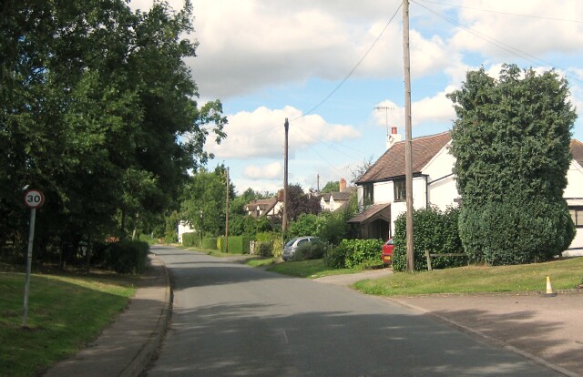
Bishampton is a small civil parish located in the county of Worcestershire, England. Situated approximately 12 miles east of the city of Worcester, the village is nestled in the picturesque countryside, offering a tranquil and idyllic setting.

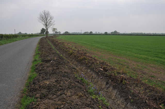
The parish covers an area of around 4 square miles and is home to a population of approximately 1,000 residents. Bishampton is surrounded by rolling hills and green fields, making it a popular destination for nature lovers and outdoor enthusiasts. The River Avon also runs through the village, adding to its natural beauty.

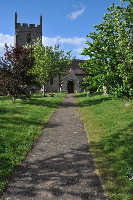
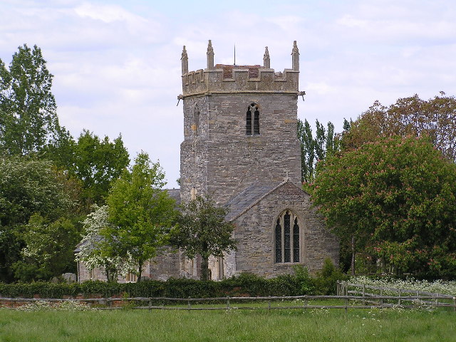
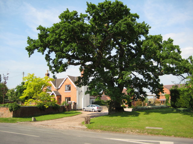
The village itself has a rich history, with evidence of settlements dating back to the Roman times. It is known for its traditional architecture, with many buildings constructed from local honey-colored Cotswold stone. The historic St. James' Church, built in the 12th century, stands as a prominent landmark in the village.

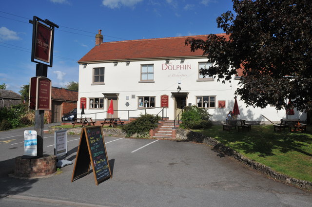
Bishampton offers a range of amenities for its residents, including a primary school, village hall, post office, and a local pub. The surrounding countryside provides ample opportunities for walking, cycling, and other outdoor activities. The village also benefits from good transport links, with easy access to nearby towns and cities via the A44 and A422 roads.

Overall, Bishampton is a charming and peaceful village that offers a high quality of life for its residents. With its beautiful surroundings and sense of community, it remains a desirable place to live within Worcestershire.

If you have any feedback on the listing, please let us know in the comments section below.
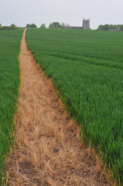
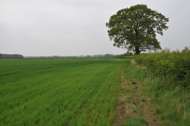
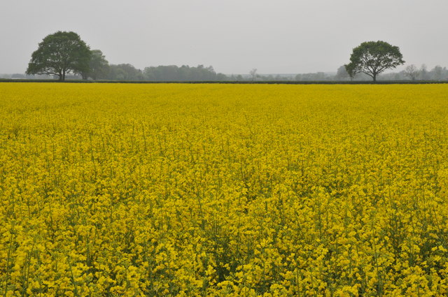
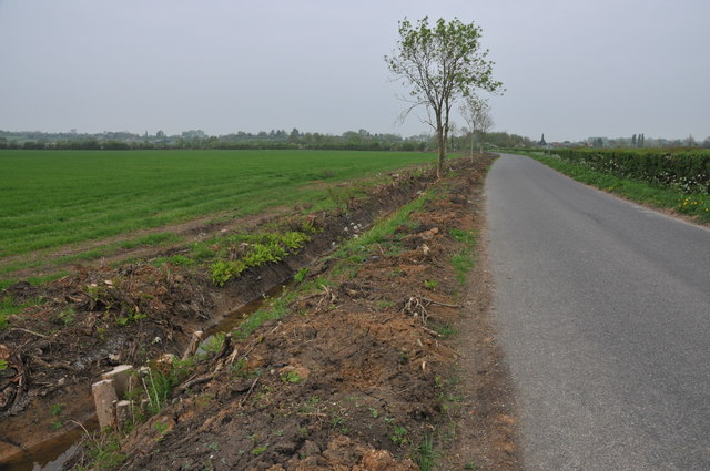
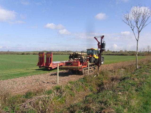
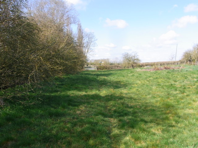
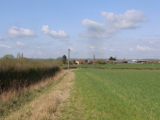
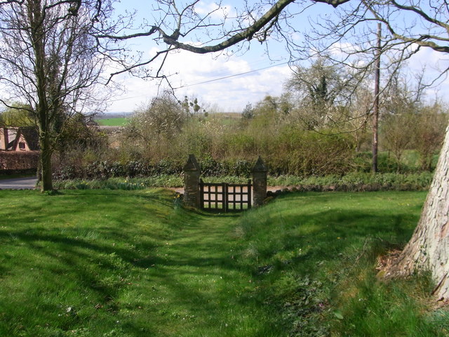
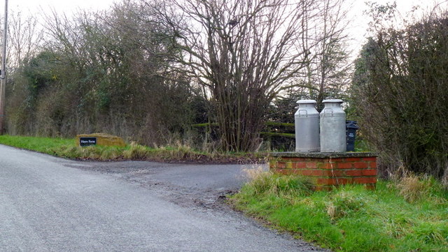
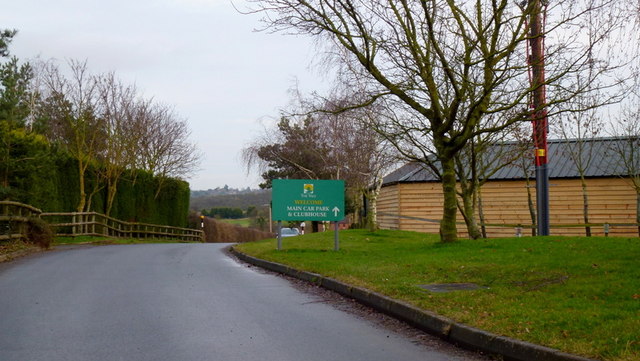
Bishampton Images

Images are sourced within 2km of 52.162094/-2.018169 or Grid Reference SO9851. Thanks to Geograph Open Source API. All images are credited.

Footpath to Bishampton church Footpath through a field of cereal to Bishampton church runs roughly parallel with the road, the church can be seen beyond the brow.
Footpath to Bishampton church
Footpath through a field of cereal to Bishampton church runs roughly parallel with the road, the church can be seen beyond the brow.
Footpath to North Piddle There are no roads through this square, just a couple of footpaths. There is one house on the western boundary, the rest is farmland, with a few lakes to the east of the square.
Footpath to North Piddle
There are no roads through this square, just a couple of footpaths. There is one house on the western boundary, the rest is farmland, with a few lakes to the east of the square.
Oilseed rape field Oilseed rape field near Naunton Beauchamp.
Oilseed rape field
Oilseed rape field near Naunton Beauchamp.
Grubbed hedgerow Grubbed hedgerow and recently dug ditch beside a road to the east of Naunton Beauchamp.
Grubbed hedgerow
Grubbed hedgerow and recently dug ditch beside a road to the east of Naunton Beauchamp.
Grubbed hedgerow Grubbed hedgerow and recently dug ditch beside a road to Naunton Beauchamp.
Grubbed hedgerow
Grubbed hedgerow and recently dug ditch beside a road to Naunton Beauchamp.
Entrance to Abberton Hall Abberton Hall is next to the parish church.
Entrance to Abberton Hall
Abberton Hall is next to the parish church.
Bishampton church
Bishampton church
The Dolphin at Bishampton The Dolphin at Bishampton is now open, when previously pictured on Geograph it was closed. See: <a href="https://www.geograph.org.uk/photo/1027189">SO9851 : A sad sight</a>
The Dolphin at Bishampton
The Dolphin at Bishampton is now open, when previously pictured on Geograph it was closed. See: SO9851 : A sad sight
Fencing work by the road border near Baynhall Farm
Bridleway in the paddock below Baynhall Farm
Baynhall Farm from the bridleway
Path and gate , Abberton church
Entering Bishampton Approaching the village from the south-east via Broad Lane.
Entering Bishampton
Approaching the village from the south-east via Broad Lane.
Hayes Farm A public path passes along the drive and through this dairy farm.
Hayes Farm
A public path passes along the drive and through this dairy farm.
Footpath south from Broad Lane, 1 This skirts some recently-landscaped land.
Footpath south from Broad Lane, 1
This skirts some recently-landscaped land.
Footpath south from Broad Lane, 2 Just over the stile in <a href="https://www.geograph.org.uk/photo/3302889">SO9951 : Footpath south from Broad Lane, 1</a>.
Footpath south from Broad Lane, 2
Entrance to Hayes Farm The milk churns featured in the first geograph are still screwed down!
See - <a href="https://www.geograph.org.uk/photo/40277">SO9950 : Milk churns by a country road</a>.
Entrance to Hayes Farm
The milk churns featured in the first geograph are still screwed down! See - SO9950 : Milk churns by a country road.
Drive to the Vale Golf and Country Club Looking east from the Bishampton to Evesham Road.
Drive to the Vale Golf and Country Club
Looking east from the Bishampton to Evesham Road.
Show me another place!

Bishampton is located at Grid Ref: SO9851 (Lat: 52.162094, Lng: -2.018169)

Administrative County: Worcestershire

District: Wychavon

Police Authority: West Mercia

What 3 Words

///disclose.solder.apparatus. Near Kington, Worcestershire

Nearby Locations

Bishampton Bishampton

Related Wikis

Bishampton

Bishampton is a village and civil parish in the Wychavon district of Worcestershire, England with a population of 625. It contains a church, a village...
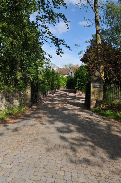
Abberton Hall

Abberton Hall is a small country house in the village of Abberton, Worcestershire, England, near Pershore. == History == It is an irregular two-story...

Abberton, Worcestershire

Abberton is a small village in Worcestershire, England. In 1991, the population was 44, this grew to 67 in 24 households in 2001.The principal house in...

Throckmorton, Worcestershire

Throckmorton is a small village and civil parish in the administrative district of Wychavon, in the county of Worcestershire, England. The village lies...

QinetiQ Pershore

QinetiQ Pershore is a Business Park and Trials Centre operated by QinetiQ. The site is located near the village of Throckmorton, Worcestershire, England...

Mid Worcestershire (UK Parliament constituency)

Mid Worcestershire is a constituency represented in the House of Commons of the UK Parliament since 2015 by Nigel Huddleston, a Conservative.Under the...

Naunton Beauchamp

Naunton Beauchamp is a village and is also a civil parish within Wychavon district in Worcestershire, England. It is in the east of the county, about...

Flyford Flavell

Flyford Flavell is a village in Worcestershire , it has a traditional pub in the centre of the village adjacent to the village green and a first school...

Nearby Amenities

Located within 500m of 52.162094,-2.018169
Bishampton
Place: village
Wikidata: Q2595092
Lat/Long: 52.162486/-2.01705
Dolphin Inn
Naptan AtcoCode: 2000G032200
Naptan Bearing: S
Naptan BusStopType: CUS
Naptan CommonName: Dolphin Inn
Naptan Indicator: Adj
Naptan Landmark: Dolphin Inn
Naptan NaptanCode: wocdjdwd
Naptan Street: Main Street
Naptan Verified: no
Source: naptan_import
Lat/Long: 52.1611791/-2.0171189
Moat Farm Lane
Naptan AtcoCode: 2000G032201
Naptan Bearing: S
Naptan BusStopType: CUS
Naptan CommonName: Moat Farm Lane
Naptan Crossing: Moat Farm Lane
Naptan Indicator: Adj
Naptan NaptanCode: wocdjdwg
Naptan Street: Main Street
Naptan Verified: no
Source: naptan_import
Lat/Long: 52.1578074/-2.018521
Dolphin Inn
Naptan AtcoCode: 2000G032202
Naptan Bearing: N
Naptan BusStopType: CUS
Naptan CommonName: Dolphin Inn
Naptan Indicator: Opp
Naptan Landmark: Dolphin Inn
Naptan NaptanCode: wocdjdwj
Naptan Street: Main Street
Naptan Verified: no
Source: naptan_import
Lat/Long: 52.161224/-2.0173529
Post Office
Naptan AtcoCode: 2000G032203
Naptan Bearing: S
Naptan BusStopType: CUS
Naptan CommonName: Post Office
Naptan Indicator: Opp
Naptan Landmark: Post office
Naptan NaptanCode: wocdjdwm
Naptan Street: Main Street
Naptan Verified: no
Source: naptan_import
Lat/Long: 52.1603609/-2.0173087
Moat Farm Lane
Naptan AtcoCode: 2000G323388
Naptan Bearing: N
Naptan BusStopType: CUS
Naptan CommonName: Moat Farm Lane
Naptan Crossing: Moat Farm Lane
Naptan Indicator: Opp
Naptan NaptanCode: wocdjwtg
Naptan Street: Main Street
Naptan Verified: no
Source: naptan_import
Lat/Long: 52.1578343/-2.0187695
Abberton Road- Church lane
Naptan AtcoCode: 2000G323389
Naptan Bearing: W
Naptan BusStopType: CUS
Naptan CommonName: Abberton Road- Church lane
Naptan Indicator: opp
Naptan Landmark: Church
Naptan NaptanCode: wocdjwtj
Naptan Street: Abberton Road
Naptan Verified: no
Source: naptan_import
Lat/Long: 52.1636697/-2.0158333
Post Office
Naptan AtcoCode: 2000G675019
Naptan Bearing: N
Naptan BusStopType: CUS
Naptan CommonName: Post Office
Naptan Indicator: Adj
Naptan Landmark: Post Office
Naptan NaptanCode: wocgadpg
Naptan Street: Main Street
Naptan Verified: no
Source: naptan_import
Lat/Long: 52.1603879/-2.017528
Bishampton- Church Lane- Abberton Road
Naptan AtcoCode: 2000G675023
Naptan Bearing: E
Naptan BusStopType: CUS
Naptan CommonName: Bishampton- Church Lane- Abberton Road
Naptan Indicator: Adj
Naptan Landmark: Church
Naptan NaptanCode: wocgadpw
Naptan Street: Church End
Naptan Verified: no
Source: naptan_import
Lat/Long: 52.1638225/-2.0159065
Post Box
Collection Times: Mo-Fr 09:00; Sa 07:00
Operator: Royal Mail
Post Box Type: lamp
Ref: WR10 227D
Royal Cypher: EIIR
Royal Cypher Wikidata: Q33102113
Source: survey
Lat/Long: 52.1637705/-2.0162729
Post Box
Collection Times: Mo-Fr 16:00; Sa 09:30
Operator: Royal Mail
Post Box Type: lamp
Ref: WR10 394
Royal Cypher: EIIR
Royal Cypher Wikidata: Q33102113
Source: survey
Lat/Long: 52.1603526/-2.017535
Post Office
Bishampton Post Office
Addr City: Pershore
Addr Postcode: WR10 2LX
Addr Street: Main Street
Addr Village: Bishampton
Opening Hours: Mo-Fr 08:00-19:00; Sa 08:00-14:00
Ref Pol Id: 136212
Source: OS OpenData StreetView
Lat/Long: 52.1603154/-2.0176701
Barrier: stile
Lat/Long: 52.1649223/-2.0155118
Barrier: stile
Lat/Long: 52.165062/-2.0149227
Barrier: stile
Lat/Long: 52.1605466/-2.0114025
Barrier: stile
Lat/Long: 52.1605899/-2.0121284
Barrier: stile
Lat/Long: 52.1606763/-2.0132482
Barrier: stile
Lat/Long: 52.1607447/-2.0135947
Barrier: stile
Lat/Long: 52.1611713/-2.0134194
Barrier: stile
Lat/Long: 52.161411/-2.0136457
Barrier: stile
Lat/Long: 52.1615735/-2.0136274
Barrier: stile
Lat/Long: 52.1616219/-2.0131727
Barrier: stile
Lat/Long: 52.162658/-2.0109826
Power: pole
Lat/Long: 52.1630251/-2.0131839
Bishampton Church
Power: pole
Transformer: distribution
Voltage Primary: 11000
Lat/Long: 52.1636171/-2.0137221
Defibrillator
Defibrillator Location: On wall of Bishmpton Post Office.
Emergency: defibrillator
Source: survey
Lat/Long: 52.1602863/-2.0176069
Barrier: stile
Lat/Long: 52.1609051/-2.0240294
Generator Method: photovoltaic
Generator Output Electricity: yes
Generator Source: solar
Generator Type: solar_photovoltaic_panel
Location: roof
Power: generator
Lat/Long: 52.1576573/-2.0183221
Generator Method: photovoltaic
Generator Output Electricity: yes
Generator Source: solar
Generator Type: solar_photovoltaic_panel
Location: roof
Power: generator
Lat/Long: 52.1625573/-2.0162353
Generator Method: photovoltaic
Generator Output Electricity: yes
Generator Source: solar
Generator Type: solar_photovoltaic_panel
Location: roof
Power: generator
Lat/Long: 52.1626232/-2.0162863
Generator Method: photovoltaic
Generator Output Electricity: yes
Generator Source: solar
Generator Type: solar_photovoltaic_panel
Location: roof
Power: generator
Lat/Long: 52.1621641/-2.0161924
Generator Method: photovoltaic
Generator Output Electricity: yes
Generator Source: solar
Generator Type: solar_photovoltaic_panel
Location: roof
Power: generator
Lat/Long: 52.1627696/-2.0154548
Generator Method: photovoltaic
Generator Output Electricity: yes
Generator Source: solar
Generator Type: solar_photovoltaic_panel
Location: roof
Power: generator
Lat/Long: 52.1634343/-2.0159966
Generator Method: photovoltaic
Generator Output Electricity: yes
Generator Source: solar
Generator Type: solar_photovoltaic_panel
Location: roof
Power: generator
Lat/Long: 52.163505/-2.0158356
Generator Method: photovoltaic
Generator Output Electricity: yes
Generator Source: solar
Generator Type: solar_photovoltaic_panel
Location: roof
Power: generator
Lat/Long: 52.1640315/-2.0142934
Generator Method: photovoltaic
Generator Output Electricity: yes
Generator Source: solar
Generator Type: solar_photovoltaic_panel
Location: roof
Power: generator
Lat/Long: 52.1640299/-2.0147225
Generator Method: photovoltaic
Generator Output Electricity: yes
Generator Source: solar
Generator Type: solar_photovoltaic_panel
Location: roof
Power: generator
Lat/Long: 52.1639723/-2.0153555
Generator Method: photovoltaic
Generator Output Electricity: yes
Generator Source: solar
Generator Type: solar_photovoltaic_panel
Location: roof
Power: generator
Lat/Long: 52.1639805/-2.0180109
Generator Method: photovoltaic
Generator Output Electricity: yes
Generator Source: solar
Generator Type: solar_photovoltaic_panel
Location: roof
Power: generator
Lat/Long: 52.1593521/-2.0141794
Main Street Bishampton
Power: pole
Transformer: distribution
Voltage Primary: 11000
Lat/Long: 52.1607513/-2.0177085
Broad Lane
Power: pole
Transformer: distribution
Voltage Primary: 11000
Lat/Long: 52.1601888/-2.0154266
Bishampton
Power: pole
Transformer: distribution
Voltage Primary: 11000
Lat/Long: 52.1609749/-2.0153917
Power: pole
Lat/Long: 52.1618605/-2.0148781
Power: pole
Lat/Long: 52.1620818/-2.0135745
Power: pole
Lat/Long: 52.1622406/-2.0126633
Power: pole
Lat/Long: 52.1624076/-2.0117117
Power: pole
Lat/Long: 52.1617618/-2.0110747
The data included in this document is from www.openstreetmap.org. The data is made available under ODbL.

Have you been to Bishampton?

Leave your review of Bishampton below (or comments, questions and feedback).