Billingham

Civil Parish in Durham

England

Billingham

Path at RSPB reserve, Saltholme The grit and gravel-surfaced path connects the main area of the reserve, ahead in the image, with the more remote parts around Haverton Pools and Allotment Pool. The RSPB maintains a number of habitat types on the site, the main one being wetland, with pools and reedbeds, but grassed areas too as seen in the image.
Path at RSPB reserve, Saltholme Credit: Trevor Littlewood

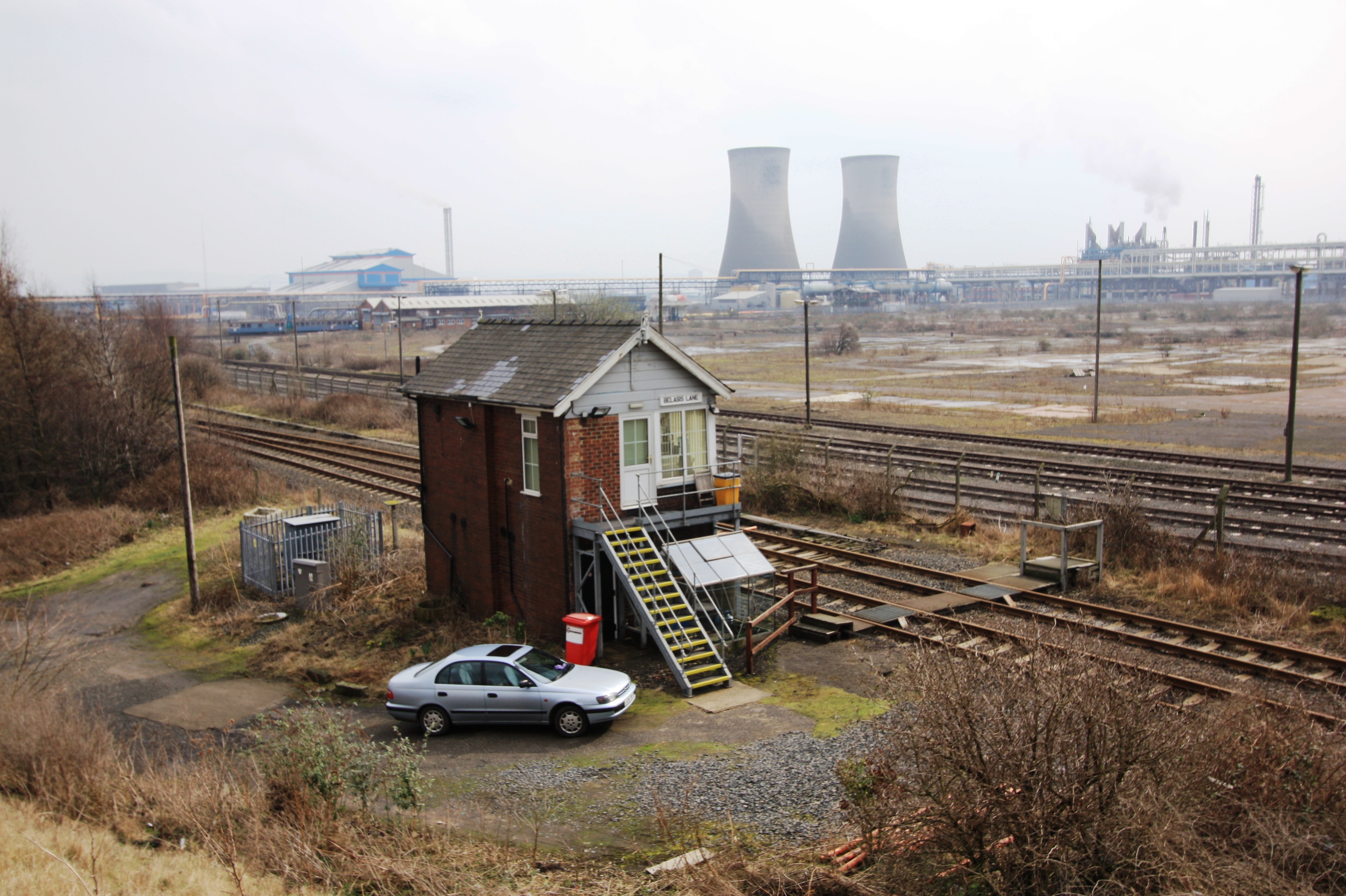
Billingham is a civil parish located in the borough of Stockton-on-Tees, in the county of Durham, England. Situated on the northern bank of the River Tees, it is approximately 5 miles east of Stockton-on-Tees town center. Historically an industrial town, Billingham is known for its chemical industry and is home to the Billingham Manufacturing Plant, which is one of the largest chemical complexes in the United Kingdom.

The town is well-connected with nearby towns and cities through excellent transportation links, including the A19 road and the A689 road. Billingham also benefits from a railway station, providing direct services to Darlington and Middlesbrough.

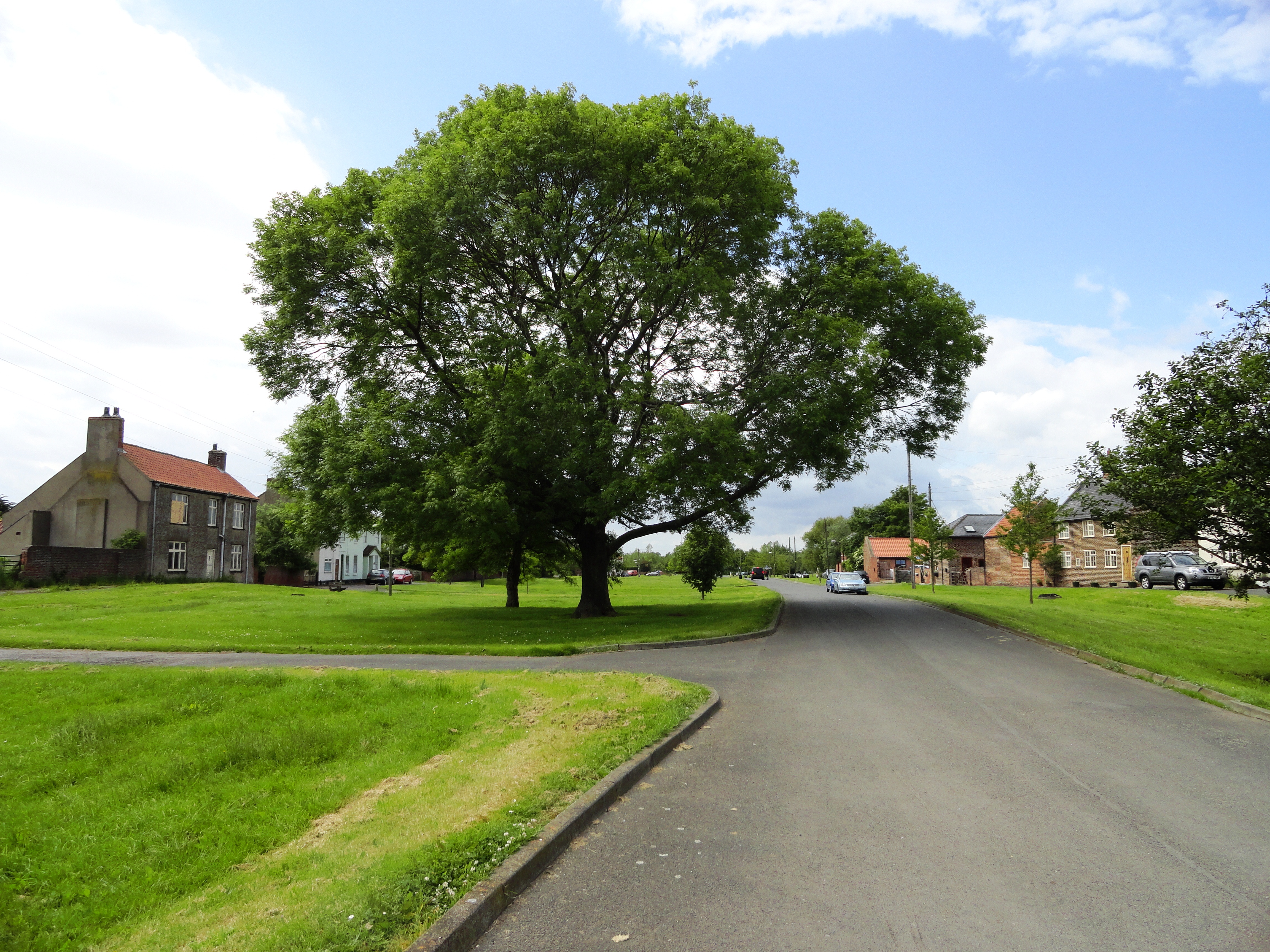
Billingham offers a range of amenities to its residents, including shopping centers, supermarkets, and a variety of local businesses. The town is also known for its recreational facilities, with several parks, sports clubs, and leisure centers available for residents and visitors to enjoy.

Education in Billingham is provided by a number of primary and secondary schools, ensuring that the educational needs of the community are well catered for.

The town has a strong sense of community, with various local events and activities taking place throughout the year. The Billingham Carnival, held annually in the summer, attracts visitors from far and wide.

Overall, Billingham is a thriving civil parish with a rich industrial heritage, offering its residents a range of amenities and a strong sense of community.

If you have any feedback on the listing, please let us know in the comments section below.

Billingham Images

Images are sourced within 2km of 54.605867/-1.236799 or Grid Reference NZ4923. Thanks to Geograph Open Source API. All images are credited.

Path at RSPB reserve, Saltholme The grit and gravel-surfaced path connects the main area of the reserve, ahead in the image, with the more remote parts around Haverton Pools and Allotment Pool. The RSPB maintains a number of habitat types on the site, the main one being wetland, with pools and reedbeds, but grassed areas too as seen in the image.
Path at RSPB reserve, Saltholme
The grit and gravel-surfaced path connects the main area of the reserve, ahead in the image, with the more remote parts around Haverton Pools and Allotment Pool. The RSPB maintains a number of habitat types on the site, the main one being wetland, with pools and reedbeds, but grassed areas too as seen in the image.
Haverton Pool(s) at RSPB Saltholme There's no hide at the Haverton Pools area of the Saltholme RSPB reserve but there's a viewpoint which has this view over at least one of them. The extent of the pools is displayed on OS mapping differently, according to the map scale.
Haverton Pool(s) at RSPB Saltholme
There's no hide at the Haverton Pools area of the Saltholme RSPB reserve but there's a viewpoint which has this view over at least one of them. The extent of the pools is displayed on OS mapping differently, according to the map scale.
Industrial works at Haverton Hill as seen across R Tees
MTE Limited, Billingham Large industrial building formerly part of the ship building complex on the north bank of the Tees.
MTE Limited, Billingham
Large industrial building formerly part of the ship building complex on the north bank of the Tees.
War Memorial, Port Clarence
Limetrees Close, High Clarence
Saltholme Hide at RSPB reserve The Saltholme Hide is one of those at the RSPB nature reserve at the site of the same name. The hide has been rebuilt, at least in part, with an upper storey being added in recent times. Oliver Dixon's image from January 2014 shows it as it was previously - <a title="https://www.geograph.org.uk/photo/3824543" href="https://www.geograph.org.uk/photo/3824543">Link</a> .
Saltholme Hide at RSPB reserve
The Saltholme Hide is one of those at the RSPB nature reserve at the site of the same name. The hide has been rebuilt, at least in part, with an upper storey being added in recent times. Oliver Dixon's image from January 2014 shows it as it was previously - Link .
Car park at RSPB reserve The car park is at the RSPB's reserve at Saltholme. The grey vehicle to the right and a number of others are parked beneath a canopy which was thought to be simply a form of sheltering but its roof is actually covered with electricity-generating solar panels. There are two such structures in the car park.
Car park at RSPB reserve
The car park is at the RSPB's reserve at Saltholme. The grey vehicle to the right and a number of others are parked beneath a canopy which was thought to be simply a form of sheltering but its roof is actually covered with electricity-generating solar panels. There are two such structures in the car park.
Moving the tern rafts At the RSPB reserve at Saltholme the raft is being moved to the edge of the lake by the hand over hand hauling of a rope by the two individuals upon it. It had been moored out in the water as a platform for the nesting of terns and with the breeding season being past it no longer needed to be exposed there.
Moving the tern rafts
At the RSPB reserve at Saltholme the raft is being moved to the edge of the lake by the hand over hand hauling of a rope by the two individuals upon it. It had been moored out in the water as a platform for the nesting of terns and with the breeding season being past it no longer needed to be exposed there.
Billingham Community Fire Station Set among the marshes and sprawling petro-chemical industries of Billingham.
Billingham Community Fire Station
Set among the marshes and sprawling petro-chemical industries of Billingham.
Pipelines, Saltholme, Billingham
Pipeline near Cowpen Marsh
RSPB Saltholme Nature Reserve One of several ponds overlooked by a bird hide.  Not much about today.
RSPB Saltholme Nature Reserve
One of several ponds overlooked by a bird hide. Not much about today.
Stock Dove at RSPB Saltholme
Little Egret flies off RSPB Saltholme
Little Egret Hunting at RSPB Saltholme
Stegosaurus, Teesaurus Park Teesaurus Park contains at least seven sculptures of prehistoric animals created by apprentices of the old ironworks on the site which was opened as a public park in 1979. A recent move by Middlesbrough Council to sell off the site has now been put on hold.
Stegosaurus, Teesaurus Park
Teesaurus Park contains at least seven sculptures of prehistoric animals created by apprentices of the old ironworks on the site which was opened as a public park in 1979. A recent move by Middlesbrough Council to sell off the site has now been put on hold.
Industrial buildings, Billingham Newish looking, a view from over the river.
Industrial buildings, Billingham
Newish looking, a view from over the river.
Show me another place!

Billingham is located at Grid Ref: NZ4923 (Lat: 54.605867, Lng: -1.236799)

Unitary Authority: Stockton-on-Tees

Police Authority: Cleveland

What 3 Words

///keeps.gift.admiral. Near Middlesbrough, North Yorkshire

Related Wikis

Haverton Hill

Haverton Hill is an area within the borough of Stockton-on-Tees and ceremonial county of County Durham, England. Once considered a part of Billingham,...

Tees Valley

The Tees Valley is a combined authority area in North East England, around the lower River Tees. The area is not a geographical valley; the local term...

Cowpen Bewley

Cowpen Bewley is a village and former civil parish, now in the parish of Billingham, in the Stockton-on-Tees district, in the ceremonial county of Durham...

Offshore Structures (Britain) Ltd.

Offshore Structures (Britain) Ltd. is a marine offshore structure foundation manufacture based at Haverton Hill near Billingham on the north bank of the...

Related Videos

Transporter Bridge - Middlesbrough

Had half an hour or so to kill so thought I'd head to the Tees and the get the drone up over the Transporter Bridge. Times it well as ...

Cowpen bewely park

Walk around Cowpen woodland park.

Middlesbrough Transporter Bridge

Transporter Bridge opened 1911 crossing the river Tees Music by Pixabay.com.

A Visit to RSPB Saltholme

Making use of the good weather, we took off in the Zoe to RSPB Saltholme, the nearest bird sanctuary. This channel will ...

Nearby Amenities

Located within 500m of 54.605867,-1.236799
Design: barrel
Line Attachment: anchor
Material: metal
Power: tower
Source: Bing
Structure: lattice
Lat/Long: 54.6089474/-1.2407545
Design: barrel
Line Attachment: anchor
Material: steel
Power: tower
Structure: lattice
Lat/Long: 54.6052382/-1.240339
Design: barrel
Line Attachment: anchor
Line Management: branch
Material: metal
Power: tower
Structure: lattice
Lat/Long: 54.6034297/-1.2377453
Design: portal
Power: portal
Structure: lattice
Lat/Long: 54.6049544/-1.2378381
Power: tower
Lat/Long: 54.6051477/-1.2361329
Design: barrel
Power: tower
Source: Bing
Structure: lattice
Lat/Long: 54.6078855/-1.2388323
Design: barrel
Power: tower
Source: Bing
Structure: lattice
Lat/Long: 54.6086916/-1.2388042
Power: tower
Lat/Long: 54.6061024/-1.2364027
Power: tower
Lat/Long: 54.6066169/-1.236059
Design: barrel
Power: tower
Source: Bing
Structure: lattice
Lat/Long: 54.6062867/-1.2335074
Power: tower
Lat/Long: 54.6050993/-1.2312618
Design: barrel
Power: tower
Source: Bing
Structure: lattice
Lat/Long: 54.605886/-1.2324071
Design: barrel
Line Attachment: suspension
Material: metal
Power: tower
Source: Bing
Structure: lattice
Lat/Long: 54.60697/-1.2404854
Power: transformer
Lat/Long: 54.6054015/-1.2383272
Power: tower
Lat/Long: 54.605412/-1.2380743
Power: tower
Lat/Long: 54.605421/-1.2378573
Power: transformer
Lat/Long: 54.6056057/-1.2383635
Power: tower
Lat/Long: 54.6056102/-1.2380806
Power: tower
Lat/Long: 54.6056164/-1.2377978
Power: portal
Lat/Long: 54.6057677/-1.2378069
Power: tower
Lat/Long: 54.6061298/-1.2374684
Power: tower
Lat/Long: 54.6067309/-1.2369273
Inscription: CH02 AC MITIGATION CH02 DC DECOUPLER LCP 6 GRID REF 449514 - 523721
Marker: plate
Operator: Northern Gas Networks
Lat/Long: 54.6090437/-1.2378039
Marker: post
Ref: CBSS(200mm)12
Utility: gas
Lat/Long: 54.6089707/-1.2378086
Inscription: CH01 AC MITIGATION ???01 DC DECOUPLER 5 ? REF 449509-523 -
Marker: plate
Lat/Long: 54.609041/-1.237821
Height: 15
Man Made: chimney
Lat/Long: 54.6073128/-1.2427104
Height: 15
Man Made: chimney
Lat/Long: 54.6073734/-1.2427264
Height: 15
Man Made: chimney
Lat/Long: 54.6074386/-1.2427586
Height: 15
Man Made: chimney
Lat/Long: 54.607493/-1.2427774
Height: 15
Man Made: chimney
Lat/Long: 54.6078301/-1.2428901
Height: 15
Man Made: chimney
Lat/Long: 54.6078876/-1.2429115
Height: 15
Man Made: chimney
Lat/Long: 54.6079513/-1.2429276
Height: 15
Man Made: chimney
Lat/Long: 54.6080072/-1.2429437
Generator Method: combustion
Generator Output Electricity: 12.5 MW
Generator Source: gas
Generator Type: reciprocating_engine
Power: generator
Lat/Long: 54.6077928/-1.2437671
Generator Method: combustion
Generator Output Electricity: 12.5 MW
Generator Source: gas
Generator Type: reciprocating_engine
Power: generator
Lat/Long: 54.6077322/-1.2437484
Generator Method: combustion
Generator Output Electricity: 12.5 MW
Generator Source: gas
Generator Type: reciprocating_engine
Power: generator
Lat/Long: 54.6074107/-1.2436384
Generator Method: combustion
Generator Output Electricity: 12.5 MW
Generator Source: gas
Generator Type: reciprocating_engine
Power: generator
Lat/Long: 54.6073579/-1.2436089
Generator Method: combustion
Generator Output Electricity: 12.5 MW
Generator Source: gas
Generator Type: reciprocating_engine
Power: generator
Lat/Long: 54.6072802/-1.2435874
Generator Method: combustion
Generator Output Electricity: 12.5 MW
Generator Source: gas
Generator Type: reciprocating_engine
Power: generator
Lat/Long: 54.6072134/-1.2435767
The data included in this document is from www.openstreetmap.org. The data is made available under ODbL.

Have you been to Billingham?

Leave your review of Billingham below (or comments, questions and feedback).