Bigby
Civil Parish in Lincolnshire West Lindsey
England
Bigby
Bigby is a civil parish located in the West Lindsey district of Lincolnshire, England. Situated approximately 5 miles north of the town of Brigg, it covers an area of about 1.7 square miles. The parish consists of the village of Bigby and the surrounding rural area.
The village of Bigby has a small population of around 150 residents, giving it a close-knit and community-oriented atmosphere. It is known for its picturesque countryside surroundings, with rolling hills, fields, and farmland dominating the landscape. The area is dotted with traditional English cottages, some of which date back several centuries, adding to the village's charm.
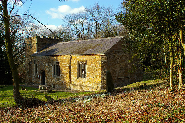
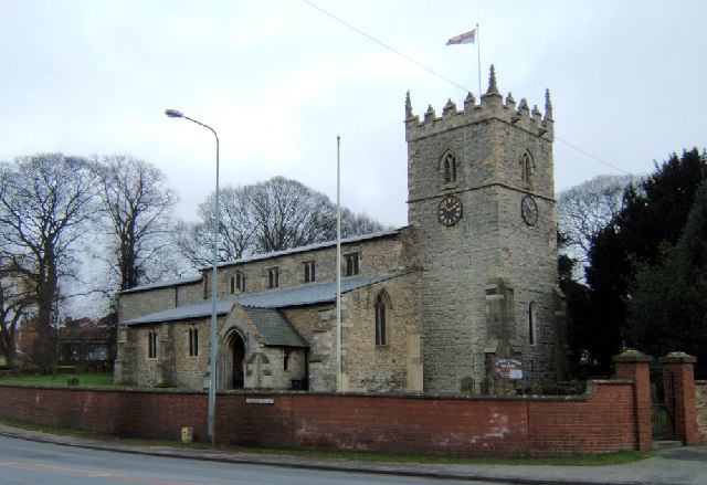
The parish is home to St. Martin's Church, a Grade II listed building that dates back to the 12th century. The church is an important local landmark and is renowned for its beautiful architecture, including a Norman-era chancel arch and a 13th-century tower. It serves as a place of worship for the villagers and also attracts visitors interested in historical and architectural sites.
Although small in size, Bigby has a strong sense of community spirit. The village hosts various events throughout the year, including summer fetes, Christmas celebrations, and social gatherings, which bring residents together and foster a sense of belonging.
Overall, Bigby is a tranquil and idyllic rural parish, offering a peaceful and picturesque setting for its residents and visitors alike.
If you have any feedback on the listing, please let us know in the comments section below.
Bigby Images
Images are sourced within 2km of 53.553277/-0.431681 or Grid Reference TA0307. Thanks to Geograph Open Source API. All images are credited.


Bigby is located at Grid Ref: TA0307 (Lat: 53.553277, Lng: -0.431681)
Administrative County: Lincolnshire
District: West Lindsey
Police Authority: Lincolnshire
What 3 Words
///anchors.irrigate.speeches. Near Wrawby, Lincolnshire
Nearby Locations
Related Wikis
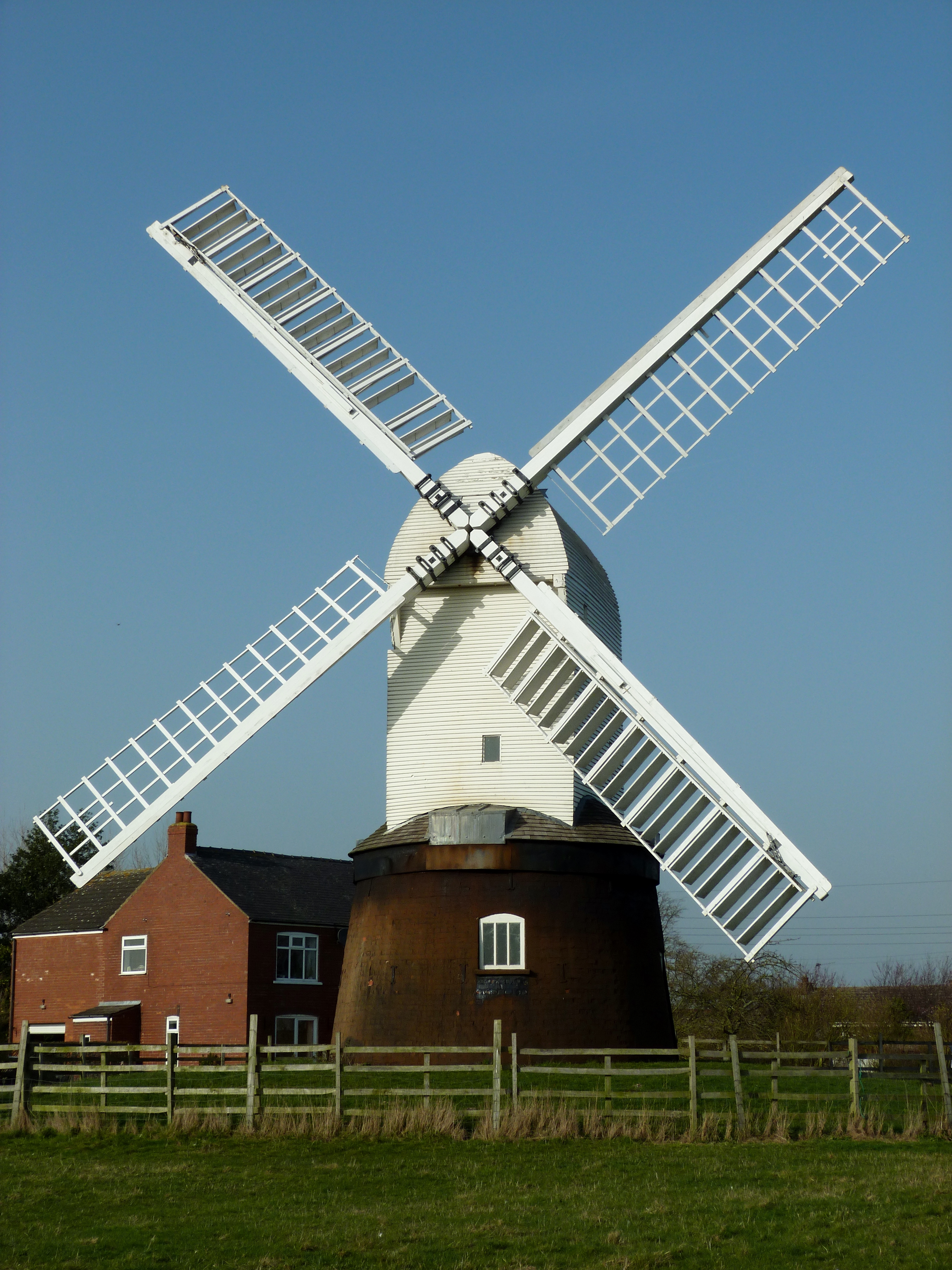
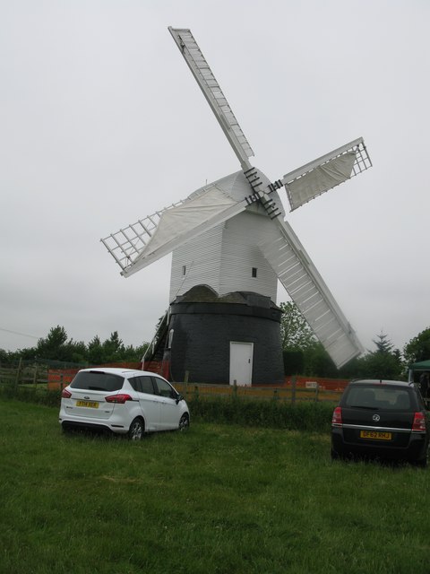
Wrawby Windmill
Wrawby Postmill is a windmill at Wrawby near Brigg, in North Lincolnshire, England. The mill is the last post mill in the north of England, and was built...

Bigby, Lincolnshire
Bigby is a village and civil parish in the West Lindsey district of Lincolnshire, England. The village is situated about 10 miles (20 km) south from the...

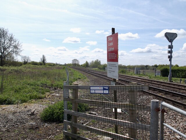
Wrawby Junction
Wrawby Junction is a busy railway junction located a short distance west of Barnetby, North Lincolnshire, England and controls the confluence of the Network...

Wrawby Junction rail crash
The Wrawby Junction rail crash was a train crash which occurred on 9 December 1983, at Wrawby Junction, near Barnetby station, North Lincolnshire, England...
1898 Wrawby Junction rail crash
On 17 October 1898 at Wrawby Junction, on what was the Great Central Railway near Brigg in Lincolnshire, England, a passenger train collided with a derailed...
Somerby (Juxta Bigby)
Somerby (also known as Somerby juxta Bigby or Somerby by Brigg) is a hamlet and civil parish in the West Lindsey district of Lincolnshire, England. It...
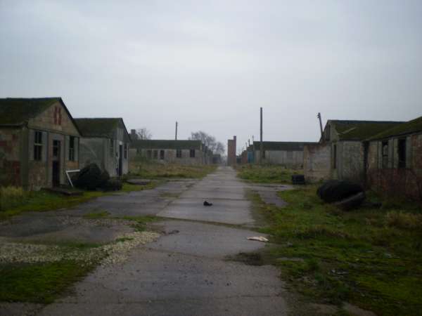
Pingley POW Camp
Pingley POW (prisoner of war) camp is one of the few prisoner of war camps in the United Kingdom that remains in good condition. Unlike the relatively...
Wrawby
Wrawby is a village in North Lincolnshire, England. It lies 2 miles (3 km) east of Brigg and close to Humberside Airport, on the A18. The 2001 Census recorded...
Nearby Amenities
Located within 500m of 53.553277,-0.431681Have you been to Bigby?
Leave your review of Bigby below (or comments, questions and feedback).