Brinkley

Settlement in Cambridgeshire East Cambridgeshire

England

Brinkley

Weston Colville: houses on Brinkley Road A fine October morning.
Weston Colville: houses on Brinkley Road Credit: John Sutton

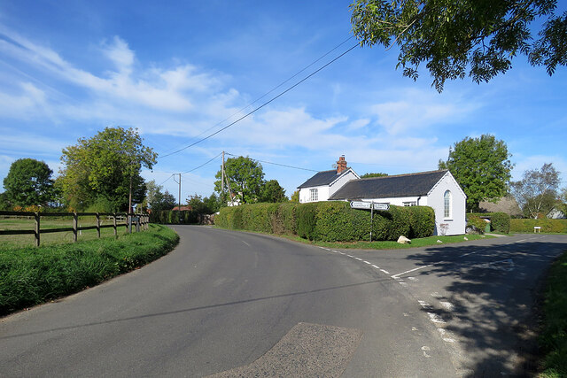
Brinkley is a small village located in the county of Cambridgeshire, England. Situated about 13 miles east of the city of Cambridge, it falls within the district of East Cambridgeshire. With a population of around 400 residents, it exudes a peaceful and tight-knit community atmosphere.

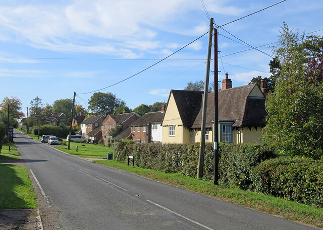
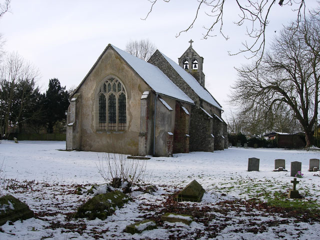
The village is characterized by its picturesque rural setting, surrounded by beautiful countryside and farmlands. Brinkley is known for its charming thatched cottages, which add to its traditional English village aesthetics. The village boasts a rich history, with evidence of settlements dating back to Roman times.

Despite its small size, Brinkley offers a range of amenities and services for its residents. There is a local primary school, providing education for children within the village and nearby areas. Additionally, Brinkley is home to a village hall, serving as a hub for community events and gatherings.

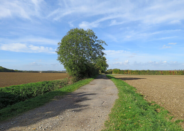
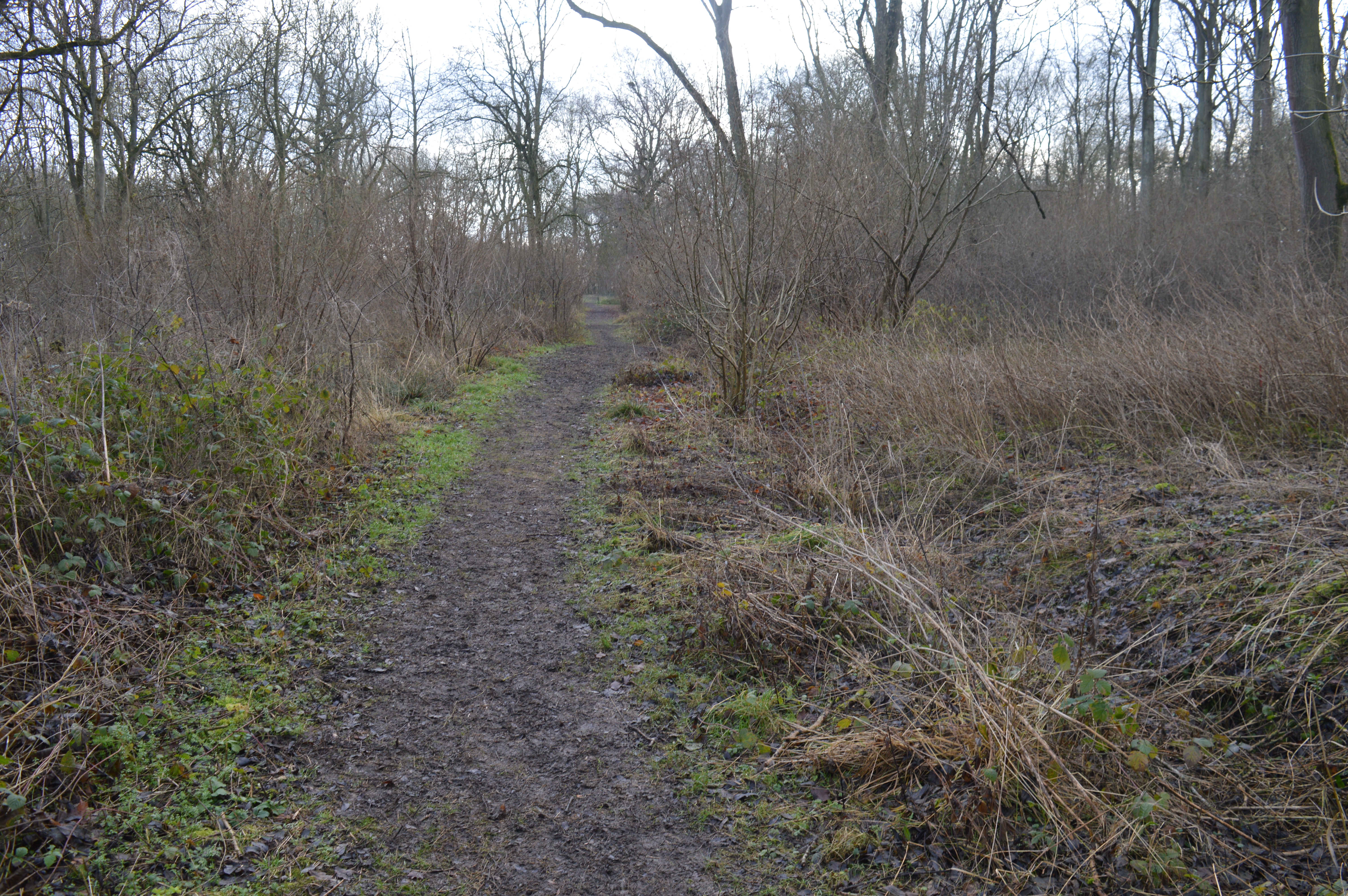
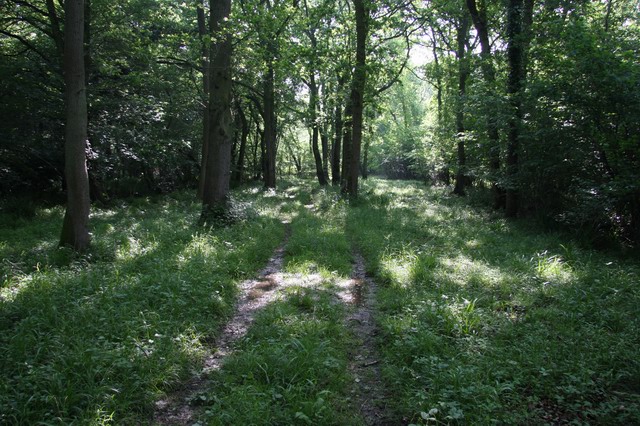
For outdoor enthusiasts, the village provides an ideal base for exploring the surrounding countryside. There are numerous footpaths and bridleways, allowing residents and visitors to enjoy leisurely walks and bike rides. The nearby Wicken Fen Nature Reserve offers opportunities for birdwatching and observing wildlife in their natural habitats.

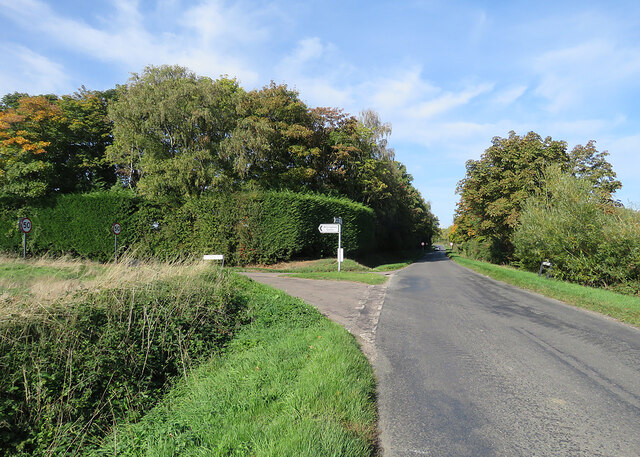
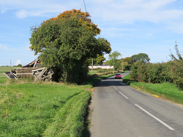
Transport links in Brinkley are limited, with no train station in the immediate vicinity. However, the village is well-connected by road, with the A11 passing nearby, providing easy access to Cambridge and other major towns in the region.

In summary, Brinkley is a tranquil and idyllic village in Cambridgeshire, offering a peaceful rural lifestyle amidst stunning natural landscapes.

If you have any feedback on the listing, please let us know in the comments section below.

Brinkley Images

Images are sourced within 2km of 52.166804/0.381865 or Grid Reference TL6254. Thanks to Geograph Open Source API. All images are credited.

Weston Colville: houses on Brinkley Road A fine October morning.
Weston Colville: houses on Brinkley Road
A fine October morning.
Bridleway to Grange Road The start of a track which ends at the road from Weston Colville to Dullingham, a mile and a half away.
Bridleway to Grange Road
The start of a track which ends at the road from Weston Colville to Dullingham, a mile and a half away.
Towards Weston Colville on Brinkley Road This is the winding B1052, between Willingham Green and Weston Colville, photographed on a bright October morning.
Towards Weston Colville on Brinkley Road
This is the winding B1052, between Willingham Green and Weston Colville, photographed on a bright October morning.
Cottages at Willingham Green A hamlet between Weston Colville and Brinkley (ahead) in the gentle hills of East Cambridgeshire.
Cottages at Willingham Green
A hamlet between Weston Colville and Brinkley (ahead) in the gentle hills of East Cambridgeshire.
Willingham Green Road This is a hamlet in East Cambridgeshire. The road leads to Carlton and on into Suffolk.
Willingham Green Road
This is a hamlet in East Cambridgeshire. The road leads to Carlton and on into Suffolk.
The start of a footpath at Willingham Green This is part of a complex network of footpaths linking Carlton, Brinkley and Weston Green.
The start of a footpath at Willingham Green
This is part of a complex network of footpaths linking Carlton, Brinkley and Weston Green.
Turn left for Willingham Green A turn off the road from Carlton to Brinkley (ahead), photographed on a sunny morning in early autumn.
Turn left for Willingham Green
A turn off the road from Carlton to Brinkley (ahead), photographed on a sunny morning in early autumn.
Collapsed shed, fallen apples, pink cottages and a red car Near Raynor's Bridge on the undulating road from Carlton to Brinkley (ahead). The pink row is Little Low Cottages.

Keith Edkins was here in 2018: <a href="https://www.geograph.org.uk/photo/5922622">TL6353 : Old shed at Raynor Bridge</a>.
Collapsed shed, fallen apples, pink cottages and a red car
Near Raynor's Bridge on the undulating road from Carlton to Brinkley (ahead). The pink row is Little Low Cottages. Keith Edkins was here in 2018: TL6353 : Old shed at Raynor Bridge.
Carlton: a cottage on Brinkley Road In the valley of the River Stour, which rises on nearby Wratting Common. The original parts of the Grade II listed cottage were built in the 18th century.
Carlton: a cottage on Brinkley Road
In the valley of the River Stour, which rises on nearby Wratting Common. The original parts of the Grade II listed cottage were built in the 18th century.
Carlton Hill: across the Stour Valley John Constable's Stour is a Suffolk river, but it rises not far from here, at Wratting Common near Weston Colville in the hills of East Cambridgeshire and reaches the sea at Manningtree in Essex. <a href="https://www.geograph.org.uk/photo/7307887">TL6453 : Carlton: a cottage on Brinkley Road</a> is a closer look at the house in the centre middle distance.
Carlton Hill: across the Stour Valley
John Constable's Stour is a Suffolk river, but it rises not far from here, at Wratting Common near Weston Colville in the hills of East Cambridgeshire and reaches the sea at Manningtree in Essex. TL6453 : Carlton: a cottage on Brinkley Road is a closer look at the house in the centre middle distance.
Carlton: former school and school house This is where Church Road, Brinkley Road (left) and Acre Road (right) meet. The picture was taken on a sunny October morning when only some trees' leaves had changed colour.
Carlton: former school and school house
This is where Church Road, Brinkley Road (left) and Acre Road (right) meet. The picture was taken on a sunny October morning when only some trees' leaves had changed colour.
Westley Waterless: water shortage After the drought summer of 2022 the water level looks low in the pond on Church Lane.

For comparison: <a href="https://www.geograph.org.uk/photo/3276200">TL6156 : Westley Waterless: Church Lane and pond</a> (2012).
Westley Waterless: water shortage
After the drought summer of 2022 the water level looks low in the pond on Church Lane. For comparison: TL6156 : Westley Waterless: Church Lane and pond (2012).
Westley Waterless: St Mary - restoration Two men were working on the bellcote - one on the lead, the other painting the louvres. The spirelet replaced a round tower which collapsed in 1855.

Inside are two exquisite 14th-century brasses: <a href="https://www.geograph.org.uk/photo/3276297">TL6156 : Westley Waterless: brass of Sir John Creke (detail)</a> and <a href="https://www.geograph.org.uk/photo/3276294">TL6156 : Westley Waterless: brass of Lady Creke (detail)</a>.
Westley Waterless: St Mary - restoration
Two men were working on the bellcote - one on the lead, the other painting the louvres. The spirelet replaced a round tower which collapsed in 1855. Inside are two exquisite 14th-century brasses: TL6156 : Westley Waterless: brass of Sir John Creke (detail) and TL6156 : Westley Waterless: brass of Lady Creke (detail).
Westley Waterless: building work A new house on Main Road
Westley Waterless: building work
A new house on Main Road
Converted water tower near Burrough Green A house on the B1061 between Dullingham and Brinkley.
Converted water tower near Burrough Green
A house on the B1061 between Dullingham and Brinkley.
Burrough End: the B1052 near the Westley Waterless turn <a href="https://www.geograph.org.uk/photo/3276486">TL6255 : Nearing Burrough End</a> is a winter view from the other side of the road, taken nearly ten years before.
Burrough End: the B1052 near the Westley Waterless turn
TL6255 : Nearing Burrough End is a winter view from the other side of the road, taken nearly ten years before.
On the B1052 Dullingham Road Nearing Fern Cottage, between Brinkley and Burrough End, on a sparkling October morning.
On the B1052 Dullingham Road
Nearing Fern Cottage, between Brinkley and Burrough End, on a sparkling October morning.
Brinkley: autumn sunlight The fine trees form an avenue to Brinkley Hall. <a href="https://www.geograph.org.uk/photo/3275507">TL6254 : Brinkley: winter sunlight</a> is a closer view, taken almost ten years before.
Brinkley: autumn sunlight
The fine trees form an avenue to Brinkley Hall. TL6254 : Brinkley: winter sunlight is a closer view, taken almost ten years before.
Show me another place!

Brinkley is located at Grid Ref: TL6254 (Lat: 52.166804, Lng: 0.381865)

Administrative County: Cambridgeshire

District: East Cambridgeshire

Police Authority: Cambridgeshire

What 3 Words

///candles.increased.beyond. Near Balsham, Cambridgeshire

Nearby Locations

Brinkley

Related Wikis

Brinkley, Cambridgeshire

Brinkley is a small village in Cambridgeshire, England. It is situated about 15 miles east of Cambridge and 5 miles south of Newmarket, the horse racing...

Park Wood, Cambridgeshire

Park Wood is an 8.1-hectare (20-acre) biological Site of Special Scientific Interest east of Brinkley in Cambridgeshire.This is woodland of the wet ash/maple...

Burrough Green

Burrough Green is a village and parish in Cambridgeshire, England. The population of the village at the 2011 census was 378. The soil is various; subsoil...

Westley Waterless

Westley Waterless is a small village and civil parish in East Cambridgeshire, England, 5 miles south west of Newmarket. == History == The parish of Westley...

Lower Wood

Lower Wood is a 9 hectare nature reserve east of Weston Colville in Cambridgeshire. It is managed by the Wildlife Trust for Bedfordshire, Cambridgeshire...

Weston Colville

Weston Colville is a village in South Cambridgeshire, 10 miles southeast of Cambridge and 6 miles south of Newmarket, close to the border with Suffolk...

Carlton, Cambridgeshire

Carlton is a village and civil parish near the eastern boundary of the county of Cambridgeshire in the east of England. It is in the district of South...

Out and Plunder Woods

Out and Plunder Woods is a 38.6-hectare (95-acre) biological Site of Special Scientific Interest between Great Bradley and Burrough Green in Cambridgeshire...

Nearby Amenities

Located within 500m of 52.166804,0.381865
Brinkley
Is In: Cambridgeshire, England, UK
Place: village
Wikidata: Q953314
Lat/Long: 52.1678912/0.3791921
Post Box
Collection Times: Mo-Fr 16:15; Sa 10:00
Operator: Royal Mail
Post Box Design: type_m
Post Box Type: pillar
Ref: CB8 116
Royal Cypher: EIIR
Royal Cypher Wikidata: Q33102113
Source: survey
Lat/Long: 52.167062/0.3806526
Leisure: playground
Lat/Long: 52.1659938/0.380882
Recycling
Lat/Long: 52.1662727/0.3830007
Bus Stop
Old School Lane
Naptan AtcoCode: 0500EBRIN001
Naptan Bearing: NW
Naptan CommonName: Old School Lane
Naptan Indicator: opp
Naptan Landmark: Old School Lane
Naptan NaptanCode: cmbdgjgt
Naptan ShortCommonName: Old School Lane
Naptan Street: High Street
Naptan Verified: no
Source: naptan_import
Lat/Long: 52.1643233/0.3860829
Bus Stop
Weston Colville Road
Naptan AtcoCode: 0500EBRIN002
Naptan Bearing: NW
Naptan BusStopType: CUS
Naptan CommonName: Weston Colville Road
Naptan Indicator: near
Naptan Landmark: Weston Colville Road
Naptan NaptanCode: cmbdgjgw
Naptan ShortCommonName: Weston Colville Rd
Naptan Street: High Street
Naptan Verified: no
Source: naptan_import
Lat/Long: 52.1678454/0.3786667
Bus Stop
Weston Colville Road
Naptan AtcoCode: 0500EBRIN003
Naptan Bearing: SE
Naptan BusStopType: CUS
Naptan CommonName: Weston Colville Road
Naptan Indicator: opp
Naptan Landmark: Weston Colville Road
Naptan NaptanCode: cmbdgjma
Naptan ShortCommonName: Weston Colville Rd
Naptan Street: High Street
Naptan Verified: no
Source: naptan_import
Lat/Long: 52.1679173/0.3786705
Bus Stop
Brinkley Road
Naptan AtcoCode: 0500EBRIN004
Naptan Bearing: W
Naptan BusStopType: CUS
Naptan CommonName: Brinkley Road
Naptan Indicator: opp
Naptan Landmark: Brinkley Road
Naptan NaptanCode: cmbdgjmd
Naptan ShortCommonName: Brinkley Road
Naptan Street: High Street
Naptan Verified: no
Source: naptan_import
Lat/Long: 52.1684086/0.3766054
Bus Stop
Brinkley Road
Naptan AtcoCode: 0500EBRIN005
Naptan Bearing: E
Naptan BusStopType: CUS
Naptan CommonName: Brinkley Road
Naptan Indicator: near
Naptan Landmark: Brinkley Road
Naptan NaptanCode: cmbdgjmg
Naptan ShortCommonName: Brinkley Road
Naptan Street: High Street
Naptan Verified: no
Source: naptan_import
Lat/Long: 52.1684804/0.3766093
Bus Stop
Beechcroft
Naptan AtcoCode: 0500EBRIN006
Naptan Bearing: NW
Naptan BusStopType: CUS
Naptan CommonName: Beechcroft
Naptan Indicator: near
Naptan Landmark: Beechcroft
Naptan NaptanCode: cmbdgjmj
Naptan ShortCommonName: Beechcroft
Naptan Street: High Street
Naptan Verified: no
Source: naptan_import
Lat/Long: 52.1668029/0.3817552
Bus Stop
Beechcroft
Naptan AtcoCode: 0500EBRIN007
Naptan Bearing: SE
Naptan BusStopType: CUS
Naptan CommonName: Beechcroft
Naptan Indicator: opp
Naptan Landmark: Hall Lane
Naptan NaptanCode: cmbdgjmp
Naptan ShortCommonName: Beechcroft
Naptan Street: High Street
Naptan Verified: no
Source: naptan_import
Lat/Long: 52.1668736/0.3818175
Bus Stop
Green Park
Naptan AtcoCode: 0500EBRIN009
Naptan Bearing: N
Naptan BusStopType: CUS
Naptan CommonName: Green Park
Naptan Indicator: near
Naptan Landmark: Green Park
Naptan NaptanCode: cmbdgjmw
Naptan ShortCommonName: Green Park
Naptan Street: Weston Colville Road
Naptan Verified: no
Source: naptan_import
Lat/Long: 52.1675512/0.3780953
Bus Stop
Old School Lane
Naptan AtcoCode: 0500EBRIN010
Naptan Bearing: SE
Naptan BusStopType: CUS
Naptan CommonName: Old School Lane
Naptan Indicator: near
Naptan Landmark: Old School Lane
Naptan NaptanCode: cmbgdtdm
Naptan ShortCommonName: Old School Lane
Naptan Street: High Street
Naptan Verified: no
Source: naptan_import
Lat/Long: 52.1643959/0.3862306
Bus Stop
Green Park
Naptan AtcoCode: 0500EBRIN011
Naptan Bearing: S
Naptan BusStopType: CUS
Naptan CommonName: Green Park
Naptan Indicator: opp
Naptan Landmark: Green Park
Naptan NaptanCode: cmbgdpwp
Naptan ShortCommonName: Green Park
Naptan Street: Weston Colville Road
Naptan Verified: no
Source: naptan_import
Lat/Long: 52.1675575/0.3782272
Power: pole
Lat/Long: 52.1652983/0.3816728
Power: pole
Lat/Long: 52.1656601/0.3753855
Power: pole
Lat/Long: 52.1653738/0.3788136
Power: pole
Lat/Long: 52.1642684/0.3823967
Power: pole
Lat/Long: 52.1691646/0.3849772
Power: pole
Lat/Long: 52.1637058/0.3846125
Power: pole
Lat/Long: 52.163989/0.3834377
Power: pole
Lat/Long: 52.1638705/0.3854011
Power: pole
Lat/Long: 52.1646118/0.3812722
Power: pole
Lat/Long: 52.1690213/0.3779365
Power: pole
Lat/Long: 52.1693882/0.3767912
Power: pole
Lat/Long: 52.1643735/0.3794874
Power: pole
Lat/Long: 52.1691117/0.3773517
Power: pole
Lat/Long: 52.1697564/0.3783037
Power: pole
Lat/Long: 52.1693914/0.378092
Power: pole
Lat/Long: 52.1635541/0.3788884
Barrier: kissing_gate
Lat/Long: 52.1670643/0.3860738
Barrier: kissing_gate
Lat/Long: 52.167172/0.3873876
Telephone
Defibrillator
Booth: K6
Defibrillator Location: inside red phone box opposite Memorial Hall, Brinkley
Emergency: defibrillator
Man Made: telephone_box
Ref GB The Circuit: FB1F4220-6BB7-4274-816D-B07A00EB7B00
Lat/Long: 52.1663886/0.383205
Bench
Lat/Long: 52.1662101/0.3833076
Barrier: kissing_gate
Lat/Long: 52.1664356/0.3831213
The data included in this document is from www.openstreetmap.org. The data is made available under ODbL.

Have you been to Brinkley?

Leave your review of Brinkley below (or comments, questions and feedback).