Bentley Pauncefoot

Civil Parish in Worcestershire Bromsgrove

England

Bentley Pauncefoot

Cur Lane
Cur Lane Credit: Martin Wilson

Bentley Pauncefoot is a civil parish located in the county of Worcestershire, England. It is situated approximately 10 miles southwest of the city of Worcester and covers an area of about 1.5 square miles. The parish is part of the Wychavon district and falls within the administrative boundaries of the West Midlands region.

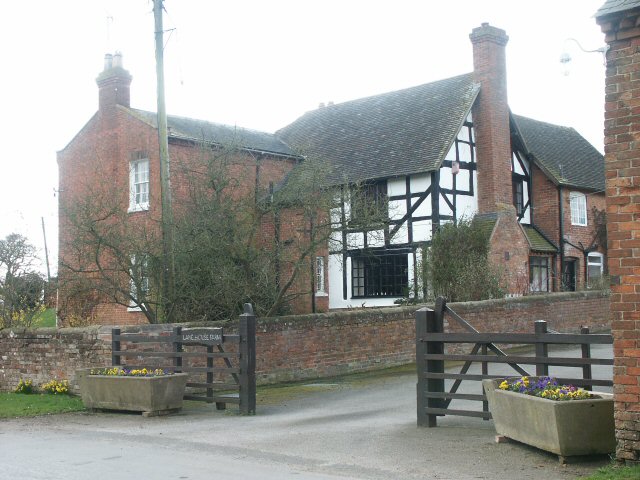
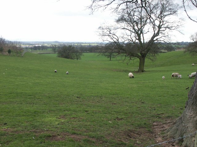
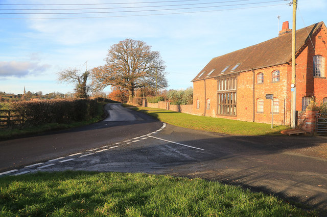
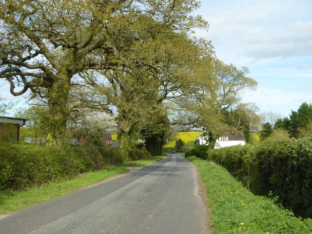
Bentley Pauncefoot is a small, rural parish with a population of around 300 residents. The area is characterized by its picturesque countryside, rolling hills, and charming historic buildings. The parish is predominantly residential, with a mix of traditional stone cottages and modern houses.

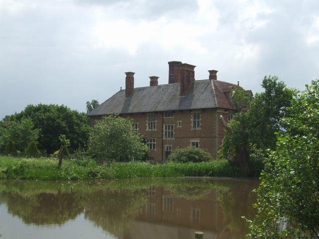
The heart of Bentley Pauncefoot is the village center, which features a few local amenities including a village hall and a small shop. The village also boasts a medieval church, St. Mary's, which is a significant historical landmark.

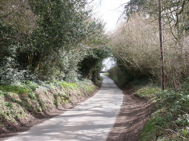
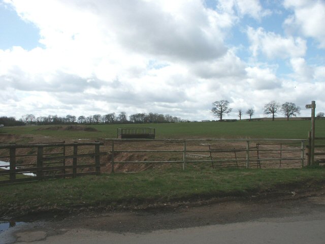
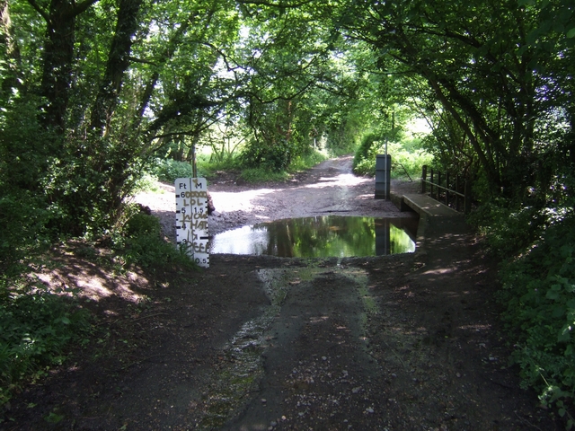
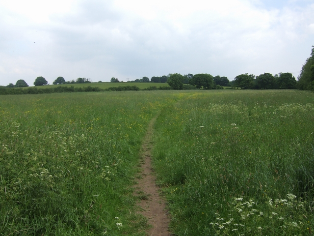
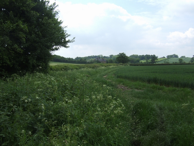
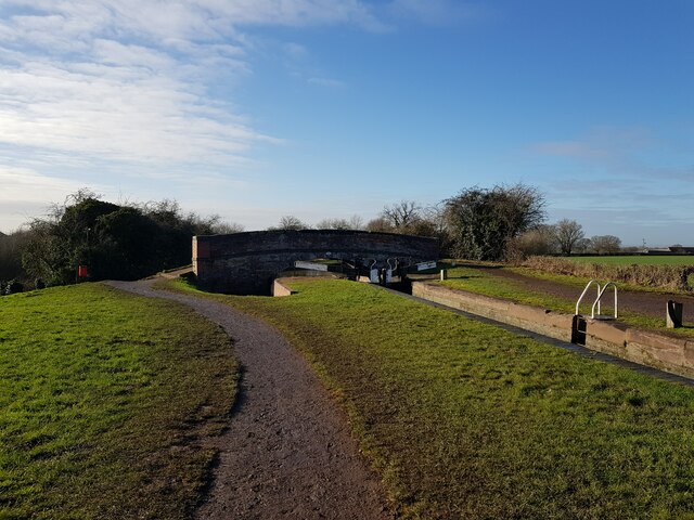
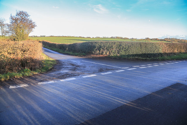
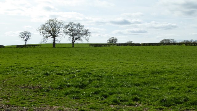
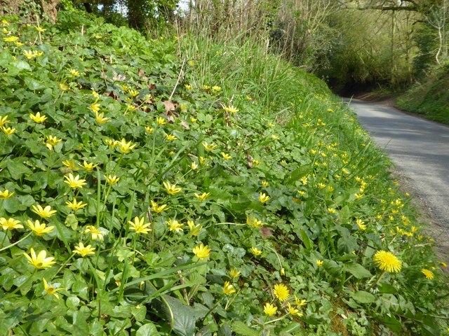
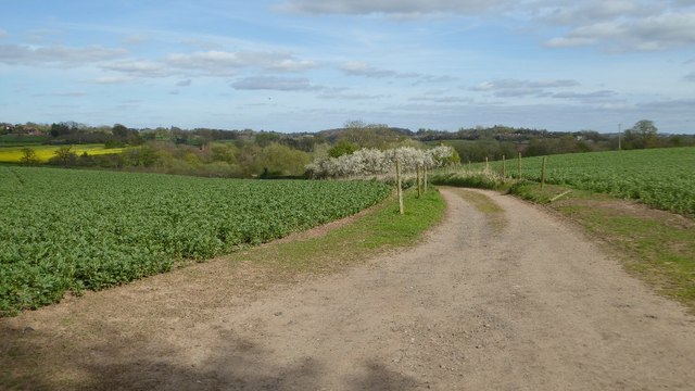
The surrounding area is mainly agricultural, with vast farmlands and open fields. The landscape offers scenic views and is ideal for countryside walks and outdoor activities. Bentley Pauncefoot is also known for its proximity to the River Avon, which runs through the nearby village of Pershore.

Overall, Bentley Pauncefoot is a peaceful and idyllic parish, offering a rural lifestyle with easy access to nearby towns and cities. Its natural beauty and historical charm make it an attractive place to live for those seeking a tranquil setting away from the hustle and bustle of urban life.

If you have any feedback on the listing, please let us know in the comments section below.

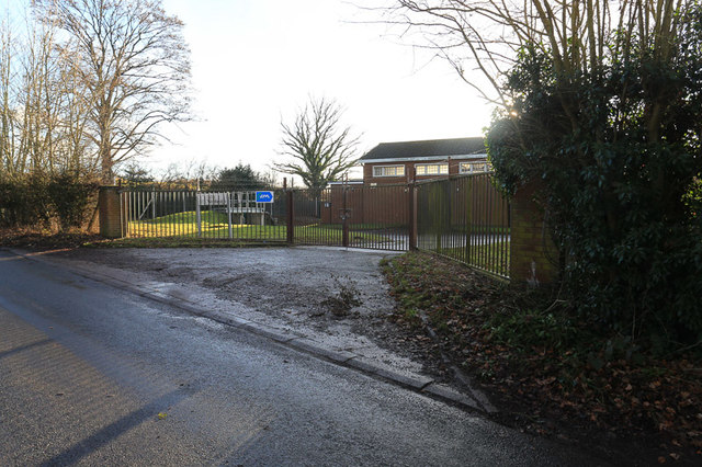
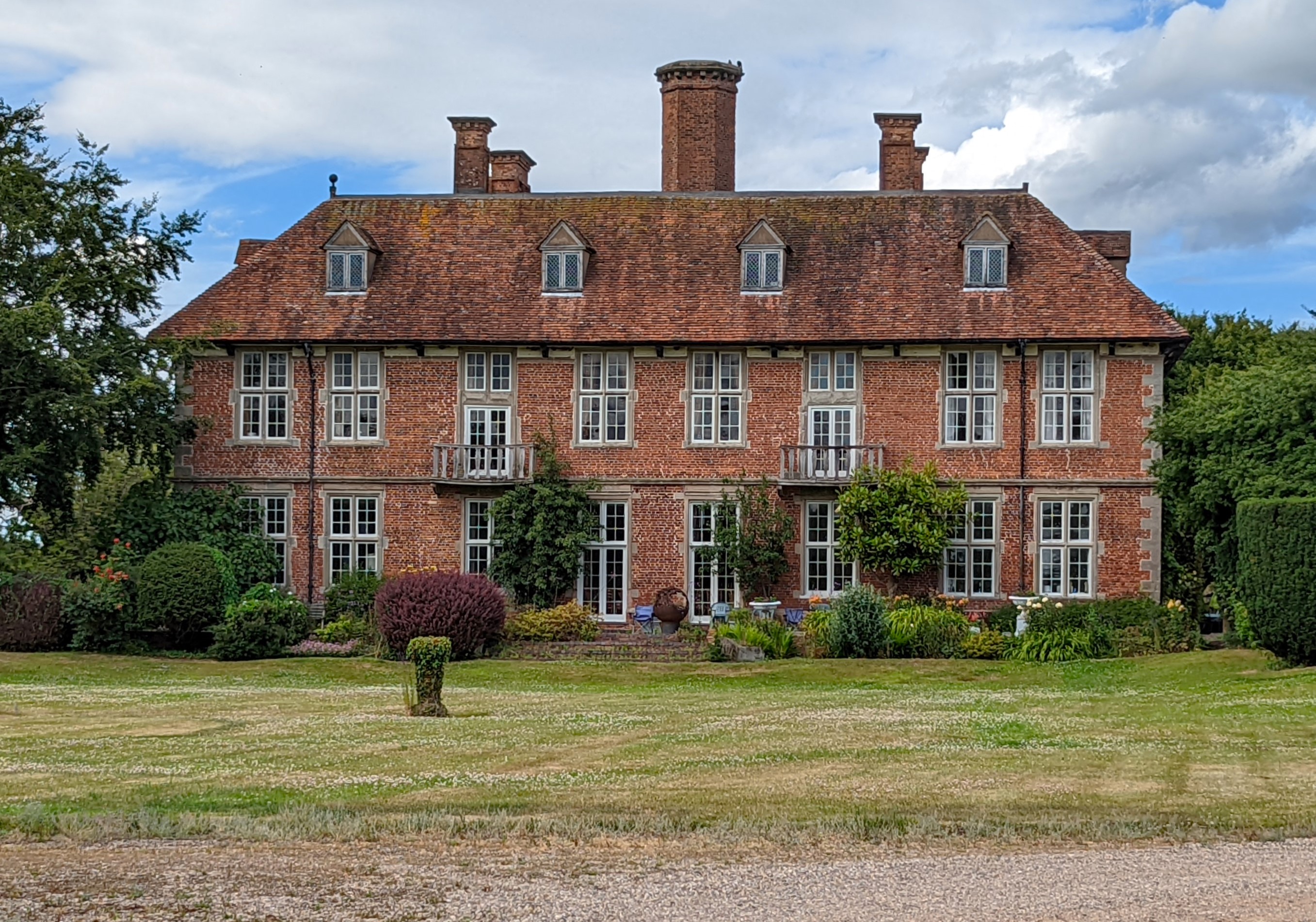
Bentley Pauncefoot Images

Images are sourced within 2km of 52.298374/-2.012344 or Grid Reference SO9966. Thanks to Geograph Open Source API. All images are credited.

Cur Lane
Cur Lane
Stream, field and footpath
Lane House Farm
Lane House Farm
Where sheep may safely graze... with the Malvern Hills in the far distance, though indistinguishable on this photo.
Where sheep may safely graze...
with the Malvern Hills in the far distance, though indistinguishable on this photo.
Ford on the Spring Brook The road was closed even to cyclists on NCN 5.
Ford on the Spring Brook
The road was closed even to cyclists on NCN 5.
Rear view of Norgrove Court Taken from the Monarch's Way this view of the older part of the building shows the 1593 fenestration. The front of the building was extended in 1649. There is a secret priest hole which may suggest the family held Catholic sympathies.

At the time of King Charles II's escape following the Battle of Worcester in September 1651 this would have been a prominent building and it is reputed that he may have stayed overnight on his journey to Bristol. However, this is disputed by the current owners as groundless.
Rear view of Norgrove Court
Taken from the Monarch's Way this view of the older part of the building shows the 1593 fenestration. The front of the building was extended in 1649. There is a secret priest hole which may suggest the family held Catholic sympathies. At the time of King Charles II's escape following the Battle of Worcester in September 1651 this would have been a prominent building and it is reputed that he may have stayed overnight on his journey to Bristol. However, this is disputed by the current owners as groundless.
Monarch's Way - Crumpfield The footpath drops down towards Norgrove Court.
Monarch's Way - Crumpfield
The footpath drops down towards Norgrove Court.
Monarch's Way approaching Norgrove Court Tucked away in the countryside between Bromsgrove and Redditch, Norgrove Court is reputed to have been one of the houses where King Charles II may have rested during his flight from the Battle of Worcester in September 1651. The Monarch's Way passes the house on its way south.
Monarch's Way approaching Norgrove Court
Tucked away in the countryside between Bromsgrove and Redditch, Norgrove Court is reputed to have been one of the houses where King Charles II may have rested during his flight from the Battle of Worcester in September 1651. The Monarch's Way passes the house on its way south.
Lock and Grimley Lane Bridge The Worcester and Birmingham Canal.
Lock and Grimley Lane Bridge
The Worcester and Birmingham Canal.
Webheath Pumping Station, Curr Lane Severn Trent building in Curr Lane.  Note that the OS map refers to it as Cur Lane but the road signs there spell it CURR LANE. Update of <a href="https://www.geograph.org.uk/photo/3580130">SP0066 : Webheath Pumping Station</a>.
Webheath Pumping Station, Curr Lane
Severn Trent building in Curr Lane. Note that the OS map refers to it as Cur Lane but the road signs there spell it CURR LANE. Update of SP0066 : Webheath Pumping Station.
Road junction, Curr Lane / Gypsy Lane Note that the OS map calls it Cur Lane but the local road signs are CURR LANE.
Road junction, Curr Lane / Gypsy Lane
Note that the OS map calls it Cur Lane but the local road signs are CURR LANE.
Road junction, Gypsy Lane/ Holyoakes Lane, Nr. Hewell This updates <a href="https://www.geograph.org.uk/photo/3580139">SP0068 : Holyoakes Barn</a> from 2013, with Holyoakes Barn in the background.
Road junction, Gypsy Lane/ Holyoakes Lane, Nr. Hewell
This updates SP0068 : Holyoakes Barn from 2013, with Holyoakes Barn in the background.
Field at Springhill Farm
Farmland south of Cur Lane Farmland south of Cur Lane to the west of Redditch.
Farmland south of Cur Lane
Farmland south of Cur Lane to the west of Redditch.
Cur Lane Cur Lane at Webheath on the western edge of Redditch.
Cur Lane
Cur Lane at Webheath on the western edge of Redditch.
Yellow flowers on the verge Yellow flowers on the verge of Cur Lane.
Yellow flowers on the verge
Yellow flowers on the verge of Cur Lane.
Cur Lane Cur Lane in the springtime.
Cur Lane
Cur Lane in the springtime.
Bridleway off Bentley Lane The bridleway passes through farmland and leads down to Norgrove Court.
Bridleway off Bentley Lane
The bridleway passes through farmland and leads down to Norgrove Court.
Show me another place!

Bentley Pauncefoot is located at Grid Ref: SO9966 (Lat: 52.298374, Lng: -2.012344)

Administrative County: Worcestershire

District: Bromsgrove

Police Authority: West Mercia

What 3 Words

///condensed.guidebook.dressing. Near Redditch, Worcestershire

Related Wikis

Upper Bentley

Upper Bentley is a village in Worcestershire, England. It is located between the towns of Redditch and Bromsgrove. It is near the villages of Elcocks Brook...

Tardebigge Lake

Tardebigge Lake is a large feeder reservoir, about 25 acres (100,000 m2) in size, built to supply water for the famous flight of locks running from Tardebigge...

Norgrove Court

Norgrove Court is a stately home near Redditch in North Eastern Worcestershire built in 1649. It is listed Grade I on the National Heritage List for England...

Tardebigge Engine House

Tardebigge Engine House (grid reference SO988689) is a former canal-pumping engine house at Tardebigge, Worcestershire, England. It is grade II listed...

Tardebigge Locks

Tardebigge Locks or the Tardebigge Flight is the longest flight of locks in the UK, comprising 30 narrow locks on a two-and-a-quarter-mile (3.6 km) stretch...

Tardebigge

Tardebigge () is a village in Worcestershire, England. The village is most famous for the Tardebigge Locks, a flight of 30 canal locks that raise the Worcester...

Webheath

Webheath is a district of Redditch, in Worcestershire, England. The district neighbours Batchley, Headless Cross and the village of Callow Hill. It is...
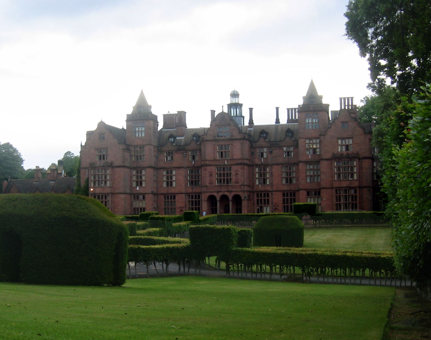
Hewell Grange

Hewell Grange is a former country house in Tardebigge, Worcestershire, England. "One of the most important late 19th century country houses in England...

Nearby Amenities

Located within 500m of 52.298374,-2.012344
Bus Stop
Old Garage
Bus: yes
Naptan AtcoCode: 2000G632001
Naptan Bearing: SW
Naptan CommonName: Old Garage
Naptan Crossing: Banks Green
Naptan Indicator: Adj
Naptan Landmark: Old Garage
Naptan NaptanCode: wocdmgpj
Naptan Street: Copyholt Lane
Naptan Verified: no
Public Transport: platform
Source: naptan_import
Lat/Long: 52.3026199/-2.0105592
Power: pole
Lat/Long: 52.3021177/-2.0153582
Power: pole
Lat/Long: 52.3027541/-2.0129462
Power: pole
Lat/Long: 52.3022608/-2.0138448
Banks Green
Power: pole
Transformer: distribution
Voltage Primary: 11000
Lat/Long: 52.3024006/-2.012383
Power: pole
Lat/Long: 52.3024691/-2.0117325
Power: pole
Lat/Long: 52.3022042/-2.011349
Power: pole
Lat/Long: 52.3019143/-2.0109238
Power: pole
Lat/Long: 52.3016056/-2.0104773
Power: pole
Lat/Long: 52.3008605/-2.0099925
Location Transition: yes
Power: pole
Lat/Long: 52.3005374/-2.0098101
Location Transition: yes
Power: pole
Lat/Long: 52.2996902/-2.0092213
Power: pole
Lat/Long: 52.2994126/-2.0090269
Upper Bentley Farm
Power: pole
Transformer: distribution
Voltage Primary: 11000
Lat/Long: 52.2990259/-2.0087855
Power: pole
Lat/Long: 52.2986494/-2.0085427
Power: pole
Lat/Long: 52.2979786/-2.0088512
Power: pole
Lat/Long: 52.2973282/-2.009165
Power: pole
Lat/Long: 52.296622/-2.0091127
Becks Corner
Power: pole
Transformer: distribution
Voltage Primary: 11000
Lat/Long: 52.2958428/-2.0090657
Location Transition: yes
Power: pole
Lat/Long: 52.2955758/-2.0088659
Location Transition: yes
Power: pole
Lat/Long: 52.295274/-2.0077233
Power: pole
Lat/Long: 52.2952473/-2.0076596
The data included in this document is from www.openstreetmap.org. The data is made available under ODbL.

Have you been to Bentley Pauncefoot?

Leave your review of Bentley Pauncefoot below (or comments, questions and feedback).