Belton
Civil Parish in Lincolnshire
England
Belton

Belton is a civil parish located in the county of Lincolnshire, England. It is situated approximately 5 miles east of Grantham and 10 miles west of Sleaford. The parish covers an area of around 3.5 square miles and has a population of approximately 1,200 people.
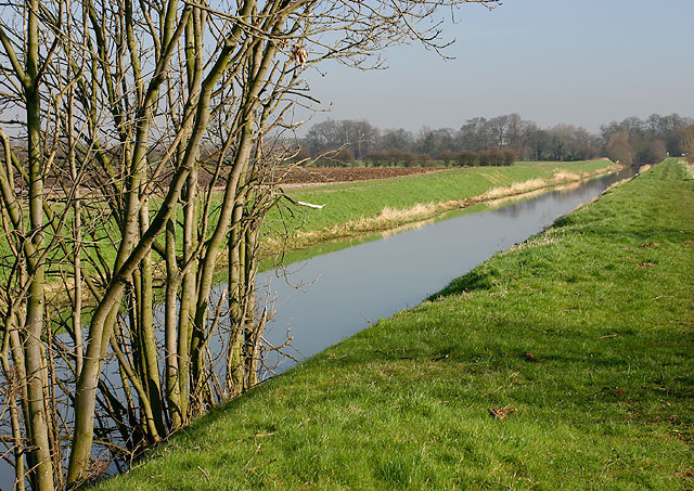
Belton is a predominantly rural area characterized by its picturesque countryside and charming village atmosphere. The parish is known for its beautiful landscapes, including rolling hills, open fields, and small woodlands, making it an ideal location for outdoor activities such as walking, cycling, and horse riding.
The village itself is small but offers a range of amenities for its residents. These include a primary school, a village hall, a post office, and a few local shops. The village also has a pub, which serves as a social hub for the community.
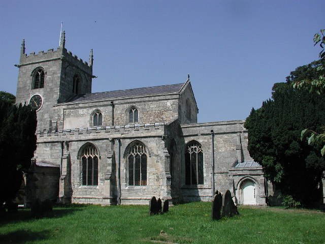
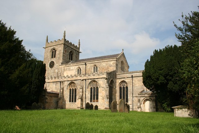
Belton has a rich history, with several historical buildings and landmarks scattered throughout the area. One notable landmark is the Church of St. Peter and St. Paul, a Grade I listed building dating back to the 12th century. The church features impressive architectural details and is a popular destination for history enthusiasts and visitors.
Overall, Belton, Lincolnshire, is a charming and peaceful civil parish that offers a rural lifestyle with access to basic amenities and a strong sense of community. It is an idyllic place for those seeking a tranquil and picturesque setting in the heart of the English countryside.
If you have any feedback on the listing, please let us know in the comments section below.
Belton Images
Images are sourced within 2km of 53.563824/-0.823603 or Grid Reference SE7808. Thanks to Geograph Open Source API. All images are credited.

![Recycled Chapel, Westgate The inscription on the yellow rectangle above the high doors reads: "When God makes up his last account / of Holy Children in his mount; / T'will be an honour to appear / as one new-born [and] nourished here." This seems to be a slight variation of the Isaac Watts version of Psalm 87.](https://s2.geograph.org.uk/photos/14/05/140514_5bd12a03.jpg)


Belton is located at Grid Ref: SE7808 (Lat: 53.563824, Lng: -0.823603)
Unitary Authority: North Lincolnshire
Police Authority: Humberside
What 3 Words
///yummy.applauded.photocopy. Near Belton, Lincolnshire
Related Wikis
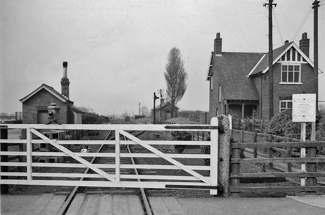
Belton railway station
Belton railway station was a station that served the village of Belton on the Isle of Axholme in Lincolnshire, England on the Axholme Joint Railway....
Belton, North Lincolnshire
Belton is a village and civil parish in the Isle of Axholme area of North Lincolnshire, England. It is situated on the A161 road, and approximately 6 miles...

Bracon
Bracon is a hamlet in North Lincolnshire, England. Bracon lies within the Isle of Axholme and the civil parish of Belton, a village to the north to which...
Hyrst Priory
Hyrst (or Hirst) Priory was a priory just south of the town of Crowle in the Isle of Axholme, Lincolnshire, England. It was dedicated to St. Mary. ��2...

Hirst Priory
Hirst Priory is an 18th-century country house in Belton on the Isle of Axholme, North Lincolnshire, United Kingdom. The current house was built on the...

Brigg and Goole (UK Parliament constituency)
Brigg and Goole is a constituency in Yorkshire and Lincolnshire represented in the House of Commons of the UK Parliament since 2010 by Andrew Percy, a...

Isle of Axholme Rural District
Isle of Axholme was a rural district in Lincolnshire, Parts of Lindsey from 1894 to 1974. It was formed under the Local Government Act 1894 based on the...

Sandtoft Airfield
Sandtoft Airfield (ICAO: EGCF), also known as Sandtoft Aerodrome, is in Belton, North Lincolnshire, England on the south side of the M180 motorway, approximately...
Nearby Amenities
Located within 500m of 53.563824,-0.823603Have you been to Belton?
Leave your review of Belton below (or comments, questions and feedback).