Belstead

Civil Parish in Suffolk Babergh

England

Belstead

Carpet of Bluebells Carpet of Bluebells in wood May 2005.
Carpet of Bluebells Credit: Keith Evans

Belstead is a civil parish located in the county of Suffolk, in eastern England. It is situated approximately three miles south of the historic town of Ipswich, on the eastern bank of the River Orwell. Belstead covers an area of around 3.5 square miles and has a population of approximately 1,000 residents.

The parish has a rich historical background, with evidence of human settlement dating back to the Roman period. The name "Belstead" is derived from the Old English words "beo," meaning bee, and "stede," meaning a place or settlement. This suggests that the area may have been known for its beekeeping activities in the past.

Belstead is predominantly a rural area, characterized by its picturesque countryside, farmland, and woodland areas. The landscape is dotted with charming cottages, traditional farmhouses, and historic buildings, adding to the area's quaint charm.

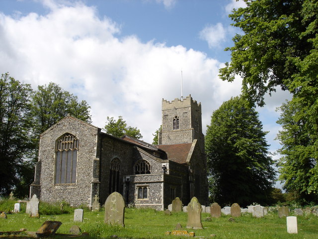
The parish is home to St. Mary's Church, a beautiful medieval church dating back to the 14th century. The church features stunning architectural details and houses several notable monuments and memorials. It serves as a focal point for the local community and holds regular religious services and events.

Belstead is well-connected to the nearby town of Ipswich, which offers a range of amenities, including shops, schools, and leisure facilities. The parish is also close to major road networks, making it easily accessible by car.

Overall, Belstead offers a peaceful and idyllic countryside setting, making it an attractive place to live for those seeking a rural lifestyle while still being within reach of urban amenities.

If you have any feedback on the listing, please let us know in the comments section below.
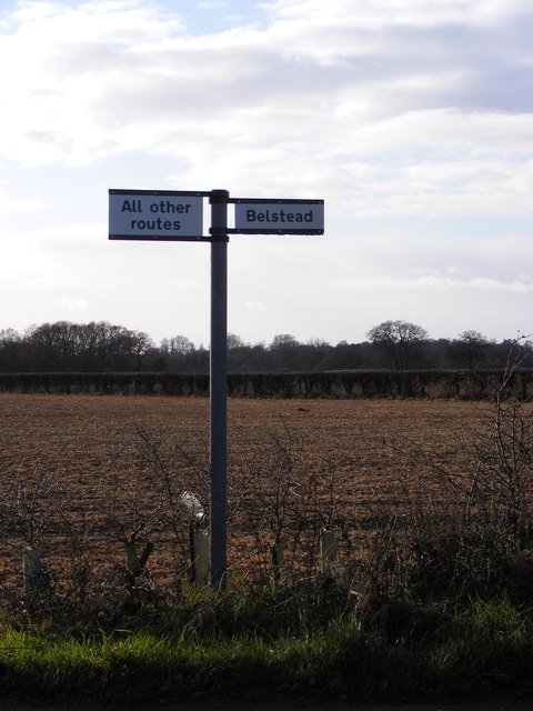
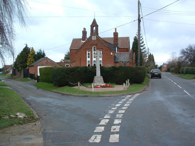
Belstead Images

Images are sourced within 2km of 52.024137/1.098721 or Grid Reference TM1240. Thanks to Geograph Open Source API. All images are credited.

Carpet of Bluebells Carpet of Bluebells in wood May 2005.
Carpet of Bluebells
Carpet of Bluebells in wood May 2005.
Four Trees Four trees in a field near to Blacksmiths Corner Belstead Suffolk.
Four Trees
Four trees in a field near to Blacksmiths Corner Belstead Suffolk.
To Bentley Old Hall This track lead to Bentley Old Hall Suffolk.
To Bentley Old Hall
This track lead to Bentley Old Hall Suffolk.
Bentley Manor Distant view of Bentley Manor Suffolk.
Bentley Manor
Distant view of Bentley Manor Suffolk.
A14 eastbound at junction 55 for Ipswich
A14 westbound near Ipswich
A14 westbound approaching junction 55
Leaving the A14 westbound at junction 55
A12 southbound nearing junctions 32 and 32a
Pizza Hut on London Road, Ipswich
The A12, Belstead
The A12, Belstead
The A12, Belstead
The A12, Belstead
Footpath and farm buildings, Hubbard's Hall Farm This public footpath leads past some farm buildings at Hubbard's Hall Farm, Bentley.
Footpath and farm buildings, Hubbard's Hall Farm
This public footpath leads past some farm buildings at Hubbard's Hall Farm, Bentley.
Footpath bridge over railway, near Bentley Manor This bridge over the Great Eastern Main Line carries a track and public footpath. Very similar in design to <a href="https://www.geograph.org.uk/photo/2457558">TM1238 : Bentley railway bridge</a>.
Footpath bridge over railway, near Bentley Manor
This bridge over the Great Eastern Main Line carries a track and public footpath. Very similar in design to TM1238 : Bentley railway bridge.
Farm track near Bentley Old Hall This track leads to Old Hall Wood, and is not marked as a public footpath.
Farm track near Bentley Old Hall
This track leads to Old Hall Wood, and is not marked as a public footpath.
The Street Looking towards Blacksmith's Corner at the exit to Pannington Hall Farm (Jimmys Farm).
The Street
Looking towards Blacksmith's Corner at the exit to Pannington Hall Farm (Jimmys Farm).
The Street Looking towards the A137 at the exit to Pannington Hall Farm (Jimmys Farm).
The Street
Looking towards the A137 at the exit to Pannington Hall Farm (Jimmys Farm).
Roadsign on The Street At the exit to Pannington Hall Farm (Jimmys Farm).
Roadsign on The Street
At the exit to Pannington Hall Farm (Jimmys Farm).
Show me another place!

Belstead is located at Grid Ref: TM1240 (Lat: 52.024137, Lng: 1.098721)

Administrative County: Suffolk

District: Babergh

Police Authority: Suffolk

What 3 Words

///outlines.less.motorist. Near Capel St Mary, Suffolk

Nearby Locations

Belstead

Related Wikis

Ipswich Hoard

There are two notable Ipswich Hoards (which is to say, ancient hoards found in Ipswich, the county town of Suffolk, England). The first was a hoard of...

Belstead

Belstead is a village and civil parish in the Babergh district of the English county of Suffolk. Located on the southern edge of Ipswich, around 3 miles...

Old London Road

Old London Road is a cricket ground in Copdock, Suffolk. The first recorded match on the ground was in 1847, when the Gentlemen of Suffolk played the...

Copdock

Copdock is a village and former civil parish, now in the parish of Copdock and Washbrook, in the Babergh district, in the county of Suffolk, England. In...

Nearby Amenities

Located within 500m of 52.024137,1.098721
Power: pole
Lat/Long: 52.0213984/1.1037532
Power: pole
Lat/Long: 52.0227568/1.103206
Power: pole
Lat/Long: 52.026731/1.0934562
Power: pole
Lat/Long: 52.0254944/1.0965125
Power: pole
Lat/Long: 52.0240376/1.1000651
Power: pole
Lat/Long: 52.0260824/1.0950682
Power: pole
Lat/Long: 52.0225522/1.1036888
Power: pole
Lat/Long: 52.0233114/1.1018434
Power: pole
Lat/Long: 52.0247654/1.0982895
Crossing: informal
Lat/Long: 52.0255131/1.1010965
Entrance: main
Lat/Long: 52.0274476/1.0983995
Man Made: village_sign
Lat/Long: 52.0253052/1.1052469
Defibrillator
Access: yes
Defibrillator Location: outside Belstead Village Hall
Emergency: defibrillator
Indoor: no
Ref GB The Circuit: 5579E302-200B-45CC-A2C1-B11B00BD3F52
Lat/Long: 52.0254944/1.1054032
Entrance: yes
Lat/Long: 52.0254712/1.1054015
The data included in this document is from www.openstreetmap.org. The data is made available under ODbL.

Have you been to Belstead?

Leave your review of Belstead below (or comments, questions and feedback).