Brineton

Settlement in Staffordshire South Staffordshire

England

Brineton

Great Chatwell House farmhouse The core of this substantial rural farmhouse is 18th century, with a later additional bay on the right. It was Grade II listed <span class="nowrap"><a title="https://historicengland.org.uk/listing/the-list/list-entry/1178111" rel="nofollow ugc noopener" href="https://historicengland.org.uk/listing/the-list/list-entry/1178111">Link</a><img style="margin-left:2px;" alt="External link" title="External link - shift click to open in new window" src="https://s1.geograph.org.uk/img/external.png" width="10" height="10"/></span> & <span class="nowrap"><a title="https://britishlistedbuildings.co.uk/101178111-great-chatwell-house-farmhouse-and-attached-implement-shed-blymhill-and-weston-under-lizard" rel="nofollow ugc noopener" href="https://britishlistedbuildings.co.uk/101178111-great-chatwell-house-farmhouse-and-attached-implement-shed-blymhill-and-weston-under-lizard">Link</a><img style="margin-left:2px;" alt="External link" title="External link - shift click to open in new window" src="https://s1.geograph.org.uk/img/external.png" width="10" height="10"/></span> in 1985, along with the single-storey implement shed seen here to its left (which looks to have been converted to residential use)
Great Chatwell House farmhouse Credit: Richard Law

Brineton is a small village located in the county of Staffordshire, England. Situated approximately 4 miles southwest of the town of Newport, it is nestled in the picturesque countryside of the West Midlands region. With a population of around 500 residents, Brineton has a distinct rural charm that attracts visitors seeking tranquility and natural beauty.

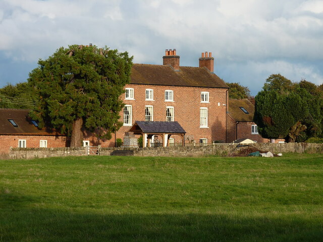
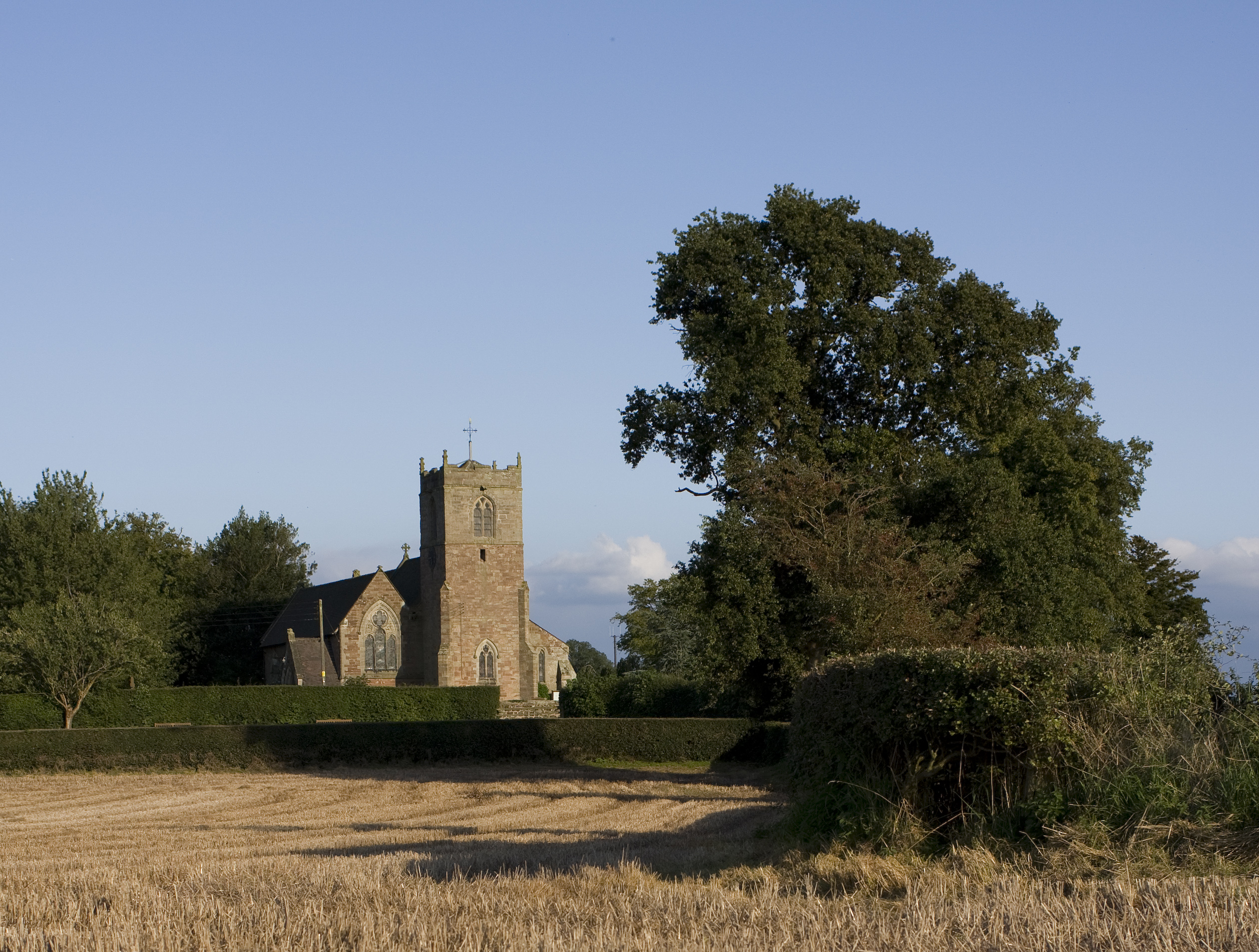
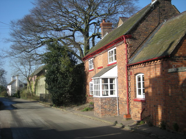
The village is known for its well-preserved historic buildings, including the Grade II listed St. Chad's Church, which dates back to the 13th century. Its unique architectural features and stained glass windows offer a glimpse into the village's rich history. Brineton also boasts a number of traditional thatched cottages, which add to its quaint and traditional atmosphere.

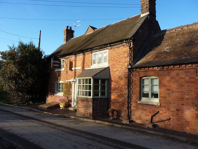
Despite its small size, Brineton is well-served by local amenities. The village has a primary school, a community hall, and a local pub that serves as a popular meeting place for both residents and visitors. Additionally, a range of shops, supermarkets, and other facilities can be found in the nearby town of Newport, providing further convenience for the village's residents.

Nature enthusiasts will appreciate the scenic surroundings of Brineton. The village is surrounded by rolling hills, lush green fields, and meandering streams, making it an ideal location for outdoor activities such as hiking, cycling, and birdwatching. The nearby Shropshire Hills and Cannock Chase Area of Outstanding Natural Beauty offer further opportunities for exploration and enjoyment of the great outdoors.

In conclusion, Brineton is a charming and idyllic village in Staffordshire, offering a peaceful retreat amidst beautiful countryside. Its rich history, well-preserved architecture, and natural surroundings make it a delightful destination for both residents and visitors alike.

If you have any feedback on the listing, please let us know in the comments section below.
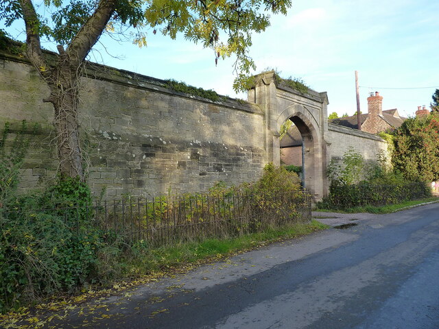
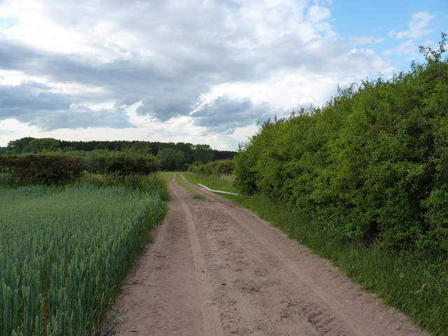
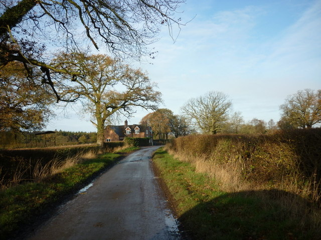
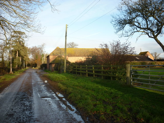
Brineton Images

Images are sourced within 2km of 52.720852/-2.285712 or Grid Reference SJ8013. Thanks to Geograph Open Source API. All images are credited.

Great Chatwell House farmhouse The core of this substantial rural farmhouse is 18th century, with a later additional bay on the right. It was Grade II listed <span class="nowrap"><a title="https://historicengland.org.uk/listing/the-list/list-entry/1178111" rel="nofollow ugc noopener" href="https://historicengland.org.uk/listing/the-list/list-entry/1178111">Link</a><img style="margin-left:2px;" alt="External link" title="External link - shift click to open in new window" src="https://s1.geograph.org.uk/img/external.png" width="10" height="10"/></span> & <span class="nowrap"><a title="https://britishlistedbuildings.co.uk/101178111-great-chatwell-house-farmhouse-and-attached-implement-shed-blymhill-and-weston-under-lizard" rel="nofollow ugc noopener" href="https://britishlistedbuildings.co.uk/101178111-great-chatwell-house-farmhouse-and-attached-implement-shed-blymhill-and-weston-under-lizard">Link</a><img style="margin-left:2px;" alt="External link" title="External link - shift click to open in new window" src="https://s1.geograph.org.uk/img/external.png" width="10" height="10"/></span> in 1985, along with the single-storey implement shed seen here to its left (which looks to have been converted to residential use)
Great Chatwell House farmhouse
The core of this substantial rural farmhouse is 18th century, with a later additional bay on the right. It was Grade II listed LinkExternal link & LinkExternal link in 1985, along with the single-storey implement shed seen here to its left (which looks to have been converted to residential use)
Chatwell Court screen and entrance wall This mid 19th century construction is thought to incorporate a section of an earlier house, but was mainly built to smarten up the approach to Chatwell Court house a distance to the rear. It was Grade II listed <span class="nowrap"><a title="https://britishlistedbuildings.co.uk/101374056-screen-and-entrance-wall-to-chatwell-court-driveway-blymhill-and-weston-under-lizard" rel="nofollow ugc noopener" href="https://britishlistedbuildings.co.uk/101374056-screen-and-entrance-wall-to-chatwell-court-driveway-blymhill-and-weston-under-lizard">Link</a><img style="margin-left:2px;" alt="External link" title="External link - shift click to open in new window" src="https://s1.geograph.org.uk/img/external.png" width="10" height="10"/></span> & <span class="nowrap"><a title="https://historicengland.org.uk/listing/the-list/list-entry/1374056" rel="nofollow ugc noopener" href="https://historicengland.org.uk/listing/the-list/list-entry/1374056">Link</a><img style="margin-left:2px;" alt="External link" title="External link - shift click to open in new window" src="https://s1.geograph.org.uk/img/external.png" width="10" height="10"/></span> in 1985, and has recently been opened up by the removal of the large tree that overhung it a few years ago <a href="https://www.geograph.org.uk/photo/2462206">SJ7914 : A grand entrance</a>
Chatwell Court screen and entrance wall
This mid 19th century construction is thought to incorporate a section of an earlier house, but was mainly built to smarten up the approach to Chatwell Court house a distance to the rear. It was Grade II listed LinkExternal link & LinkExternal link in 1985, and has recently been opened up by the removal of the large tree that overhung it a few years ago SJ7914 : A grand entrance
Chadwell/Chatwell Lodge The maps and other sources are in slight disagreement about the exact spelling, but either way this was once The Cock Inn, lying pretty much right opposite <a href="https://www.geograph.org.uk/photo/5235506">SJ7914 : The Red Lion, Great Chatwell</a>. It dates from the early 18th century, with later alterations, and was Grade II listed <span class="nowrap"><a title="https://britishlistedbuildings.co.uk/101374055-chatwell-lodge-blymhill-and-weston-under-lizard" rel="nofollow ugc noopener" href="https://britishlistedbuildings.co.uk/101374055-chatwell-lodge-blymhill-and-weston-under-lizard">Link</a><img style="margin-left:2px;" alt="External link" title="External link - shift click to open in new window" src="https://s1.geograph.org.uk/img/external.png" width="10" height="10"/></span> & <span class="nowrap"><a title="https://historicengland.org.uk/listing/the-list/list-entry/1374055" rel="nofollow ugc noopener" href="https://historicengland.org.uk/listing/the-list/list-entry/1374055">Link</a><img style="margin-left:2px;" alt="External link" title="External link - shift click to open in new window" src="https://s1.geograph.org.uk/img/external.png" width="10" height="10"/></span> in 1985.
Chadwell/Chatwell Lodge
The maps and other sources are in slight disagreement about the exact spelling, but either way this was once The Cock Inn, lying pretty much right opposite SJ7914 : The Red Lion, Great Chatwell. It dates from the early 18th century, with later alterations, and was Grade II listed LinkExternal link & LinkExternal link in 1985.
St Mary's Church, Blymhill The Datum Line with Pheon is cut into the south face of the tower of the Grade-I Listed St Mary's Church, Blymhill, Staffordshire. The benchmark is not recorded within the Ordnance Survey records but it is recorded on the historical maps.
St Mary's Church, Blymhill
The Datum Line with Pheon is cut into the south face of the tower of the Grade-I Listed St Mary's Church, Blymhill, Staffordshire. The benchmark is not recorded within the Ordnance Survey records but it is recorded on the historical maps.
The Red Lion pub Stripped of its coat of ivy since <a href="https://www.geograph.org.uk/photo/349226">SJ7914 : The Red Lion, Great Chatwell</a> was taken in 2007; this pub seems to be doing better than many rural watering holes.
The Red Lion pub
Stripped of its coat of ivy since SJ7914 : The Red Lion, Great Chatwell was taken in 2007; this pub seems to be doing better than many rural watering holes.
A grand entrance The imposing wall, and fine entrance archway to Chatwell Court.
A grand entrance
The imposing wall, and fine entrance archway to Chatwell Court.
Disused mill at Great Chatwell
Farm track across Guy's Bank The public right of way (a bridleway) runs through a narrow strip of fenced land just over the hedge on the right, but you're hard pushed to see it, let alone follow it, in the summer, for undergrowth.
Farm track across Guy's Bank
The public right of way (a bridleway) runs through a narrow strip of fenced land just over the hedge on the right, but you're hard pushed to see it, let alone follow it, in the summer, for undergrowth.
Chatwell Park Farm Set well back from the road, Chatwell Park Farm grows a wide variety of crops which are harvested by a business called PDM, whose trucks are regularly seen on the lanes in this area.
Chatwell Park Farm
Set well back from the road, Chatwell Park Farm grows a wide variety of crops which are harvested by a business called PDM, whose trucks are regularly seen on the lanes in this area.
House on Chatwell Lane
Red Brick Barn Most farm buildings in this area are made from red brick.
Red Brick Barn
Most farm buildings in this area are made from red brick.
Red Brick Storage Barn on T Junction
Narrow Country Lane This is a very narrow lane, that turns sharply to the left behind this very nice old cottage.
Narrow Country Lane
This is a very narrow lane, that turns sharply to the left behind this very nice old cottage.
Lower Beighterton Cottage
Lower Beighterton Farm
The Red Lion PH
The Red Lion PH
PDM Salads Major salad crop producers PDM specialise in whole head lettuce, spinach, chard and wild rocket. A workforce of 350 tend and harvest the crops during the season. Temporary workers are accommodated in mobile homes on the site.
PDM Salads
Major salad crop producers PDM specialise in whole head lettuce, spinach, chard and wild rocket. A workforce of 350 tend and harvest the crops during the season. Temporary workers are accommodated in mobile homes on the site.
Irrigation equipment at PDM salads During the growing season this will be used to irrigate the lettuce, spinach, chard and wild rocket crops.
Irrigation equipment at PDM salads
During the growing season this will be used to irrigate the lettuce, spinach, chard and wild rocket crops.
Show me another place!

Brineton is located at Grid Ref: SJ8013 (Lat: 52.720852, Lng: -2.285712)

Administrative County: Staffordshire

District: South Staffordshire

Police Authority: Staffordshire

What 3 Words

///research.resonated.laminated. Near Woodcote, Shropshire

Nearby Locations

Brineton

Related Wikis

Brineton

Brineton is a hamlet in Staffordshire, England. It is 3/4 mile north of the village of Blymhill, and is within the civil parish of Blymhill and Weston...

St Mary's Church, Blymhill

St. Mary's Church, Blymhill is an Anglican church in the village of Blymhill, Staffordshire, England (grid reference SJ808122). The building, which is...

Orslow

Orslow is an upland hamlet in Staffordshire, England, 0.75 miles (1.21 km) north-east of Great Chatwell. Its Anglo-Saxon name means 'Horsa's burial mound...

Great Chatwell

Great Chatwell is a small village within the civil parish of Blymhill and Weston-under-Lizard, in the South Staffordshire district of Staffordshire, England...

Nearby Amenities

Located within 500m of 52.720852,-2.285712
Brineton
Created By: Potlatch 0.10f
Is In: Staffordshire
Place: hamlet
Lat/Long: 52.720639/-2.2855329
Bus Stop
Rose Cottages
Bus: yes
Naptan AtcoCode: 3800C603600
Naptan Bearing: W
Naptan CommonName: Rose Cottages
Naptan Indicator: Opp
Naptan Landmark: Rose Cottages
Naptan Street: Main Rd
Naptan Verified: no
Public Transport: platform
Source: naptan_import
Lat/Long: 52.7210007/-2.2848577
Bus Stop
Rose Cottages
Bus: yes
Naptan AtcoCode: 3800C603601
Naptan Bearing: E
Naptan CommonName: Rose Cottages
Naptan Indicator: Adj
Naptan Landmark: Rose Cottages
Naptan Street: Main Rd
Naptan Verified: no
Public Transport: platform
Source: naptan_import
Lat/Long: 52.721052/-2.284842
Post Box
Post Box Type: lamp
Ref: TF11 142
Royal Cypher: EIIR
Royal Cypher Wikidata: Q33102113
Lat/Long: 52.7209378/-2.284627
Telephone
Booth: K6
Covered: booth
Man Made: telephone_box
Lat/Long: 52.7203763/-2.2848386
Generator Method: photovoltaic
Generator Output Electricity: yes
Generator Source: solar
Generator Type: solar_photovoltaic_panel
Location: roof
Power: generator
Lat/Long: 52.7218678/-2.2866596
The data included in this document is from www.openstreetmap.org. The data is made available under ODbL.

Have you been to Brineton?

Leave your review of Brineton below (or comments, questions and feedback).