Bearpark

Civil Parish in Durham

England

Bearpark

Boulders on Deerness Valley Railway Walk Immediately beyond the rocks a steep, rough road rises to the left reaching the B6302, Broom Lane, between Broompark and Ushaw Moor. They are surely in place to prevent vehicles descending to the railway path and then travelling along it in the direction of the camera!
Boulders on Deerness Valley Railway Walk Credit: Trevor Littlewood

Bearpark is a civil parish located in County Durham, in the northeast of England. It is situated approximately three miles northwest of Durham city center. The parish covers an area of about 1.6 square miles and has a population of around 1,500 people.

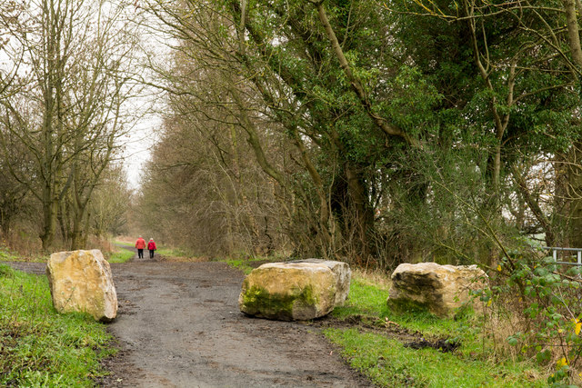
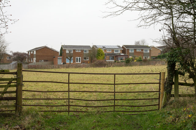
The village of Bearpark is nestled in a semi-rural area, surrounded by picturesque countryside and woodland. It is predominantly a residential area, with a mix of housing styles from traditional cottages to more modern developments. The village has a close-knit community atmosphere, with a range of amenities to cater to the needs of its residents.

One of the notable features of Bearpark is its strong industrial heritage. In the early 20th century, the village was home to several coal mines and associated industries, which played a significant role in the local economy. Today, remnants of this industrial past can still be seen, including disused mine shafts and buildings.

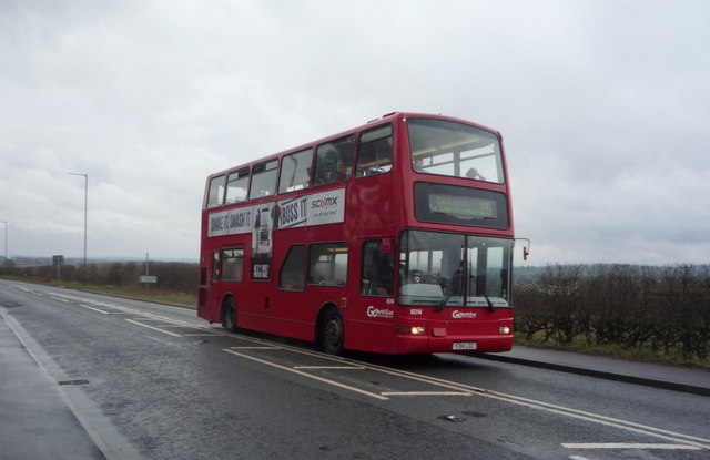
Despite its rural setting, Bearpark benefits from excellent transport links. The A691 road runs through the village, connecting it to nearby towns and providing easy access to the A1(M) motorway. There are also regular bus services connecting Bearpark to Durham city center and other surrounding areas.

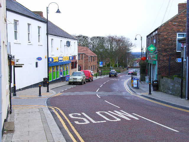
In terms of amenities, Bearpark has a primary school, a community center, and a local shop for everyday essentials. The village is also home to a number of recreational spaces, including a park and a sports field, providing opportunities for outdoor activities.

In summary, Bearpark is a small yet vibrant civil parish in County Durham, offering a peaceful rural lifestyle with convenient access to nearby urban centers.

If you have any feedback on the listing, please let us know in the comments section below.

Bearpark Images

Images are sourced within 2km of 54.787332/-1.625573 or Grid Reference NZ2443. Thanks to Geograph Open Source API. All images are credited.

Boulders on Deerness Valley Railway Walk Immediately beyond the rocks a steep, rough road rises to the left reaching the B6302, Broom Lane, between Broompark and Ushaw Moor. They are surely in place to prevent vehicles descending to the railway path and then travelling along it in the direction of the camera!
Boulders on Deerness Valley Railway Walk
Immediately beyond the rocks a steep, rough road rises to the left reaching the B6302, Broom Lane, between Broompark and Ushaw Moor. They are surely in place to prevent vehicles descending to the railway path and then travelling along it in the direction of the camera!
Field beyond metal gate The field lies on the west side of a lane rising from the B6302 at the west end of the village of Broompark. The modern houses beyond the field maybe considered as being in Broompark or the neighbouring village of Ushaw Moor; they are closer to the former but the estate is more contiguous with the latter.
Field beyond metal gate
The field lies on the west side of a lane rising from the B6302 at the west end of the village of Broompark. The modern houses beyond the field maybe considered as being in Broompark or the neighbouring village of Ushaw Moor; they are closer to the former but the estate is more contiguous with the latter.
Durham Fire Station Durham Fire Station is a recently built facility just south of Sniperley Farm.
Durham Fire Station
Durham Fire Station is a recently built facility just south of Sniperley Farm.
Two crows in a muddy field One field on the western outskirts of Durham city is still very muddy following a particularly wet winter; those on the slope beyond the hedge however appear to be in a rather better state.
Two crows in a muddy field
One field on the western outskirts of Durham city is still very muddy following a particularly wet winter; those on the slope beyond the hedge however appear to be in a rather better state.
Farmland north of the A691, Witton Gilbert
A691 towards Durham  Heading south east.
A691 towards Durham
Heading south east.
Footpath off the A691 Towards Fyndoune.
Footpath off the A691
Towards Fyndoune.
A691 approaching the Park and Ride Heading south east.
A691 approaching the Park and Ride
Heading south east.
Young crop field off the A691
Heading south east on the A691 Towards Durham.
Heading south east on the A691
Towards Durham.
Half-Way Houses On the A691.
Half-Way Houses
On the A691.
Lanchester Road Hospital
Grazing off the A691
Bus stop and shelter on Lanchester Road (A691)
Go North East bus on the A691 near Lanchester Road Hospital On the No. 15 route to Consett.
Go North East bus on the A691 near Lanchester Road Hospital
On the No. 15 route to Consett.
West Lodge, Lanchester Road Hospital
Access road to Lanchester Road Hospital
Crop field near Sniperley Farm Off the A691.
Crop field near Sniperley Farm
Off the A691.
Show me another place!

Bearpark is located at Grid Ref: NZ2443 (Lat: 54.787332, Lng: -1.625573)

Unitary Authority: County Durham

Police Authority: Durham

What 3 Words

///explains.stun.tidal. Near Ushaw Moor, Co. Durham

Nearby Locations

Bearpark

Related Wikis

Bearpark

Bearpark is a village and civil parish in County Durham in England. It is situated two and a half miles west of Durham, and a short distance to the north...

Aldin Grange for Bearpark railway station

Aldin Grange for Bearpark railway station was located on the Lanchester Valley Railway that operated in County Durham, England. The railway station opened...

Durham Academy, Ushaw Moor

Durham Academy (formerly Durham Community Business College) is a coeducational secondary school located in Ushaw Moor, County Durham, England.The school...

Ushaw Moor

Ushaw Moor is an old pit village in County Durham, in England, on the north side of the River Deerness. It is situated to the west of Durham, a short distance...

Broompark

Broompark is a village in County Durham, England. It is situated some 3 miles (4.8 km) west of Durham city. It was once the site of the Broompark colliery...

Ushaw Moor railway station

Ushaw Moor railway station, was a station on the Deerness Valley Railway, south of the village of Ushaw Moor in County Durham, was opened on 1 September...

Durham Johnston Comprehensive School

Durham Johnston Comprehensive School is a secondary school in Durham, England. == Introduction == Durham Johnston is a 1700-place 11–18 school serving...

University Hospital of North Durham

University Hospital of North Durham is an acute care hospital built to replace the older Dryburn Hospital on the same site. It is managed by the County...

Nearby Amenities

Located within 500m of 54.787332,-1.625573
Ford: yes
Lat/Long: 54.7906614/-1.6247505
Bearpark Brancepeth Colliery
Historic: archaeological_site
Lat/Long: 54.7839469/-1.6245665
Barrier: stile
Foot: yes
Lat/Long: 54.7843356/-1.6274513
Leisure: fitness_station
Sport: exercise
Lat/Long: 54.7850982/-1.6289119
Bench
Lat/Long: 54.7854087/-1.6294584
Bench
Lat/Long: 54.7854449/-1.6293442
Barrier: stile
Material: wood
Stile: stepover
Lat/Long: 54.7894817/-1.6242651
Bench
Backrest: no
Lat/Long: 54.7862356/-1.6244209
Ford: yes
Lat/Long: 54.7882951/-1.6239044
Location Transition: yes
Material: wood
Power: pole
Lat/Long: 54.7905111/-1.6304317
Material: wood
Power: pole
Lat/Long: 54.7907214/-1.6286641
Material: wood
Power: pole
Lat/Long: 54.7910833/-1.6257995
Material: wood
Power: pole
Lat/Long: 54.7912225/-1.6246462
Material: wood
Power: pole
Lat/Long: 54.7911939/-1.6230637
Material: wood
Power: pole
Lat/Long: 54.7911622/-1.6214973
Power: pole
Lat/Long: 54.7906132/-1.6295801
Access: no
Barrier: block
Lat/Long: 54.7895075/-1.627542
Where we live: Bearpark
Board Type: history
Information: board
Tourism: information
Lat/Long: 54.7847632/-1.6315837
Barrier: stile
Material: wood
Stile: stepover
Lat/Long: 54.7899926/-1.6249895
Power: pole
Lat/Long: 54.7863957/-1.6326351
Power: pole
Switch: mechanical
Transformer: distribution
Lat/Long: 54.7859232/-1.6312364
Barrier: motorcycle_barrier
Lat/Long: 54.7850717/-1.631562
Waste Basket
Touchless: yes
Lat/Long: 54.790581/-1.6289976
The data included in this document is from www.openstreetmap.org. The data is made available under ODbL.

Have you been to Bearpark?

Leave your review of Bearpark below (or comments, questions and feedback).