Bean

Civil Parish in Kent Dartford

England

Bean

Closed pub, Green Street Green, near Dartford The Ship pub in the hamlet of Green Street Green, near Dartford in Kent.  The pub had been closed for about two years when this image was taken.
Closed pub, Green Street Green, near Dartford Credit: Malc McDonald

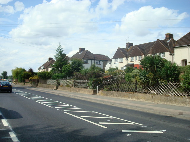
Bean is a civil parish located in the Dartford district of Kent, England. Situated on the southeastern outskirts of Dartford, it covers an area of approximately 6.54 square kilometers. The parish is primarily rural, with a small population of around 600 residents.

Bean is characterized by its picturesque landscapes and tranquil atmosphere. It is bordered by farmland and woodland, providing beautiful scenery for residents and visitors alike. The area is known for its rich agricultural heritage and is home to several working farms.

The parish is well-connected to neighboring areas, with the A2 road passing through and providing easy access to Dartford town center and the wider motorway network. The nearby Bluewater shopping center offers a variety of retail and leisure facilities, attracting visitors from across the region.

Despite its rural setting, Bean benefits from a range of amenities. The local primary school, Bean Primary School, serves the community, providing education for children aged 4 to 11. There is also a village hall, which hosts various community events and activities.

Outdoor enthusiasts will find plenty to explore in Bean, with numerous walking and cycling routes in the surrounding countryside. The parish is also close to the expansive Darenth Country Park, offering a tranquil retreat for nature lovers.

In summary, Bean is a small but charming civil parish in Kent, offering a peaceful rural lifestyle while remaining well-connected to neighboring towns and amenities.

If you have any feedback on the listing, please let us know in the comments section below.
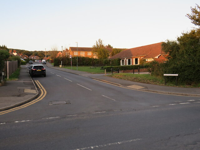
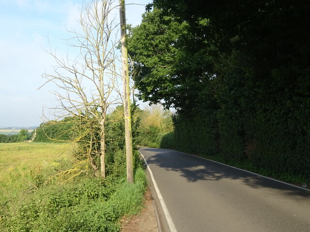
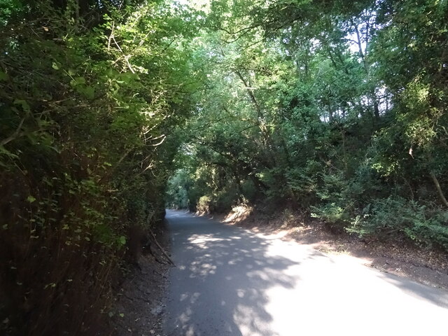
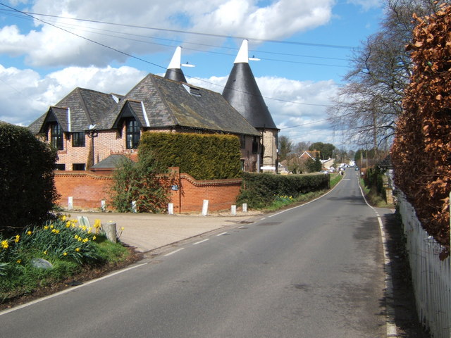
Bean Images

Images are sourced within 2km of 51.424199/0.283016 or Grid Reference TQ5871. Thanks to Geograph Open Source API. All images are credited.

Closed pub, Green Street Green, near Dartford The Ship pub in the hamlet of Green Street Green, near Dartford in Kent.  The pub had been closed for about two years when this image was taken.
Closed pub, Green Street Green, near Dartford
The Ship pub in the hamlet of Green Street Green, near Dartford in Kent. The pub had been closed for about two years when this image was taken.
Ladywood Road, Darenth, near Dartford, at sunset Ladywood Road in the village of Darenth, in north Kent.  This image was taken at sunset on an October day.
Ladywood Road, Darenth, near Dartford, at sunset
Ladywood Road in the village of Darenth, in north Kent. This image was taken at sunset on an October day.
Bean Village sign
Bean Village sign
National Cycle Route 1 towards Gravesend Beside the A296.
National Cycle Route 1 towards Gravesend
Beside the A296.
National Cycle Route 1 beside the A296 Towards Gravesend.
National Cycle Route 1 beside the A296
Towards Gravesend.
B255 bridge over National Cycle Route 1 Beside the A296.
B255 bridge over National Cycle Route 1
Beside the A296.
Roadworks on National Cycle Route 1 Beside the A296 - towards Gravesend.
Roadworks on National Cycle Route 1
Beside the A296 - towards Gravesend.
Woodland beside the A296
Merry Chest Cafe & Bar On Watling Street (A296).
Merry Chest Cafe & Bar
On Watling Street (A296).
Roadworks on National Cycle Route 1 Beside the A296 - towards Gravesend.
Roadworks on National Cycle Route 1
Beside the A296 - towards Gravesend.
Watling Street (A2)
Watling Street (A2)
Watling Street (A2) Looking east from a footbridge.
Watling Street (A2)
Looking east from a footbridge.
Crop field off the B262
B262 towards Green Street Green
Track off Sandbanks Hill
Sandbanks Hill (B262) Towards Green Street Green.
Sandbanks Hill (B262)
Towards Green Street Green.
The Ship Inn, Green Street Green Currently boarded up (June 2022).
The Ship Inn, Green Street Green
Currently boarded up (June 2022).
Green, Green Street Green
Show me another place!

Bean is located at Grid Ref: TQ5871 (Lat: 51.424199, Lng: 0.283016)

Administrative County: Kent

District: Dartford

Police Authority: Kent

What 3 Words

///scores.ground.lowest. Near Darenth, Kent

Nearby Locations

Lords Wood Bean

Related Wikis

Bean, Kent

Bean is a village and civil parish in the Borough of Dartford, Kent, England. It is located 4.4 miles south east of Dartford and 5.4 miles south west of...

Beacon Wood Country Park

Beacon Wood Country Park is a public woodland in Bean near Dartford, in Kent, England. It was previously an industrial claypit then re-claimed as woodland...

North West Kent

North West Kent is a geographical area in Kent, a county in south-east England. The term North West Kent may refer to one or both of two distinct areas...

Darenth Wood

Darenth Wood is a 122.9-hectare (304-acre) biological Site of Special Scientific Interest east of Dartford in Kent.This ancient semi-natural wood has many...

Ebbsfleet Valley

Ebbsfleet Valley is a new town and redevelopment area in Kent, South East England, and part of the Thames Gateway, southwest of Gravesend. Development...

Betsham

Betsham is a hamlet in the parish of Southfleet in Kent, England.Betsham is a mile north-west from the village of Southfleet, which is situated nearly...

Westwood, Southfleet

Westwood is a hamlet in the parish of Southfleet in Kent, England, in the west of the parish. It is one mile west of the village of Southfleet. In the...

Darenth

Darenth is a village and civil parish in the Borough of Dartford, Kent, England. It is located 3.4 miles south east of Dartford and 4.6 miles north east...

Nearby Amenities

Located within 500m of 51.424199,0.283016
Crossing
Lat/Long: 51.4251056/0.2853146
Mini Roundabout
Direction: clockwise
Lat/Long: 51.4275133/0.2830195
Bean
Created By: Potlatch 0.10f
Place: village
Source: npe
Lat/Long: 51.4264576/0.2866341
Mini Roundabout
Direction: clockwise
Lat/Long: 51.4267384/0.2837695
Turning Circle
Lat/Long: 51.4266819/0.2862887
Post Box
Operator: Royal Mail
Lat/Long: 51.4257029/0.2876134
Bus Stop
Bramble Avenue
Naptan AtcoCode: 2400105109
Naptan Bearing: NW
Naptan CommonName: Bramble Avenue
Naptan Indicator: opp
Naptan Landmark: Bramble Avenue
Naptan NaptanCode: kntjpwad
Naptan Street: Beacon Drive
Public Transport: platform
Ref: kntjpwad
Source: NAPTAN
Source Date: 2012-04-16T09:24:00
Lat/Long: 51.4280624/0.2861564
Bus Stop
Bramble Avenue
Naptan AtcoCode: 2400105107
Naptan Bearing: SE
Naptan CommonName: Bramble Avenue
Naptan Indicator: adj
Naptan Landmark: Bramble Avenue
Naptan NaptanCode: kntjptwt
Naptan Street: Beacon Drive
Public Transport: platform
Ref: kntjptwt
Source: NAPTAN
Source Date: 2012-04-16T09:21:00
Lat/Long: 51.4281674/0.2863054
Bus Stop
Public Transport: platform
Lat/Long: 51.4275699/0.2832918
Post Box
Brand: Royal Mail
Brand Wikidata: Q638098
Operator: Royal Mail
Operator Wikidata: Q638098
Post Box Mounting: pier
Post Box Type: lamp
Lat/Long: 51.4275219/0.2832449
Bus Stop
The Black Horse
Naptan AtcoCode: 2400A019950A
Naptan Bearing: SE
Naptan CommonName: The Black Horse
Naptan Indicator: opp
Naptan Landmark: The Black Horse
Naptan NaptanCode: kntawagt
Naptan Street: High Street
Naptan Verified: no
Public Transport: platform
Ref: kntawagt
Source: naptan_import
Source Date: 2018-08-20T12:27:00
Lat/Long: 51.4257239/0.2847881
Bus Stop
Foxwood Road
Naptan AtcoCode: 2400A019960A
Naptan Bearing: SW
Naptan CommonName: Foxwood Road
Naptan Indicator: adj
Naptan Landmark: Bean Lane
Naptan NaptanCode: kntawagw
Naptan Street: Beacon Drive
Naptan Verified: no
Public Transport: platform
Ref: kntawagw
Source: naptan_import
Source Date: 2018-08-20T12:22:00
Lat/Long: 51.4276491/0.2835487
Post Office
Bean Post Office
Addr Postcode: DA2 8BS
Branch: Bean
Brand: Post Office
Brand Wikidata: Q1783168
Check Date: 2020-02-20
Contact Website: https://www.postoffice.co.uk/branch-finder/0540145/bean
Ref Pol Id: 18024
Lat/Long: 51.4250393/0.2858225
Pub
Black Horse
Addr Postcode: DA2 8AS
Addr Street: High Street
Contact Phone: +44 1474 709379
Website: https://www.theblackhorsebean.com/
Lat/Long: 51.4254789/0.2846808
Bench
Lat/Long: 51.4213917/0.285835
Hudson Railway Wagons
Historic: yes
Lat/Long: 51.4221833/0.2830551
sit ups
Leisure: fitness_station
Sport: fitness
Lat/Long: 51.4219913/0.2892552
Leisure: picnic_table
Lat/Long: 51.4223883/0.2885318
Bench
Lat/Long: 51.4227753/0.2861067
Leisure: picnic_table
Lat/Long: 51.4229746/0.2808043
Leisure: picnic_table
Lat/Long: 51.4234467/0.2866353
Leisure: picnic_table
Lat/Long: 51.4222905/0.2885731
press ups
Leisure: fitness_station
Lat/Long: 51.4224228/0.28862
Bench
Backrest: no
Material: wood
Lat/Long: 51.4225081/0.2870687
parallel bars
Leisure: fitness_station
Sport: fitness
Lat/Long: 51.4222879/0.2884358
Covered: no
Leisure: picnic_table
Lat/Long: 51.4223637/0.2886297
Bench
Backrest: no
Seats: 3
Lat/Long: 51.4227927/0.2856055
Bench
Backrest: no
Seats: 3
Lat/Long: 51.4227763/0.2856296
Bench
Backrest: yes
Seats: 3
Lat/Long: 51.4219286/0.2888671
Bench
Backrest: yes
Material: wood
Lat/Long: 51.4224757/0.2876093
Bench
Backrest: yes
Material: wood
Lat/Long: 51.4224235/0.2872581
Bench
Backrest: no
Material: wood
Lat/Long: 51.4211656/0.2833987
chin ups
Leisure: fitness_station
Sport: fitness
Lat/Long: 51.4221942/0.2890296
Covered: no
Leisure: picnic_table
Lat/Long: 51.4222435/0.2886567
Covered: no
Leisure: picnic_table
Lat/Long: 51.4222995/0.2883637
trapeze walk
Leisure: fitness_station
Sport: fitness
Lat/Long: 51.4223531/0.288244
Burma bridge
Leisure: fitness_station
Sport: fitness
Lat/Long: 51.4222426/0.2887208
Covered: no
Leisure: picnic_table
Lat/Long: 51.4223892/0.288224
Barrier: stile
Material: wood
Lat/Long: 51.4233525/0.2802832
Barrier: stile
Material: wood
Lat/Long: 51.4235087/0.2802238
School
Bus: yes
Public Transport: stop_position
Lat/Long: 51.423501/0.2896613
Bus Stop
School
Naptan AtcoCode: 2400104438
Naptan Bearing: W
Naptan CommonName: School
Naptan Indicator: opp
Naptan Landmark: School
Naptan NaptanCode: kntjpdjw
Naptan Street: School Lane
Naptan Verified: no
Public Transport: platform
Ref: kntjpdjw
Source: NAPTAN
Source Date: 2011-06-23T09:46:00
Lat/Long: 51.4234349/0.2896366
Bramble Avenue
Bus: yes
Public Transport: stop_position
Lat/Long: 51.4281065/0.2862801
Foxwood Road
Bus: yes
Public Transport: stop_position
Lat/Long: 51.4276788/0.2835028
Foxwood Road
Bus: yes
Public Transport: stop_position
Lat/Long: 51.4277538/0.2836858
Bus Stop
Foxwood Road
Naptan AtcoCode: 2400104436
Naptan Bearing: NE
Naptan CommonName: Foxwood Road
Naptan Indicator: opp
Naptan Landmark: Foxwood Road
Naptan NaptanCode: kntjpdjm
Naptan Street: Beacon Drive
Naptan Verified: no
Public Transport: platform
Ref: kntjpdjm
Source: NAPTAN
Source Date: 2018-08-20T12:24:00
Lat/Long: 51.4278065/0.2835973
Crossing
Lat/Long: 51.4274248/0.2830528
Crossing
Lat/Long: 51.4255398/0.2848762
Post Box
Brand: Royal Mail
Brand Wikidata: Q638098
Mapillary: 3323488147916862
Operator: Royal Mail
Operator Wikidata: Q638098
Post Box Type: pillar
Survey Date: 2023-05-07
Lat/Long: 51.4249618/0.2856595
Defibrillator
Defibrillator Location: On post outside Bean Post Office on Southfleet Road, next to post box
Emergency: defibrillator
Indoor: no
Mapillary: 3323488147916862
Survey Date: 2023-05-07
Lat/Long: 51.4249679/0.2857197
The data included in this document is from www.openstreetmap.org. The data is made available under ODbL.

Have you been to Bean?

Leave your review of Bean below (or comments, questions and feedback).