Beal

Civil Parish in Yorkshire Selby

England

Beal

Farm buildings off Manor Road, Beal Barns and other buildings associated with Manor Farm at the west end of the village.
Farm buildings off Manor Road, Beal Credit: Gordon Hatton

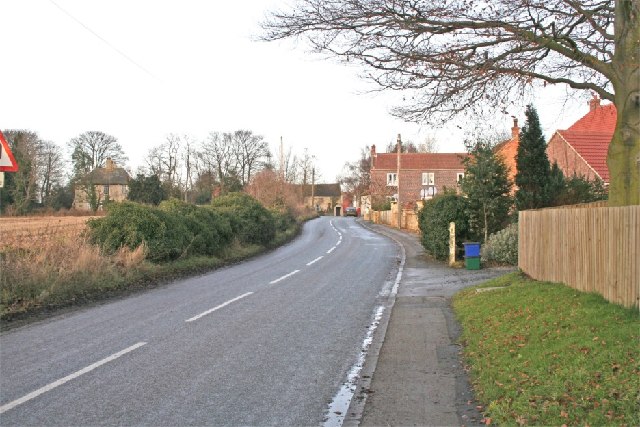
Beal is a civil parish situated in the county of Yorkshire, England. It is a small village located approximately 6 miles east of Selby and 16 miles south-east of York. The village is nestled in the beautiful countryside, surrounded by scenic landscapes and rolling hills.

With a population of around 300 residents, Beal is a close-knit community that offers a tranquil and peaceful setting for its inhabitants. The village has a rich history, with evidence of human settlement dating back to the medieval period. The name "Beal" is believed to have originated from the Old English word "beo," meaning bee, suggesting the presence of beekeeping activities in the past.

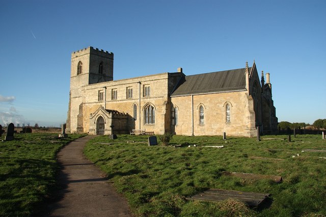
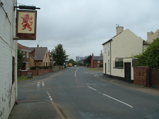
Despite its small size, Beal offers a range of amenities for its residents. The village has a local pub, the Plough Inn, which serves as a meeting place for locals and visitors alike. Additionally, there is a village hall that hosts various community events and gatherings. The picturesque St. Mary's Church, dating back to the 12th century, is another notable landmark in Beal.

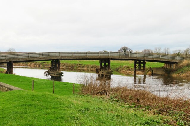
The surrounding countryside provides ample opportunities for outdoor activities such as hiking, cycling, and horseback riding. The village is also in close proximity to the River Ouse, which offers fishing and boating opportunities for enthusiasts.

Overall, Beal is a charming and idyllic village with a strong sense of community and a rich historical heritage. Its peaceful surroundings and range of amenities make it an attractive place to live or visit for those seeking a serene rural experience in Yorkshire.

If you have any feedback on the listing, please let us know in the comments section below.

Beal Images

Images are sourced within 2km of 53.715262/-1.194251 or Grid Reference SE5324. Thanks to Geograph Open Source API. All images are credited.

Farm buildings off Manor Road, Beal Barns and other buildings associated with Manor Farm at the west end of the village.
Farm buildings off Manor Road, Beal
Barns and other buildings associated with Manor Farm at the west end of the village.
The Jenny Wren, Beal Beal is a small riverside village with two pubs, the other being the Kings Arms near the bridge over the Aire.
The Jenny Wren, Beal
Beal is a small riverside village with two pubs, the other being the Kings Arms near the bridge over the Aire.
Beal Bridge A lightweight construction that carries a minor road over the Aire at Beal.
Beal Bridge
A lightweight construction that carries a minor road over the Aire at Beal.
Beal Lock on the Aire Beal Lock is numbered as 4 on the Aire, the navigable channel here being separate from the Aire and Calder Navigation which runs along a relatively straight course some 2 miles to the south. The river is navigable for small craft, but bridges, such as that just upstream from this lock restrict headroom to less than 10 feet.
Beal Lock on the Aire
Beal Lock is numbered as 4 on the Aire, the navigable channel here being separate from the Aire and Calder Navigation which runs along a relatively straight course some 2 miles to the south. The river is navigable for small craft, but bridges, such as that just upstream from this lock restrict headroom to less than 10 feet.
Birkin Lane passing Letherbelly Wood Looking along Birkin Lane between Byram and Birkin.
Birkin Lane passing Letherbelly Wood
Looking along Birkin Lane between Byram and Birkin.
Fields north of Birkin Lane Wheat fields growing to the north of the River Aire.
Fields north of Birkin Lane
Wheat fields growing to the north of the River Aire.
Wheat growing to the north of Birkin Lane Looking across farmland from Birkin Lane between Byram and Birkin.
Wheat growing to the north of Birkin Lane
Looking across farmland from Birkin Lane between Byram and Birkin.
Along Birkin Lane Looking along Birkin Lane between Byram and Birkin.
Along Birkin Lane
Looking along Birkin Lane between Byram and Birkin.
Wheat fields and Birkin Lane Looking along Birkin Lane between Byram and Birkin.
Wheat fields and Birkin Lane
Looking along Birkin Lane between Byram and Birkin.
Field south of Park House Looking across farmland from Birkin Lane between Byram and Birkin.
Field south of Park House
Looking across farmland from Birkin Lane between Byram and Birkin.
Field near Birkin Looking across farmland from Birkin Lane between Byram and Birkin.
Field near Birkin
Looking across farmland from Birkin Lane between Byram and Birkin.
Farm track off Birkin Lane Looking along a farm track from Birkin Lane between Byram and Birkin.
Farm track off Birkin Lane
Looking along a farm track from Birkin Lane between Byram and Birkin.
Birkin Lane crossing Fleet Drain Looking along Birkin Lane between Byram and Birkin.
Birkin Lane crossing Fleet Drain
Looking along Birkin Lane between Byram and Birkin.
Horses beside Birkin Lane Looking along Birkin Lane between Byram and Birkin.
Horses beside Birkin Lane
Looking along Birkin Lane between Byram and Birkin.
Canal west of Southmoor Lane The Aire and Calder Navigation east of Knottingley.
Canal west of Southmoor Lane
The Aire and Calder Navigation east of Knottingley.
Electric wires crossing the canal The Aire and Calder Navigation east of Knottingley.
Electric wires crossing the canal
The Aire and Calder Navigation east of Knottingley.
Towpath to the west of Southmoor Lane The Aire and Calder Navigation east of Knottingley.
Towpath to the west of Southmoor Lane
The Aire and Calder Navigation east of Knottingley.
Bridge carrying Southmoor Lane The Aire and Calder Navigation east of Knottingley.
Bridge carrying Southmoor Lane
The Aire and Calder Navigation east of Knottingley.
Show me another place!

Beal is located at Grid Ref: SE5324 (Lat: 53.715262, Lng: -1.194251)

Division: West Riding

Administrative County: North Yorkshire

District: Selby

Police Authority: North Yorkshire

What 3 Words

///model.reservoir.custodial. Near Knottingley, West Yorkshire

Nearby Locations

Beal Kellingley

Related Wikis

Beal, North Yorkshire

Beal is a village and civil parish in North Yorkshire, England. It is situated on the River Aire, 3.5 miles (6 km) north-east of Knottingley, 8 miles...

Kellingley Colliery

Kellingley Colliery, known affectionately as the 'Big K', was a deep coal mine in North Yorkshire, England, 3.6 miles (5.8 km) east of Ferrybridge power...

Church of St Edmund King and Martyr, Kellington

The Church of St Edmund King and Martyr, Kellington, is a grade I listed 12th century church in the village of Kellington, North Yorkshire, England. Excavations...

Kellington

Kellington is a small village and civil parish in the Selby District of North Yorkshire, England, on the banks of the River Aire. Situated almost equidistant...

Birkin

Birkin is a village and civil parish in the south-west of the Selby district of North Yorkshire, England. It is north of the River Aire, near Beal, North...
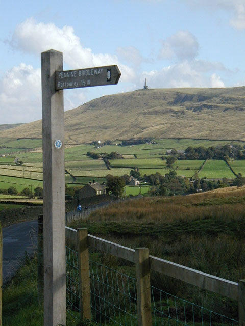
Mary Towneley Loop

The Mary Towneley Loop is a 47-mile (76 km) circular route that forms part of the Pennine Bridleway National Trail, along the borders of Lancashire and...

Whitley Bridge railway station

Whitley Bridge railway station serves the villages of Eggborough and Whitley in North Yorkshire, England. It is located on the Pontefract Line and is 20...

Knottingley Town Hall

Knottingley Town Hall is a municipal building in Weeland Road, Knottingley, West Yorkshire, England. The structure, which served as the headquarters of...

Nearby Amenities

Located within 500m of 53.715262,-1.194251
Power: pole
Lat/Long: 53.7185112/-1.1896844
Power: pole
Lat/Long: 53.718766/-1.1944081
Power: pole
Lat/Long: 53.7141546/-1.1940054
Power: pole
Lat/Long: 53.7143249/-1.1932959
Power: pole
Lat/Long: 53.7147136/-1.1919295
Power: pole
Lat/Long: 53.7151023/-1.1905679
Power: pole
Lat/Long: 53.7154087/-1.1885975
Power: pole
Lat/Long: 53.715491/-1.1872695
Power: pole
Lat/Long: 53.7123331/-1.1920028
Power: pole
Lat/Long: 53.7124294/-1.1905052
Power: pole
Lat/Long: 53.7125101/-1.1889792
Power: pole
Lat/Long: 53.7126883/-1.1933811
Power: pole
Lat/Long: 53.7130221/-1.2004219
Power: pole
Lat/Long: 53.7130705/-1.1948959
Power: pole
Lat/Long: 53.7133398/-1.1988924
Power: pole
Lat/Long: 53.7133779/-1.196157
Power: pole
Lat/Long: 53.7136711/-1.1973191
The data included in this document is from www.openstreetmap.org. The data is made available under ODbL.

Have you been to Beal?

Leave your review of Beal below (or comments, questions and feedback).