Bavington

Civil Parish in Northumberland

England

Bavington

Hedchester Cottage Hedchester Cottage is not to be confused with the ruined farmhouse of Hetchester located to the south-west <a href="https://www.geograph.org.uk/photo/7402363">NY9479 : Hetchester</a>

Two adjoined cottages are shown here on the 2nd Edition 25" Ordnance Survey map published in 1896. A Tile Works and Clay Pit are shown in this location on the 1st Edition 6" map published in 1866, with the original cottage(s) on the roadside possibly part of the same enterprise.
Hedchester Cottage Credit: Andrew Curtis

Bavington is a civil parish located in the county of Northumberland, in the northeastern part of England. It is situated approximately 17 miles northwest of the city of Newcastle upon Tyne and 7 miles west of the market town of Hexham. The parish covers an area of around 7 square miles and is predominantly rural in nature.

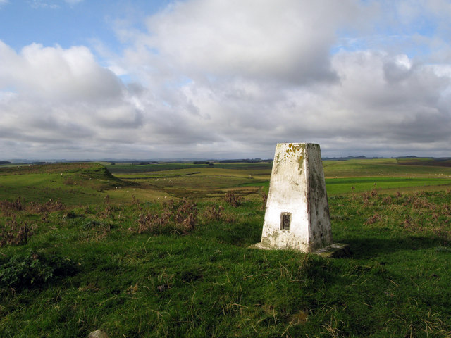
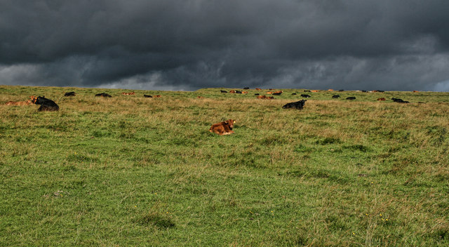
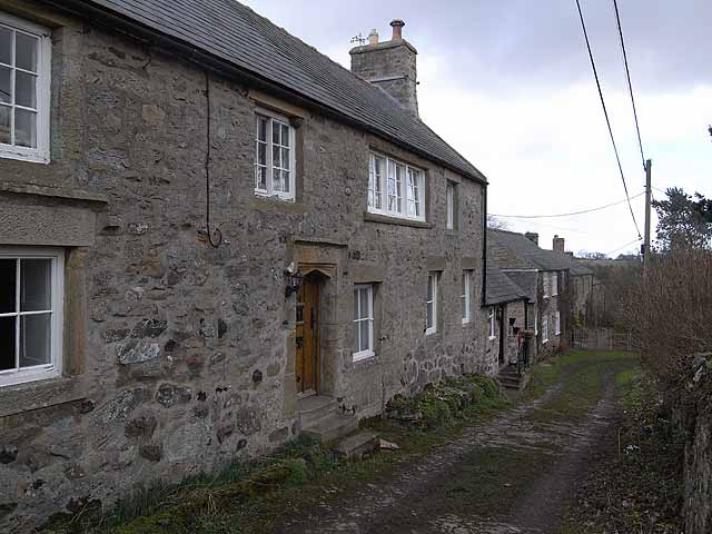
Bavington is characterized by its picturesque countryside, with rolling hills, farmland, and open spaces. The landscape is dotted with charming farmhouses, cottages, and traditional buildings, reflecting the area's agricultural heritage. The parish is surrounded by beautiful natural features, including the River Pont, which flows through the region, and the Northumberland National Park, which lies to the northwest.

The parish is home to a small population, with the number of residents estimated to be around 150. The community is close-knit and friendly, with a strong sense of local pride. Bavington has a parish church, St. John's Church, which serves as a focal point for religious activities and community gatherings.

The area offers plenty of opportunities for outdoor activities, such as walking, cycling, and horseback riding, with numerous trails and paths to explore. Additionally, Bavington is within close proximity to a range of attractions and amenities, including historic sites, country parks, and leisure facilities.

Overall, Bavington is a tranquil and picturesque civil parish, offering a peaceful and rural lifestyle, surrounded by natural beauty and a friendly community spirit.

If you have any feedback on the listing, please let us know in the comments section below.

Bavington Images

Images are sourced within 2km of 55.116872/-2.053381 or Grid Reference NY9680. Thanks to Geograph Open Source API. All images are credited.

Hedchester Cottage Hedchester Cottage is not to be confused with the ruined farmhouse of Hetchester located to the south-west <a href="https://www.geograph.org.uk/photo/7402363">NY9479 : Hetchester</a>

Two adjoined cottages are shown here on the 2nd Edition 25" Ordnance Survey map published in 1896. A Tile Works and Clay Pit are shown in this location on the 1st Edition 6" map published in 1866, with the original cottage(s) on the roadside possibly part of the same enterprise.
Hedchester Cottage
Hedchester Cottage is not to be confused with the ruined farmhouse of Hetchester located to the south-west NY9479 : Hetchester Two adjoined cottages are shown here on the 2nd Edition 25" Ordnance Survey map published in 1896. A Tile Works and Clay Pit are shown in this location on the 1st Edition 6" map published in 1866, with the original cottage(s) on the roadside possibly part of the same enterprise.
North Heugh
North Heugh
Old and new walls near Sweethope Crags
Old boundary wall near Sweethope Crags
Ridge south of Sweethope Crags
North Heugh from Sweethope Crags
Old boundary below Sweethope Crags
Disused limestone quarry, north of Quarry House "Firstly, at the east of this part of the area, is a limekiln [site 12] which is also marked on the Thockrington Tithe Map of 1844. No kiln is marked on the site in the Second Edition Ordnance Survey Map (1898) - indicating that it was disused by that date - but the map indicates a quarry adjacent and to the east of the site of the limekiln. This quarry would have been the source of limestone when the kiln was operating. Today, the limekiln appears only as a grassy mound, although the ramp which was used for loading the kiln is evident on the south side. No arch (from which the lime was drawn) is now visible, but it is likely that at least one drawing arch was originally located at the foot of the north side of the kiln, facing the modern tarmac road."
A Field Survey at Quarry House and North Heugh Farms, Northumberland.
P.C. Sellers and D.H. Prothero (1991). Northern Archaeology Vol.11 p.57-72.
Disused limestone quarry, north of Quarry House
"Firstly, at the east of this part of the area, is a limekiln [site 12] which is also marked on the Thockrington Tithe Map of 1844. No kiln is marked on the site in the Second Edition Ordnance Survey Map (1898) - indicating that it was disused by that date - but the map indicates a quarry adjacent and to the east of the site of the limekiln. This quarry would have been the source of limestone when the kiln was operating. Today, the limekiln appears only as a grassy mound, although the ramp which was used for loading the kiln is evident on the south side. No arch (from which the lime was drawn) is now visible, but it is likely that at least one drawing arch was originally located at the foot of the north side of the kiln, facing the modern tarmac road." A Field Survey at Quarry House and North Heugh Farms, Northumberland. P.C. Sellers and D.H. Prothero (1991). Northern Archaeology Vol.11 p.57-72.
Site of lead mine, north of Quarry House See description here <a href="https://www.geograph.org.uk/photo/7402988">NY9680 : Site of lead mine, north of Quarry House</a>
Site of lead mine, north of Quarry House
Site of lead mine, north of Quarry House The mine shaft, blocked by dumped rubbish, lies within the fenced enclosure (now wooded). The area of stones in the foreground may have been part of the mine spoil heap although the 2nd Edition map does show a small building nearby. These features were all within a larger enclosure. Just south of what is now an unfenced road, west of the shaft, the map indicates a small pond probably part of the infrastructure for the lead mine.

"The second feature marked on the First Edition Ordnance Survey Map is an old lead mine. A brief history of this site is given in the Northumberland county history (Hodgson, 1897). A lease was issued in 1736 by the local landowner, George Delaval, for 'John Lee of Calf Gapp' and some other persons to work for lead on this site. The outcome of this enterprise is unrecorded, but in 1828 the site was worked again by Messrs Milner and Featherstone, who found it unproductive. Greenwood's county map of 1828 identifies a 'lead mine' on this site.
From the county history entry, it appears that the site was disused after about 1828 ..."
A Field Survey at Quarry House and North Heugh Farms, Northumberland.
P. C. Sellers and D. H. Prothero (1991). Northern Archaeology Vol.11 p.57-72.

The mine was reopened in 1874 with the formation of the Quarry House Lead Mining Company with three shafts sunk into limestone and shales 20-30 fathoms below the Whin Sill. The vein was described as varying in width from a narrow string to 60cm. Shares were sold with the benefit of an optimistic prospectus and descriptions of distinguished mining engineers, but no returns appear to have been made.
R A Fairbairn (2000) British Mining No 65. Allendale, Tynedale and Derwent Lead Mines. Northern Mine Research Society.
Site of lead mine, north of Quarry House
The mine shaft, blocked by dumped rubbish, lies within the fenced enclosure (now wooded). The area of stones in the foreground may have been part of the mine spoil heap although the 2nd Edition map does show a small building nearby. These features were all within a larger enclosure. Just south of what is now an unfenced road, west of the shaft, the map indicates a small pond probably part of the infrastructure for the lead mine. "The second feature marked on the First Edition Ordnance Survey Map is an old lead mine. A brief history of this site is given in the Northumberland county history (Hodgson, 1897). A lease was issued in 1736 by the local landowner, George Delaval, for 'John Lee of Calf Gapp' and some other persons to work for lead on this site. The outcome of this enterprise is unrecorded, but in 1828 the site was worked again by Messrs Milner and Featherstone, who found it unproductive. Greenwood's county map of 1828 identifies a 'lead mine' on this site. From the county history entry, it appears that the site was disused after about 1828 ..." A Field Survey at Quarry House and North Heugh Farms, Northumberland. P. C. Sellers and D. H. Prothero (1991). Northern Archaeology Vol.11 p.57-72. The mine was reopened in 1874 with the formation of the Quarry House Lead Mining Company with three shafts sunk into limestone and shales 20-30 fathoms below the Whin Sill. The vein was described as varying in width from a narrow string to 60cm. Shares were sold with the benefit of an optimistic prospectus and descriptions of distinguished mining engineers, but no returns appear to have been made. R A Fairbairn (2000) British Mining No 65. Allendale, Tynedale and Derwent Lead Mines. Northern Mine Research Society.
Bield, north of Quarry House A roughly semi-circular high dry-stone wall, open on the west side. It is marked on the 2nd Edition 25" OS map as a 'Bield'.

"This is a Cumbrian dialect word for a shelter or animal den, from the Old English belde. Goose bields, found in Cumbria, are designed so geese penned in cannot escape and foxes cannot get in. These are circular shelter with high walls overhanging on the inside (to stop the geese) and outside (so as to stop the foxes). The word is also used for a general livestock shelter."
Keys to the Past, glossary: <span class="nowrap"><a title="https://keystothepast.info/glossary/?AZ=B" rel="nofollow ugc noopener" href="https://keystothepast.info/glossary/?AZ=B">Link</a><img style="margin-left:2px;" alt="External link" title="External link - shift click to open in new window" src="https://s1.geograph.org.uk/img/external.png" width="10" height="10"/></span>
Bield, north of Quarry House
A roughly semi-circular high dry-stone wall, open on the west side. It is marked on the 2nd Edition 25" OS map as a 'Bield'. "This is a Cumbrian dialect word for a shelter or animal den, from the Old English belde. Goose bields, found in Cumbria, are designed so geese penned in cannot escape and foxes cannot get in. These are circular shelter with high walls overhanging on the inside (to stop the geese) and outside (so as to stop the foxes). The word is also used for a general livestock shelter." Keys to the Past, glossary: LinkExternal link
North Heugh Farm
North Heugh Farm
Plantations near North Heugh
Bridleway towards Sweethope Lough
Trig point of Bavington Crags The trig point at Bavington Crags stands above a broken line of rocks, close to an un-fenced minor road. The land about is marginal farmland.
Trig point of Bavington Crags
The trig point at Bavington Crags stands above a broken line of rocks, close to an un-fenced minor road. The land about is marginal farmland.
Hawthorn Wind blown Hawthorn tree near The Shield.
Hawthorn
Wind blown Hawthorn tree near The Shield.
Great Bavington Cows sitting down near Great Bavington - a possible indication of rain to come!
Great Bavington
Cows sitting down near Great Bavington - a possible indication of rain to come!
Plashetts Farm The farmhouse at Plashetts.
Plashetts Farm
The farmhouse at Plashetts.
Show me another place!

Bavington is located at Grid Ref: NY9680 (Lat: 55.116872, Lng: -2.053381)

Unitary Authority: Northumberland

Police Authority: Northumbria

What 3 Words

///dozens.shower.remodel. Near Birtley, Northumberland

Nearby Locations

Bavington

Related Wikis

Have you been to Bavington?

Leave your review of Bavington below (or comments, questions and feedback).