Bathford

Civil Parish in Somerset

England

Bathford

Old Milestone, High Street, Bathford Hill The milestone is located on the wide bank beside trees on the south side of the road. Parish of Bathford (Bath and North East Somerset District). Metal plate attached to stone post, Bath incised iron plate Erected by the Bath turnpike trust in the 19th century.

The replacement plate was fitted by Bath and North East Somerset council in 2007.

Inscription reads:-
To / BATH / 4

Grade II Listed, List Entry Number: 1115291
<span class="nowrap"><a title="https://historicengland.org.uk/listing/the-list/list-entry/1115291" rel="nofollow ugc noopener" href="https://historicengland.org.uk/listing/the-list/list-entry/1115291">Link</a><img style="margin-left:2px;" alt="External link" title="External link - shift click to open in new window" src="https://s1.geograph.org.uk/img/external.png" width="10" height="10"/></span>


Milestone Society National ID: SO_BAKD04
Old Milestone, High Street, Bathford Hill Credit: Janet Dowding

Bathford is a civil parish located in the county of Somerset, England. Situated just east of the city of Bath, it lies on the southern bank of the River Avon. Covering an area of approximately 3.5 square miles, Bathford is a picturesque village with a population of around 1,500 residents.

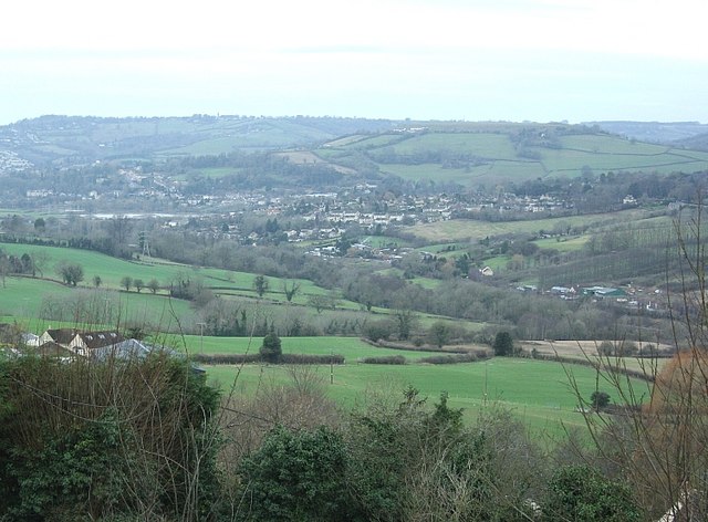
The parish is known for its beautiful countryside and charming architecture. It is surrounded by rolling hills and offers stunning views of the Avon Valley. Bathford is particularly popular with hikers, as it boasts numerous walking trails that allow visitors to explore the scenic landscape.

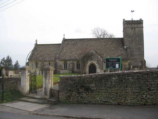
The village itself is home to several historic buildings, including St. Swithun's Church, which dates back to the 12th century. The church features a distinctive tower and is a popular attraction for those interested in local history and architecture.

Bathford has a close-knit community and offers a range of amenities to its residents. These include a primary school, a village hall, a local shop, and a pub. The village also hosts various events throughout the year, such as the Bathford Flower Show and the Bathford Village Festival, which bring the community together.

With its proximity to the city of Bath, Bathford benefits from easy access to a wide range of cultural and recreational activities. Residents can enjoy the city's famous Roman Baths, Georgian architecture, and vibrant arts scene.

Overall, Bathford offers a tranquil and picturesque setting, making it an attractive place to live or visit for those seeking a blend of rural charm and convenient access to nearby amenities.

If you have any feedback on the listing, please let us know in the comments section below.
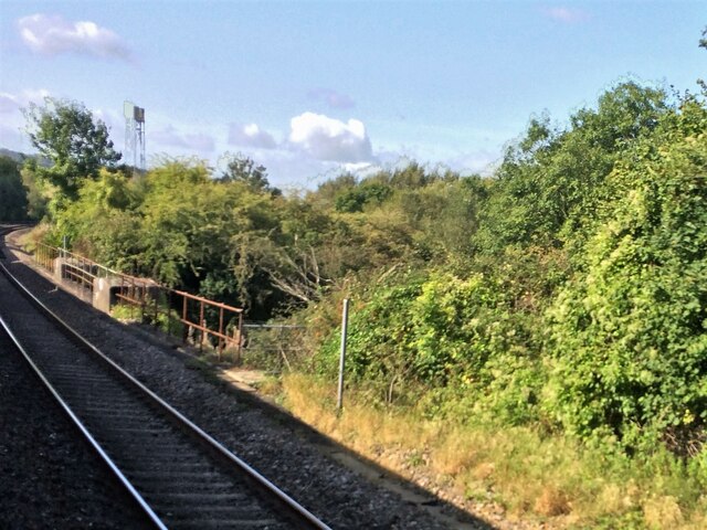
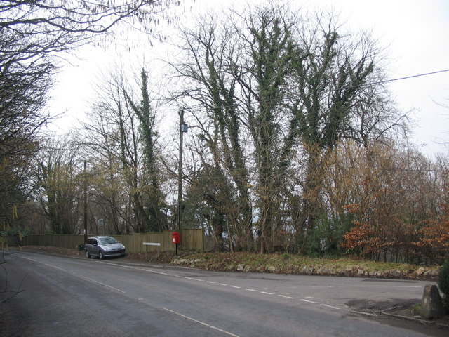
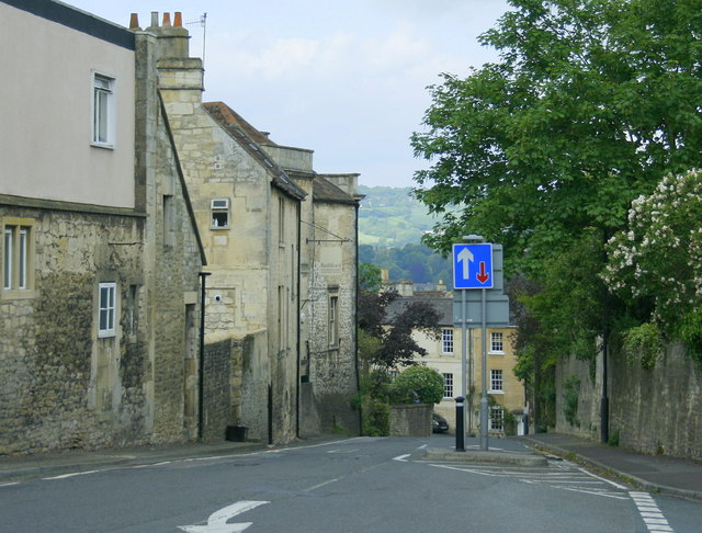
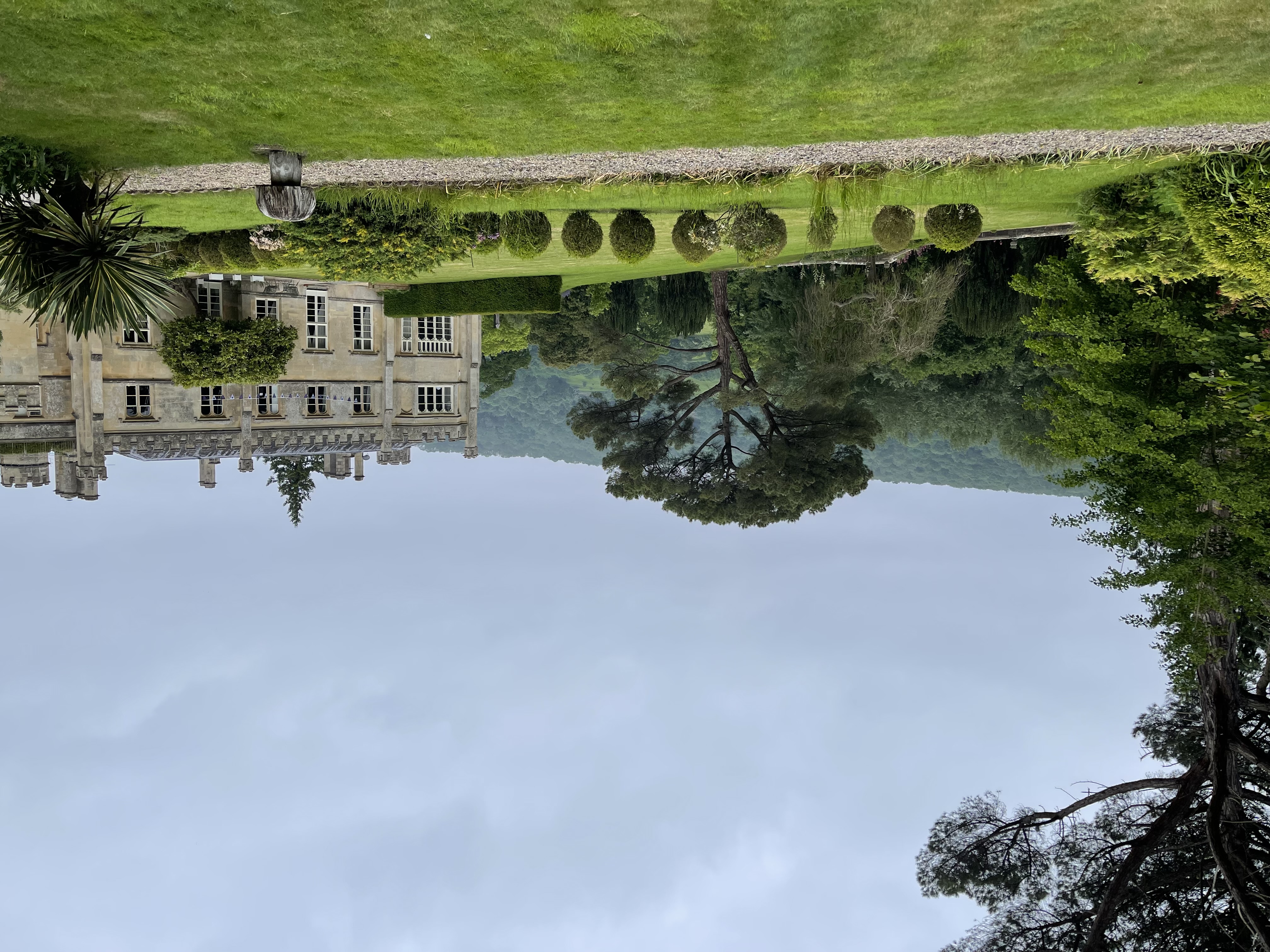
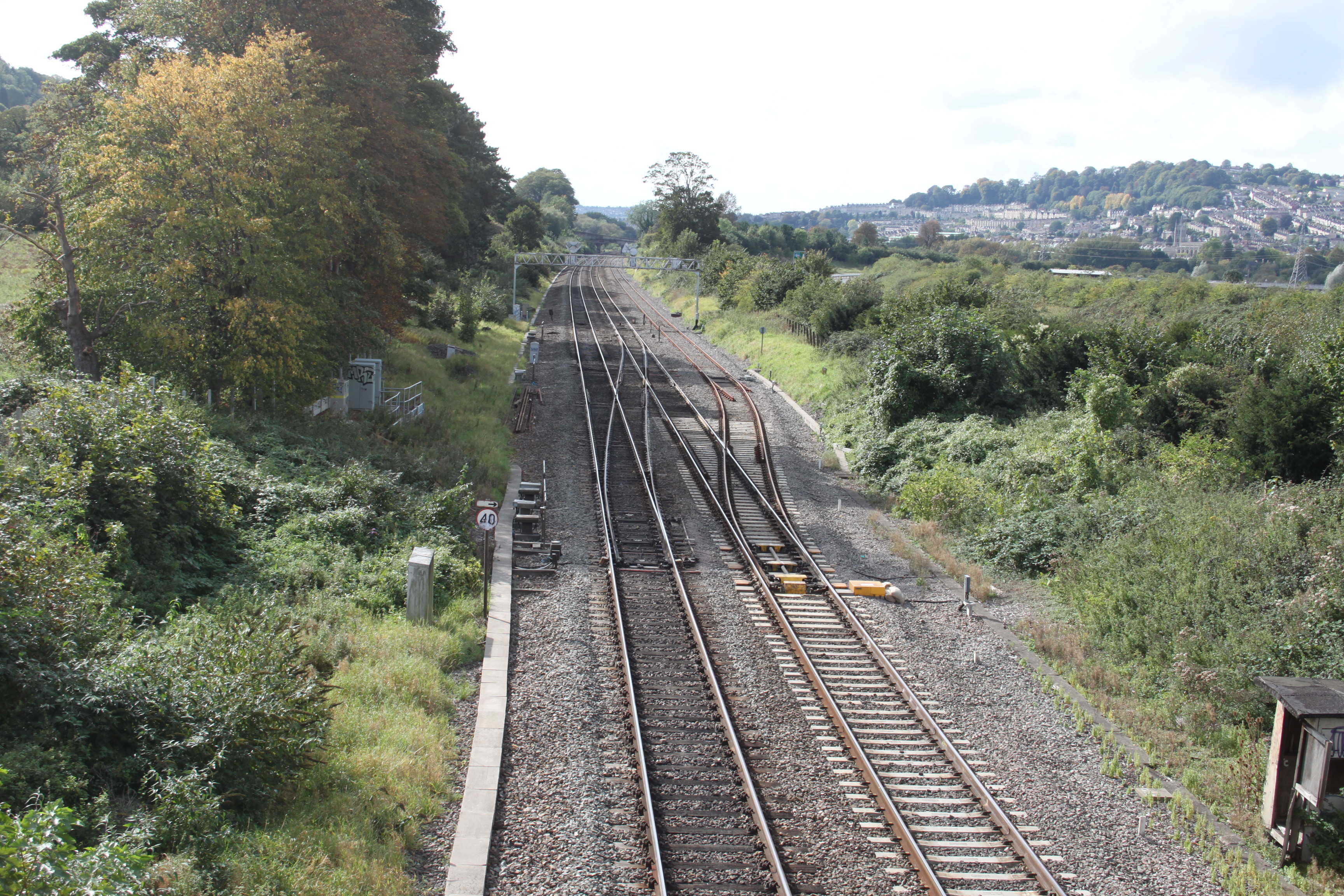
Bathford Images

Images are sourced within 2km of 51.397646/-2.297085 or Grid Reference ST7966. Thanks to Geograph Open Source API. All images are credited.

Old Milestone, High Street, Bathford Hill The milestone is located on the wide bank beside trees on the south side of the road. Parish of Bathford (Bath and North East Somerset District). Metal plate attached to stone post, Bath incised iron plate Erected by the Bath turnpike trust in the 19th century.

The replacement plate was fitted by Bath and North East Somerset council in 2007.

Inscription reads:-
To / BATH / 4

Grade II Listed, List Entry Number: 1115291
<span class="nowrap"><a title="https://historicengland.org.uk/listing/the-list/list-entry/1115291" rel="nofollow ugc noopener" href="https://historicengland.org.uk/listing/the-list/list-entry/1115291">Link</a><img style="margin-left:2px;" alt="External link" title="External link - shift click to open in new window" src="https://s1.geograph.org.uk/img/external.png" width="10" height="10"/></span>


Milestone Society National ID: SO_BAKD04
Old Milestone, High Street, Bathford Hill
The milestone is located on the wide bank beside trees on the south side of the road. Parish of Bathford (Bath and North East Somerset District). Metal plate attached to stone post, Bath incised iron plate Erected by the Bath turnpike trust in the 19th century. The replacement plate was fitted by Bath and North East Somerset council in 2007. Inscription reads:- To / BATH / 4 Grade II Listed, List Entry Number: 1115291 LinkExternal link Milestone Society National ID: SO_BAKD04
Milestone by A4, London Road East; 100m West of Lower Shockerwick Lodge The Milestone is located on grass verge by path on the North of the road.  Parish of Bathford (Bath and North East Somerset District). Metal plate attached to stone post, Bath incised iron plate design, erected by the Bath turnpike trust in the 21st Century. An earlier photograph can be found here: <a title="https://www.geograph.org.uk/photo/6049925" href="https://www.geograph.org.uk/photo/6049925">Link</a> 

Inscription reads:-  
To / BATH / 4 

Milestone Society National ID: SO_BACH04
Milestone by A4, London Road East; 100m West of Lower Shockerwick Lodge
The Milestone is located on grass verge by path on the North of the road.  Parish of Bathford (Bath and North East Somerset District). Metal plate attached to stone post, Bath incised iron plate design, erected by the Bath turnpike trust in the 21st Century. An earlier photograph can be found here: Link  Inscription reads:- To / BATH / 4 Milestone Society National ID: SO_BACH04
From a Swindon-Bristol train, crossing a bridge at Box Bridge
Box Bridge This bridge carries the main Bristol - London railway line over a minor road, which joins the A4 on the other side of the bridge.
Box Bridge
This bridge carries the main Bristol - London railway line over a minor road, which joins the A4 on the other side of the bridge.
Lower Kingsdown Road A view looking west down the hill from Kingsdown to Bathampton, at the junction with Lower Kingsdown Road (right)
Lower Kingsdown Road
A view looking west down the hill from Kingsdown to Bathampton, at the junction with Lower Kingsdown Road (right)
St. Peters, Monkton Farleigh A view looking south to the gate and stile at the entrance to the churchyard of St. Peters church.
St. Peters, Monkton Farleigh
A view looking south to the gate and stile at the entrance to the churchyard of St. Peters church.
14 District This photo shows part of 14 District in the ammunition depot at Farleigh. Converted from a Bath Stone Quarry during the mid to late 1930's this was to become until the early 1960's the largest underground ammunition storage facility totaling 80 acres with approx 1,250,000 sq ft of storage. After closure it fell into disrepair and was badly vandalized. In 1984 it was opened as a museum which we ran successfully until 1990 when a property developer purchased the site from the owners, went bankrupt and let the site fall into very bad condition until part of the workings was taken over and is now used for secure storage.
14 District
This photo shows part of 14 District in the ammunition depot at Farleigh. Converted from a Bath Stone Quarry during the mid to late 1930's this was to become until the early 1960's the largest underground ammunition storage facility totaling 80 acres with approx 1,250,000 sq ft of storage. After closure it fell into disrepair and was badly vandalized. In 1984 it was opened as a museum which we ran successfully until 1990 when a property developer purchased the site from the owners, went bankrupt and let the site fall into very bad condition until part of the workings was taken over and is now used for secure storage.
2008 : North east of Monkton Farleigh Looking east from a field gate near Manor Farm.
2008 : North east of Monkton Farleigh
Looking east from a field gate near Manor Farm.
2008 : The Swan at Kingsdown Perched at the top of the hill, probably the highest building in Kingsdown, The Swan has fine views to the north and west.
2008 : The Swan at Kingsdown
Perched at the top of the hill, probably the highest building in Kingsdown, The Swan has fine views to the north and west.
2008 : Wormcliffe Lane, Kingsdown At least one very steep hill along here with some good views to make up for it.
Wormcliffe Lane heads north from Kingsdown to Ashley.
2008 : Wormcliffe Lane, Kingsdown
At least one very steep hill along here with some good views to make up for it. Wormcliffe Lane heads north from Kingsdown to Ashley.
2008 : Lower Kingsdown Road The post box appearing in <a href="https://www.geograph.org.uk/photo/137468">ST8066 : Lower Kingsdown Road</a> is visible where Lower Kingsdown Road joins the road from Bathford.
2008 : Lower Kingsdown Road
The post box appearing in ST8066 : Lower Kingsdown Road is visible where Lower Kingsdown Road joins the road from Bathford.
2008 : Monkton Farleigh crossroads This is the nearest thing to a crossroads in Monkton Farleigh. The road behind us goes to Wraxall, follow the road ahead and you get to Bathford, left leads to the A363 and the road to the right wanders around a bit then gets to Kingsdown.
For one of the more interesting village websites see: <span class="nowrap"><a title="http://www.britinfo.net/index_Monkton_Farleigh.htm" rel="nofollow ugc noopener" href="http://www.britinfo.net/index_Monkton_Farleigh.htm">Link</a><img style="margin-left:2px;" alt="External link" title="External link - shift click to open in new window" src="https://s1.geograph.org.uk/img/external.png" width="10" height="10"/></span>
2008 : Monkton Farleigh crossroads
This is the nearest thing to a crossroads in Monkton Farleigh. The road behind us goes to Wraxall, follow the road ahead and you get to Bathford, left leads to the A363 and the road to the right wanders around a bit then gets to Kingsdown. For one of the more interesting village websites see: LinkExternal link
2008 :The Road to Wraxall, Monkton Farleigh Turning our back on the crossroads this pleasant scene is just a few yards away. The sign for the Post Office can be seen and St.Peters Church is about 200 yards on to the right.
2008 :The Road to Wraxall, Monkton Farleigh
Turning our back on the crossroads this pleasant scene is just a few yards away. The sign for the Post Office can be seen and St.Peters Church is about 200 yards on to the right.
2008 : Village store and Post Office, Monkton Farleigh There are people who are concerned about the survival of village stores and post offices, not just the owners either. <span class="nowrap"><a title="http://www.timesonline.co.uk/article/0,,2-2505465.html" rel="nofollow ugc noopener" href="http://www.timesonline.co.uk/article/0,,2-2505465.html">Link</a><img style="margin-left:2px;" alt="External link" title="External link - shift click to open in new window" src="https://s1.geograph.org.uk/img/external.png" width="10" height="10"/></span>
2008 : Village store and Post Office, Monkton Farleigh
There are people who are concerned about the survival of village stores and post offices, not just the owners either. LinkExternal link
2008 : Monkton Farleigh, the Road to Wraxall (2) Continuing our virtual walk along Wraxall Road we round another bend and see the speed delimiting sign at the bottom of the hill marking the end of the village.
The entrance to St.Peter's is almost visible on the right.
2008 : Monkton Farleigh, the Road to Wraxall (2)
Continuing our virtual walk along Wraxall Road we round another bend and see the speed delimiting sign at the bottom of the hill marking the end of the village. The entrance to St.Peter's is almost visible on the right.
2008 : The Old School, Monkton Farleigh This building, standing next to St.Peter's Church would appear to be the old school. More information would be welcome.
2008 : The Old School, Monkton Farleigh
This building, standing next to St.Peter's Church would appear to be the old school. More information would be welcome.
2008 : The King's Arms, Monkton Farleigh If you want to get some idea of the inside take a look at the cars standing outside. <span class="nowrap"><a title="http://www.kingsarms-bath.co.uk/" rel="nofollow ugc noopener" href="http://www.kingsarms-bath.co.uk/">Link</a><img style="margin-left:2px;" alt="External link" title="External link - shift click to open in new window" src="https://s1.geograph.org.uk/img/external.png" width="10" height="10"/></span>

Hope you enjoyed your visit to Monkton Farleigh as much as I did. This is a village that treats its modern developments with discretion.
2008 : The King's Arms, Monkton Farleigh
If you want to get some idea of the inside take a look at the cars standing outside. LinkExternal link Hope you enjoyed your visit to Monkton Farleigh as much as I did. This is a village that treats its modern developments with discretion.
2008 : View from Kingsdown The By Brook, the A4 and the main line railway between Bath and Paddington are at the foot of the valley before us and to the right.
Little Solsbury Hill <a href="https://www.geograph.org.uk/gridref/ST7667">ST7667</a> stands in the top right hand third of the frame with the top of Lansdown running almost the whole width behind it. If you look carefully you can see Beckford's Tower. <a href="https://www.geograph.org.uk/gridref/ST7367">ST7367</a>
Batheaston is this side of Little Solsbury.
This makes an interesting comparison with <a href="https://www.geograph.org.uk/photo/547691">ST7966 : 2007 : View from Bathford Hill</a> which was taken from a spot near Brown's Folly.
2008 : View from Kingsdown
The By Brook, the A4 and the main line railway between Bath and Paddington are at the foot of the valley before us and to the right. Little Solsbury Hill ST7667 stands in the top right hand third of the frame with the top of Lansdown running almost the whole width behind it. If you look carefully you can see Beckford's Tower. ST7367 Batheaston is this side of Little Solsbury. This makes an interesting comparison with ST7966 : 2007 : View from Bathford Hill which was taken from a spot near Brown's Folly.
Show me another place!

Bathford is located at Grid Ref: ST7966 (Lat: 51.397646, Lng: -2.297085)

Unitary Authority: Bath and North East Somerset

Police Authority: Avon and Somerset

What 3 Words

///retire.arrive.reason. Near Bathford, Somerset

Related Wikis

Browne's Folly

Browne's Folly or Brown's Folly (grid reference ST793662) is a folly tower sitting within a 39.9 hectare biological and geological Site of Special Scientific...

Browne's Folly (tower)

Browne's Folly is a folly tower on the Farleigh Rise near the village of Bathford in Somerset, England. The Folly was designated a Grade II listed building...

Bathford

Bathford (pronounced with the emphasis on the second syllable) is a village and civil parish 3 miles (4.8 km) east of Bath, England. The parish, which...

Warleigh

Warleigh is a hamlet in the civil parish of Bathford, in the Bath and North East Somerset district, in the ceremonial county of Somerset, England. It lies...

Shockerwick House

Shockerwick House in Bathford, Somerset, England was built as a manor house around 1750 by John Wood, the Elder. It has been designated as a Grade I listed...
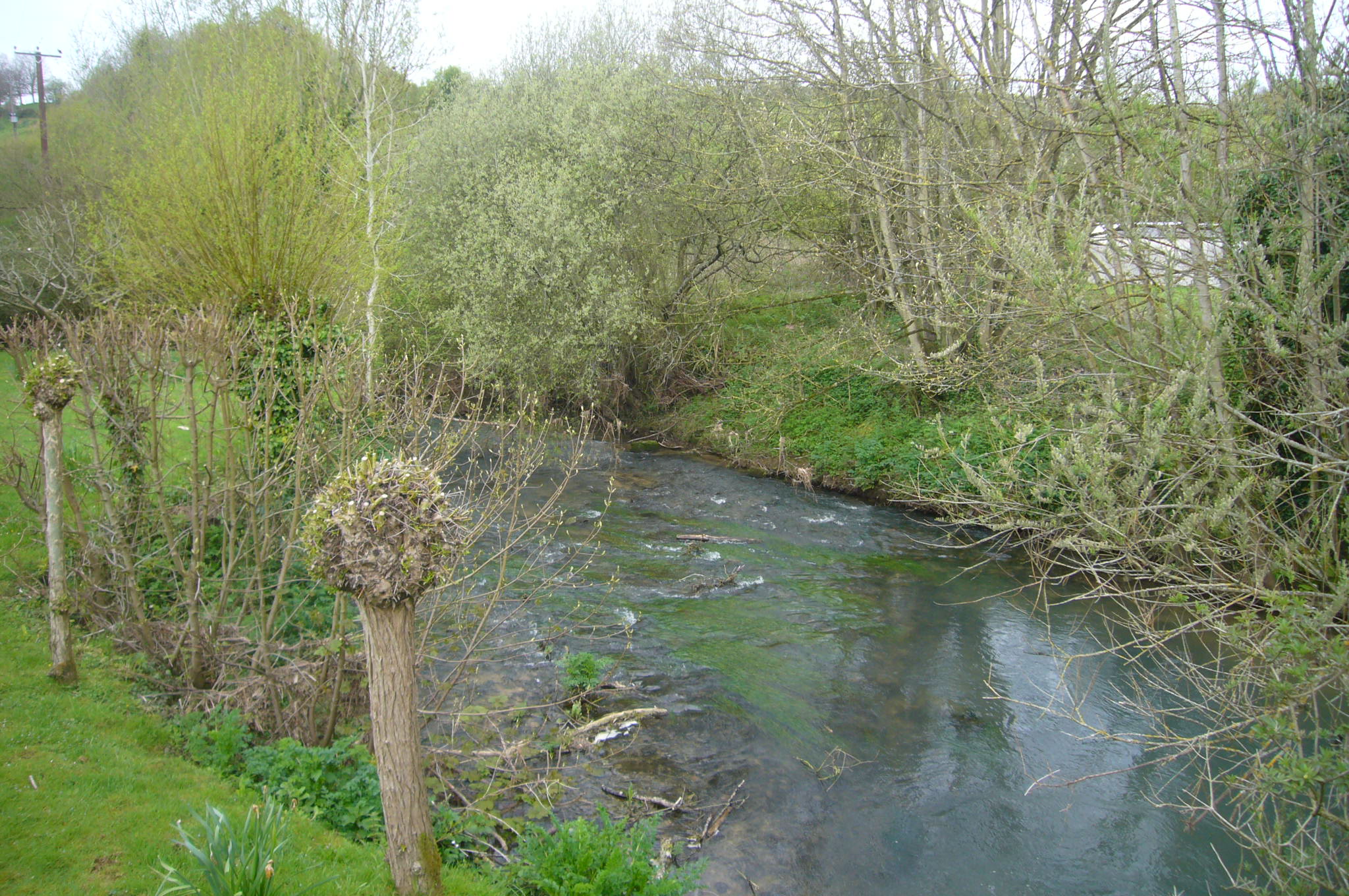
Bybrook River

The Bybrook, also known as the By Brook, is a small river in England. It is a tributary of the Bristol Avon and is some 12 miles (19 km) long. Its sources...

Monkton Farleigh

Monkton Farleigh is a village and civil parish in west Wiltshire, England, on high ground 3 miles (5 km) northwest of Bradford-on-Avon, and a similar distance...

Hampton Rocks Cutting

Hampton Rocks Cutting (grid reference ST779666) is a 1.3 hectare geological Site of Special Scientific Interest near the village of Bathampton, Somerset...

Nearby Amenities

Located within 500m of 51.397646,-2.297085
Post Box
Lat/Long: 51.4002919/-2.3014121
Barrier: stile
Lat/Long: 51.3970618/-2.302974
Barrier: stile
Lat/Long: 51.3938299/-2.2980316
Tourism: viewpoint
Lat/Long: 51.3941057/-2.2974234
Barrier: stile
Lat/Long: 51.3950227/-2.3010246
Bus Stop
British Legion
Bus: yes
Naptan AtcoCode: 0180BAC30558
Naptan Bearing: E
Naptan CommonName: British Legion
Naptan Crossing: Titan Barrow
Naptan NaptanCode: bthmgjg
Naptan PlusbusZoneRef: BATHSPA
Naptan Street: Bathford Hill
Naptan Verified: no
Public Transport: platform
Source: naptan_import
Lat/Long: 51.4005899/-2.3008898
Bus Stop
Dovers Park
Bus: yes
Naptan AtcoCode: 0180BAC30559
Naptan Bearing: NE
Naptan CommonName: Dovers Park
Naptan Crossing: High Street
Naptan NaptanCode: bthmgjp
Naptan PlusbusZoneRef: BATHSPA
Naptan Street: Dovers Park
Naptan Verified: no
Public Transport: platform
Source: naptan_import
Lat/Long: 51.4002551/-2.3005498
Bus Stop
Dovers Park
Bus: yes
Naptan AtcoCode: 0180BAC30560
Naptan Bearing: SW
Naptan CommonName: Dovers Park
Naptan Crossing: High Street
Naptan NaptanCode: bthmgjm
Naptan PlusbusZoneRef: BATHSPA
Naptan Street: Dovers Park
Naptan Verified: no
Public Transport: platform
Source: naptan_import
Lat/Long: 51.4000599/-2.3006851
Bus Stop
Dovers Park
Bus: yes
Naptan AtcoCode: 0180BAC30561
Naptan Bearing: SE
Naptan CommonName: Dovers Park
Naptan NaptanCode: bthmgjt
Naptan PlusbusZoneRef: BATHSPA
Naptan Street: Dovers Park
Naptan Verified: no
Public Transport: platform
Source: naptan_import
Lat/Long: 51.3994678/-2.3003889
Bus Stop
Stone Wharf
Bus: yes
Naptan AtcoCode: 0180BAC30562
Naptan Bearing: E
Naptan CommonName: Stone Wharf
Naptan Crossing: The Garstons
Naptan NaptanCode: bthmgjw
Naptan Street: High Street
Naptan Verified: no
Public Transport: platform
Source: naptan_import
Lat/Long: 51.399131/-2.2946847
Barrier: cycle_barrier
Lat/Long: 51.3960268/-2.2920262
Barrier: kissing_gate
Lat/Long: 51.3949583/-2.2968508
Barrier: stile
Lat/Long: 51.3956556/-2.2916196
Barrier: kissing_gate
Lat/Long: 51.394905/-2.297362
Barrier: kissing_gate
Lat/Long: 51.3941541/-2.2981086
Barrier: stile
Lat/Long: 51.401626/-2.3002276
Barrier: cycle_barrier
Foot: designated
Lat/Long: 51.3998252/-2.3011338
Bicycle Parking
Bicycle Parking: stands
Capacity: 8
Covered: no
Lat/Long: 51.400245/-2.3011413
Post Box
Brand: Royal Mail
Brand Wikidata: Q638098
Operator: Royal Mail
Operator Wikidata: Q638098
Post Box Mounting: stone_wall
Post Box Type: wall
Lat/Long: 51.3999877/-2.2981196
Bench
Lat/Long: 51.3976629/-2.294029
Defibrillator
Defibrillator Location: On outside wall of Bathford Village Shop, next to car parking area
Emergency: defibrillator
Ref: CHT-14-1384
Lat/Long: 51.4004752/-2.3016655
Breakfast & After School Club
Addr Postcode: BA1 7UB
Addr Street: Dovers Park
Club: school
Fhrs Id: 1199457
Website: https://www.farringtongurneyschool.co.uk/website
Lat/Long: 51.3992803/-2.3008006
Bench
Lat/Long: 51.3991544/-2.3022804
Waste Basket
Lat/Long: 51.3991954/-2.3021745
Waste Basket
Lat/Long: 51.3978693/-2.3026527
Bench
Backrest: yes
Lat/Long: 51.3978781/-2.3026447
Bicycle Parking
Bicycle Parking: stands
Capacity: 12
Covered: no
Lat/Long: 51.3993106/-2.3005795
Waste Basket
Lat/Long: 51.399492/-2.3004571
Crossing
Crossing: unmarked
Crossing Markings: no
Crossing Ref: zebra
Lat/Long: 51.400497/-2.3004664
Board Type: notice
Information: board
Tourism: information
Lat/Long: 51.4002834/-2.3013823
Board Type: history
Information: board
Tourism: information
Lat/Long: 51.4003026/-2.3014414
Bench
Lat/Long: 51.4001672/-2.3008676
Leisure: picnic_table
Lat/Long: 51.4003212/-2.3006009
Bench
Lat/Long: 51.4004091/-2.3004775
Bench
Lat/Long: 51.4003881/-2.3007793
Waste Basket
Lat/Long: 51.3997655/-2.2976809
Waste Basket
Lat/Long: 51.4014514/-2.3005533
Bench
Backrest: yes
Lat/Long: 51.3995077/-2.2966684
Waste Basket
Lat/Long: 51.4002674/-2.3005329
Waste Basket
Lat/Long: 51.4010522/-2.3000073
The data included in this document is from www.openstreetmap.org. The data is made available under ODbL.

Have you been to Bathford?

Leave your review of Bathford below (or comments, questions and feedback).