Barton Turf

Civil Parish in Norfolk North Norfolk

England

Barton Turf

Barton Broad - Gayes Staithe 1980
Barton Broad - Gayes Staithe 1980 Credit: Roy Hughes

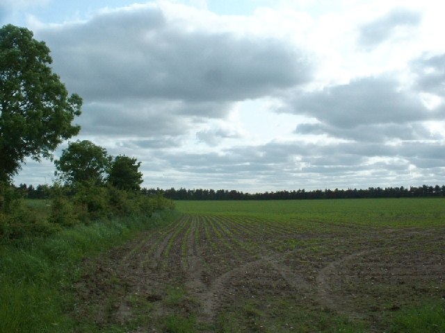
Barton Turf is a civil parish located in the county of Norfolk, England. Situated about 11 miles northeast of Norwich, it is part of the Broadland district. The parish covers an area of approximately 6 square miles and is bordered by the villages of Neatishead, Irstead, and Neaton.

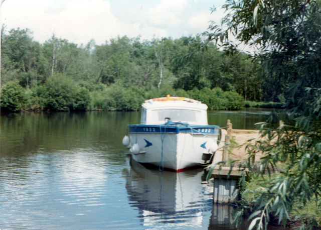
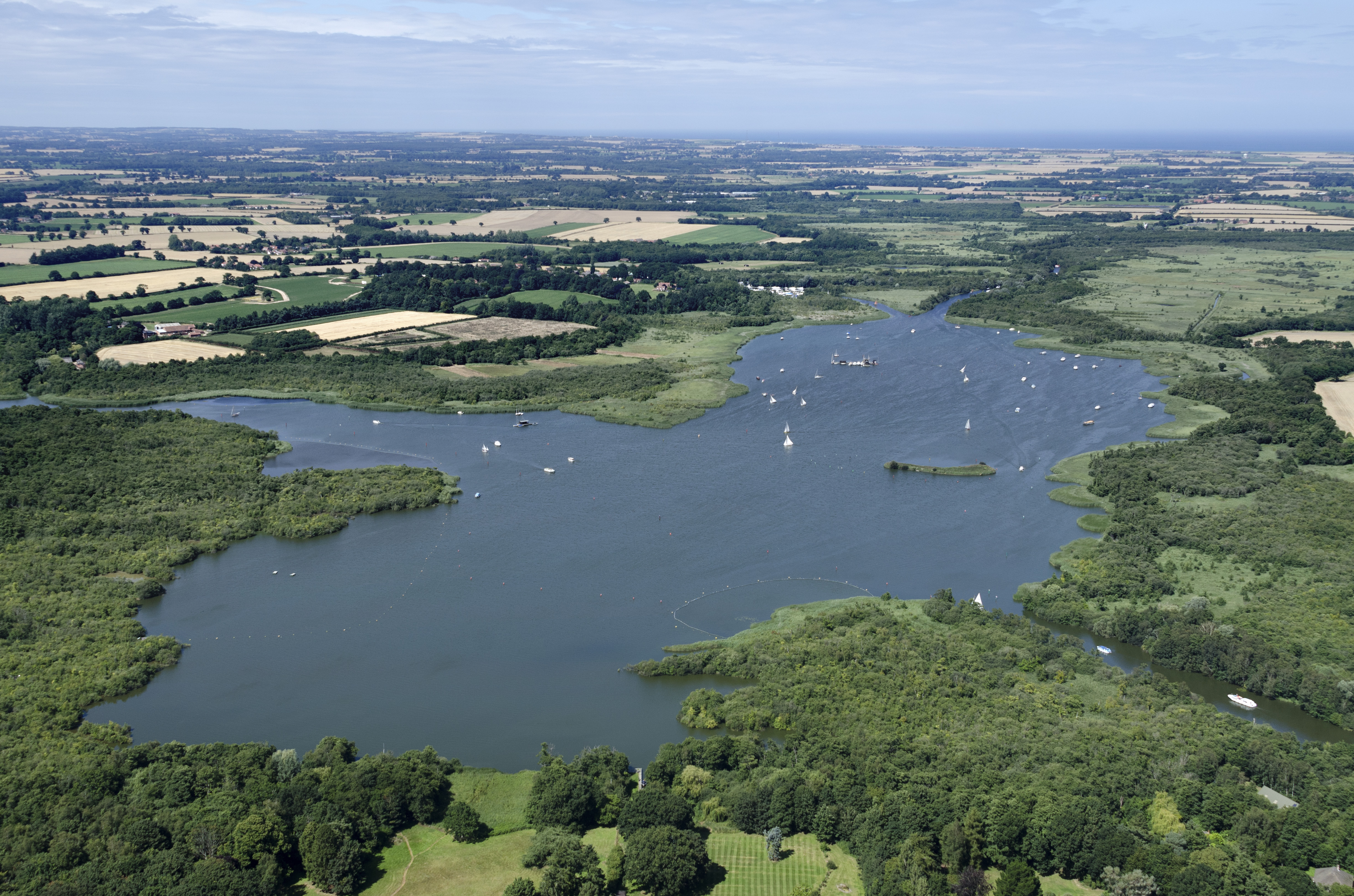
The village of Barton Turf is set in a rural landscape, surrounded by picturesque countryside and waterways. It is well-known for its proximity to Barton Broad, a large lake that forms part of the Norfolk Broads National Park. The broad attracts many visitors who enjoy boating, fishing, and birdwatching.

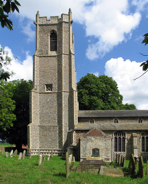
The village itself is small, with a population of around 300 residents. It has a charming and peaceful atmosphere, with traditional Norfolk cottages and a 14th-century church, St. Michael and All Angels, at its heart. The church features a thatched roof, a unique feature that sets it apart from other local churches.

Barton Turf is also home to a popular sailing club, which was established in the 1930s. The club offers sailing lessons and hosts various events throughout the year, attracting sailing enthusiasts from near and far.

The village has limited amenities, with a community hall serving as a hub for local activities and events. For more extensive facilities, residents and visitors often travel to nearby towns such as Wroxham or Stalham.

Overall, Barton Turf is a charming and idyllic village, offering a tranquil escape for those seeking a peaceful countryside experience. Its natural beauty and close proximity to the Norfolk Broads make it a popular destination for nature lovers and outdoor enthusiasts.

If you have any feedback on the listing, please let us know in the comments section below.

Barton Turf Images

Images are sourced within 2km of 52.7341/1.474032 or Grid Reference TG3420. Thanks to Geograph Open Source API. All images are credited.

Barton Broad - Gayes Staithe 1980
The Old Saddlery At the road-junction in the village of Neatishead.
The Old Saddlery
At the road-junction in the village of Neatishead.
The White Horse Inn, Neatishead
The Street, Neatishead The White Horse Inn <a href="https://www.geograph.org.uk/photo/3329186">TG3421 : The White Horse Inn, Neatishead</a> is on the left, with the Old Saddlery <a href="https://www.geograph.org.uk/photo/3329184">TG3420 : The Old Saddlery</a> to the right.
The Street, Neatishead
The White Horse Inn TG3421 : The White Horse Inn, Neatishead is on the left, with the Old Saddlery TG3420 : The Old Saddlery to the right.
Cox's Boatyard, Barton Turf
Car park for Barton Broad There is a boardwalk through the marshy area at the southern edge of Barton Broad, reached by a footpath across fields from the car park.
Car park for Barton Broad
There is a boardwalk through the marshy area at the southern edge of Barton Broad, reached by a footpath across fields from the car park.
Little house in the wood Derelict cottage near Barton Broad car park.
Little house in the wood
Derelict cottage near Barton Broad car park.
Neatishead village sign Village signs are typically placed along the principal road or in a prominent location such as a village green or close by the church. The design often depicts a particularly feature of the village or a scene from its history, heritage, or culture. They are typically made of wood or metal or a combination of both, the designs are often made by the local community.
Although they do appear in villages and towns all over the country they are more prominent in East Anglia than elsewhere in the country.
Neatishead village sign
Village signs are typically placed along the principal road or in a prominent location such as a village green or close by the church. The design often depicts a particularly feature of the village or a scene from its history, heritage, or culture. They are typically made of wood or metal or a combination of both, the designs are often made by the local community. Although they do appear in villages and towns all over the country they are more prominent in East Anglia than elsewhere in the country.
Beeston Hall This fine country house is attributed to the architect William Wilkins of Norwich. It was built in 1786 for Jacob Preston near the site of an older mansion which was torn down.  The surrounding park, now largely given over to farming, is believed to have been laid out at around the same time. 

In the 1940s, Beeston Hall was owned by Sir Thomas Preston, O.B.E (1886-1976), 6th baronet, who spent most of his time  overseas. As a young man, he went on mining expeditions in northern Siberia prospecting for gold and he later joined the Diplomatic Service. He was British Consul in Ekaterinburg at the time of the murder in 1918 by the Bolsheviks of Tsar Nicholas II and the Russian Imperial family.  Sir Thomas was succeeded by his eldest son, Sir Ronald Douglas Hildebrand Preston, 7th Baronet, who served as a Major in the Intelligence Corps and later worked for Reuters and The Times as a foreign correspondent. He was also a member of the SOE (Special Operations Executive, a covert military organisation).

From 1940 to 1942, Beeston Hall housed the Norfolk Auxiliary Units' administrative headquarters and it was here where Captain Nigel Oxenden [later Major Nigel Oxenden MC] and his staff were based.  Although the Hall is surrounded by extensive park and farmland, no training exercises appear to have been held at Beeston.  

At present, the estate is known as the Beeston Hall Arabian Stud. 

(Picture taken by kind permission of the owner.)
Beeston Hall
This fine country house is attributed to the architect William Wilkins of Norwich. It was built in 1786 for Jacob Preston near the site of an older mansion which was torn down. The surrounding park, now largely given over to farming, is believed to have been laid out at around the same time. In the 1940s, Beeston Hall was owned by Sir Thomas Preston, O.B.E (1886-1976), 6th baronet, who spent most of his time overseas. As a young man, he went on mining expeditions in northern Siberia prospecting for gold and he later joined the Diplomatic Service. He was British Consul in Ekaterinburg at the time of the murder in 1918 by the Bolsheviks of Tsar Nicholas II and the Russian Imperial family. Sir Thomas was succeeded by his eldest son, Sir Ronald Douglas Hildebrand Preston, 7th Baronet, who served as a Major in the Intelligence Corps and later worked for Reuters and The Times as a foreign correspondent. He was also a member of the SOE (Special Operations Executive, a covert military organisation). From 1940 to 1942, Beeston Hall housed the Norfolk Auxiliary Units' administrative headquarters and it was here where Captain Nigel Oxenden [later Major Nigel Oxenden MC] and his staff were based. Although the Hall is surrounded by extensive park and farmland, no training exercises appear to have been held at Beeston. At present, the estate is known as the Beeston Hall Arabian Stud. (Picture taken by kind permission of the owner.)
Marsh pasture by Irstead
Alderfen Broad, Norfolk A view from a boat moored off the East bank towards the reed edge and alder swamp beyond. Actual location was towards the southern end of the broad.
Alderfen Broad, Norfolk
A view from a boat moored off the East bank towards the reed edge and alder swamp beyond. Actual location was towards the southern end of the broad.
 RA at Gay’s Staithe RA (solar powered boat) runs pleasure pleasure trips on Barton Broad from Gay’s Staithe
RA at Gay’s Staithe
RA (solar powered boat) runs pleasure pleasure trips on Barton Broad from Gay’s Staithe
Neatishead village sign Many Norfolk villages have these lovely ornate signs.  Neatishead is North of Wroxham.
Neatishead village sign
Many Norfolk villages have these lovely ornate signs. Neatishead is North of Wroxham.
Field near Neatishead A field near Neatishead
Field near Neatishead
A field near Neatishead
Boats moored near Neatishead A backwater off the Norfolk Broads known as Neatishead Staithe.
Boats moored near Neatishead
A backwater off the Norfolk Broads known as Neatishead Staithe.
Alderfen Broad Alderfen Broad nature reserve
Alderfen Broad
Alderfen Broad nature reserve
A countryside church at Threehammer Common A countryside church at Threehammer Common
A countryside church at Threehammer Common
Show me another place!

Barton Turf is located at Grid Ref: TG3420 (Lat: 52.7341, Lng: 1.474032)

Administrative County: Norfolk

District: North Norfolk

Police Authority: Norfolk

What 3 Words

///robes.automate.spits. Near Horning, Norfolk

Related Wikis

Neatishead

Neatishead ( NEET-stəd) is a village and civil parish in the English county of Norfolk. The village is situated some 20 km (12 mi) north-east of the city...

St Michael and All Angels Church, Barton Turf

St Michael and All Angels is the Church of England parish church of Barton Turf in the county of Norfolk in England. See Inside here. It stands about a...

Barton Broad

Barton Broad is a large lake that forms part of the River Ant which gives its name to a 164-hectare (410-acre) nature reserve north-east of Norwich in...

Ant Broads & Marshes National Nature Reserve

Ant Broads & Marshes NNR is a national nature reserve in Norfolk, England established by English Nature. It is named after the River Ant. It is part of...

Nearby Amenities

Located within 500m of 52.7341,1.474032
Neatishead
Is In Country: United Kingdom
Is In County: Norfolk
Is In Nation: England
Place: village
Postal Code: NR12
Lat/Long: 52.7359857/1.4680584
Parking
Lat/Long: 52.7356032/1.4715298
Waterway: turning_point
Lat/Long: 52.7365641/1.4711385
Parish Staithe
Leisure: slipway
Lat/Long: 52.7358139/1.4715499
Village Information
Tourism: information
Lat/Long: 52.7357701/1.4714829
Recycling
Lat/Long: 52.7357717/1.4715446
Ladder
Emergency: ladder
Lat/Long: 52.7358395/1.471567
Ladder
Emergency: ladder
Lat/Long: 52.7364898/1.4717156
Ladder
Emergency: ladder
Lat/Long: 52.7364966/1.4714926
Water Point
Drinking Water: yes
Fee: yes
Fixme: position approx
Lat/Long: 52.7361325/1.4717241
Water Point
Drinking Water: yes
Fee: yes
Fixme: position approx
Lat/Long: 52.7361406/1.4714599
Tourism: picnic_site
Lat/Long: 52.7336976/1.4801073
Tourism: picnic_site
Lat/Long: 52.7338661/1.4800959
Bicycle Parking
Bicycle Parking: stands
Capacity: 8
Covered: no
Lat/Long: 52.7338295/1.4802414
The data included in this document is from www.openstreetmap.org. The data is made available under ODbL.

Have you been to Barton Turf?

Leave your review of Barton Turf below (or comments, questions and feedback).