Brimaston

Settlement in Pembrokeshire

Wales

Brimaston

Footpath near Poll Carn The footpath crosses fields adjacent to the rocky outcrop.
Footpath near Poll Carn Credit: Jeremy Bolwell

Brimaston is a small village located in the county of Pembrokeshire, Wales. Situated in the western part of the country, it lies approximately 3 miles north of the town of Haverfordwest. With a population of around 300 inhabitants, Brimaston is known for its peaceful and rural environment.

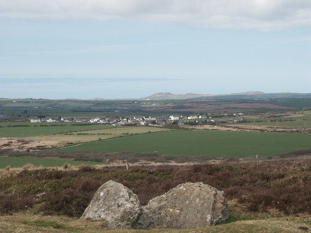
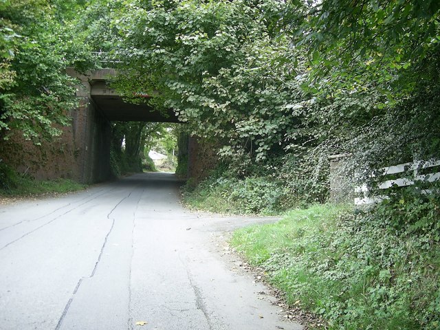
The village is surrounded by picturesque countryside, characterized by rolling hills, lush green fields, and dense woodland. The area is home to a variety of wildlife, making it a popular destination for nature lovers and outdoor enthusiasts. Several walking trails and footpaths crisscross the village, offering residents and visitors the opportunity to explore the scenic surroundings.

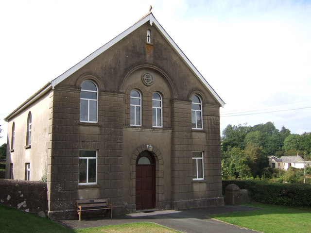
Although small in size, Brimaston boasts a close-knit community and a strong sense of camaraderie. The village features a village hall, which serves as a hub for social gatherings, events, and activities. Local residents also benefit from a nearby primary school, ensuring convenient access to education for families in the area.

For amenities and services, residents can easily access the nearby town of Haverfordwest, which offers a wider range of shops, supermarkets, restaurants, and leisure facilities. Additionally, the stunning Pembrokeshire coastline is just a short drive away, providing opportunities for beach visits, water sports, and coastal walks.

Overall, Brimaston offers a tranquil and idyllic lifestyle, away from the hustle and bustle of larger towns and cities. Its natural beauty, community spirit, and convenient location make it an attractive place to live or visit for those seeking a peaceful retreat in the heart of Pembrokeshire.

If you have any feedback on the listing, please let us know in the comments section below.

Brimaston Images

Images are sourced within 2km of 51.886525/-5.005617 or Grid Reference SM9325. Thanks to Geograph Open Source API. All images are credited.

Footpath near Poll Carn The footpath crosses fields adjacent to the rocky outcrop.
Footpath near Poll Carn
The footpath crosses fields adjacent to the rocky outcrop.
Footpath on Great Treffgarne Mountain The field edge footpath gradually heads towards the broad summit of this large hill across high pasture grazed by both sheep and cattle.
Footpath on Great Treffgarne Mountain
The field edge footpath gradually heads towards the broad summit of this large hill across high pasture grazed by both sheep and cattle.
On top of Great Treffgarne Mountain The 'mountain' is in fact only barely a hillock, rising to a modest 531 ft / 162m above sea level, but it does offer some great all round views to the coast and inland. The Preseli Hills are on the horizon here.
On top of Great Treffgarne Mountain
The 'mountain' is in fact only barely a hillock, rising to a modest 531 ft / 162m above sea level, but it does offer some great all round views to the coast and inland. The Preseli Hills are on the horizon here.
Farm track on Great Treffgarne Mountain The track wends its way across the hill top.
Farm track on Great Treffgarne Mountain
The track wends its way across the hill top.
Silage or haylage storage in a field near Upper North Hill farm I heard this long before I saw it - a silage stack under a large black sheet, roaring in the wind like a hovercraft engine or an idling and revving jet engine. It struggled like a trapped spirit in the underworld, throwing weird shapes one second resembling a bunch of black grapes, the next an old telephone, the next a huge black cab and so on.
Silage or haylage storage in a field near Upper North Hill farm
I heard this long before I saw it - a silage stack under a large black sheet, roaring in the wind like a hovercraft engine or an idling and revving jet engine. It struggled like a trapped spirit in the underworld, throwing weird shapes one second resembling a bunch of black grapes, the next an old telephone, the next a huge black cab and so on.
Field access track near Brimaston This old droveway or green lane is used to access corn and barley fields on the broad ridge ahead.
Field access track near Brimaston
This old droveway or green lane is used to access corn and barley fields on the broad ridge ahead.
Fields above the Nant-y-coy brook The tips of Poll Carn and Maiden Castle stand out above the fields.
Fields above the Nant-y-coy brook
The tips of Poll Carn and Maiden Castle stand out above the fields.
Lane near South Hill farm Farm access lane with barking farm dog. Great Treffgarne Mountain laid out behind.
Lane near South Hill farm
Farm access lane with barking farm dog. Great Treffgarne Mountain laid out behind.
Gorse on the ramparts of a 'settlement' near the Nant-y-coy valley Might be an Iron Age settlement, a circular bank and ditch on the hilltop. Wooden waymarker post for approximate scale.
Gorse on the ramparts of a 'settlement' near the Nant-y-coy valley
Might be an Iron Age settlement, a circular bank and ditch on the hilltop. Wooden waymarker post for approximate scale.
Approach to Hayscastle Cross Approaching Hayscastle Cross on the B4330.
Approach to Hayscastle Cross
Approaching Hayscastle Cross on the B4330.
Road junction near Mountain Water The road from Brimaston joins the B4330 near Mountain Water.
Road junction near Mountain Water
The road from Brimaston joins the B4330 near Mountain Water.
Track near Upper Newton Farm
Ordnance Survey Trig Pillar S6388 This toppled and moved pillar can be found in the field edge beside the footpath.
Ordnance Survey Trig Pillar S6388
This toppled and moved pillar can be found in the field edge beside the footpath.
Cutting grass for silage near Hayscastle Cross Looking north west from the road to Brimaston.
Cutting grass for silage near Hayscastle Cross
Looking north west from the road to Brimaston.
Farmyard at Barnards Hill On the road between Hayscastle Cross and Welsh Hook.
Farmyard at Barnards Hill
On the road between Hayscastle Cross and Welsh Hook.
Farmhouse and barns at Pen-parc
Applying a top-dressing of fertiliser Looking west from the lane just south of New Buildings, near Tre-rhos.
Applying a top-dressing of fertiliser
Looking west from the lane just south of New Buildings, near Tre-rhos.
New farmhouse and barns near Cold Comfort
Show me another place!

Brimaston is located at Grid Ref: SM9325 (Lat: 51.886525, Lng: -5.005617)

Unitary Authority: Pembrokeshire

Police Authority: Dyfed Powys

What 3 Words

///cadet.enhancement.ozone. Near Letterston, Pembrokeshire

Nearby Locations

Brimaston Treowman

Related Wikis

Hayscastle

Hayscastle or Hays-Castle (Welsh: Cas-lai) is a village, parish and community of Pembrokeshire in West Wales, 7½ miles (N. W. by N.) from Haverfordwest...

Welsh Hook Halt railway station

Welsh Hook Halt railway station served the hamlet of Welsh Hook, Pembrokeshire, Wales, from 1924 to 1964 on the Clarbeston Road and Letterston Railway...

Treffgarne Hall

Treffgarne Hall is a privately owned Grade II listed Georgian country house, located to the west of the village of Treffgarne, West Wales. It was built...

Wolf's Castle

Wolfscastle (Welsh: Casblaidd), also spelt Wolf's Castle, is a village and community in Pembrokeshire, between Haverfordwest and Fishguard, in southwest...

Nearby Amenities

Located within 500m of 51.886525,-5.005617
Brimaston Cross
Junction: yes
Lat/Long: 51.8903618/-5.0075648
The data included in this document is from www.openstreetmap.org. The data is made available under ODbL.

Have you been to Brimaston?

Leave your review of Brimaston below (or comments, questions and feedback).