Barcheston

Civil Parish in Warwickshire Stratford-on-Avon

England

Barcheston

Raised granary Old staddle stones used as ornaments are a common sight in country districts,  but it is rare to find them still in their original position as in this timber-framed granary with brick infilling, where their purpose is to support the structure clear of the ground and out of the reach of vermin.  For more detail see <a href="https://www.geograph.org.uk/photo/1674578">SP2637 : High off the ground</a> (I see that honey is no longer for sale!)
Raised granary Credit: Tiger

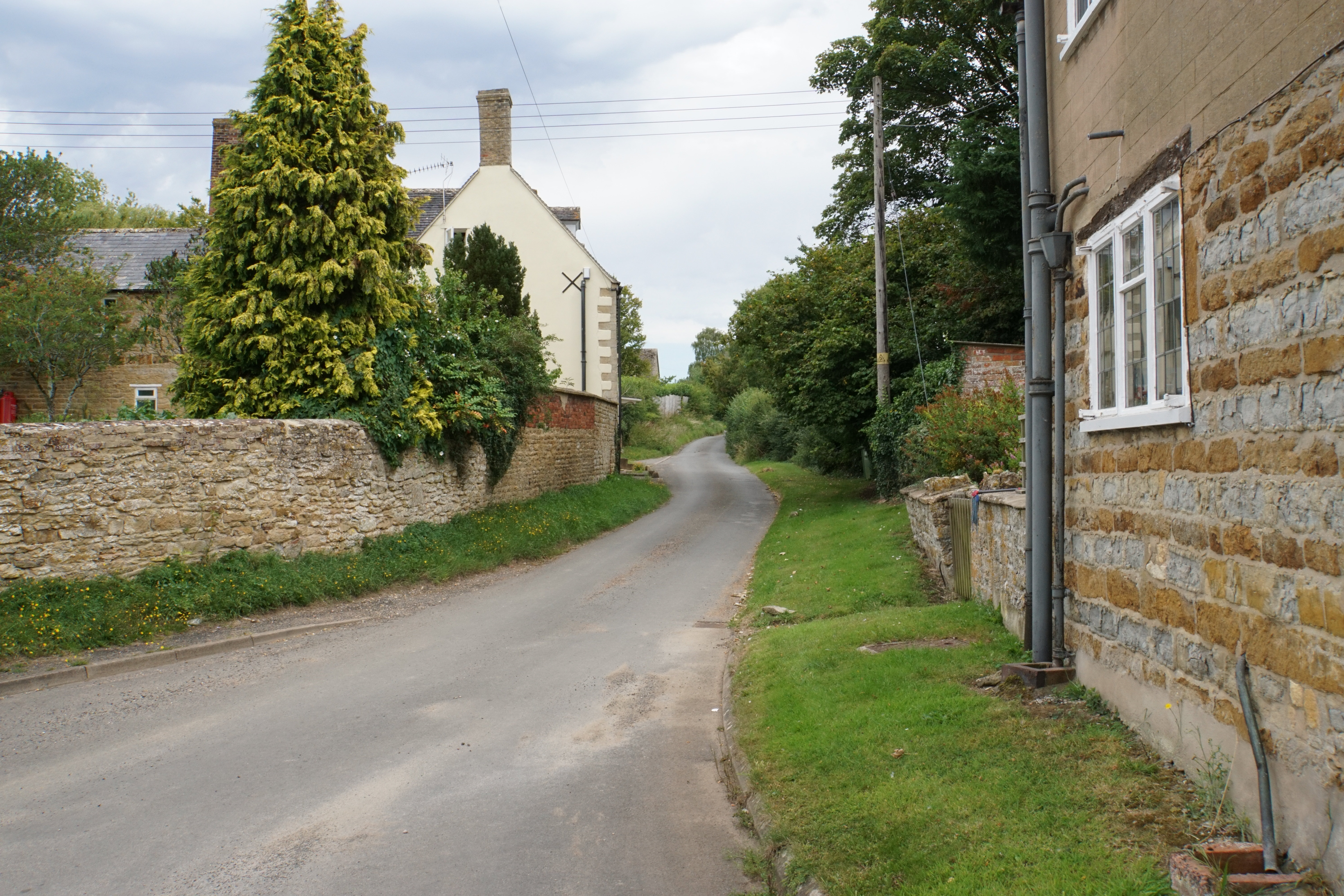
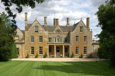
Barcheston is a civil parish located in the county of Warwickshire, England. Situated in the Stratford-on-Avon district, this small rural village covers an area of approximately 5.2 square kilometers. Barcheston is nestled in the picturesque countryside, surrounded by rolling hills and farmland. It is located about 10 miles south-west of the historic town of Stratford-upon-Avon.

The village of Barcheston is home to a small population, estimated to be around 100 residents. The community is tight-knit, with a strong sense of local pride. The village is characterized by its charming and well-preserved traditional cottages, which add to its rustic appeal.

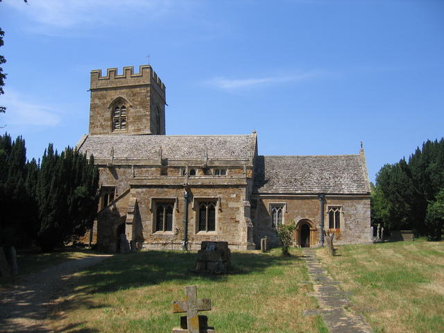
One of the notable landmarks in Barcheston is the Church of St Martin. This Grade I listed building dates back to the 13th century and features stunning medieval architecture. The church is known for its beautiful stained glass windows and intricate stone carvings.

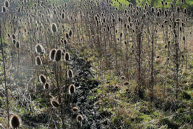
Barcheston is surrounded by idyllic countryside, making it a popular destination for nature lovers and outdoor enthusiasts. The area offers numerous walking and cycling routes, allowing visitors to explore the scenic surroundings at their leisure.

Despite its small size, Barcheston benefits from a vibrant community spirit. The village hosts various events throughout the year, including a summer fete and a harvest festival, providing an opportunity for residents to come together and celebrate.

Overall, Barcheston offers a tranquil and picturesque setting, making it an attractive place to live or visit for those seeking a peaceful retreat amidst the beauty of the Warwickshire countryside.

If you have any feedback on the listing, please let us know in the comments section below.

Barcheston Images

Images are sourced within 2km of 52.053807/-1.599902 or Grid Reference SP2739. Thanks to Geograph Open Source API. All images are credited.

Raised granary Old staddle stones used as ornaments are a common sight in country districts,  but it is rare to find them still in their original position as in this timber-framed granary with brick infilling, where their purpose is to support the structure clear of the ground and out of the reach of vermin.  For more detail see <a href="https://www.geograph.org.uk/photo/1674578">SP2637 : High off the ground</a> (I see that honey is no longer for sale!)
Raised granary
Old staddle stones used as ornaments are a common sight in country districts, but it is rare to find them still in their original position as in this timber-framed granary with brick infilling, where their purpose is to support the structure clear of the ground and out of the reach of vermin. For more detail see SP2637 : High off the ground (I see that honey is no longer for sale!)
Tree near Tidmington Probably a pine of some description.
Tree near Tidmington
Probably a pine of some description.
Barcheston church It is difficult to get a good view of the church from this direction.  This is from Shakespeare's Way, which runs through a thinly populated orchard here.
Barcheston church
It is difficult to get a good view of the church from this direction. This is from Shakespeare's Way, which runs through a thinly populated orchard here.
Barcheston hamlet The Shakespeare's Way guide describes Barcheston as "minute hamlet" which seems somewhat tautologous.  Unless of course the guide is thinking of a miniature version of the Prince of Denmark, of whom there was no evidence.  There is a cast iron village water pump adjacent to this barn conversion though.
Barcheston hamlet
The Shakespeare's Way guide describes Barcheston as "minute hamlet" which seems somewhat tautologous. Unless of course the guide is thinking of a miniature version of the Prince of Denmark, of whom there was no evidence. There is a cast iron village water pump adjacent to this barn conversion though.
Teasels on the path We were heading directly in to low winter sun, which was backlighting this profusion of teasels adjacent to the footpath, part of Shakespeare's Way.
Teasels on the path
We were heading directly in to low winter sun, which was backlighting this profusion of teasels adjacent to the footpath, part of Shakespeare's Way.
Shakespeare's Way near Willington The path crosses this pasture adjacent to the River Stour, with more pasture on the far bank.
Shakespeare's Way near Willington
The path crosses this pasture adjacent to the River Stour, with more pasture on the far bank.
Bridge at Bridge Farm This bridge carries a farm access track across the River Stour, and is also a public footpath.  It is not used by Shakespeare's Way though, which stays on this side.
Bridge at Bridge Farm
This bridge carries a farm access track across the River Stour, and is also a public footpath. It is not used by Shakespeare's Way though, which stays on this side.
Cottage in Willington Shakespeare's Way passes the door.  Note the bread oven.
Cottage in Willington
Shakespeare's Way passes the door. Note the bread oven.
Cottages in Willington A corner of the village showing a couple of the cottages, the postbox and the village noticeboard.  Shakespeare's Way passes here.
Cottages in Willington
A corner of the village showing a couple of the cottages, the postbox and the village noticeboard. Shakespeare's Way passes here.
Rest near College Farm College Farm is in the background.  Shakespeare's Way passes this bench, a good point for a tea stop.
Rest near College Farm
College Farm is in the background. Shakespeare's Way passes this bench, a good point for a tea stop.
Approaching Willington Straight ahead for Willington, and also Shakespeare's Way.
Approaching Willington
Straight ahead for Willington, and also Shakespeare's Way.
Towards Ivy Ground Spinney Shakespeare's Way uses this footpath, diagonally across this field towards the spinney, on the right, and beyond.  It contains very claggy clay soil.
Towards Ivy Ground Spinney
Shakespeare's Way uses this footpath, diagonally across this field towards the spinney, on the right, and beyond. It contains very claggy clay soil.
Near Ivy Ground Spinney The spinney is to the left.  The footpath, used by Shakespeare's Way, crosses from one claggy clay field to another here.
Near Ivy Ground Spinney
The spinney is to the left. The footpath, used by Shakespeare's Way, crosses from one claggy clay field to another here.
Towards Burmington Grange The impressive grange is in SP2837.  This square is mainly arable land, here with a grass crop crossed by a footpath used by Shakespeare's Way.
Towards Burmington Grange
The impressive grange is in SP2837. This square is mainly arable land, here with a grass crop crossed by a footpath used by Shakespeare's Way.
On Shakespeare's Way The route here follows footpaths across arable land, without any substantial change of direction to the crest on the horizon.
On Shakespeare's Way
The route here follows footpaths across arable land, without any substantial change of direction to the crest on the horizon.
Lane to Willington Looking SSW down the lane with a recently ploughed field on the left.
Lane to Willington
Looking SSW down the lane with a recently ploughed field on the left.
View west from lane to Willington Looking west across the fields towards the church at Barcheston.
View west from lane to Willington
Looking west across the fields towards the church at Barcheston.
Hall on Old Road, Shipston on Stour It looks like a public toilets, but there's only one door on the entrance.
Hall on Old Road, Shipston on Stour
It looks like a public toilets, but there's only one door on the entrance.
Show me another place!

Barcheston is located at Grid Ref: SP2739 (Lat: 52.053807, Lng: -1.599902)

Administrative County: Warwickshire

District: Stratford-on-Avon

Police Authority: Warwickshire

What 3 Words

///cackling.among.benched. Near Shipston on Stour, Warwickshire

Nearby Locations

Barcheston

Related Wikis

Shipston-on-Stour Rural District

Shipston on Stour was a rural district in England from 1894 to 1974. [1] The district covered an area around Shipston-on-Stour. Originally it was a detached...

Evolution of Worcestershire county boundaries since 1844

The administrative boundaries of Worcestershire, England have been fluid for over 150 years since the first major changes in 1844. There were many detached...

Willington, Warwickshire

Willington is a village in Warwickshire, England. Population details are included within Barcheston. The origin of the place-name is from Old English tun...
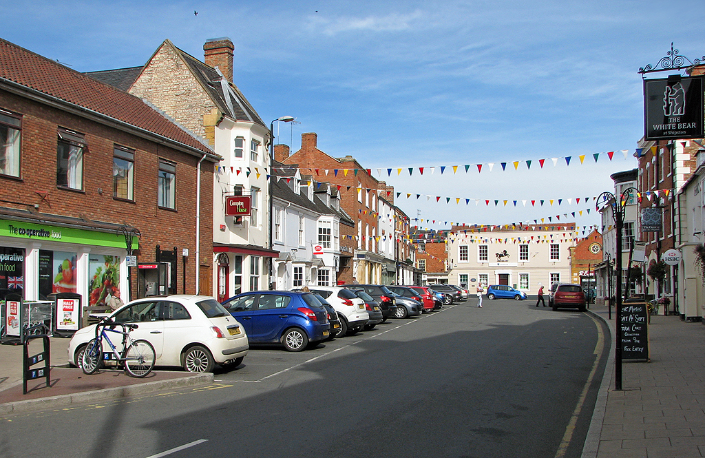
Shipston-on-Stour

Shipston-on-Stour is a town and civil parish in the Stratford-on-Avon District in southern Warwickshire, England. It is located on the banks of the River...
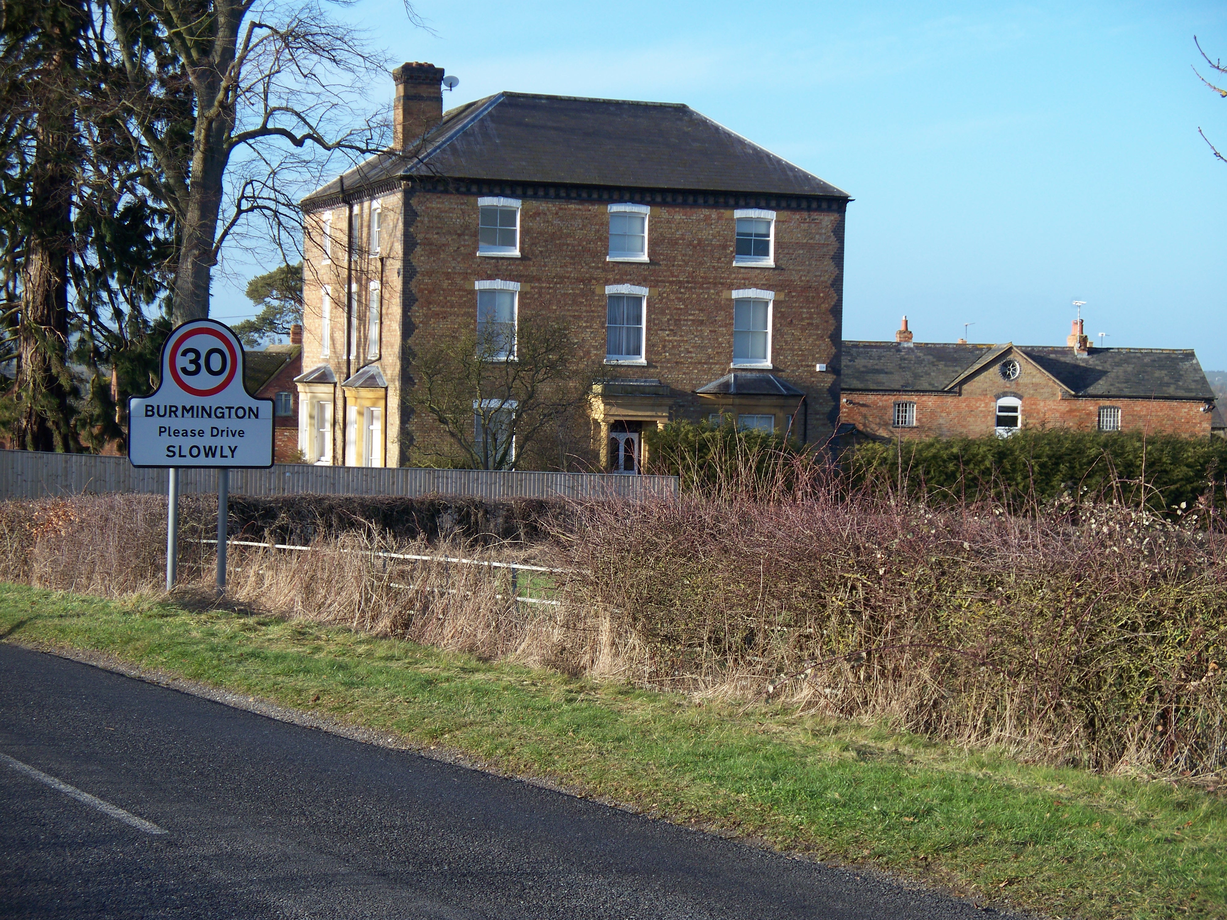
Burmington

Burmington is a village and civil parish in Warwickshire, England. It is 2 miles (3 km) south of Shipston-on-Stour. The population at the 2001 Census was...

Tidmington

Tidmington is a village and civil parish in the Stratford-on-Avon District of Warwickshire, England. It is 11 miles (18 km) south from the town of Stratford...

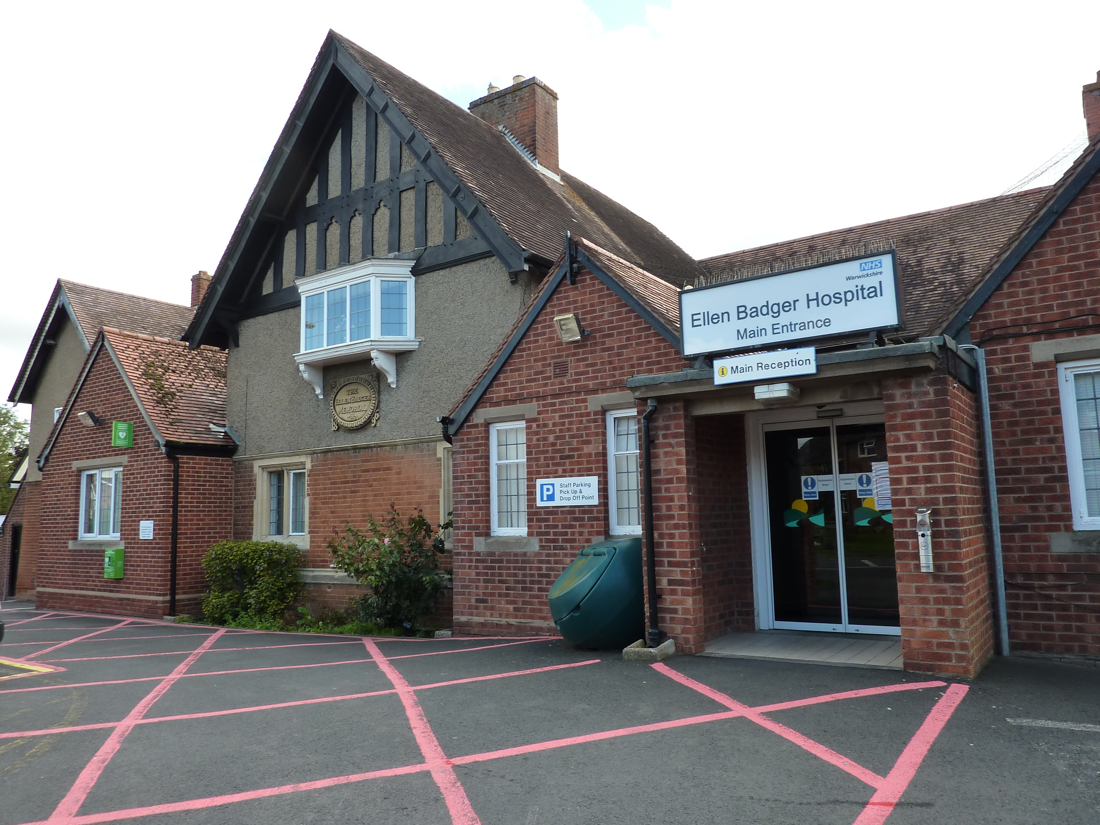
Ellen Badger Hospital

The Ellen Badger is a small community NHS hospital located within the town of Shipston-on-Stour in Warwickshire, England. It is operated by South Warwickshire...

Barcheston

Barcheston is a village and civil parish in the Stratford-on-Avon district of Warwickshire, England. The village is on the east bank of the River Stour...

Nearby Amenities

Located within 500m of 52.053807,-1.599902
Barrier: stile
Lat/Long: 52.0542382/-1.6023363
Barrier: stile
Lat/Long: 52.0531346/-1.5958514
Barrier: cattle_grid
Source: survey
Lat/Long: 52.051406/-1.6021029
Barrier: stile
Source: survey
Lat/Long: 52.0512254/-1.5945357
Barrier: cattle_grid
Lat/Long: 52.0521624/-1.5975419
Famington Farm Barn
Power: pole
Transformer: distribution
Voltage Primary: 11000
Lat/Long: 52.0536665/-1.59609
The data included in this document is from www.openstreetmap.org. The data is made available under ODbL.

Have you been to Barcheston?

Leave your review of Barcheston below (or comments, questions and feedback).