Aylton

Civil Parish in Herefordshire

England

Aylton

St Andrew's church, Pixley Small medieval parish church <span class="nowrap"><a title="https://historicengland.org.uk/listing/the-list/list-entry/1098989?section=official-list-entry" rel="nofollow ugc noopener" href="https://historicengland.org.uk/listing/the-list/list-entry/1098989?section=official-list-entry">Link</a><img style="margin-left:2px;" alt="External link" title="External link - shift click to open in new window" src="https://s1.geograph.org.uk/img/external.png" width="10" height="10"/></span>
St Andrew's church, Pixley Credit: Jonathan Thacker

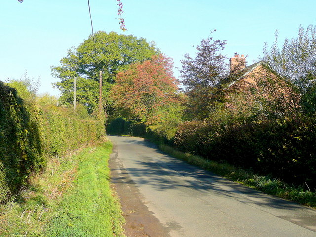
Aylton is a small civil parish located in the county of Herefordshire, England. Situated about 5 miles southeast of the city of Hereford, the parish covers an area of approximately 2 square miles. Aylton is a rural community surrounded by picturesque countryside and is known for its tranquil and idyllic setting.

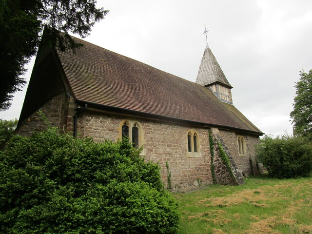
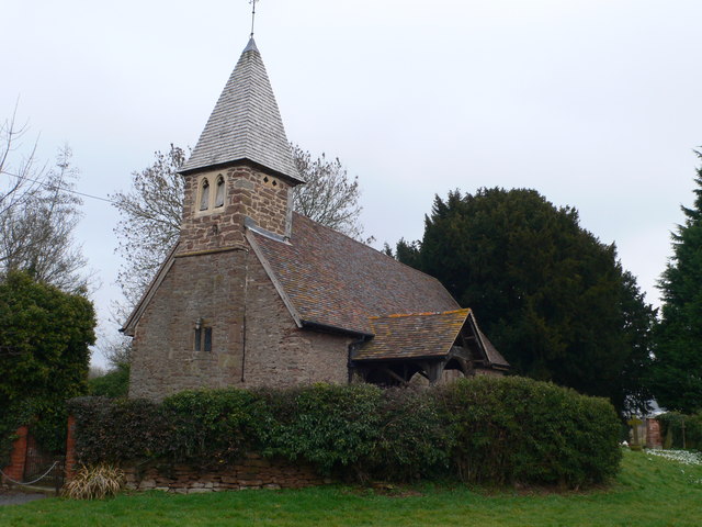
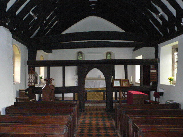
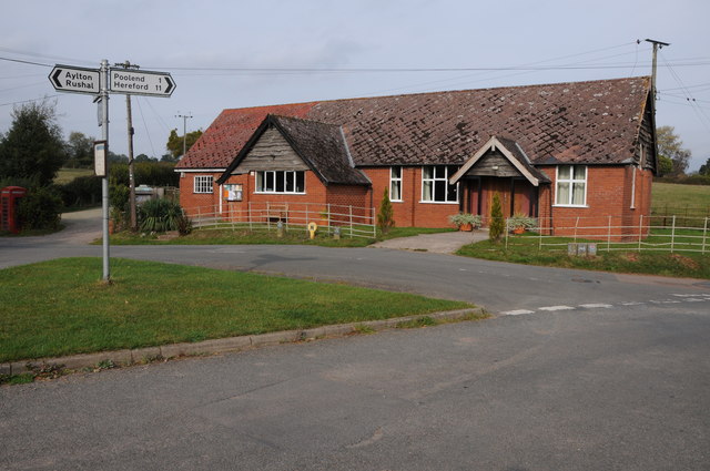
The parish consists of a scattering of houses and farms, with a population of around 150 residents. The village itself is centered around St. John the Baptist Church, a beautiful Grade II listed building that dates back to the 12th century. The church is a focal point for the community and holds regular services and events.

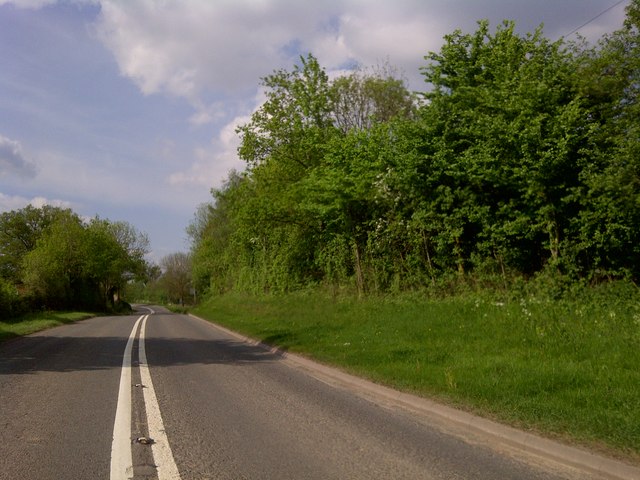
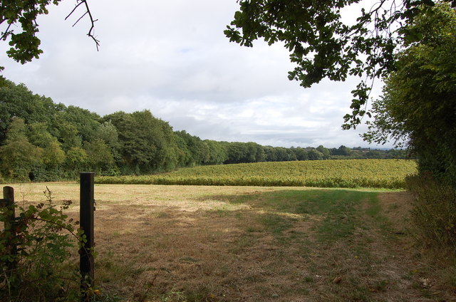
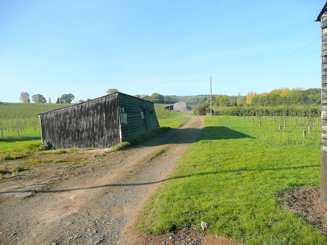
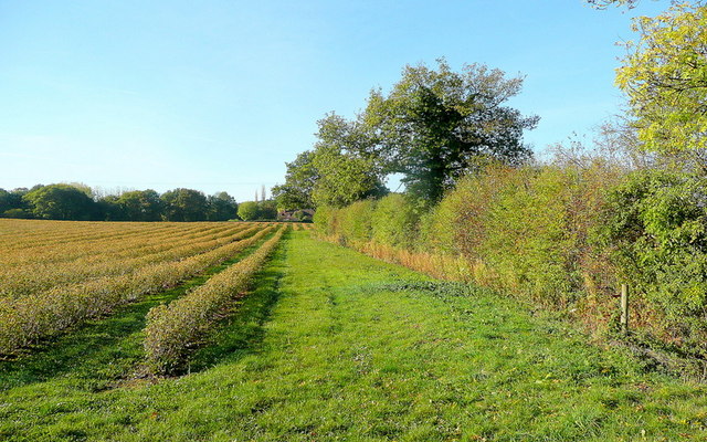
Aylton is predominantly an agricultural area, with farming playing a significant role in the local economy. The landscape is characterized by rolling hills, green meadows, and farmland, which contribute to the area's scenic beauty. The parish is also home to several small woodlands and streams, adding to the natural charm of the village.

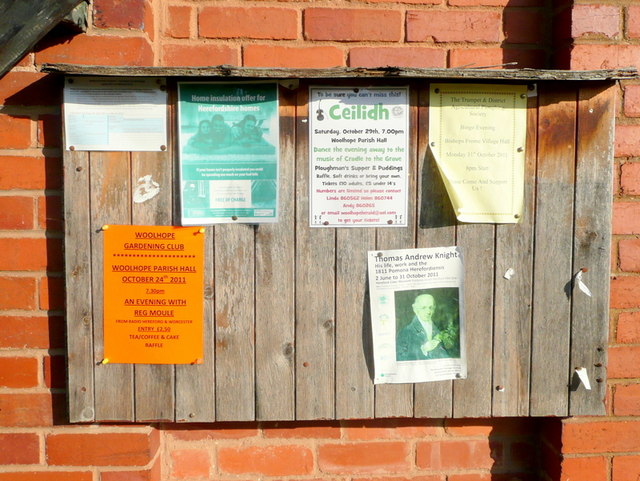
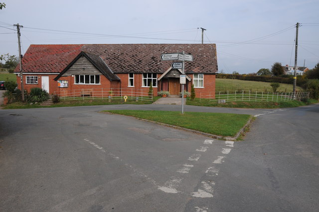
Despite its small size, Aylton has a strong sense of community spirit. Residents often come together for various social events and activities, fostering a tight-knit and friendly atmosphere. The village offers a peaceful and serene environment, making it an attractive place for those seeking a rural retreat.

Overall, Aylton, Herefordshire, offers a tranquil countryside setting, with its farming heritage, picturesque landscapes, and close-knit community contributing to its charm and appeal.

If you have any feedback on the listing, please let us know in the comments section below.

Aylton Images

Images are sourced within 2km of 52.03368/-2.495934 or Grid Reference SO6637. Thanks to Geograph Open Source API. All images are credited.

St Andrew's church, Pixley Small medieval parish church <span class="nowrap"><a title="https://historicengland.org.uk/listing/the-list/list-entry/1098989?section=official-list-entry" rel="nofollow ugc noopener" href="https://historicengland.org.uk/listing/the-list/list-entry/1098989?section=official-list-entry">Link</a><img style="margin-left:2px;" alt="External link" title="External link - shift click to open in new window" src="https://s1.geograph.org.uk/img/external.png" width="10" height="10"/></span>
St Andrew's church, Pixley
Small medieval parish church LinkExternal link
St Andrew's church, Pixley, interior The screen dates from the fourteenth century. the pews have been turned to face westwards (perhaps for a baptism?).
St Andrew's church, Pixley, interior
The screen dates from the fourteenth century. the pews have been turned to face westwards (perhaps for a baptism?).
St Andrew's church, Pixley, north side Small medieval parish church <span class="nowrap"><a title="https://historicengland.org.uk/listing/the-list/list-entry/1098989?section=official-list-entry" rel="nofollow ugc noopener" href="https://historicengland.org.uk/listing/the-list/list-entry/1098989?section=official-list-entry">Link</a><img style="margin-left:2px;" alt="External link" title="External link - shift click to open in new window" src="https://s1.geograph.org.uk/img/external.png" width="10" height="10"/></span>
St Andrew's church, Pixley, north side
Small medieval parish church LinkExternal link
St Andrew's Church, Pixley Much of the church building is thought to date from the thirteenth century. It is built of local red sandstone on a mound which until fairly recently was surrounded by a moat. The church was extensively restored in 1865. Additional repairs were carried out in the 1980s and again in 2005 when the roof and Victorian turret were renovated.
St Andrew's Church, Pixley
Much of the church building is thought to date from the thirteenth century. It is built of local red sandstone on a mound which until fairly recently was surrounded by a moat. The church was extensively restored in 1865. Additional repairs were carried out in the 1980s and again in 2005 when the roof and Victorian turret were renovated.
Relics of a cider mill An old millstone from the cider mill which used to be at Pixley Court Farm.
Relics of a cider mill
An old millstone from the cider mill which used to be at Pixley Court Farm.
Benchmark on Pixley Church Flush bracket S9688 on the western face of St Andrew's Church.
Benchmark on Pixley Church
Flush bracket S9688 on the western face of St Andrew's Church.
Inside St Andrew's Church, Pixley The little white-washed nave is divided from the white-washed chancel by a screen, its entrance arch (only six feet high) made of naturally curved timbers from some great tree. The screen has three bays and the cross-beam has a patch of neat carving; So have the roof beams which match these venerable timbers. There are no iron nails in the screen, which is fastened together with pegs.
Inside St Andrew's Church, Pixley
The little white-washed nave is divided from the white-washed chancel by a screen, its entrance arch (only six feet high) made of naturally curved timbers from some great tree. The screen has three bays and the cross-beam has a patch of neat carving; So have the roof beams which match these venerable timbers. There are no iron nails in the screen, which is fastened together with pegs.
A4172 at Pixley
A4172 at Pixley
Land near Birchall
Land near Birchall
Oast cowl at the White House A typical Herefordshire pointed cowl
Oast cowl at the White House
A typical Herefordshire pointed cowl
That should read Pool End Someone has had fun scraping the 'L' off this country sign.
That should read Pool End
Someone has had fun scraping the 'L' off this country sign.
Village notice board On the wall of Putley Green village hall.
Village notice board
On the wall of Putley Green village hall.
Fruit growing at Birchall The predominant crop here is cider apples.
Fruit growing at Birchall
The predominant crop here is cider apples.
Lane at Birchall Looking north towards Poolend.
Lane at Birchall
Looking north towards Poolend.
Fruit crop by Birchall Lane The rows are of blackcurrants, probably for processing.
Fruit crop by Birchall Lane
The rows are of blackcurrants, probably for processing.
Putley Village Hall Putley Village Hall at Putley Green, when I last passed through here this was also a Post Office though it now appears to have closed.
Putley Village Hall
Putley Village Hall at Putley Green, when I last passed through here this was also a Post Office though it now appears to have closed.
Restored barn at Aylton This barn at Aylton Court has undergone a major restoration since I last visited in 2005. <a href="https://www.geograph.org.uk/photo/71425">SO6537 : Old barn at Court Farm, Aylton</a>
Restored barn at Aylton
This barn at Aylton Court has undergone a major restoration since I last visited in 2005. SO6537 : Old barn at Court Farm, Aylton
Show me another place!

Aylton is located at Grid Ref: SO6637 (Lat: 52.03368, Lng: -2.495934)

Unitary Authority: County of Herefordshire

Police Authority: West Mercia

What 3 Words

///shows.anchors.splinters. Near Ledbury, Herefordshire

Nearby Locations

Aylton Patches Coppice

Related Wikis

Aylton

Aylton is a village in eastern Herefordshire, England. It is 5.5 km (3.4 mi) west of Ledbury. The population of this parish at the 2011 Census was 144...

Little Marcle

Little Marcle is a village and civil parish 10 miles (16 km) east of Hereford, in the county of Herefordshire, England. In 2011 the parish had a population...

Pixley, Herefordshire

Pixley is a village and civil parish in Herefordshire, England. The population of the civil parish at the 2011 census was 258. The village consists of...

Putley

Putley is a village and civil parish 8 miles (13 km) east of Hereford, in the county of Herefordshire, England. In 2011 the parish had a population of...

Trumpet, Herefordshire

Trumpet or The Trumpet is a village in Herefordshire, England. The village is named after the timber-framed Trumpet Inn. The inn is located at a major...

Ashperton railway station

Ashperton railway station was a railway station serving the village of Ashperton in Herefordshire, England. It was located on what is now known as the...

Rushall, Herefordshire

Rushall is a small hamlet in Herefordshire, England. It is approximately halfway between Woolhope and Much Marcle. == Notes == === References ===

Preston, Forest of Dean

Preston is a village, former manor, civil and ecclesiastical parish in the Forest of Dean in Gloucestershire, England. It is situated 22 km north-west...

Nearby Amenities

Located within 500m of 52.03368,-2.495934
Aylton
Place: hamlet
Source: survey
Wikidata: Q3784279
Lat/Long: 52.0360215/-2.4974992
Power: pole
Lat/Long: 52.0307743/-2.4997483
Power: pole
Lat/Long: 52.0315927/-2.4985892
Power: pole
Lat/Long: 52.0323795/-2.4974823
Barrier: stile
Lat/Long: 52.0337624/-2.489015
Power: pole
Lat/Long: 52.0343002/-2.494845
Power: pole
Lat/Long: 52.0350116/-2.4938651
Power: pole
Lat/Long: 52.0368162/-2.4913999
Aylton
Power: pole
Transformer: distribution
Voltage Primary: 11000
Lat/Long: 52.0367509/-2.4995287
Power: pole
Lat/Long: 52.0370491/-2.5004173
Barrier: stile
Lat/Long: 52.0371541/-2.499493
Power: pole
Lat/Long: 52.0379067/-2.4982906
Power: pole
Lat/Long: 52.0380048/-2.4975176
Barrier: stile
Lat/Long: 52.0381506/-2.4965339
Generator Method: photovoltaic
Generator Output Electricity: yes
Generator Source: solar
Generator Type: solar_photovoltaic_panel
Location: roof
Power: generator
Lat/Long: 52.0312808/-2.4901789
Power: pole
Lat/Long: 52.0360925/-2.4923864
Power: pole
Lat/Long: 52.0334804/-2.4959926
The data included in this document is from www.openstreetmap.org. The data is made available under ODbL.

Have you been to Aylton?

Leave your review of Aylton below (or comments, questions and feedback).