Aston cum Aughton

Civil Parish in Yorkshire Rotherham

England

Aston cum Aughton

View from Conduit Trig Point
View from Conduit Trig Point Credit: thejackrustles

Aston cum Aughton is a civil parish located in the county of Yorkshire, England. It is situated approximately 5 miles east of the city of Sheffield, on the eastern bank of the River Rother. The parish is made up of two small villages, Aston and Aughton, which are separated by the Rother.

Aston cum Aughton has a rich history, with evidence of human habitation dating back to prehistoric times. The area was settled by the Romans, who established a fort nearby. In the Middle Ages, the parish was predominantly agricultural, with farming being the main occupation of the residents.

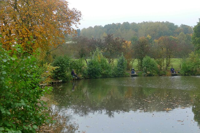
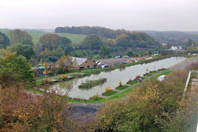
Today, Aston cum Aughton is a quiet and picturesque area, known for its scenic beauty and rural atmosphere. The parish is surrounded by rolling countryside, with fields and woodlands stretching as far as the eye can see. The River Rother offers opportunities for fishing and boating activities.

The villages of Aston and Aughton have a combined population of around 1,500 people. They both have a range of amenities, including local shops, pubs, and schools. The parish also has a community center that hosts various events and activities throughout the year.

Overall, Aston cum Aughton is a charming and idyllic parish, offering a peaceful and close-knit community for its residents. It is a popular destination for those seeking a rural retreat, while still being within easy reach of the nearby city of Sheffield.

If you have any feedback on the listing, please let us know in the comments section below.

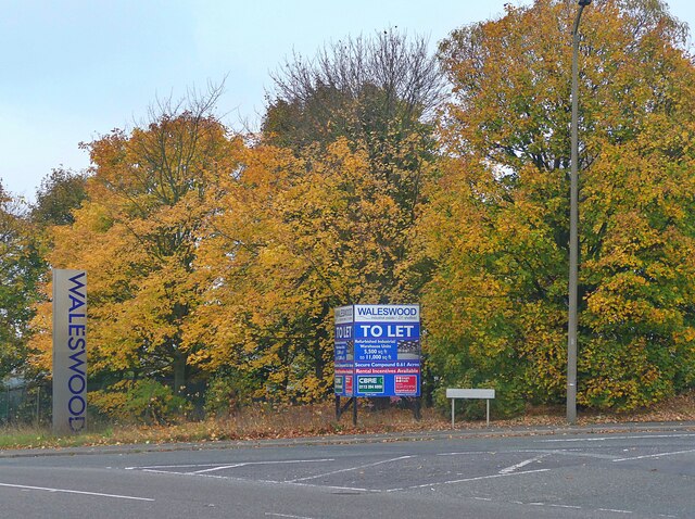
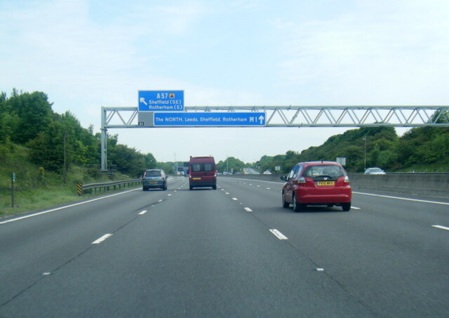
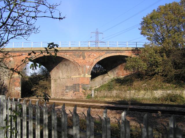
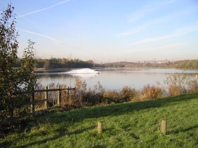
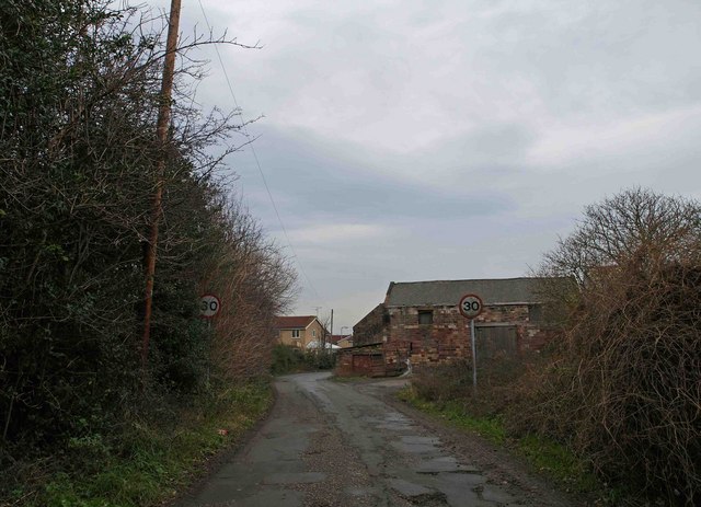
Aston cum Aughton Images

Images are sourced within 2km of 53.362262/-1.307228 or Grid Reference SK4685. Thanks to Geograph Open Source API. All images are credited.

View from Conduit Trig Point
Conduit Trig Point Flush Bracket S1845
All Saints' Church, Aston
Fishing in Fiddle Neck Pond
Tree trunk fish sculpture at Aston Park Fisheries' Hepworth Pond
Aston Park Fisheries Looking over two of the seven fishing lakes from the footbridge over the A57
Aston Park Fisheries
Looking over two of the seven fishing lakes from the footbridge over the A57
Meat or fish for tea today? Butcher's and fish 'n chips shops in Swallownest
Meat or fish for tea today?
Butcher's and fish 'n chips shops in Swallownest
Autumn colour at Waleswood Industrial Estate
M1 nearing Junction 31
Old milestone On Aughton High Street, now just to the right of a large grey utilities cabinet, this milestone can be difficult to spot behind parked cars.  It has rusted badly and may disappear into the bush growing out of the pavement.   There is slight damage to the bottom right hand corner below the hole for a fixing bolt.  There was a Rotherham to Pleasley turnpike from 1764 to 1874.   But in 1893/94 the young West Riding CC had 615 of this type of milestone set up on many routes they wished to promote for trade not only on old turnpike routes.
Old milestone
On Aughton High Street, now just to the right of a large grey utilities cabinet, this milestone can be difficult to spot behind parked cars. It has rusted badly and may disappear into the bush growing out of the pavement. There is slight damage to the bottom right hand corner below the hole for a fixing bolt. There was a Rotherham to Pleasley turnpike from 1764 to 1874. But in 1893/94 the young West Riding CC had 615 of this type of milestone set up on many routes they wished to promote for trade not only on old turnpike routes.
Old milestone Worksop Road in Aston was the original main route to and from Sheffield.   This milestone opposite Lodge Lane is one of four stones remaining  from the era of the 16 mile long Worksop to Attercliffe (Sheffield) tollroad, 1764-1881.   The plate has disappeared since 1992 when it was first photographed but a feature is made of the stone now with the pebble surround.   It is Grade II listed, 1151883. Link <a href="https://www.geograph.org.uk/photo/6778202">SK4785 : Old milestone off B6067, old Worksop Road, M1 junction 31</a> for Sheffield 9 which does have its plate.
Old milestone
Worksop Road in Aston was the original main route to and from Sheffield. This milestone opposite Lodge Lane is one of four stones remaining from the era of the 16 mile long Worksop to Attercliffe (Sheffield) tollroad, 1764-1881. The plate has disappeared since 1992 when it was first photographed but a feature is made of the stone now with the pebble surround. It is Grade II listed, 1151883. Link SK4785 : Old milestone off B6067, old Worksop Road, M1 junction 31 for Sheffield 9 which does have its plate.
Gulliver's Valley, Rotherham
Overflow car park at Gulliver's Valley, Rotherham
Railway crossing, Woodhouse Mill Despite the ubiquitous 'orrible British Railway galvanised fence, this is a nice spot as the GC atop Beighton Viaduct crosses the MR. The GC (top) heads west-east towards Sheffield (left) and Kiveton (right). The MR comes down from Rotherham and heads down towards Chesterfield (behind me). The GC is interesting here because it's still controlled by semaphore signals.
Railway crossing, Woodhouse Mill
Despite the ubiquitous 'orrible British Railway galvanised fence, this is a nice spot as the GC atop Beighton Viaduct crosses the MR. The GC (top) heads west-east towards Sheffield (left) and Kiveton (right). The MR comes down from Rotherham and heads down towards Chesterfield (behind me). The GC is interesting here because it's still controlled by semaphore signals.
Railway viaduct, Woodhouse Mill Under the Beighton railway viaduct on a crisp November morning. I just liked the setting! There's another picture for this square that's a better geograph!
Railway viaduct, Woodhouse Mill
Under the Beighton railway viaduct on a crisp November morning. I just liked the setting! There's another picture for this square that's a better geograph!
Rother Valley Park - North end One of the difficulties of locating the photographer position on the 1940's map is that the lake wasn't there then and the river has been moved. On a crisp November morning (actually nearer 13:30), a couple of hardy souls were taking to the water on their jet skis. Brrr! The photo, looking north, looks towards Swallownest just visible in the distance.
Rother Valley Park - North end
One of the difficulties of locating the photographer position on the 1940's map is that the lake wasn't there then and the river has been moved. On a crisp November morning (actually nearer 13:30), a couple of hardy souls were taking to the water on their jet skis. Brrr! The photo, looking north, looks towards Swallownest just visible in the distance.
Aston Hall. Originally designed by the famous York architect, John Carr, and built in 1772 for the Lord Holderness, Secretary of State for the North.  Now a luxury hotel.
Aston Hall.
Originally designed by the famous York architect, John Carr, and built in 1772 for the Lord Holderness, Secretary of State for the North. Now a luxury hotel.
Swallownest - Wetherby Drive Looking in an easterly direction from the main road to Swallownest.
Swallownest - Wetherby Drive
Looking in an easterly direction from the main road to Swallownest.
Show me another place!

Aston cum Aughton is located at Grid Ref: SK4685 (Lat: 53.362262, Lng: -1.307228)

Division: West Riding

Administrative County: South Yorkshire

District: Rotherham

Police Authority: South Yorkshire

What 3 Words

///ditched.unguarded.infects. Near Ulley, South Yorkshire

Nearby Locations

Aston cum Aughton Aston

Related Wikis

Aston, South Yorkshire

Aston is a residential village in the Metropolitan Borough of Rotherham, South Yorkshire, England. The village falls within the Holderness ward of the...

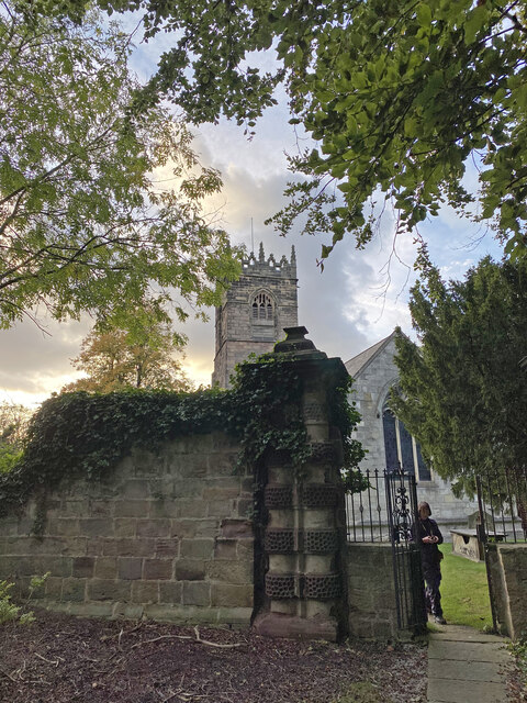
Church of All Saints, Aston cum Aughton

The Church of All Saints is the parish church of Aston cum Aughton in South Yorkshire, England. It is a Church of England church in the Diocese of Sheffield...

North Staveley Colliery

Aston Colliery was a small coal mine sunk on Aston Common, within Rotherham Rural District but six miles east of Sheffield in the 1840s. In 1864 its workings...

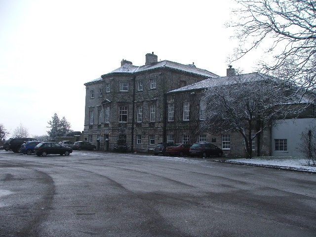
Aston Hall, Yorkshire

Aston Hall is a former English country house in the village of Aston, South Yorkshire. It is now a hotel, and a Grade II* listed building. == History... ==

Aston cum Aughton

Aston cum Aughton is a civil parish in the Metropolitan Borough of Rotherham in South Yorkshire, England, with a population of 13,961 according to the...

Aughton, South Yorkshire

Aughton is a village near Rotherham in South Yorkshire, England, located in the civil parish of Aston cum Aughton, 4 miles (6 km) south of Rotherham. The...

Ulley

Ulley is a village and civil parish of the Metropolitan Borough of Rotherham in South Yorkshire, England. The population of the civil parish as of the...

Swallownest

Swallownest is a village in the civil parish of Aston cum Aughton and the Metropolitan Borough of Rotherham, South Yorkshire, England. The village is 4...

Nearby Amenities

Located within 500m of 53.362262,-1.307228
Aston
Place: village
Wikidata: Q4810940
Wikipedia: en:Aston, South Yorkshire
Lat/Long: 53.3635061/-1.3011695
Bus Stop
The Warren/Church Lane
Alt Name: The Warren/Church Lane
Naptan AltCommonName: The Warren/Church Lane
Naptan AtcoCode: 370030915
Naptan Bearing: NW
Naptan CommonName: The Warren/Church Lane
Naptan Indicator: 30915
Naptan Landmark: POST OFFICE
Naptan PlusbusZoneRef: ROTHCEN
Naptan Street: The Warren
Naptan Verified: no
Source: naptan_import
Lat/Long: 53.3633448/-1.2999648
Bus Stop
Worksop Road/The Chase
Naptan AtcoCode: 370030917
Naptan Bearing: E
Naptan CommonName: Worksop Road/The Chase
Naptan Indicator: 30917
Naptan Landmark: TELEPHONE EXCHANGE/OPPOSITE PE
Naptan PlusbusZoneRef: ROTHCEN
Naptan Street: Worksop Road
Naptan Verified: no
Source: naptan_import
Lat/Long: 53.3639145/-1.3051551
Bus Stop
Worksop Road/Lodge Lane
Naptan AtcoCode: 370030918
Naptan Bearing: E
Naptan CommonName: Worksop Road/Lodge Lane
Naptan Indicator: 30918
Naptan Landmark: EMPLOYMENT TRAINING
Naptan PlusbusZoneRef: ROTHCEN
Naptan Street: Worksop Road
Naptan Verified: no
Source: naptan_import
Lat/Long: 53.363624/-1.3074928
Bus Stop
Lodge Lane/School Grove
Alt Name: Lodge Lane/School Grove
Naptan AltCommonName: Lodge Lane/School Grove
Naptan AtcoCode: 370030919
Naptan Bearing: SW
Naptan CommonName: Lodge Lane/School Grove
Naptan Indicator: 30919
Naptan Landmark: School
Naptan PlusbusZoneRef: ROTHCEN
Naptan Street: Lodge Lane
Naptan Verified: no
Source: naptan_import
Lat/Long: 53.3627193/-1.3083153
Bus Stop
Lodge Lane/Shaldon Grove
Naptan AtcoCode: 370030920
Naptan Bearing: N
Naptan CommonName: Lodge Lane/Shaldon Grove
Naptan Indicator: 30920
Naptan Landmark: 30920
Naptan PlusbusZoneRef: ROTHCEN
Naptan Street: Lodge Lane
Naptan Verified: no
Source: naptan_import
Lat/Long: 53.3606824/-1.310482
Bus Stop
Worksop Road/Wesley Avenue
Naptan AtcoCode: 370030921
Naptan Bearing: E
Naptan CommonName: Worksop Road/Wesley Avenue
Naptan Indicator: 30921
Naptan Landmark: 30921
Naptan PlusbusZoneRef: ROTHCEN
Naptan Street: Worksop Road
Naptan Verified: no
Source: naptan_import
Lat/Long: 53.3634344/-1.3123679
Bus Stop
Holderness Drive/Fane Crescent
Naptan AtcoCode: 370030922
Naptan Bearing: N
Naptan CommonName: Holderness Drive/Fane Crescent
Naptan Indicator: 30922
Naptan Landmark: 30922
Naptan PlusbusZoneRef: ROTHCEN
Naptan Street: Holderness Drive
Naptan Verified: no
Source: naptan_import
Lat/Long: 53.3648011/-1.3123391
Bus Stop
Worksop Road/Lodge Lane
Naptan AtcoCode: 370035080
Naptan Bearing: W
Naptan CommonName: Worksop Road/Lodge Lane
Naptan Indicator: 35080
Naptan Landmark: Opposite No 137
Naptan PlusbusZoneRef: ROTHCEN
Naptan Street: Worksop Road
Naptan Verified: no
Source: naptan_import
Lat/Long: 53.3633905/-1.3085251
Bus Stop
Worksop Road/Egerton Road
Alt Name: Worksop Road/Egerton Road
Naptan AltCommonName: Worksop Road/Egerton Road
Naptan AtcoCode: 370035087
Naptan Bearing: N
Naptan CommonName: Worksop Road/Egerton Road
Naptan Indicator: 35087
Naptan Landmark: OPPOSITE NO. 53
Naptan PlusbusZoneRef: ROTHCEN
Naptan Street: Worksop Road
Naptan Verified: no
Source: naptan_import
Lat/Long: 53.3633173/-1.3140984
Bus Stop
Aughton Lane/Maple Grove
Naptan AtcoCode: 370035100
Naptan Bearing: S
Naptan CommonName: Aughton Lane/Maple Grove
Naptan Indicator: 35100
Naptan Landmark: 35100
Naptan PlusbusZoneRef: ROTHCEN
Naptan Street: Aughton Lane
Naptan Verified: no
Source: naptan_import
Lat/Long: 53.3646429/-1.3021226
Bus Stop
Worksop Road/The Chase
Naptan AtcoCode: 370035106
Naptan Bearing: W
Naptan CommonName: Worksop Road/The Chase
Naptan Indicator: 35106
Naptan Landmark: TELEPHONE EXCHANGE/PETROL STAT
Naptan PlusbusZoneRef: ROTHCEN
Naptan Street: Worksop Road
Naptan Verified: no
Source: naptan_import
Lat/Long: 53.3638251/-1.304692
Bus Stop
The Warren/North Farm Court
Alt Name: The Warren/North Farm Court
Naptan AltCommonName: The Warren/North Farm Court
Naptan AtcoCode: 370031157
Naptan Bearing: SE
Naptan CommonName: The Warren/North Farm Court
Naptan Indicator: 31157
Naptan Landmark: BLUE BELL PUBLIC HOUSE
Naptan PlusbusZoneRef: ROTHCEN
Naptan Street: The Warren
Naptan Verified: no
Source: naptan_import
Lat/Long: 53.3637249/-1.3003944
Lodge Lane/Shaldon Grove
Naptan AtcoCode: 370035521
Naptan Bearing: NE
Naptan BusStopType: CUS
Naptan CommonName: Lodge Lane/Shaldon Grove
Naptan Indicator: 35521
Naptan Landmark: 35521
Naptan PlusbusZoneRef: ROTHCEN
Naptan Street: Lodge Lane
Naptan Verified: no
Source: naptan_import
Lat/Long: 53.3607283/-1.3106466
Wesley Avenue/Holderness Drive
Alt Name: Wesley Avenue/Holderness Drive
Naptan AltCommonName: Wesley Avenue/Holderness Drive
Naptan AtcoCode: 370035719
Naptan Bearing: N
Naptan BusStopType: CUS
Naptan CommonName: Wesley Avenue/Holderness Drive
Naptan Indicator: 35719
Naptan Landmark: 35719
Naptan PlusbusZoneRef: ROTHCEN
Naptan Street: Wesley Avenue
Naptan Verified: no
Source: naptan_import
Lat/Long: 53.3639246/-1.3131046
Bus Stop
Aughton Lane/Maple Grove
Naptan AtcoCode: 370035740
Naptan Bearing: NW
Naptan CommonName: Aughton Lane/Maple Grove
Naptan Indicator: 35740
Naptan Landmark: 35740
Naptan PlusbusZoneRef: ROTHCEN
Naptan Street: Aughton Lane
Naptan Verified: no
Source: naptan_import
Lat/Long: 53.3651235/-1.3028361
Turning Circle
Lat/Long: 53.3620042/-1.3122358
Turning Circle
Source: Bing
Lat/Long: 53.3596475/-1.3131353
Turning Circle
Lat/Long: 53.3643612/-1.304168
Turning Circle
Lat/Long: 53.3645387/-1.3055757
PaellaWorld UK
Addr City: Sheffield
Addr Housename: PaellaWorld UK
Addr Housenumber: 27
Addr Postcode: S26 2BL
Addr Street: Lodge Lane
Office: company
Payment Litecoin: yes
Website: https://www.paellaworld.co.uk/
Lat/Long: 53.3618398/-1.3093115
Cafe
Ricardo's Cafe and Bistro
Addr City: Sheffield
Addr Housenumber: 3
Addr Postcode: S26 2EB
Addr Street: Worksop Road
Addr Suburb: Aston
Cuisine: coffee_shop
Lat/Long: 53.3644064/-1.3027698
Post Box
Brand: Royal Mail
Brand Wikidata: Q638098
Collection Times: Mo-Fr 09:00; Sa 07:00
Operator: Royal Mail
Operator Wikidata: Q638098
Post Box Type: pillar
Ref: S26 385D
Royal Cypher: EIIR
Royal Cypher Wikidata: Q33102113
Lat/Long: 53.3645594/-1.3023343
Fast Food
Sun Yee
Addr City: Sheffield
Addr Country: GB
Addr Housenumber: 185
Addr Postcode: S26 2EA
Addr Street: Worksop Road
Addr Village: Aston
Cuisine: chinese
Delivery: yes
Fhrs Id: 460584
Outdoor Seating: no
Takeaway: yes
Lat/Long: 53.3644412/-1.3027448
Breathe Home Interiors
Addr City: Sheffield
Addr Housenumber: Unit 2
Addr Postcode: S26 2EB
Addr Street: Worksop Road
Addr Suburb: Aston
Contact Facebook: https://www.facebook.com/Breathehi
Shop: interior_decoration
Lat/Long: 53.3643779/-1.302796
Toffs Hair
Addr City: Sheffield
Addr Housenumber: 177
Addr Postcode: S26 4WB
Addr Street: Worksop Road
Addr Suburb: Aston
Shop: hairdresser
Lat/Long: 53.3642602/-1.303178
Post Office
Aston Post Office
Addr City: Sheffield
Addr Country: GB
Addr Housenumber: 75
Addr Postcode: S26 2BL
Addr Street: Lodge Lane
Addr Village: Aston
Opening Hours: Mo-Sa 06:30-20:00; Su 07:30-19:00
Ref Pol Id: 119162
Lat/Long: 53.3603109/-1.3107978
Shop: convenience
Lat/Long: 53.3602717/-1.3106863
Post Box
Collection Times: Mo-Fr 16:30; Sa 11:00
Post Box Type: pillar
Ref: S26 1019
Royal Cypher: EIIR
Royal Cypher Wikidata: Q33102113
Lat/Long: 53.3617595/-1.3045045
Post Box
Collection Times: Mo-Fr 16:30; Sa 11:00
Post Box Type: pillar
Ref: S26 665
Royal Cypher: EIIR
Royal Cypher Wikidata: Q33102113
Lat/Long: 53.3617298/-1.3096133
Monument
Historic: monument
Lat/Long: 53.3630689/-1.3068926
Entrance: main
Lat/Long: 53.3596687/-1.3103564
Defibrillator
Access: yes
Check Date: 2023-03-09
Defibrillator Location: On outside wall. Available 24/7.
Emergency: defibrillator
Indoor: no
Opening Hours: 24/7
Lat/Long: 53.3661645/-1.310953
Turning Circle
Lat/Long: 53.3655658/-1.3025786
Give Way
Direction: forward
Lat/Long: 53.3641824/-1.3021587
Defibrillator
Access: yes
Defibrillator Location: On the outside wall of the lodge.
Emergency: defibrillator
Indoor: no
Lat/Long: 53.3636704/-1.31054
Atm
Lat/Long: 53.3635725/-1.3053832
The data included in this document is from www.openstreetmap.org. The data is made available under ODbL.

Have you been to Aston cum Aughton?

Leave your review of Aston cum Aughton below (or comments, questions and feedback).