Astley and Dunley

Civil Parish in Worcestershire Malvern Hills

England

Astley and Dunley

Yarhampton House Early 17th century timber-framed former farmhouse viewed from the passing road.
Yarhampton House Credit: Philip Halling

Astley and Dunley is a civil parish located in the county of Worcestershire, England. Situated approximately 5 miles north of the town of Stourport-on-Severn, this rural area covers a land area of around 6 square miles. The civil parish is home to a population of approximately 600 residents.

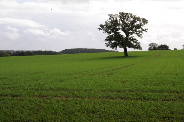
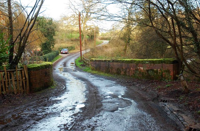
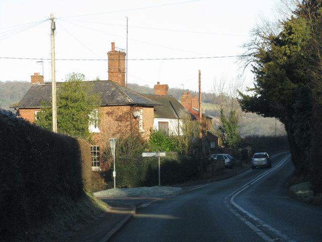
The village of Astley is the main settlement within the parish. It features a picturesque landscape with rolling hills and farmland, giving it a tranquil and idyllic atmosphere. The village is known for its charming cottages and historic buildings, including the Grade II listed St. Peter's Church, which dates back to the 12th century. The church is a notable landmark in the area and attracts visitors interested in its architectural and historical significance.

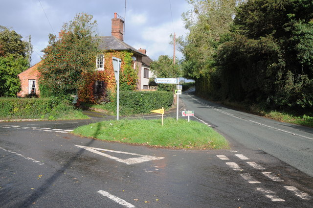
Dunley, on the other hand, is a smaller hamlet within the parish. It is located to the east of Astley and is surrounded by countryside. Despite its size, Dunley has its own unique charm, with a scattering of residential properties and a peaceful environment.

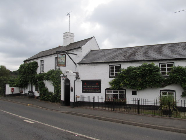
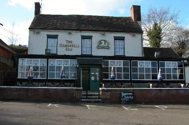
The civil parish of Astley and Dunley offers a close-knit community, with various local amenities and social activities. These include a village hall, a primary school, and a pub, which serves as a focal point for social gatherings and events.

Overall, Astley and Dunley is a quiet and rural area in Worcestershire, offering a peaceful countryside setting and a strong sense of community.

If you have any feedback on the listing, please let us know in the comments section below.

Astley and Dunley Images

Images are sourced within 2km of 52.313865/-2.305601 or Grid Reference SO7968. Thanks to Geograph Open Source API. All images are credited.

Yarhampton House Early 17th century timber-framed former farmhouse viewed from the passing road.
Yarhampton House
Early 17th century timber-framed former farmhouse viewed from the passing road.
Looking southwest from the B4196 in 1987
The Dog, Dunley
The Dog, Dunley
Road junction in Dunley House on the corner by a road junction in Dunley.
Road junction in Dunley
House on the corner by a road junction in Dunley.
Oak tree in an arable field Oak tree in an arable field between Astely Cross and Dunley.
Oak tree in an arable field
Oak tree in an arable field between Astely Cross and Dunley.
Access road to the church etc., Astley, Worcs The road on the left gives access to St. Peter's Church, its small car park and a couple of other properties. The road in the foreground is Church Lane.
Access road to the church etc., Astley, Worcs
The road on the left gives access to St. Peter's Church, its small car park and a couple of other properties. The road in the foreground is Church Lane.
St. Peter's Church, Astley, Worcs The church dates from Norman times, probably mid-12th century. The aisle was rebuilt and widened in 1837-8, and there was a major restoration with substantial alterations in the very early years of the 20th century. Currently the church is fund raising for essential works. The church was originally built as the church for a Benedictine priory which was attached to the Abbey of St. Taurin near Rouen in France. As an "alien" foundation, the priory was suppressed in 1414, over a hundred years before King Henry VIII closed all the other remaining religious houses. Fortunately the church survived and contains a number of interesting monuments.

<a href="https://www.geograph.org.uk/photo/3856068">SO7867 : Porch of St. Peter's Church, Astley, Worcs</a>.
St. Peter's Church, Astley, Worcs
The church dates from Norman times, probably mid-12th century. The aisle was rebuilt and widened in 1837-8, and there was a major restoration with substantial alterations in the very early years of the 20th century. Currently the church is fund raising for essential works. The church was originally built as the church for a Benedictine priory which was attached to the Abbey of St. Taurin near Rouen in France. As an "alien" foundation, the priory was suppressed in 1414, over a hundred years before King Henry VIII closed all the other remaining religious houses. Fortunately the church survived and contains a number of interesting monuments. SO7867 : Porch of St. Peter's Church, Astley, Worcs.
Porch of St. Peter's Church, Astley, Worcs The porch was rebuilt in 1903-4, at the time of a major restoration of the church by the rector, the Rev. Martin Brereton Buckle.

<a href="https://www.geograph.org.uk/photo/3855997">SO7867 : St. Peter's Church, Astley, Worcs</a>.
Porch of St. Peter's Church, Astley, Worcs
The porch was rebuilt in 1903-4, at the time of a major restoration of the church by the rector, the Rev. Martin Brereton Buckle. SO7867 : St. Peter's Church, Astley, Worcs.
Old graveyard at St. Peter's Church, Astley, Worcs The graves here seem quite old and are showing the ravages of time. It is located opposite the church and next to the car park.
Old graveyard at St. Peter's Church, Astley, Worcs
The graves here seem quite old and are showing the ravages of time. It is located opposite the church and next to the car park.
Looking towards Church Lane, Astley, Worcs Looking from the access road which serves the church and a couple of other properties.
Looking towards Church Lane, Astley, Worcs
Looking from the access road which serves the church and a couple of other properties.
St. Peter's Church Restoration Fund information board, Astley, Worcs Located at the side of the car park.
St. Peter's Church Restoration Fund information board, Astley, Worcs
Located at the side of the car park.
Church Lane, Astley, Worcs The main road in the straggly village of Astley.
Church Lane, Astley, Worcs
The main road in the straggly village of Astley.
End of access road, Astley, Worcs Just past St. Peter's Church the access road ends here, with entrances to two residential properties.

<a href="https://www.geograph.org.uk/photo/3855968">SO7867 : Access road to the church etc., Astley, Worcs</a>.
End of access road, Astley, Worcs
Just past St. Peter's Church the access road ends here, with entrances to two residential properties. SO7867 : Access road to the church etc., Astley, Worcs.
Prior's Mill and weir, Astley, Worcs Prior's Mill is a former seventeenth century timber-framed water mill, with twentieth century alterations, and now used as a private residence. Next to it is a very high weir on the Dick Brook. There used to be several mills on this stream long ago. The Prior's Mill would not have been connected to Astley Priory, as that was dissolved in 1414 as an "alien house" and demolished centuries ago. However it is possible that an earlier mill was on the site of the present one or near to it, and perhaps that belonged to the priory.

<a href="https://www.geograph.org.uk/photo/3859678">SO7867 : Weir on the Dick Brook, Astley, Worcs</a>.
Prior's Mill and weir, Astley, Worcs
Prior's Mill is a former seventeenth century timber-framed water mill, with twentieth century alterations, and now used as a private residence. Next to it is a very high weir on the Dick Brook. There used to be several mills on this stream long ago. The Prior's Mill would not have been connected to Astley Priory, as that was dissolved in 1414 as an "alien house" and demolished centuries ago. However it is possible that an earlier mill was on the site of the present one or near to it, and perhaps that belonged to the priory. SO7867 : Weir on the Dick Brook, Astley, Worcs.
Weir on the Dick Brook, Astley, Worcs This very high weir is next to the former Prior's Mill. Photographed from the road bridge over the Dick Brook.

See:- <a href="https://www.geograph.org.uk/photo/3859676">SO7867 : Prior's Mill and weir, Astley, Worcs</a>.
Weir on the Dick Brook, Astley, Worcs
This very high weir is next to the former Prior's Mill. Photographed from the road bridge over the Dick Brook. See:- SO7867 : Prior's Mill and weir, Astley, Worcs.
The Dick Brook, Astley, Worcs Andrew Yarranton (1619-1684), who was born at Astley, was an early pioneer in attempting, not always successfully, to make various waterways navigable. The Dick Brook was one of his projects. The navigable section ran for about three-quarters of a mile from the River Severn, 3 miles below Stourport-on-Severn, to his blast furnace at Astley. It probably had 2 flash locks in the first quarter of a mile and was used to take iron-ore to the forge, which was about half a mile above the upper lock. It is thought that this work was done about January 1653 and that the navigation was not in use for very long. Looking at this rather unimpressive brook today, it is difficult to imagine that part of it was once used by boats.
The Dick Brook, Astley, Worcs
Andrew Yarranton (1619-1684), who was born at Astley, was an early pioneer in attempting, not always successfully, to make various waterways navigable. The Dick Brook was one of his projects. The navigable section ran for about three-quarters of a mile from the River Severn, 3 miles below Stourport-on-Severn, to his blast furnace at Astley. It probably had 2 flash locks in the first quarter of a mile and was used to take iron-ore to the forge, which was about half a mile above the upper lock. It is thought that this work was done about January 1653 and that the navigation was not in use for very long. Looking at this rather unimpressive brook today, it is difficult to imagine that part of it was once used by boats.
Public footpath at Astley, Worcs The footpath is ascending through a wood.
Public footpath at Astley, Worcs
The footpath is ascending through a wood.
Bridge over the Dick Brook, Astley, Worcs The bridge carries a minor road over the Dick Brook.

<a href="https://www.geograph.org.uk/photo/3872383">SO7867 : Approaching the bridge over the Dick Brook at Astley, Worcs</a>.
Bridge over the Dick Brook, Astley, Worcs
The bridge carries a minor road over the Dick Brook. SO7867 : Approaching the bridge over the Dick Brook at Astley, Worcs.
Show me another place!

Astley and Dunley is located at Grid Ref: SO7968 (Lat: 52.313865, Lng: -2.305601)

Administrative County: Worcestershire

District: Malvern Hills

Police Authority: West Mercia

What 3 Words

///banquets.divorcing.haggling. Near Stourport-on-Severn, Worcestershire

Nearby Locations

Astley and Dunley Astley

Related Wikis

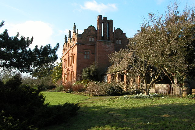
Pool House, Worcestershire

Pool House is a Grade II* listed house in Astley, in the county of Worcestershire, England.In the area close to Stourport-on-Severn, there are several...

Dunley, Worcestershire

Dunley is a village, and a civil parish (with Astley), in the administrative district of Malvern Hills in the county of Worcestershire, England. ��2�...

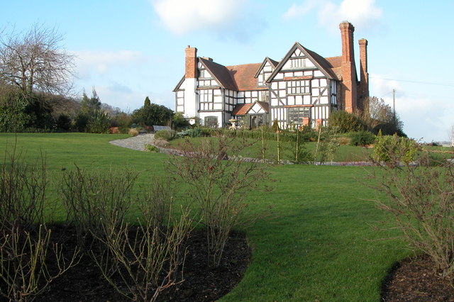
Astley Hall, Stourport-on-Severn

Astley Hall is a country house in Astley near Stourport-on-Severn, Worcestershire, England. The hall was the home of Prime Minister Stanley Baldwin from...

Astley, Worcestershire

Astley is a village, and a civil parish (with Dunley) in Worcestershire, England, about two miles outside Stourport-on-Severn and seven miles south-west...

Astley Cross

Astley Cross is a village in Worcestershire, England, located on the outskirts of Stourport-on-Severn. The village lies 1 mile (1.6 km) south of the centre...

Astley Burf

Astley Burf is a hamlet in the parish of Astley, Worcestershire, England, on the banks of the River Severn. Within the hamlet there is one riverside public...

Astley Priory

Astley Priory was a Benedictine priory in Astley, Worcestershire, England.It was founded in the 11th century, probably by Ralph de Todeni, as a cell subject...

Noutard's Green

Noutard's Green is a hamlet within the civil parish of Shrawley in Worcestershire, England. == References ==

Nearby Amenities

Located within 500m of 52.313865,-2.305601
Astley Town
Is In: Worcester
Place: village
Lat/Long: 52.3121631/-2.3041595
Power: tower
Lat/Long: 52.3155155/-2.3003657
Power: tower
Lat/Long: 52.3157188/-2.3035313
Power: tower
Lat/Long: 52.3160282/-2.3082309
Power: pole
Lat/Long: 52.311045/-2.2999006
Power: pole
Lat/Long: 52.311668/-2.2996484
Power: pole
Lat/Long: 52.3121289/-2.2994392
Pool House
Power: pole
Transformer: distribution
Voltage Primary: 11000
Lat/Long: 52.3134718/-2.2988223
Power: pole
Lat/Long: 52.3129306/-2.2987338
Power: pole
Lat/Long: 52.3126748/-2.2991629
Power: pole
Lat/Long: 52.3158041/-2.3070606
Power: pole
Lat/Long: 52.3171661/-2.3094744
Power: pole
Lat/Long: 52.3147189/-2.3051547
Power: pole
Lat/Long: 52.3153461/-2.3062518
Power: pole
Lat/Long: 52.3162403/-2.307821
Barrier: stile
Lat/Long: 52.3150088/-2.3122956
Barrier: stile
Lat/Long: 52.313688/-2.2986516
Barrier: stile
Lat/Long: 52.3116241/-2.3017647
Barrier: stile
Lat/Long: 52.3138267/-2.3122827
Barrier: stile
Lat/Long: 52.3105846/-2.3017556
Power: pole
Source: bing
Lat/Long: 52.3152289/-2.2987027
Power: pole
Source: bing
Lat/Long: 52.3150592/-2.3008633
Power: pole
Source: bing
Lat/Long: 52.3149837/-2.301802
Power: pole
Source: bing
Lat/Long: 52.3148772/-2.3032129
Power: pole
Lat/Long: 52.3108155/-2.3019194
Astley Town
Power: pole
Transformer: distribution
Voltage Primary: 11000
Lat/Long: 52.3116633/-2.3021729
Power: pole
Lat/Long: 52.3113177/-2.3021655
Power: pole
Lat/Long: 52.3102821/-2.3016659
The data included in this document is from www.openstreetmap.org. The data is made available under ODbL.

Have you been to Astley and Dunley?

Leave your review of Astley and Dunley below (or comments, questions and feedback).