Ascott-under-Wychwood

Civil Parish in Oxfordshire West Oxfordshire

England

Ascott-under-Wychwood

6233 at Ascott Under Wychwood Ex LMS Pacific No. 6233 'Duchess of Sutherland' speeds through Ascott Under Wychwood with a Railway Touring Company steam special.
6233 at Ascott Under Wychwood Credit: Bob Walters

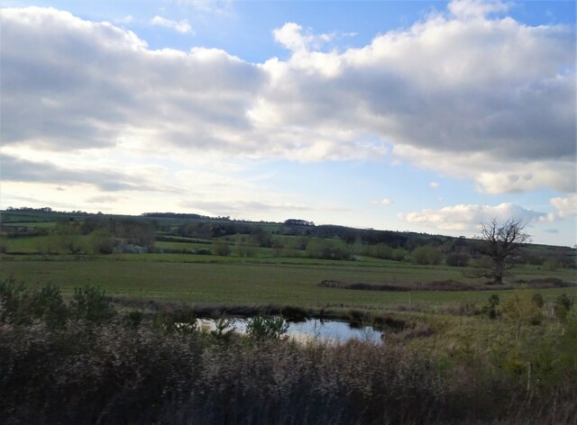
Ascott-under-Wychwood is a civil parish located in the county of Oxfordshire, England. It is situated approximately 15 miles west of Oxford, within the district of West Oxfordshire. The village is nestled in the beautiful Cotswolds, a designated Area of Outstanding Natural Beauty.

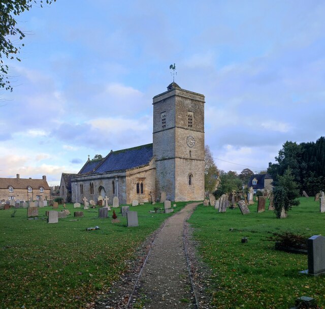
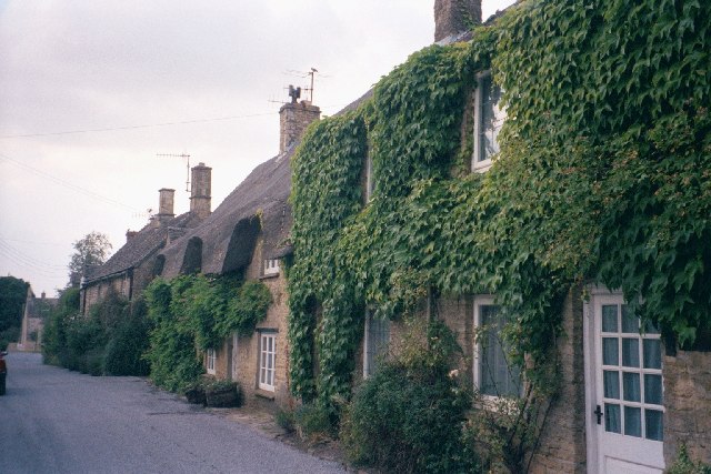
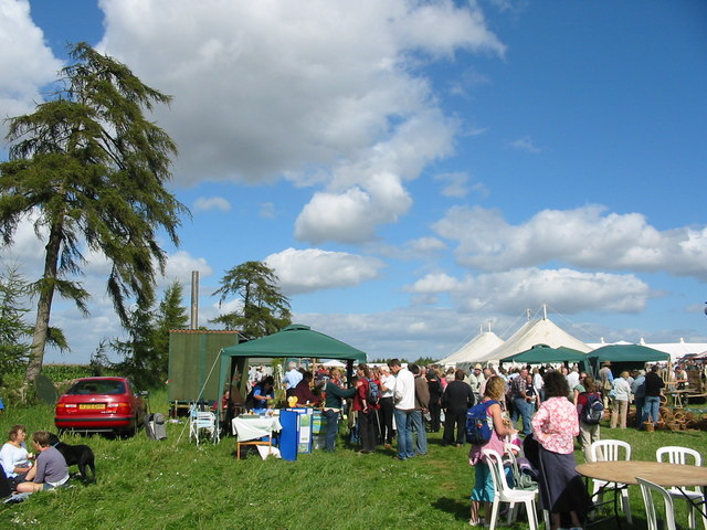
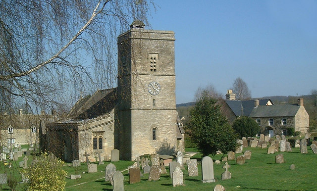
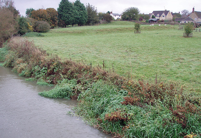
With a population of around 1,200 people, Ascott-under-Wychwood is a small yet vibrant community. The village is known for its picturesque landscapes, charming cottages, and traditional stone buildings. It offers a peaceful and idyllic setting, attracting both locals and tourists alike.

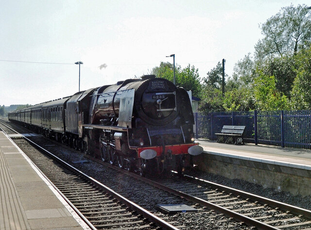
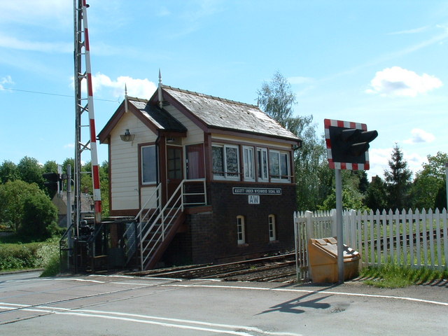
The parish boasts a range of amenities and facilities to cater to its residents' needs. These include a primary school, a village hall, a post office, and a pub. The village also has a railway station, providing convenient transportation links to nearby towns and cities.

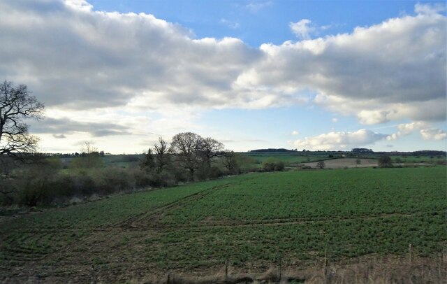
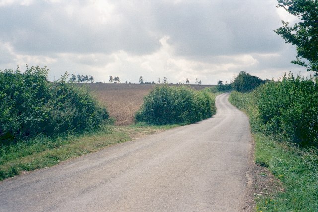
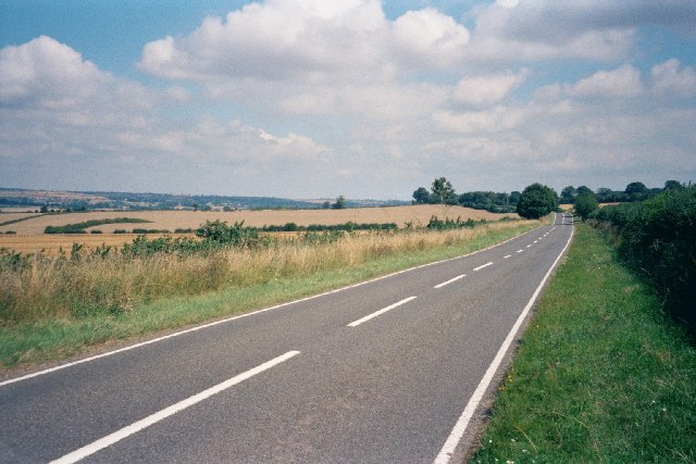
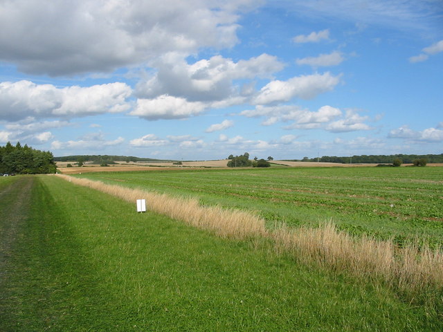
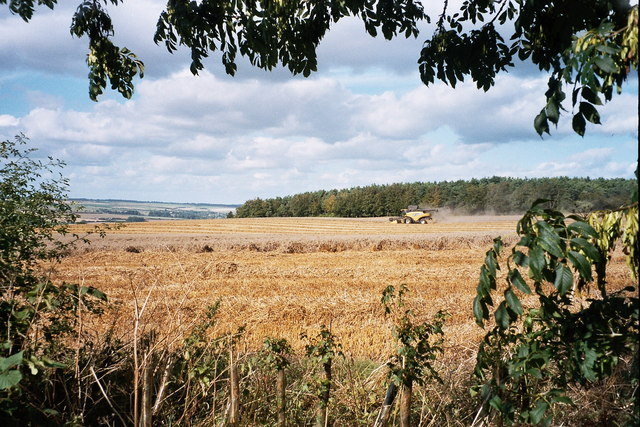
Ascott-under-Wychwood is surrounded by rolling countryside, offering ample opportunities for outdoor activities and exploration. The area is particularly popular with walkers and cyclists, with numerous scenic routes and trails to discover. The village is also known for its close proximity to the historic Wychwood Forest, which offers further opportunities for nature enthusiasts.

Overall, Ascott-under-Wychwood is a charming and peaceful village in the heart of Oxfordshire. It combines a rich history with stunning natural beauty, making it an attractive destination for those seeking a quiet and picturesque escape.

If you have any feedback on the listing, please let us know in the comments section below.

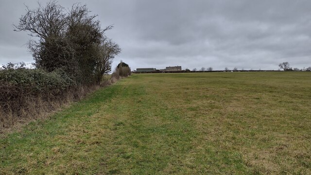
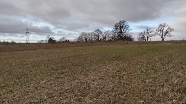
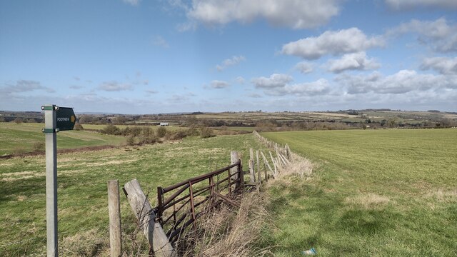
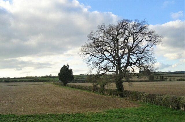
Ascott-under-Wychwood Images

Images are sourced within 2km of 51.865413/-1.563046 or Grid Reference SP3018. Thanks to Geograph Open Source API. All images are credited.

6233 at Ascott Under Wychwood Ex LMS Pacific No. 6233 'Duchess of Sutherland' speeds through Ascott Under Wychwood with a Railway Touring Company steam special.
6233 at Ascott Under Wychwood
Ex LMS Pacific No. 6233 'Duchess of Sutherland' speeds through Ascott Under Wychwood with a Railway Touring Company steam special.
Holy Trinity Church, Ascott-under-Wychwood
Pond near Chilson Farm
Crop field and hedgerow near Ascott d'Oyley
Bridleway heading to Round Pound Bridleway heading to Round Pound looking to College Farm
Bridleway heading to Round Pound
Bridleway heading to Round Pound looking to College Farm
Bridleway nearing Round Pound Bridleway nearing Round Pound with the telecom mast by the A361
Bridleway nearing Round Pound
Bridleway nearing Round Pound with the telecom mast by the A361
Path to Leafield Road Off the B4437 the path to Leafield Road
Path to Leafield Road
Off the B4437 the path to Leafield Road
Fields near Ascott-under-Wychwood
Cottages in Chilson Including a thatched cottage. Taken on Chilson's main (and only paved) road.
Cottages in Chilson
Including a thatched cottage. Taken on Chilson's main (and only paved) road.
Sunlit road This minor road goes from Farfield Corner near Leafield to the B4437 near Ascott. This image is taken facing south.
Sunlit road
This minor road goes from Farfield Corner near Leafield to the B4437 near Ascott. This image is taken facing south.
B4437 near Ascott-under-Wychwood Facing north-east towards Charlbury, along the Evenlode Valley. The road features several dips, such as the one visible in the middle distance, which produce a "roller-coaster" effect if taken at speed. It also features various sharp turns which probably should not be taken at speed. <a href="https://www.geograph.org.uk/photo/37107">SP3919 : B4437 through Sheer's Copse</a> is the same road, five miles to the east.
B4437 near Ascott-under-Wychwood
Facing north-east towards Charlbury, along the Evenlode Valley. The road features several dips, such as the one visible in the middle distance, which produce a "roller-coaster" effect if taken at speed. It also features various sharp turns which probably should not be taken at speed. SP3919 : B4437 through Sheer's Copse is the same road, five miles to the east.
The single Cotswold line The train line from Oxford to Worcester has a fairly obvious drawback, following cutbacks some years ago: it is just one line for much of its length, meaning that trains can only cross over at specific points. The Cotswold Line Promotion Group <span class="nowrap"><a title="http://www.clpg.co.uk/" rel="nofollow ugc noopener" href="http://www.clpg.co.uk/">Link</a><img style="margin-left:2px;" alt="External link" title="External link - shift click to open in new window" src="https://s1.geograph.org.uk/img/external.png" width="10" height="10"/></span>  campaigns for improvements to the line, although its 'redoubling' looks a long way off.
The single Cotswold line
The train line from Oxford to Worcester has a fairly obvious drawback, following cutbacks some years ago: it is just one line for much of its length, meaning that trains can only cross over at specific points. The Cotswold Line Promotion Group LinkExternal link campaigns for improvements to the line, although its 'redoubling' looks a long way off.
Ascott-under-Wychwood Signal Box Signal box controlling the level crossing where the Oxfordshire Way crosses the Cotswold Line.
Ascott-under-Wychwood Signal Box
Signal box controlling the level crossing where the Oxfordshire Way crosses the Cotswold Line.
Fields near Fairspear Farm Oxfordshire High in the Cotswolds, large arable fields. On the left the corner of Boynal Copse can be seen. The field on the right seems to be planted with turnips.
Fields near Fairspear Farm Oxfordshire
High in the Cotswolds, large arable fields. On the left the corner of Boynal Copse can be seen. The field on the right seems to be planted with turnips.
Folks at the fair A beautiful day at the Wychwood Forest Fair in Fairspear Field Ascott-under-Wychwood.
Folks at the fair
A beautiful day at the Wychwood Forest Fair in Fairspear Field Ascott-under-Wychwood.
Morris men at the Wychwood Forest Fair Oxfordshire The usual colourful display.
Morris men at the Wychwood Forest Fair Oxfordshire
The usual colourful display.
Harvesting of field near Kingstanding Farm This is taken from a minor road running between the B4437 and Kingstanding Farm.
Harvesting of field near Kingstanding Farm
This is taken from a minor road running between the B4437 and Kingstanding Farm.
Holy Trinity Ascott under Wychwood
Show me another place!

Ascott-under-Wychwood is located at Grid Ref: SP3018 (Lat: 51.865413, Lng: -1.563046)

Administrative County: Oxfordshire

District: West Oxfordshire

Police Authority: Thames Valley

What 3 Words

///bypassed.silver.engineers. Near Shipton under Wychwood, Oxfordshire

Related Wikis

Ascott-under-Wychwood railway station

Ascott-under-Wychwood railway station is a railway station serving the village of Ascott-under-Wychwood in Oxfordshire, England. It is on the Cotswold...

Ascott Earl

Ascott Earl is a village in Oxfordshire, England. There are the remains of a motte-and-bailey castle beside the river Evenlode. == External links == Media...

Ascot d'Oilly Castle

Ascot d'Oilly Castle is situated north of the village of Ascott-under-Wychwood in the north west region of Oxfordshire. It is a scheduled ancient monument...

Ascott Earl Castle

Ascott Earl Castle was a castle in the village of Ascott Earl, Oxfordshire, England. == Details == Ascott Earl Castle was built in the village of Ascott...

Ascott d'Oyley

Ascott d'Oyley is a village in Oxfordshire, England. The name ‘Ascott’ is derived from the Old English ēast (east) and cot (cottage), whilst d’Oyley was...

Ascott-under-Wychwood

Ascott-under-Wychwood is a village and civil parish in the Evenlode valley about 4.5 miles (7 km) south of Chipping Norton, Oxfordshire, England. The 2011...

Milton-under-Wychwood

Milton-under-Wychwood is an English village and civil parish about 4 miles (6.4 km) north of Burford, Oxfordshire, just off the A361 road between Burford...

Chilson

Chilson is a hamlet and civil parish in the Evenlode Valley in West Oxfordshire, England, about 4+1⁄2 miles (7 km) south of Chipping Norton. The civil...

Nearby Amenities

Located within 500m of 51.865413,-1.563046
Ascott-under-Wychwood
Naptan AtcoCode: 9100ASCTUWD
Network: National Rail
Network Website: https://www.nationalrail.co.uk/stations/auw/
Network Wikidata: Q26334
Operator: Great Western Railway
Operator Website: https://www.gwr.com/stations-and-destinations/stations/ascott-under-wychwood
Operator Wikidata: Q1419438
Platforms: 2
Public Transport: station
Railway: station
Ref Crs: AUW
Wikidata: Q4804064
Wikipedia: en:Ascott-under-Wychwood railway station
Lat/Long: 51.8674576/-1.5639687
Ascott-under-Wychwood
Crossing Activation: local
Crossing Barrier: double_half
Crossing Light: yes
Crossing Supervision: attendant
Railway: level_crossing
Railway Position: 80.45
Lat/Long: 51.8672188/-1.5646573
Bus Stop
The Green
Bus: yes
Naptan AtcoCode: 340000054GRN
Naptan Bearing: SE
Naptan CommonName: The Green
Naptan Indicator: Opposite
Naptan Landmark: The Green
Naptan NaptanCode: oxfamdmd
Naptan Street: London Lane
Naptan Verified: no
Public Transport: platform
Source: naptan_import
Lat/Long: 51.8666188/-1.5634261
The Green
Naptan AtcoCode: 340000054OGN
Naptan Bearing: NW
Naptan BusStopType: CUS
Naptan CommonName: The Green
Naptan Indicator: Adjacent
Naptan Landmark: The Green
Naptan NaptanCode: oxfgadmt
Naptan Street: London Lane
Naptan Verified: no
Source: naptan_import
Lat/Long: 51.8664387/-1.5633552
Bus Stop
Church View
Bus: yes
Naptan AtcoCode: 340000054OPS
Naptan Bearing: SW
Naptan CommonName: Church View
Naptan Indicator: Corner
Naptan Landmark: Swan Inn PH
Naptan NaptanCode: oxfamdma
Naptan Street: Shipton Road
Naptan Verified: no
Public Transport: platform
Source: naptan_import
Lat/Long: 51.8658585/-1.5658872
Church View
Naptan AtcoCode: 340000054SWA
Naptan Bearing: NE
Naptan BusStopType: CUS
Naptan CommonName: Church View
Naptan Indicator: Opposite
Naptan Landmark: Swan Inn PH
Naptan NaptanCode: oxfamdjw
Naptan Street: Shipton Road
Naptan Verified: no
Source: naptan_import
Lat/Long: 51.8659806/-1.5658867
Bus Stop
Dawls Close
Bus: yes
Naptan AtcoCode: 340000055DAW
Naptan Bearing: SW
Naptan CommonName: Dawls Close
Naptan Crossing: Shipton Road/Dawls Close
Naptan Indicator: Corner
Naptan NaptanCode: oxfgpdtw
Naptan Street: Dawls Close
Naptan Verified: no
Public Transport: platform
Source: naptan_import
Lat/Long: 51.863978/-1.5690138
Dawls Close
Naptan AtcoCode: 340000055OPP
Naptan Bearing: NE
Naptan BusStopType: CUS
Naptan CommonName: Dawls Close
Naptan Crossing: Shipton Road/Dawls Close
Naptan Indicator: Opposite
Naptan NaptanCode: oxfgpdwa
Naptan Street: Dawls Close
Naptan Verified: no
Source: naptan_import
Lat/Long: 51.8642027/-1.5689826
Turning Circle
Lat/Long: 51.8635595/-1.567869
Turning Circle
Lat/Long: 51.8638896/-1.5661956
Ascott-under-Wychwood
Place: village
Lat/Long: 51.8662498/-1.5635183
Ascott Earl
Place: locality
Lat/Long: 51.8639783/-1.56783
Ascott d'Oyley
Place: locality
Wikidata: Q4804066
Lat/Long: 51.8675625/-1.5567096
Ascott Village Shop
Addr City: Chipping Norton
Addr Housenumber: 7
Addr Parentstreet: High Street
Addr Postcode: OX7 6FY
Addr Street: Cook Row
Addr Village: Ascott Under Wychwood
Fhrs Id: 871093
Shop: convenience
Source: survey
Source Addr: FHRS Open Data
Lat/Long: 51.8662516/-1.5613432
Post Box
Collection Times: Mo-Fr 17:00; Sa 09:15
Post Box Type: wall
Ref: OX7 446
Royal Cypher: GR
Royal Cypher Wikidata: Q33102273
Source: survey
Lat/Long: 51.8658723/-1.5658472
Board Type: notice
Information: board
Tourism: information
Lat/Long: 51.8658829/-1.5657948
Ascott-under-Wychwood
Crossing Activation: local
Crossing Barrier: double_half
Crossing Light: yes
Crossing Supervision: attendant
Railway: level_crossing
Railway Position: 80.45
Lat/Long: 51.8672453/-1.5646798
Power: pole
Source: Bing
Lat/Long: 51.8678564/-1.5601258
Power: pole
Source: Bing
Lat/Long: 51.867035/-1.5608821
Power: pole
Source: Bing
Lat/Long: 51.8687045/-1.5593774
Power: pole
Source: Bing
Lat/Long: 51.8679592/-1.5608473
Power: pole
Source: Bing
Lat/Long: 51.8627764/-1.5674587
Power: pole
Source: Bing
Lat/Long: 51.8633479/-1.5660102
Power: pole
Source: Bing
Lat/Long: 51.8638398/-1.564366
Railway: signal
Railway Signal Direction: forward
Ref: AW2413
Lat/Long: 51.868436/-1.5611985
Board Type: public_transport
Information: board
Tourism: information
Lat/Long: 51.8672195/-1.5643498
Information: board
Tourism: information
Lat/Long: 51.8672075/-1.5644869
Barrier: kissing_gate
Lat/Long: 51.8658867/-1.5653982
Defibrillator
Defibrillator Location: On exterior wall of Ascott Village shop, facing the car park.
Emergency: defibrillator
Ref: AI14
Lat/Long: 51.8663335/-1.5613244
Board Type: notice
Information: board
Tourism: information
Lat/Long: 51.8658813/-1.5621574
Addr Housename: Bay Tree Cottage
Addr Street: The Green
Addr Village: Ascott-Under-Wychwood
Lat/Long: 51.865844/-1.5634167
Grit Bin
Lat/Long: 51.8658486/-1.5658408
Waste Basket
Lat/Long: 51.8659053/-1.5657878
Waste Basket
Lat/Long: 51.8658846/-1.5621856
Bench
Lat/Long: 51.8663343/-1.563471
Bench
Lat/Long: 51.8663198/-1.563473
Bench
Lat/Long: 51.8663194/-1.5634462
Bench
Lat/Long: 51.8663355/-1.5634469
Waste Basket
Lat/Long: 51.8665537/-1.5636192
Waste Basket
Waste: dog_excrement
Lat/Long: 51.8662871/-1.5632075
Addr Housenumber: 1
Addr Street: The Green
Addr Village: Ascott-Under-Wychwood
Lat/Long: 51.8657844/-1.5635884
Power: pole
Lat/Long: 51.8680734/-1.5616048
The data included in this document is from www.openstreetmap.org. The data is made available under ODbL.

Have you been to Ascott-under-Wychwood?

Leave your review of Ascott-under-Wychwood below (or comments, questions and feedback).