Anderby

Civil Parish in Lincolnshire East Lindsey

England

Anderby

Anderby Creek Beach The weather had taken a turn for the worse by the time this photograph was taken in late afternoon - the earlier sunshine had gone to be replaced by rain and a cold wind. The sign proclaims this to be a child-friendly beach (whatever that actually means) but unsurprisingly there were no children, or anybody else for that matter, to be seen.
Anderby Creek Beach Credit: Stephen McKay

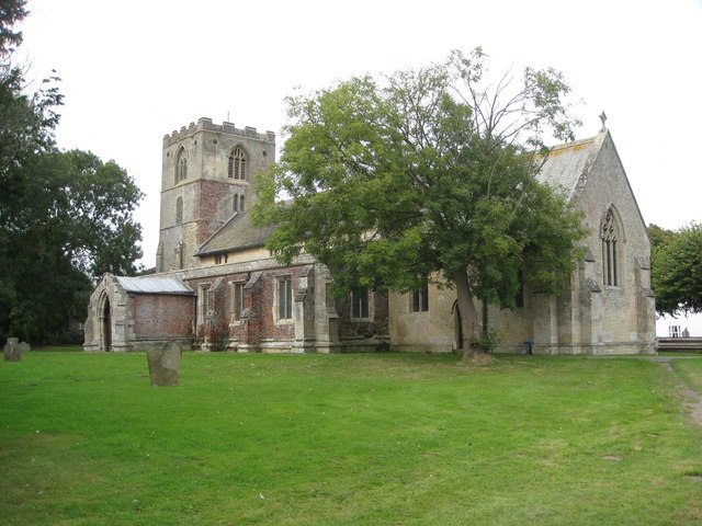
Anderby is a civil parish located in the East Lindsey district of Lincolnshire, England. Nestled along the North Sea coast, it is situated about 8 miles north-east of the town of Skegness. The parish covers an area of approximately 6 square miles and is home to a small population of around 200 residents.

Anderby is known for its beautiful sandy beach, which stretches for over a mile and is a popular destination for tourists and locals alike. The beach is backed by sand dunes and offers stunning views of the sea, making it a perfect spot for relaxing walks and picnics. It is also noteworthy for being one of the few remaining natural coastlines in Lincolnshire.

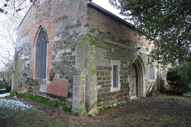
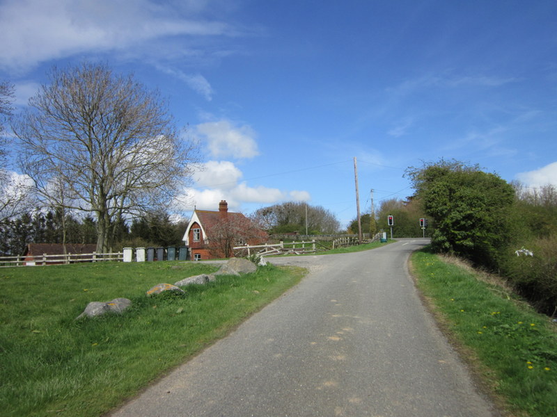
The village itself is small and charming, with a few amenities including a local pub and a small convenience store. The parish is primarily residential, with a mix of traditional houses and modern developments. The area is surrounded by agricultural land, and farming plays an important role in the local economy.

Anderby is also known for its connection to the famous mathematician and philosopher, George Boole, who lived in the village in the mid-19th century. Boole made significant contributions to the field of mathematics, particularly in the area of logic, and his work continues to be influential to this day.

Overall, Anderby offers a peaceful and picturesque setting, making it an attractive destination for those seeking a quiet coastal retreat.

If you have any feedback on the listing, please let us know in the comments section below.

Anderby Images

Images are sourced within 2km of 53.25621/0.305367 or Grid Reference TF5375. Thanks to Geograph Open Source API. All images are credited.

Anderby Creek Beach The weather had taken a turn for the worse by the time this photograph was taken in late afternoon - the earlier sunshine had gone to be replaced by rain and a cold wind. The sign proclaims this to be a child-friendly beach (whatever that actually means) but unsurprisingly there were no children, or anybody else for that matter, to be seen.
Anderby Creek Beach
The weather had taken a turn for the worse by the time this photograph was taken in late afternoon - the earlier sunshine had gone to be replaced by rain and a cold wind. The sign proclaims this to be a child-friendly beach (whatever that actually means) but unsurprisingly there were no children, or anybody else for that matter, to be seen.
Footpath to Eastfield Farm near Huttoft
Roadside drain near Huttoft Alongside Jolly Common Lane.
Roadside drain near Huttoft
Alongside Jolly Common Lane.
Footpath sign, Jolly Common Lane
Dredging operation, Moggs Eye, Anderby Creek: aerial 2023 See: <a href="https://www.geograph.org.uk/photo/7546850">TF5871 : Dredging and beach replenishment, Chapel St Leonards: aerial 2023 (1)</a>
Dredging operation, Moggs Eye, Anderby Creek: aerial 2023
Jolly Common, Huttoft, to the coast: aerial 2023 (2)
Fields west of Mogg's Eye (Anderby Creek): aerial 2023
Drain near Mumby
Drain near Mumby
Footpath and drain off Ember Lane The footpath isn't marked on OS.
Footpath and drain off Ember Lane
The footpath isn't marked on OS.
Shed and track off Ember Lane
Field entrance adjacent to The Grange, Anderby
Main drain. Anderby
Main drain. Anderby
Pinfold Lane. Anderby Becomes a footpath to Anderby Creek.
Pinfold Lane. Anderby
Becomes a footpath to Anderby Creek.
Graveyard and St Andrew's church, Anderby
St. Andrew Parish Church, Anderby, Lincolnshire The church can be found on a small lane off the A52, Mablethorpe to Skegness Road.
St. Andrew Parish Church, Anderby, Lincolnshire
The church can be found on a small lane off the A52, Mablethorpe to Skegness Road.
Anderby Pump The large black pipes are part of the Anderby Creek drainage pump.  The building in the background houses the old diesel powered pump which runs occasionally during the summer months.
Anderby Pump
The large black pipes are part of the Anderby Creek drainage pump. The building in the background houses the old diesel powered pump which runs occasionally during the summer months.
Path to the Sea This road is also a footpath which leads to the sea just over the bank on the horizon.
Path to the Sea
This road is also a footpath which leads to the sea just over the bank on the horizon.
Path to Anderby This track is a footpath to Anderby Creek.
Path to Anderby
This track is a footpath to Anderby Creek.
Show me another place!

Anderby is located at Grid Ref: TF5375 (Lat: 53.25621, Lng: 0.305367)

Administrative County: Lincolnshire

District: East Lindsey

Police Authority: Lincolnshire

What 3 Words

///engineers.assets.fictional. Near Chapel St Leonards, Lincolnshire

Nearby Locations

Anderby

Related Wikis

Anderby Creek

Anderby Creek is a small holiday village in Lincolnshire, England, to the north of Skegness. Part of the parish of Anderby, it is on the North Sea coast...

Anderby

Anderby is a village and civil parish in the East Lindsey district of Lincolnshire, England. It has a population of 335, according to the 2001 Census....

Huttoft

Huttoft is a village in the East Lindsey district of Lincolnshire, England, about 4 miles (6 km) east of the market town of Alford, on the A52 road between...

Mumby

Mumby is a village in the East Lindsey district of Lincolnshire, England. It is located 4 miles (6 km) south-east from the town of Alford. In 2001 the...

Helsey

Helsey is a hamlet in the civil parish of Mumby, and the East Lindsey district of Lincolnshire, England. It lies on the A52 1 mile (1.6 km) north-east...

Hogsthorpe

Hogsthorpe is a small village in the East Lindsey district of Lincolnshire, England. It is situated approximately 2 miles (3 km) from the North Sea and...

Cumberworth

Cumberworth is a small village and civil parish in the East Lindsey district of Lincolnshire, England. It is situated approximately 3 miles (5 km) south...

Mumby Road railway station

Mumby Road railway station was a station on the Great Northern Railway's Mablethorpe Loop line between Willoughby, Mablethorpe and Louth. It served the...

Nearby Amenities

Located within 500m of 53.25621,0.305367
Bus Stop
Manor Farm Lane End
Naptan AtcoCode: 270000009833
Naptan Bearing: SW
Naptan BusStopType: CUS
Naptan CommonName: Manor Farm Lane End
Naptan Indicator: opp
Naptan Landmark: Manor Farm Lane End
Naptan NaptanCode: linjgajw
Naptan Street: Sea Road
Naptan Verified: no
Source: naptan_import
Lat/Long: 53.2586908/0.2998771
Bus Stop
Council Houses
Naptan AtcoCode: 270000013011
Naptan Bearing: NW
Naptan BusStopType: CUS
Naptan CommonName: Council Houses
Naptan Indicator: opp
Naptan Landmark: Council Houses
Naptan NaptanCode: linjpamt
Naptan Street: Sea Road
Naptan Verified: no
Source: naptan_import
Lat/Long: 53.2588826/0.3015817
Bus Stop
Council Houses
Naptan AtcoCode: 2700LACH4038
Naptan Bearing: SE
Naptan BusStopType: CUS
Naptan CommonName: Council Houses
Naptan Indicator: adj
Naptan Landmark: Council Houses
Naptan NaptanCode: lindgwjg
Naptan Street: Sea Road
Naptan Verified: no
Source: naptan_import
Lat/Long: 53.2590565/0.3014261
Bus Stop
Manor Farm Lane End
Naptan AtcoCode: 2700LAP04039
Naptan Bearing: NE
Naptan BusStopType: CUS
Naptan CommonName: Manor Farm Lane End
Naptan Indicator: adj
Naptan Landmark: Manor Farm Lane End
Naptan NaptanCode: lindgwjm
Naptan Street: Sea Road
Naptan Verified: no
Source: naptan_import
Lat/Long: 53.2588174/0.2998389
Dairy Farm
Place: farm
Source: Bing
Lat/Long: 53.2577692/0.2983842
The Grange
Place: farm
Source: Bing
Lat/Long: 53.2567439/0.3069117
St Omer
Place: isolated_dwelling
Source: Bing
Lat/Long: 53.2568748/0.3046064
Thr Briars
Place: isolated_dwelling
Source: Bing
Lat/Long: 53.2573823/0.3088957
The data included in this document is from www.openstreetmap.org. The data is made available under ODbL.

Have you been to Anderby?

Leave your review of Anderby below (or comments, questions and feedback).