Alverdiscott

Civil Parish in Devon Torridge

England

Alverdiscott

Alverdiscott National Grid Substation This is a high voltage 400kV T-Off substation from the main Taunton to Indian Queens line. The substation consists of 2x400kV to 132kV transformers then a local distribution 132kV substation. The complete substation and point of picture are all within this square.
Alverdiscott National Grid Substation Credit: David Neale

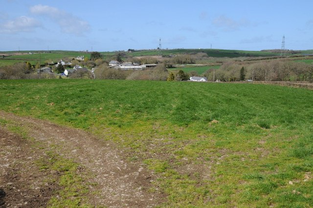
Alverdiscott is a civil parish located in the county of Devon, in the southwestern part of England. It is situated approximately 4 miles east of the town of Bideford and covers an area of around 2.44 square miles. The parish is part of the Torridge local government district.

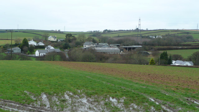
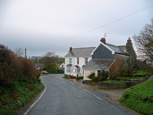
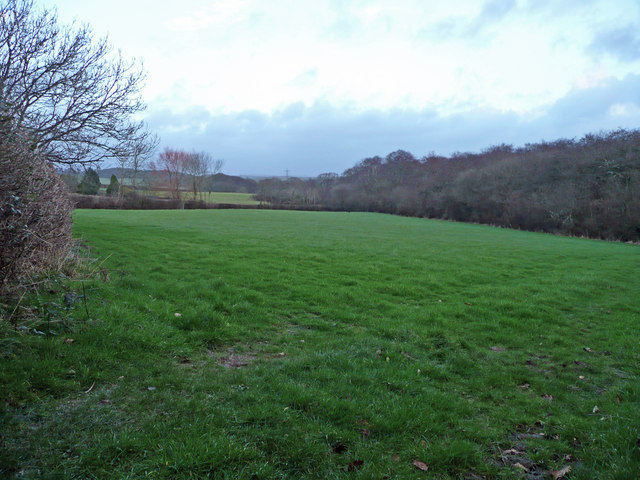
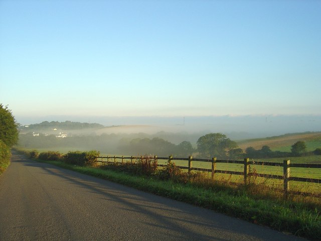
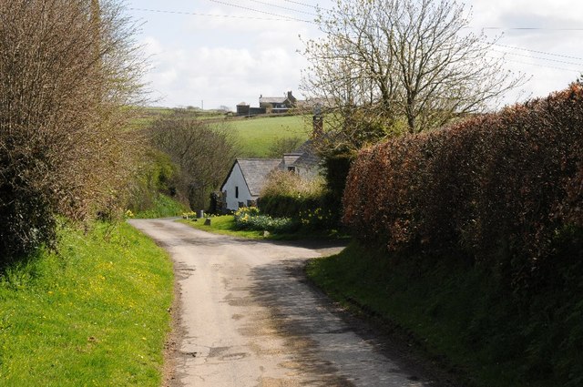
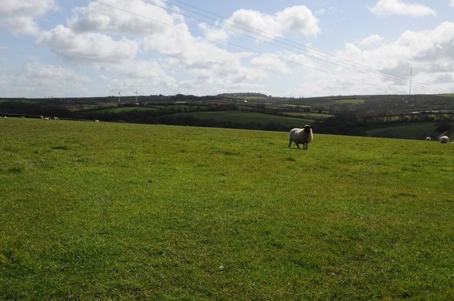
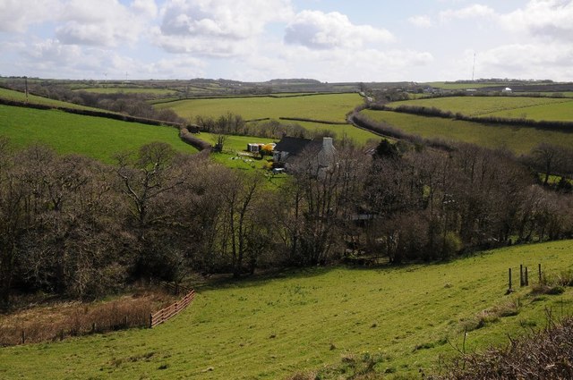
The small village of Alverdiscott is the main settlement within the parish. It is a picturesque rural community surrounded by rolling hills and farmland, typical of the Devon countryside. The village consists of a cluster of traditional stone cottages and houses, along with a few modern developments.

Historically, Alverdiscott was mentioned in the Domesday Book of 1086, indicating its long-standing presence. The village's economy has traditionally been centered around agriculture, with farming playing a vital role in the local community.

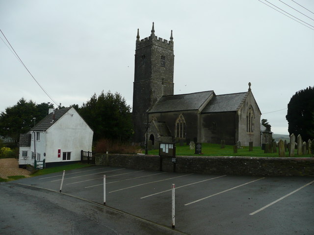
There are limited amenities within the village itself, with a small church and a village hall serving as the focal points for community gatherings and events. However, the nearby town of Bideford offers a wider range of services, including shops, schools, and healthcare facilities.

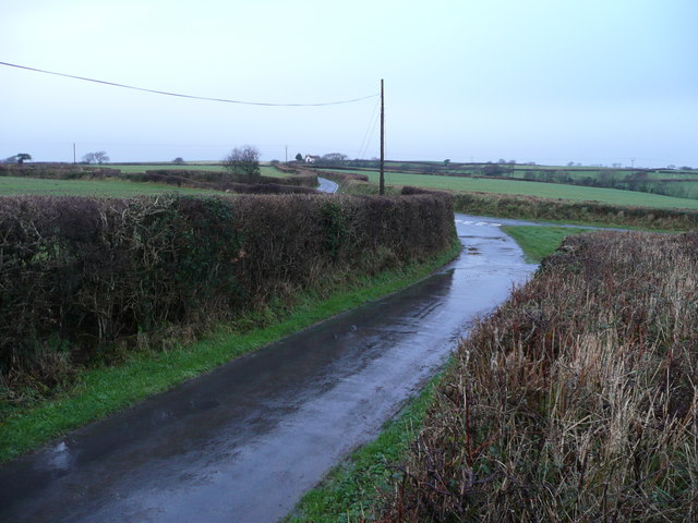
Alverdiscott is situated in a beautiful countryside setting, with plenty of opportunities for outdoor activities such as walking, hiking, and cycling. The Tarka Trail, a popular long-distance footpath, passes through the parish, providing access to stunning natural landscapes and wildlife.

Overall, Alverdiscott is a charming rural parish with a strong sense of community and a tranquil atmosphere, making it an attractive destination for those seeking a peaceful countryside lifestyle.

If you have any feedback on the listing, please let us know in the comments section below.

Alverdiscott Images

Images are sourced within 2km of 51.009683/-4.142496 or Grid Reference SS4925. Thanks to Geograph Open Source API. All images are credited.

Alverdiscott National Grid Substation This is a high voltage 400kV T-Off substation from the main Taunton to Indian Queens line. The substation consists of 2x400kV to 132kV transformers then a local distribution 132kV substation. The complete substation and point of picture are all within this square.
Alverdiscott National Grid Substation
This is a high voltage 400kV T-Off substation from the main Taunton to Indian Queens line. The substation consists of 2x400kV to 132kV transformers then a local distribution 132kV substation. The complete substation and point of picture are all within this square.
Lane and beechwood Between Webbery and Watergate in a secluded spot east of Bideford.
Lane and beechwood
Between Webbery and Watergate in a secluded spot east of Bideford.
Haddacott Cross How to make a Devon lane junction exciting? Stand on the bank in the rain in January!
Haddacott Cross
How to make a Devon lane junction exciting? Stand on the bank in the rain in January!
Brownscombe Farm Set amid surrounding fields and houses to the west of Haddacott.
Brownscombe Farm
Set amid surrounding fields and houses to the west of Haddacott.
Stony Cross A hamlet in the parish of Alverdiscott.
Stony Cross
A hamlet in the parish of Alverdiscott.
Grazing land near Budacombe North of Stony Cross in the parish of Alverdiscott.
Grazing land near Budacombe
North of Stony Cross in the parish of Alverdiscott.
Stoney Cross enshrouded in mist
Approaching Stoney Cross from the west
Farmland and cottage near Alverdiscott Farmland and thatched cottage near Alverdiscott.
Farmland and cottage near Alverdiscott
Farmland and thatched cottage near Alverdiscott.
Road passing Brownscombe Farm Road passing Brownscombe Farm near Huntshaw.
Road passing Brownscombe Farm
Road passing Brownscombe Farm near Huntshaw.
Brownscombe Farm View to Brownscombe Farm and surrounding houses from Haddacott, a similar view to Jonathan Billinger's picture from January 2008 <a href="https://www.geograph.org.uk/photo/659980">SS5024 : Brownscombe Farm</a>
Brownscombe Farm
View to Brownscombe Farm and surrounding houses from Haddacott, a similar view to Jonathan Billinger's picture from January 2008 SS5024 : Brownscombe Farm
Farmland at Haddacott Sheep in a field at Haddacott.
Farmland at Haddacott
Sheep in a field at Haddacott.
Huntshaw Water A view over farmland at Huntshaw Water.
Huntshaw Water
A view over farmland at Huntshaw Water.
Road at Huntshaw Water County road descending to Huntshaw Water.
Road at Huntshaw Water
County road descending to Huntshaw Water.
Farmland near Haddacott Farmland below Brownscombe and Haddacott.
Farmland near Haddacott
Farmland below Brownscombe and Haddacott.
Webbery : Country Lane A lane heads through the countryside.
Webbery : Country Lane
A lane heads through the countryside.
Webbery : Grassy Field A grassy field with a tree.
Webbery : Grassy Field
A grassy field with a tree.
Webbery : Grassy Field Looking towards the grassy hillside.
Webbery : Grassy Field
Looking towards the grassy hillside.
Show me another place!

Alverdiscott is located at Grid Ref: SS4925 (Lat: 51.009683, Lng: -4.142496)

Administrative County: Devon

District: Torridge

Police Authority: Devon & Cornwall

What 3 Words

///congratulations.memo.instilled. Near Bideford, Devon

Nearby Locations

Alverdiscott

Related Wikis

Webbery, Alverdiscott

Webbery (anciently Wibbery) is an historic manor in the parish of Alverdiscott in North Devon, England. == History == === Nicholas the Bowman === The manor...

Horwood, Devon

Horwood is a village and former civil parish, now in the parish of Horwood, Lovacott and Newton Tracey, in the North Devon district, in the county of Devon...

Alverdiscott

Alverdiscott (pronounced Alscott, or ) is a village, civil parish, former manor and former ecclesiastical parish in the Torridge district of Devon, England...

Huntshaw

Huntshaw is a village and civil parish located 2.5 north north east of Great Torrington, in the Torridge district, in the county of Devon, England. In...

Nearby Amenities

Located within 500m of 51.009683,-4.142496
Power: tower
Lat/Long: 51.0073484/-4.1409447
Power: tower
Lat/Long: 51.0123573/-4.1404298
Power: tower
Lat/Long: 51.0095694/-4.1414061
Power: pole
Lat/Long: 51.0107611/-4.1362237
Power: pole
Lat/Long: 51.0092996/-4.1399895
Power: pole
Lat/Long: 51.0109391/-4.1400046
Power: pole
Lat/Long: 51.0103427/-4.1399633
Power: pole
Lat/Long: 51.0109347/-4.1377343
Power: pole
Lat/Long: 51.0116469/-4.1369888
Power: pole
Lat/Long: 51.0070246/-4.1384929
Power: pole
Lat/Long: 51.0062517/-4.137994
Power: pole
Lat/Long: 51.0127423/-4.1399466
Power: pole
Lat/Long: 51.0082533/-4.1393136
Power: pole
Lat/Long: 51.0109432/-4.1380997
Power: pole
Lat/Long: 51.0118325/-4.1399759
The data included in this document is from www.openstreetmap.org. The data is made available under ODbL.

Have you been to Alverdiscott?

Leave your review of Alverdiscott below (or comments, questions and feedback).