Agden

Civil Parish in Cheshire

England

Agden

Higher Wych Looking across the border from Highbrooke House (Wales) to the hamlet of Higher Wych (England). The course of Wych Brook is the national boundary.
Higher Wych Credit: Oliver Dixon

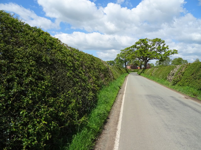
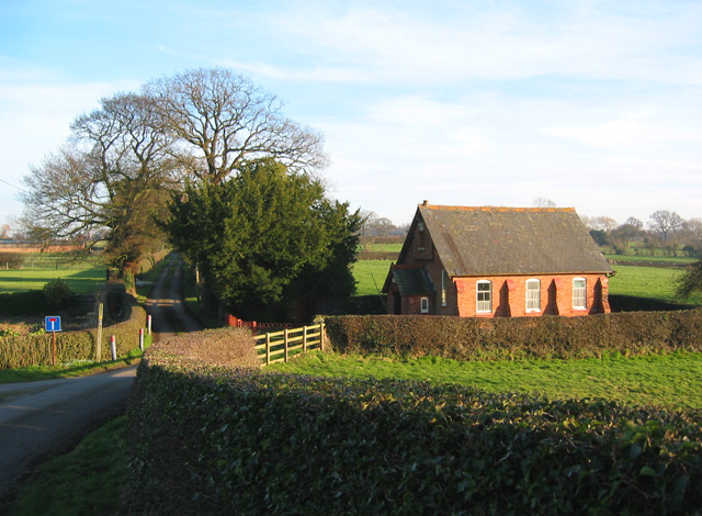
Agden is a small civil parish located in the county of Cheshire, England. Situated approximately 10 miles southwest of the city of Manchester, Agden covers an area of around 2 square miles. It is surrounded by picturesque countryside, with rolling hills and green fields.

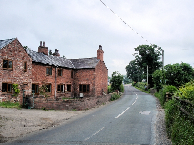
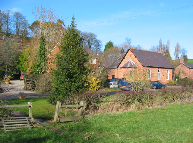
The parish is home to a relatively small population, with only a handful of residential properties. Most of the area is made up of agricultural land, with farming being the primary industry. The landscape is dotted with farms and farmhouses, giving the area a rural and tranquil feel.

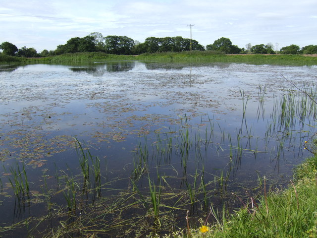
Agden is a popular destination for nature enthusiasts and walkers, as it offers numerous footpaths and trails that provide stunning views of the surrounding countryside. One of the notable features of the parish is Agden Reservoir, a man-made lake that provides a water source for the area.

Despite its small size, Agden has a close-knit community, with residents often participating in local events and activities. The parish does not have its own school or shops, with residents relying on neighboring towns for these amenities.

Overall, Agden is a charming and peaceful civil parish, offering a serene escape from the hustle and bustle of nearby urban areas. Its natural beauty and sense of community make it an attractive place to live for those seeking a slower pace of life.

If you have any feedback on the listing, please let us know in the comments section below.

Agden Images

Images are sourced within 2km of 52.990054/-2.731399 or Grid Reference SJ5143. Thanks to Geograph Open Source API. All images are credited.

Higher Wych Looking across the border from Highbrooke House (Wales) to the hamlet of Higher Wych (England). The course of Wych Brook is the national boundary.
Higher Wych
Looking across the border from Highbrooke House (Wales) to the hamlet of Higher Wych (England). The course of Wych Brook is the national boundary.
Doves on the wire A few of the flock of eighteen white doves - and one variegated one - assembled on a telegraph wire at  Higher Wych, Such a concentration of ornamental birds hints at the earlier existence of a dovecote somewhere in the vicinity.
Doves on the wire
A few of the flock of eighteen white doves - and one variegated one - assembled on a telegraph wire at Higher Wych, Such a concentration of ornamental birds hints at the earlier existence of a dovecote somewhere in the vicinity.
Grassland near Kiln Green
Lane towards Higher Wych Looking north west.
Lane towards Higher Wych
Looking north west.
Former school, Higher Wych Now a private residence.
Former school, Higher Wych
Now a private residence.
Minor road, Higher Wych Looking north west.
Minor road, Higher Wych
Looking north west.
Grassland, Higher Wych Near the former school.
Grassland, Higher Wych
Near the former school.
Barn conversion, Wigland Farm
House, Wigland Farm
House, Wigland Farm
Minor road near Wigland Farm Heading north.
Minor road near Wigland Farm
Heading north.
Golden Holly House near Fields Farm.
Golden Holly
House near Fields Farm.
Grazing near Ivy House Off Dodd's Lane.
Grazing near Ivy House
Off Dodd's Lane.
Dodd's Lane Looking east.
Dodd's Lane
Looking east.
Elizabeth II postbox, Maes-y-groes Farm Postbox No. SY13 700.

See <a href="https://www.geograph.org.uk/photo/6142841">SJ4943 : Close up, Elizabeth II postbox, Maes-y-groes Farm</a> for close up.
Elizabeth II postbox, Maes-y-groes Farm
Postbox No. SY13 700. See SJ4943 : Close up, Elizabeth II postbox, Maes-y-groes Farm for close up.
Close up, Elizabeth II postbox, Maes-y-groes Farm Postbox No. SY13 700.

See <a href="https://www.geograph.org.uk/photo/6142838">SJ4943 : Elizabeth II postbox, Maes-y-groes Farm</a> for wider view.
Close up, Elizabeth II postbox, Maes-y-groes Farm
Postbox No. SY13 700. See SJ4943 : Elizabeth II postbox, Maes-y-groes Farm for wider view.
Victorian postbox, Higher Wych Postbox No. SY14 683.
Victorian postbox, Higher Wych
Postbox No. SY14 683.
Direction Sign – Signpost Located on the northwest side of the junction of Higher Wych Road and Higher Lanes in Bronington community. 3 arms and pawn finial. See also <a title="https://www.geograph.org.uk/photo/4425618" href="https://www.geograph.org.uk/photo/4425618">Link</a>.

Milestone Society National ID: FLT_SJ4943
Direction Sign – Signpost
Located on the northwest side of the junction of Higher Wych Road and Higher Lanes in Bronington community. 3 arms and pawn finial. See also Link. Milestone Society National ID: FLT_SJ4943
Show me another place!

Agden is located at Grid Ref: SJ5143 (Lat: 52.990054, Lng: -2.731399)

Unitary Authority: Cheshire West and Chester

Police Authority: Cheshire

What 3 Words

///signified.roofed.cheat. Near Malpas, Cheshire

Nearby Locations

Agden

Related Wikis

Agden, Cheshire West and Chester

Agden is a small civil parish in the unitary authority of Cheshire West and Chester and the ceremonial county of Cheshire, England. It is the site of...

Grindley Brook Halt railway station

Grindley Brook Halt was a railway halt in the village of Grindley Brook, Shropshire on the Whitchurch and Tattenhall Railway or Chester-Whitchurch Branch...

Wigland

Wigland is a civil parish in the Borough of Cheshire West and Chester and ceremonial county of Cheshire in England. It, along with the neighbouring parishes...

Grindley Brook

Grindley Brook is a small village in Shropshire, England, on the A41 trunk road around 1.5 miles north west of the market town of Whitchurch. It is the...

Chidlow, Cheshire

Chidlow is a civil parish in the Cheshire West and Chester district and ceremonial county of Cheshire in England. In 2001 it had a population of 8.Its...

Bradley Green, Cheshire

Bradley Green is a hamlet in Cheshire West and Chester, England. It lies about 1+1⁄2 miles (2.4 km) southeast of the town of Malpas and falls within the...

Bradley, Cheshire

Bradley is a former civil parish, now in the parish of Tushingham-cum-Grindley, Macefen and Bradley, in the Cheshire West and Chester district, and the...
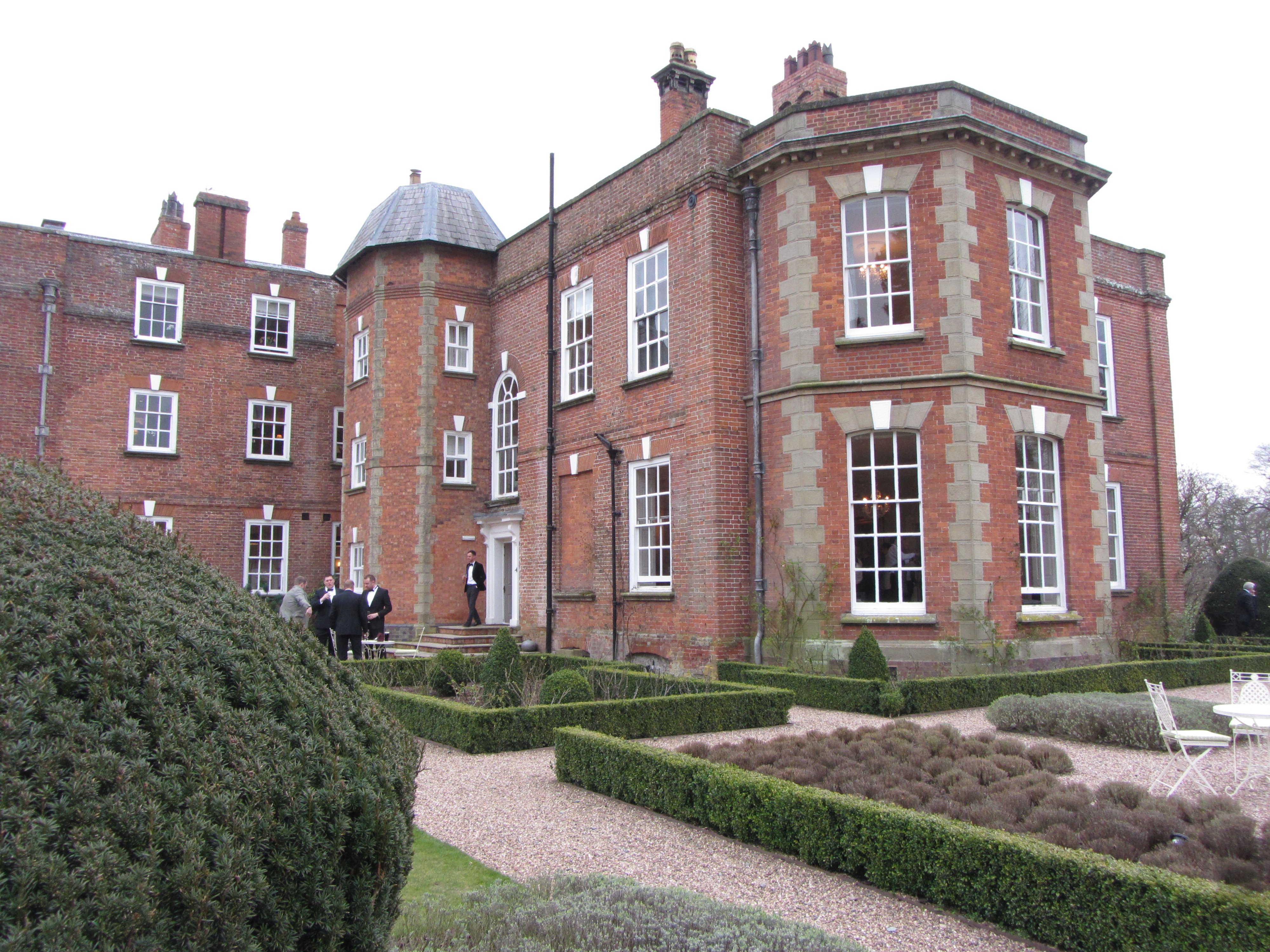
Iscoyd Park

Iscoyd Park is a three-storey redbrick country house in Wrexham County Borough, Wales. It has a slate roof built in the early 18th century. It was sold...

Nearby Amenities

Located within 500m of 52.990054,-2.731399
Barrier: stile
Foot: yes
Lat/Long: 52.986003/-2.7317499
Barrier: stile
Foot: yes
Lat/Long: 52.9898937/-2.7259934
Barrier: stile
Foot: yes
Lat/Long: 52.9884739/-2.7314873
Barrier: stile
Foot: yes
Lat/Long: 52.9920335/-2.7308985
Barrier: stile
Foot: yes
Lat/Long: 52.9935259/-2.7320741
Bus Stop
Agden, B5395 / Agden Lane
Bus: yes
Naptan AtcoCode: 0610CH1321
Naptan Bearing: NW
Naptan CommonName: Agden Lane
Naptan Crossing: Agden Lane
Naptan Indicator: cnr
Naptan Landmark: Agden Lane
Naptan LocalityName: Agden
Naptan NaptanCode: chwdwgp
Naptan ShortCommonName: Agden Lane
Naptan Street: B5395
Naptan Verified: no
Public Transport: platform
Source: naptan_import
Lat/Long: 52.9886605/-2.7254548
Barrier: stile
Foot: yes
Lat/Long: 52.9913947/-2.7368199
The data included in this document is from www.openstreetmap.org. The data is made available under ODbL.

Have you been to Agden?

Leave your review of Agden below (or comments, questions and feedback).