Bridgetown

Settlement in Somerset Somerset West and Taunton

England

Bridgetown

Bridgetown : A396 A road through the village.
Bridgetown : A396 Credit: Lewis Clarke

Bridgetown is a picturesque village located in Somerset, England. Situated on the banks of the River Parrett, it is known for its scenic beauty and tranquil atmosphere. With a population of around 500 residents, Bridgetown offers a close-knit community feel.

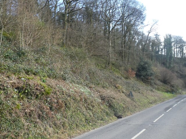
The village is adorned with charming traditional cottages, many of which showcase the local architectural style of the region. The streets are lined with well-maintained gardens and flower beds, adding to the village's appeal. The surrounding countryside boasts rolling hills, lush green fields, and meandering rivers, making it a popular destination for nature lovers and outdoor enthusiasts.

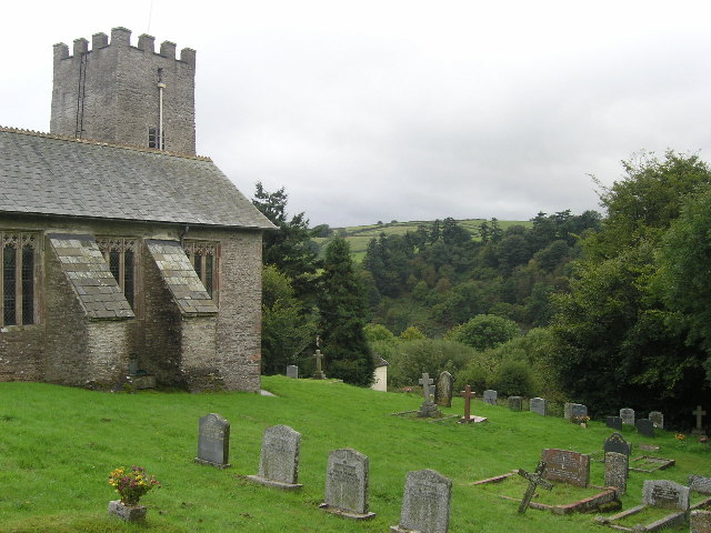
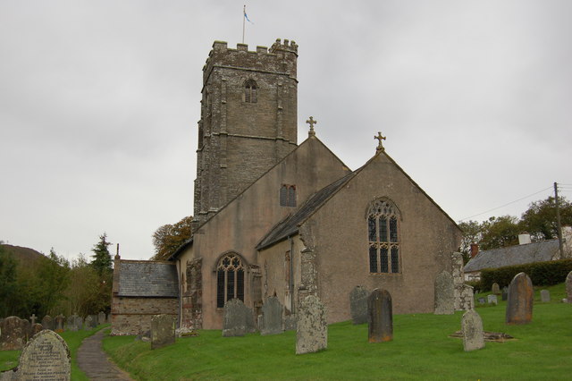
One of the village's main attractions is the historic St. Mary's Church, which dates back to the 12th century. The church features stunning medieval architecture and beautiful stained-glass windows. It serves as a focal point for the community, hosting regular religious services and community events.

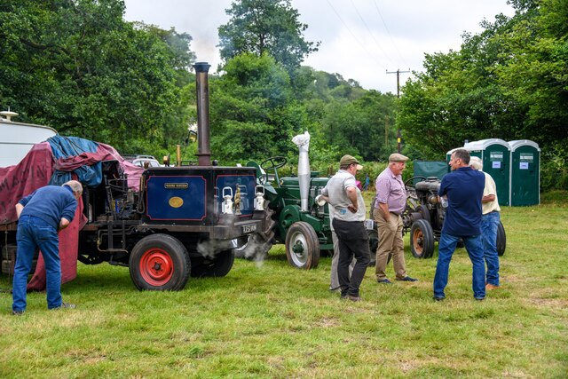
Bridgetown is also home to a few local businesses, including a small grocery store, a cozy pub, and a handful of artisan shops. These establishments provide essential services and contribute to the village's economy.

The village benefits from its proximity to the larger market towns of Taunton and Bridgwater, which offer a wider range of amenities and employment opportunities. The well-connected road network allows residents to easily access these neighboring towns, making Bridgetown an ideal place to live for those seeking a balance between a peaceful rural lifestyle and urban conveniences.

Overall, Bridgetown exudes charm and tranquility, making it a delightful place to reside or visit for anyone seeking a quintessential English village experience.

If you have any feedback on the listing, please let us know in the comments section below.

Bridgetown Images

Images are sourced within 2km of 51.088833/-3.537785 or Grid Reference SS9233. Thanks to Geograph Open Source API. All images are credited.

Bridgetown : A396 A road through the village.
Bridgetown : A396
A road through the village.
The Badgers Holt, Bridgetown Since <a href="https://www.geograph.org.uk/photo/3541981">SS9233 : The Badgers Holt in Bridgetown</a> was taken, a picture of a badger has been added to the wall
The Badgers Holt, Bridgetown
Since SS9233 : The Badgers Holt in Bridgetown was taken, a picture of a badger has been added to the wall
Bridgetown Wood
Bridgetown Wood
Bridgetown telephone box Inside the box are two notices, dated 2019 and 2020, informing the public that BT are considering removing the phone box.  It is still operational.
Bridgetown telephone box
Inside the box are two notices, dated 2019 and 2020, informing the public that BT are considering removing the phone box. It is still operational.
Bridgetown : Exmoor Rocks Festival A festival takes place on a sunny afternoon.
Bridgetown : Exmoor Rocks Festival
A festival takes place on a sunny afternoon.
Bridgetown : Exmoor Rocks Festival A festival held in Bridgetown.
Bridgetown : Exmoor Rocks Festival
A festival held in Bridgetown.
Exton : Xmoor-Roc Festival Looking across the grounds of the festival.
Exton : Xmoor-Roc Festival
Looking across the grounds of the festival.
Exton : Xmoor-Roc Festival Looking towards the drinks area.
Exton : Xmoor-Roc Festival
Looking towards the drinks area.
Exton : Xmoor-Roc Festival Steam engines at the event.
Exton : Xmoor-Roc Festival
Steam engines at the event.
Exton : Xmoor-Rox Festival Looking across the festival grounds.
Exton : Xmoor-Rox Festival
Looking across the festival grounds.
Exton : Xmoor-Rox Festival Looking across to people enjoying themselves.
Exton : Xmoor-Rox Festival
Looking across to people enjoying themselves.
Exton : Xmoor-Rox Festival The New Jersey Boys keep people entertained.
Exton : Xmoor-Rox Festival
The New Jersey Boys keep people entertained.
Exton : Howhill Farm Looking into Howhill Farm.
Exton : Howhill Farm
Looking into Howhill Farm.
Exton : Howhill Farm Looking towards Howhill Farm.
Exton : Howhill Farm
Looking towards Howhill Farm.
Exton : Edbrooke Road Looking along Edbrooke Road.
Exton : Edbrooke Road
Looking along Edbrooke Road.
Exton : Lype Lane Looking along the track.
Exton : Lype Lane
Looking along the track.
Exton : A396 A main road through the area.
Exton : A396
A main road through the area.
EXTON, Somerset St Peter's church high up overlooking the valley of the River Exe
EXTON, Somerset
St Peter's church high up overlooking the valley of the River Exe
Show me another place!

Bridgetown is located at Grid Ref: SS9233 (Lat: 51.088833, Lng: -3.537785)

Administrative County: Somerset

District: Somerset West and Taunton

Police Authority: Avon and Somerset

What 3 Words

///discloses.patrolled.headlight. Near Dulverton, Somerset

Related Wikis

Exton, Somerset

Exton is a village and civil parish 5 miles (8 km) north-east of Dulverton and 9 miles (14 km) south-west of Dunster in Somerset, England. It lies on the...

St Peter's Church, Exton

The Anglican St Peter's Church at Exton within the English county of Somerset has a 13th-century tower and 15th century aisle. It is a Grade II* listed...

Winsford, Somerset

Winsford is a village and civil parish in Somerset, England, located about 5 miles (8 km) north-west of Dulverton. It is within the borders of the Exmoor...

Garratts Wood

Garratts Wood is a woodland in Somerset, England, near the village of Winsford. It covers a total area of 1.11 hectares (2.74 acres). It is owned and managed...

Nearby Amenities

Located within 500m of 51.088833,-3.537785
Pub
Badger's Holt
Addr City: Dulverton
Addr Country: GB
Addr County: Somerset
Addr Postcode: TA22 9JL
Addr Street: A396
Addr Village: Bridgetown
Fhrs Authority: West Somerset
Fhrs Id: 160435
Fhrs Local Authority Id: PI/000000058
Wikidata: Q99593144
Lat/Long: 51.0876443/-3.5376217
Exton
Place: village
Lat/Long: 51.0915754/-3.5353063
Exe Valley Caravan Site
Addr City: Dulverton
Addr Country: GB
Addr County: Somerset
Addr Housename: Mill House
Addr Postcode: TA22 9JR
Addr Street: Week Lane
Addr Village: Bridgetown
Fhrs Authority: West Somerset
Fhrs Id: 161256
Fhrs Local Authority Id: PI/000001238
Source: ACSI
Tourism: camp_site
Lat/Long: 51.0884961/-3.5390245
Bridgetown
Place: hamlet
Wikidata: Q104531014
Lat/Long: 51.0880397/-3.5382865
Parking
Parking: layby
Lat/Long: 51.0870384/-3.5378118
Telephone
Booth: K6
Covered: booth
Lat/Long: 51.0873029/-3.5378252
The data included in this document is from www.openstreetmap.org. The data is made available under ODbL.

Have you been to Bridgetown?

Leave your review of Bridgetown below (or comments, questions and feedback).