Bridgehouse Gate

Settlement in Yorkshire Harrogate

England

Bridgehouse Gate

Long Green Head Farm
Long Green Head Farm Credit: N Chadwick

Bridgehouse Gate is a charming village located in the picturesque county of Yorkshire, England. Nestled in the heart of the Yorkshire Dales, this idyllic settlement offers a tranquil retreat for both locals and visitors alike.

The village takes its name from the iconic bridge that spans the River Wharfe, which is a prominent feature of the area. This historic stone bridge, dating back to the 17th century, serves as a beautiful backdrop to the village and is a popular spot for photography enthusiasts.

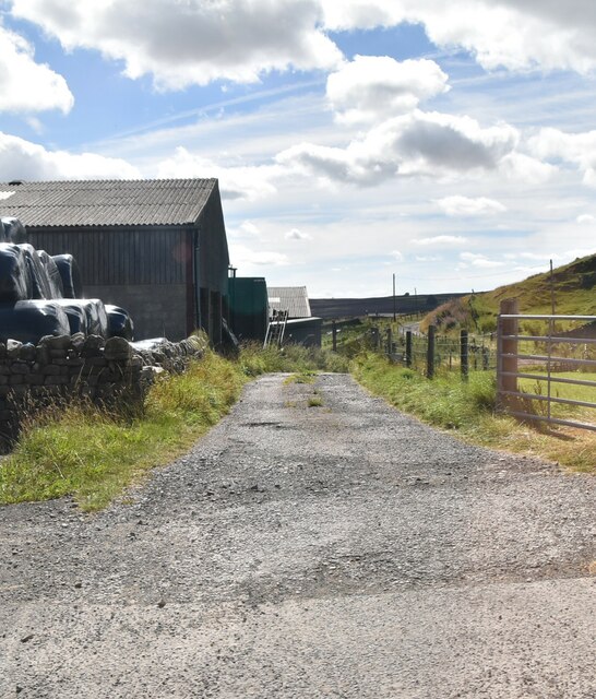
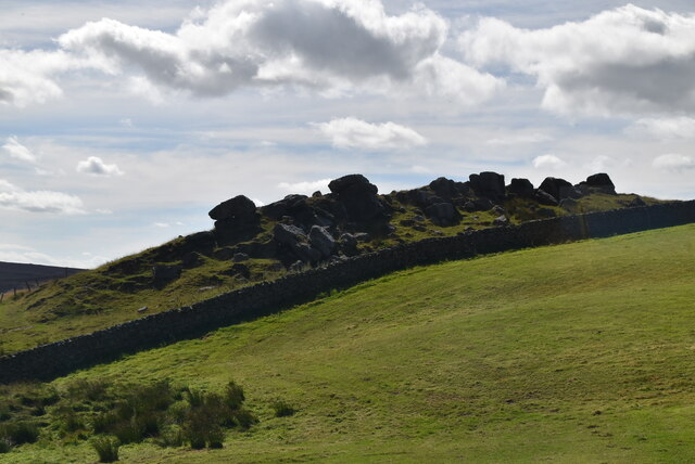
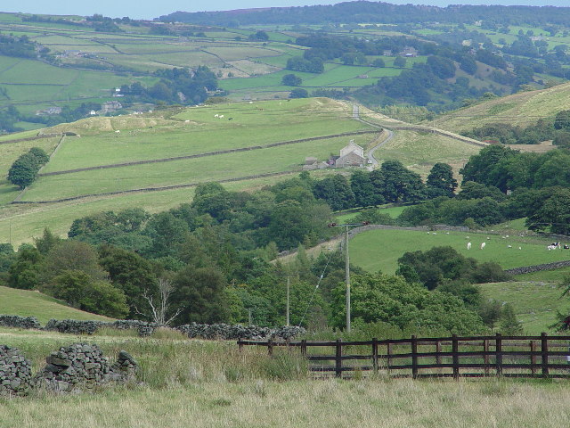
Bridgehouse Gate is renowned for its stunning natural beauty and lush green landscapes. Surrounded by rolling hills, dense forests, and meandering rivers, the village offers ample opportunities for outdoor activities such as hiking, fishing, and wildlife watching.

The village itself is home to a close-knit community, with a handful of quaint cottages and local amenities. A small, traditional pub sits at the heart of the village, offering a warm welcome and serving up hearty pub grub to hungry visitors.

For history enthusiasts, Bridgehouse Gate boasts several historical landmarks, such as the ruins of a medieval castle and a 12th-century church. These architectural gems provide a glimpse into the village's rich past and offer a fascinating insight into Yorkshire's history.

Overall, Bridgehouse Gate is a hidden gem that showcases the natural beauty and historical charm of Yorkshire. Whether it's exploring the great outdoors or immersing oneself in the village's history, this tranquil haven offers a delightful escape from the hustle and bustle of everyday life.

If you have any feedback on the listing, please let us know in the comments section below.

Bridgehouse Gate Images

Images are sourced within 2km of 54.083567/-1.763184 or Grid Reference SE1565. Thanks to Geograph Open Source API. All images are credited.

Long Green Head Farm
Rocks near Long Green Head
Rough grazing
Rough grazing
Pateley Bridge High Street In Nidderdale
Pateley Bridge High Street
In Nidderdale
Pateley Bridge High Street
Foster Beck Watermill, Pateley Bridge A breastshot wheel originally used to power a woollen mill.
Foster Beck Watermill, Pateley Bridge
A breastshot wheel originally used to power a woollen mill.
Wooden stile View over Pateley Bridge
Wooden stile
View over Pateley Bridge
Crocodile Rock View over Nidderdale from Crocodile Rock
Crocodile Rock
View over Nidderdale from Crocodile Rock
Long Green Head Farm Looking down Greenhow Hill to Long Green Head Farm. The houses in the distance are part of Pateley Bridge.
Long Green Head Farm
Looking down Greenhow Hill to Long Green Head Farm. The houses in the distance are part of Pateley Bridge.
House on Ladies Riggs Road The house is near Bale Bank Farm. In the distance the ground falls away over Ladies' Riggs into Pateley Bridge, Nidderdale.
House on Ladies Riggs Road
The house is near Bale Bank Farm. In the distance the ground falls away over Ladies' Riggs into Pateley Bridge, Nidderdale.
Castlestead
Castlestead
Moorland and Fields in the distance is RAF Menwith Hill
Moorland and Fields
in the distance is RAF Menwith Hill
St Mary's Church (ruins) This ancient church fell closed in the early 19th century, the church of St Cuthbert being only a mile or so away. The tower, walls and graveyard still exist and the place is well worth a visit.
St Mary's Church (ruins)
This ancient church fell closed in the early 19th century, the church of St Cuthbert being only a mile or so away. The tower, walls and graveyard still exist and the place is well worth a visit.
Blazefield Road leading to Kings Farm
Blazefield
Road leading to Kings Farm
High Wild Carr
High Wild Carr
Scot Gate Ash Quarries High quality stone was quarried here until the First World War. The stone was used for building railway stations and platforms. An inclined railway was built from the quarries to take the stone down to the station at Pateley Bridge.
Scot Gate Ash Quarries
High quality stone was quarried here until the First World War. The stone was used for building railway stations and platforms. An inclined railway was built from the quarries to take the stone down to the station at Pateley Bridge.
Track to Yeadon A house way out on the moor.
Track to Yeadon
A house way out on the moor.
Bandstand, Pately Bridge
Show me another place!

Bridgehouse Gate is located at Grid Ref: SE1565 (Lat: 54.083567, Lng: -1.763184)

Division: West Riding

Administrative County: North Yorkshire

District: Harrogate

Police Authority: North Yorkshire

What 3 Words

///mock.geologist.belong. Near Pateley Bridge, North Yorkshire

Related Wikis

Pateley Bridge railway station

Pateley Bridge railway station is a disused railway station in North Yorkshire, England. The station was the terminating station on the North Eastern Railway...

Bewerley

Bewerley is a village and civil parish in the former Harrogate district of North Yorkshire, England. The village is 0.5 mile south of Pateley Bridge in...

Pateley Bridge

Pateley Bridge (known locally as Pateley) is a market town in the civil parish of High and Low Bishopside, in Nidderdale, in the county and district of...

Pateley Playhouse

The Pateley Playhouse is a small amateur-run theatre in the town of Pateley Bridge in Nidderdale, North Yorkshire, England. The building was initially...

Nearby Amenities

Located within 500m of 54.083567,-1.763184
Pateley Bridge
Is In: UK, England, Yorkshire,North Yorkshire, Nidderdale, Yorkshire Dales
Place: town
Wikidata: Q1617126
Wikipedia: en:Pateley Bridge
Lat/Long: 54.0870914/-1.7596404
Fuel
Contact Phone: +44 1423 712437
Fuel Diesel: yes
Fuel Lpg: no
Fuel Octane 95: yes
Note: LPG sale discontinued according to phone enquiry.
Opening Hours: 07:00-22:00
Lat/Long: 54.0844148/-1.7625089
Veterinary
Bishopton Veterinary Group
Source: survey
Lat/Long: 54.0835638/-1.7628119
Leisure: bandstand
Lat/Long: 54.0850289/-1.7632448
War Memorial
Historic: monument
Lat/Long: 54.085139/-1.7620688
Tourism: camp_site
Lat/Long: 54.0862657/-1.7652552
Information: office
Tourism: information
Lat/Long: 54.0861397/-1.7595809
Toilets
Source: survey
Lat/Long: 54.0853326/-1.7614611
Fast Food
Bengal Cuisine
Addr Housenumber: 1a
Addr Street: High Street
Cuisine: indian
Lat/Long: 54.0860242/-1.760627
Spar
Brand: Spar
Brand Wikidata: Q610492
Shop: convenience
Source: photo
Lat/Long: 54.0860645/-1.7605103
Cafe
Wildings
Cuisine: tea_room
Lat/Long: 54.08549/-1.7602838
Fast Food
High Street Fisheries
Addr Housenumber: 16
Addr Street: High Street
Cuisine: fish_and_chips
Source: photo
Lat/Long: 54.0861256/-1.7596533
Pub
The Crown
Source: photo
Lat/Long: 54.0862403/-1.7598601
Cafe
The Old Granary Tea Shop
Addr City: Harrogate
Addr Housenumber: 17
Addr Postcode: HG3 5AP
Addr Street: High Street
Addr Suburb: Pateley Bridge
Gluten Free: yes
Source: photo
Website: www.oldgranary.net
Lat/Long: 54.0861854/-1.7600368
Fast Food
Pateley Pizza
Cuisine: pizza;burger;kebab
Drive Through: no
Source: photo
Lat/Long: 54.0860023/-1.7602442
The Old Bakehouse
Shop: bakery
Source: photo
Lat/Long: 54.0860877/-1.7598493
Sypeland Outdoors
Shop: outdoor
Source: photo
Website: www.sypeland.com
Lat/Long: 54.0861426/-1.7602254
Talbot House
Source: photo
Tourism: guest_house
Wikidata: Q26443335
Lat/Long: 54.086393/-1.7592968
Bench
Source: photo
Lat/Long: 54.0862246/-1.7591679
Pharmacy
Pateley Bridge Pharmacy
Source: photo
Lat/Long: 54.086371/-1.7594065
Restaurant
The Willow
Addr City: Pateley Bridge
Addr County: North Yorkshire
Addr Street: Park Road
Source: photo
Lat/Long: 54.0865173/-1.7596133
Restaurant
Chinese Japanese Restaurant
Addr City: Pateley Bridge
Addr County: North Yorkshire
Addr Street: High Street
Cuisine: asian
Source: photo
Lat/Long: 54.0866085/-1.7583044
Save the Children
Shop: charity
Source: photo
Lat/Long: 54.0863269/-1.7587443
Roslyn House
Source: photo
Tourism: guest_house
Lat/Long: 54.0870867/-1.7609007
Bus Stop
Pateley Bridge King Street
Bench: yes
Bin: yes
Bus: yes
Check Date Shelter: 2021-12-04
Departures Board: timetable
Network: DalesBus
Operator: Harrogate & District
Public Transport: platform
Route Ref: 24
Shelter: yes
Tactile Paving: yes
Lat/Long: 54.0863411/-1.7609061
Fast Food
The Sandwich Box
Cuisine: sandwich
Source: photo
Lat/Long: 54.08636/-1.760474
Tourist Information and Library
Addr City: Harrogate
Addr Housename: Station Square
Addr Postcode: HG3 5AT
Addr Street: King Street
Addr Suburb: Pateley Bridge
Information: office
Operator: Nidderdale Plus
Phone: +44 1423 714953
Source: photo
Tourism: information
Lat/Long: 54.0865236/-1.7613701
Crossing
Crossing: marked
Crossing Island: no
Source: Bing
Tactile Paving: yes
Lat/Long: 54.0850338/-1.761376
Bench
Source: photo
Lat/Long: 54.0848418/-1.7632128
Bench
Source: photo
Lat/Long: 54.0852823/-1.7625557
Bench
Source: photo
Lat/Long: 54.0851375/-1.7623006
Bench
Source: photo
Lat/Long: 54.0849047/-1.7628829
Bench
Source: photo
Lat/Long: 54.0851516/-1.7623679
Bench
Source: photo
Lat/Long: 54.0851061/-1.7628373
Bench
Source: photo
Lat/Long: 54.085007/-1.7631055
Turning Circle
Source: Bing
Lat/Long: 54.0876447/-1.7622224
Bench
Lat/Long: 54.0834896/-1.7628386
Post Box
Post Box Mounting: wall
Post Box Type: lamp
Ref: HG3 97
Royal Cypher: GVIR
Royal Cypher Wikidata: Q33102169
Lat/Long: 54.0836913/-1.7632361
The Laundry Room
Shop: laundry
Lat/Long: 54.0838835/-1.7624443
Atm
Lat/Long: 54.0843246/-1.7626003
Bewerley
Place: village
Lat/Long: 54.0799575/-1.7613853
Building: yes
Lat/Long: 54.0825708/-1.7562606
The Oldest Sweet Shop in England
Addr City: Harrogate
Addr Housenumber: 39
Addr Postcode: HG3 5JZ
Addr Street: High Street
Addr Suburb: Pateley Bridge
Opening Hours: We-Sa 10:00-17:00; Su 11:00-17:00
Shop: confectionery
Website: https://www.oldestsweetshop.co.uk/
Lat/Long: 54.0864942/-1.7587462
Post Office
Pateley Bridge Post Office
Addr City: Harrogate
Addr Postcode: HG3 5HG
Addr Suburb: Pateley Bridge
Brand: Post Office
Brand Wikidata: Q1783168
Brand Wikipedia: en:Post Office Ltd
Contact Website: https://www.postoffice.co.uk/branch-finder/6723233/pateley-bridge
Opening Hours: Mo-Fr 08:30-17:30; Sa 09:00-17:30
Ref Pol Id: 143949
Lat/Long: 54.0842643/-1.7626397
Post Box
Lat/Long: 54.0842114/-1.7626045
Post Box
Note: is very low
Post Box Type: wall
Ref: HG3 152
Royal Cypher: GR
Royal Cypher Wikidata: Q33102273
Lat/Long: 54.0862386/-1.7597033
Bench
Lat/Long: 54.0862027/-1.7594737
Cafe
The Pancake House
Cuisine: pancake;milshakes;ice_creams;breakfast
Lat/Long: 54.0860068/-1.7607079
Kendall's Butchers
Shop: butcher
Lat/Long: 54.0863878/-1.7585878
H. Weatherhead & Sons
Shop: butcher
Lat/Long: 54.0860836/-1.7604197
Sue's
Shop: hairdresser
Lat/Long: 54.0860437/-1.760575
Ford: yes
Lat/Long: 54.0819045/-1.7603295
Crossing
Lat/Long: 54.0843274/-1.7623854
Playground: swing
Lat/Long: 54.0797543/-1.7612833
Telephone
Booth: K6
Covered: booth
Lat/Long: 54.0800804/-1.7615873
Post Box
Post Box Type: lamp
Lat/Long: 54.080118/-1.7616126
Bench
Lat/Long: 54.0801984/-1.7616454
Bench
Lat/Long: 54.0801818/-1.7615768
Ford: yes
Lat/Long: 54.0812304/-1.7685562
Bus Stop
Panorama Walk (Southbound)
Bench: no
Bus: yes
Departures Board: timetable
Naptan AtcoCode: 3200YND24450
Naptan NaptanCode: 32024450
Network: DalesBus
Operator: Harrogate Bus Company
Public Transport: platform
Shelter: no
Tactile Paving: no
Lat/Long: 54.0855241/-1.7568124
Bus Stop
Panorama Walk (Northbound)
Bench: no
Bus: yes
Departures Board: timetable
Naptan AtcoCode: 3200YND24410
Naptan NaptanCode: 32024410
Network: DalesBus
Operator: Harrogate Bus Company
Public Transport: platform
Shelter: no
Tactile Paving: no
Lat/Long: 54.0855789/-1.7569281
Parking
Nidd Walk
Lat/Long: 54.0844565/-1.7578253
Information: guidepost
Tourism: information
Lat/Long: 54.0822955/-1.7647824
Pateley Bridge
Historic Railway: station
Railway: site
Wikidata: Q20127984
Wikipedia: en:Pateley Bridge railway station
Lat/Long: 54.0853646/-1.7596609
The data included in this document is from www.openstreetmap.org. The data is made available under ODbL.

Have you been to Bridgehouse Gate?

Leave your review of Bridgehouse Gate below (or comments, questions and feedback).