Cas-mael

Community in Pembrokeshire

Wales

Cas-mael

Fox-and-cubs in Casmael churchyard Pilosella aurantiaca, very often to be found growing in churchyards, cemeteries and other rough stony places with good drainage.
The name Fox-and-cubs refers to the way the open flowers and the buds are clustered together on the same stalk but it has a variety of other common names too.
Fox-and-cubs in Casmael churchyard Credit: Natasha Ceridwen de Chroustchoff

Cas-mael is a community located in the county of Pembrokeshire, Wales. It is situated in the southwestern part of the country, near the coast of the Celtic Sea. The community covers an area of approximately 15 square kilometers and is home to a population of around 1,200 people.

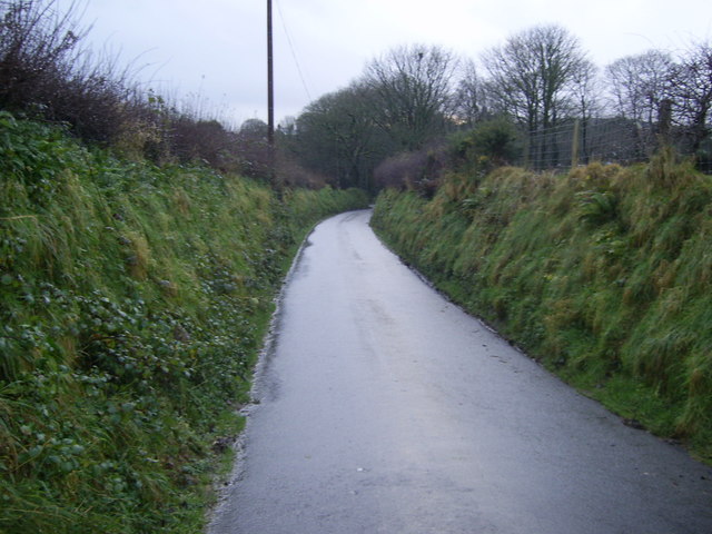
Cas-mael is a rural community characterized by its picturesque landscapes and natural beauty. It is surrounded by rolling hills, lush green fields, and stunning coastal cliffs. The area is known for its rich biodiversity and is a haven for nature enthusiasts and wildlife lovers.

The community is primarily agricultural, with farming being the main economic activity. The fertile land and favorable climate make it suitable for various types of farming, including dairy farming, sheep farming, and arable farming. The local farmers contribute significantly to the economy and maintain the traditional way of life in the area.

Cas-mael is also a popular tourist destination, attracting visitors with its scenic beauty and numerous outdoor recreational activities. The coastline offers opportunities for coastal walks, fishing, and water sports, while the nearby Preseli Hills provide excellent hiking and panoramic views.

In terms of amenities, Cas-mael has a few small shops and local businesses that cater to the needs of the community. However, for more extensive services and facilities, residents often travel to the nearby town of Fishguard.

Overall, Cas-mael is a charming and peaceful community that offers a rural lifestyle, stunning landscapes, and a close-knit community spirit.

If you have any feedback on the listing, please let us know in the comments section below.
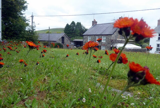
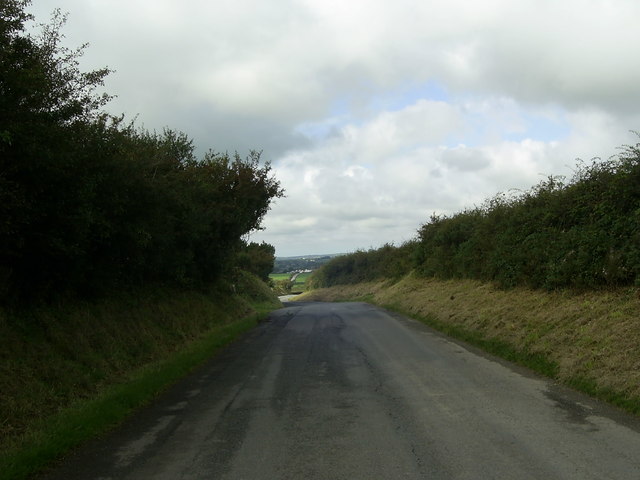
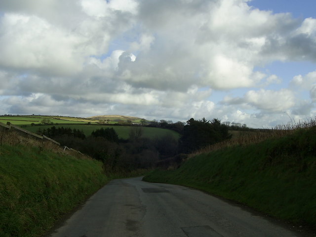
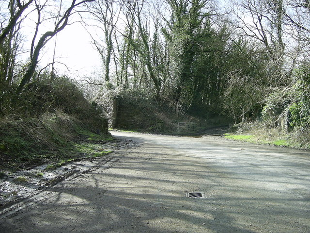
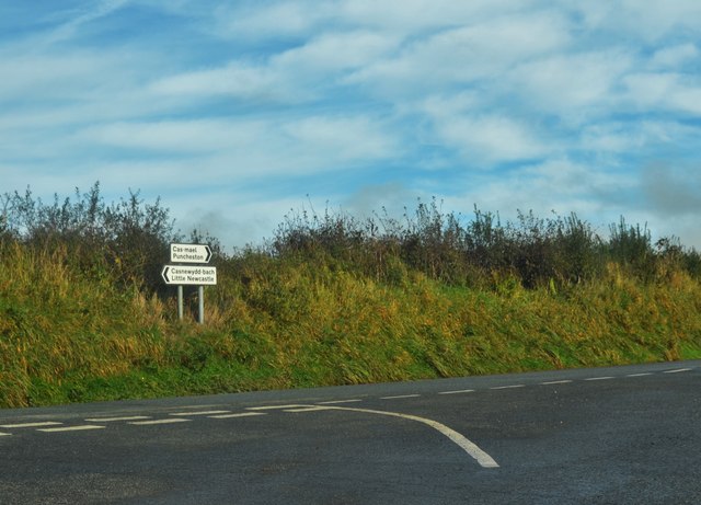
Cas-mael Images

Images are sourced within 2km of 51.927645/-4.923582 or Grid Reference SM9929. Thanks to Geograph Open Source API. All images are credited.

Fox-and-cubs in Casmael churchyard Pilosella aurantiaca, very often to be found growing in churchyards, cemeteries and other rough stony places with good drainage.
The name Fox-and-cubs refers to the way the open flowers and the buds are clustered together on the same stalk but it has a variety of other common names too.
Fox-and-cubs in Casmael churchyard
Pilosella aurantiaca, very often to be found growing in churchyards, cemeteries and other rough stony places with good drainage. The name Fox-and-cubs refers to the way the open flowers and the buds are clustered together on the same stalk but it has a variety of other common names too.
Road to Little Newcastle View of the country road from Puncheston heading for Little Newcastle near the entrance to Greenland.
Road to Little Newcastle
View of the country road from Puncheston heading for Little Newcastle near the entrance to Greenland.
Track to the fields, near Little Newcastle The view of a short track to three fields is taken from the road between Little Newcastle and Letterston.
Track to the fields, near Little Newcastle
The view of a short track to three fields is taken from the road between Little Newcastle and Letterston.
Bend in the road near Little Newcastle A bend in the road towards Glanrhyd, east of Little Newcastle.
Bend in the road near Little Newcastle
A bend in the road towards Glanrhyd, east of Little Newcastle.
Tree-lined country road Tree-lined country road to Rinaston by the entrance to New House Farm.
Tree-lined country road
Tree-lined country road to Rinaston by the entrance to New House Farm.
Former railway line and bridge near Puncheston Alongside the minor road south of Puncheston and the lane beyond the gates by the remains of the railway bridge, is the embankment lined by trees on either side of the former railway line east of Letterston which was part of the North Pembrokeshire and Fishguard railway.
A closer view of the disused railway bridge can be seen here <a href="https://www.geograph.org.uk/photo/472178">SM9928 : Dead railway bridge</a> , near Maesyafon.
Former railway line and bridge near Puncheston
Alongside the minor road south of Puncheston and the lane beyond the gates by the remains of the railway bridge, is the embankment lined by trees on either side of the former railway line east of Letterston which was part of the North Pembrokeshire and Fishguard railway. A closer view of the disused railway bridge can be seen here SM9928 : Dead railway bridge , near Maesyafon.
Former Garage, Little Newcastle View of the disused garage, old fuel pump and oil drum at Little Newcastle from the road heading for Puncheston.
Former Garage, Little Newcastle
View of the disused garage, old fuel pump and oil drum at Little Newcastle from the road heading for Puncheston.
Nondescript Lane Junction But necessary for a geograph point!
Nondescript Lane Junction
But necessary for a geograph point!
Ordnance Survey Cut Mark This OS cut mark can be found on the SE face of St Mary's Church. It marks a point 156.954m above mean sea level.
Ordnance Survey Cut Mark
This OS cut mark can be found on the SE face of St Mary's Church. It marks a point 156.954m above mean sea level.
The Drovers Arms Public house in Puncheston.
The Drovers Arms
Public house in Puncheston.
Road junction near Puncheston The tree-lined road junction east of Puncheston is just within the grid square.
Road junction near Puncheston
The tree-lined road junction east of Puncheston is just within the grid square.
Minor road heading for Puncheston This short stretch of road near Puncheston is within the grid square.
Minor road heading for Puncheston
This short stretch of road near Puncheston is within the grid square.
Cas-Mael / Puncheston Cerddwyr yn cyrraedd pentre Cas-Mael.

Walkers arriving at the village of Puncheston.
Cas-Mael / Puncheston
Cerddwyr yn cyrraedd pentre Cas-Mael. Walkers arriving at the village of Puncheston.
Rhyd Afon Anghof Ford Trac yn rhydio Afon Anghof yng Nghas-Mael.

A track fording the Afon Anghof River in Puncheston.
Rhyd Afon Anghof Ford
Trac yn rhydio Afon Anghof yng Nghas-Mael. A track fording the Afon Anghof River in Puncheston.
Lane From Spittal To Puncheston and Little Newcastle
Lane From Spittal
To Puncheston and Little Newcastle
Y Bont (The Bridge) Small bridge approaching Martel Bridge which was part of the railway infrastructure, now gone
Y Bont (The Bridge)
Small bridge approaching Martel Bridge which was part of the railway infrastructure, now gone
Lane To Puncheston Mynydd Morvil shrouded in mist
Lane To Puncheston
Mynydd Morvil shrouded in mist
Glanrhyd On the road to Little Newcastle
Glanrhyd
On the road to Little Newcastle
Show me another place!

Cas-mael is located at Grid Ref: SM9929 (Lat: 51.927645, Lng: -4.923582)

Unitary Authority: Pembrokeshire

Police Authority: Dyfed-Powys

Also known as: Puncheston

What 3 Words

///alpha.plea.stealthier. Near Ambleston, Pembrokeshire

Nearby Locations

Cas-mael Puncheston

Related Wikis

Martell Bridge Halt railway station

Martell Bridge Halt railway station served the village of Little Newcastle, Pembrokeshire, Wales, from 1930 to 1937 on the North Pembrokeshire and Fishguard...

Casnewydd Bach

Casnewydd Bach (English: Little Newcastle) is a village, parish and former civil parish in the community of Puncheston in Pembrokeshire, Wales. A map of...

Colston, Pembrokeshire

Colston is a hamlet in the community of Puncheston in Pembrokeshire, Wales. The hamlet is the site of a Neolithic chambered tomb, known as The Altar....

Beulah Halt railway station

Beulah Halt railway station served the village of Little Newcastle, Pembrokeshire, Wales, from 1928 to 1937 on the North Pembrokeshire and Fishguard Railway...

Nearby Amenities

Located within 500m of 51.927645,-4.923582
Direction: 145
Generator Method: photovoltaic
Generator Output Electricity: yes
Generator Solar Modules: 8
Generator Source: solar
Generator Type: solar_photovoltaic_panel
Location: roof
Power: generator
Lat/Long: 51.9234141/-4.9258608
The data included in this document is from www.openstreetmap.org. The data is made available under ODbL.

Have you been to Cas-mael?

Leave your review of Cas-mael below (or comments, questions and feedback).