Bridgehill

Settlement in Durham

England

Bridgehill

The Lone Tree at Harvest Time The old cow byre can just be seen above the lone tree.

Photograph was taken facing due west towards A68
The Lone Tree at Harvest Time Credit: Dennis Lovett

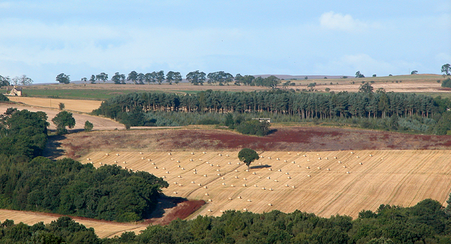
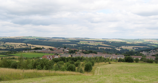
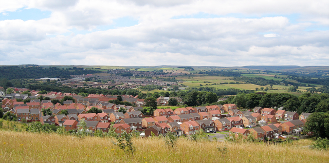
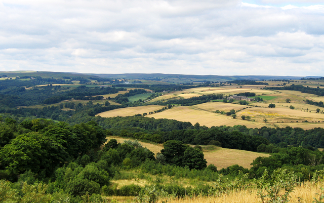
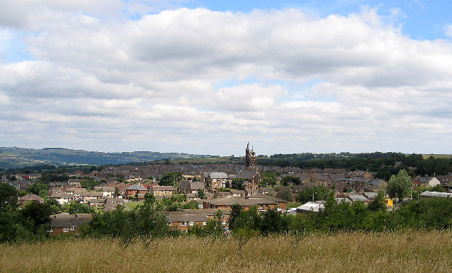
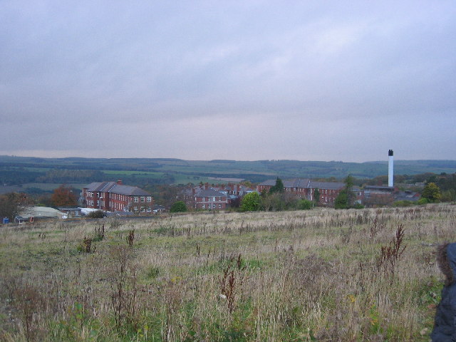
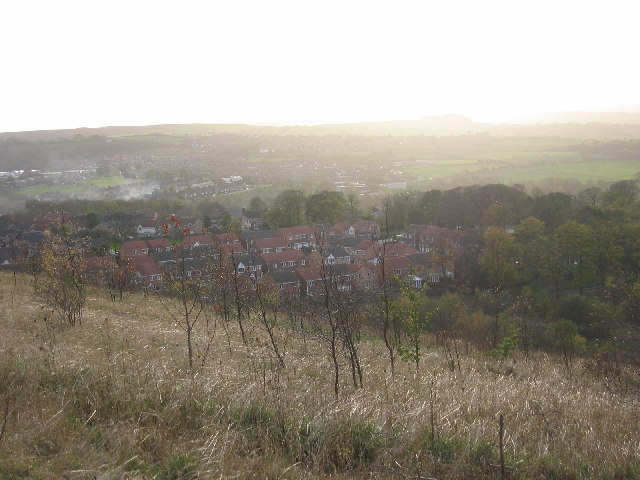
Bridgehill is a small village located in the county of Durham, in the northeast of England. Situated about 5 miles northwest of the city of Durham, it falls within the civil parish of Langley Park. The village is nestled in a picturesque setting, surrounded by rolling countryside and green pastures.

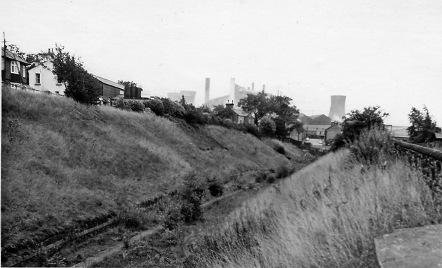
Historically, Bridgehill was a mining village, with coal mining being the main industry in the area. However, with the decline of the coal industry in the late 20th century, the village has seen a shift towards a more residential character. Today, it is predominantly a residential area with a close-knit community.

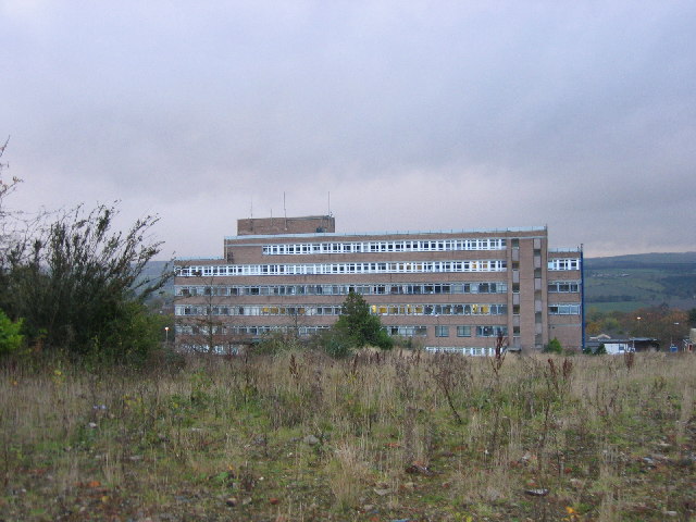
The village offers a range of amenities to its residents, including a primary school, a local convenience store, and a post office. There are also several pubs and restaurants nearby, providing options for dining and socializing.

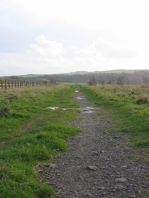
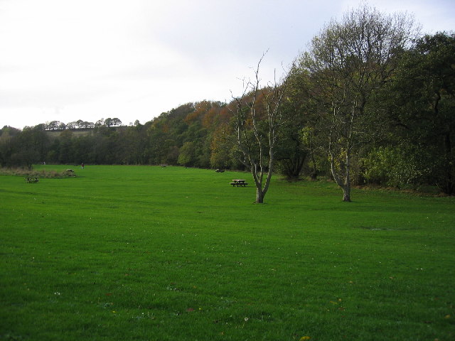
For outdoor enthusiasts, Bridgehill offers easy access to beautiful countryside and scenic walking routes. The nearby Beamish Museum, an open-air museum showcasing the region's industrial heritage, is also a popular attraction for both locals and tourists.

Transportation links in Bridgehill are convenient, with regular bus services connecting the village to Durham and other nearby towns. The A691 road, which passes through the village, provides easy access to the wider region.

Overall, Bridgehill is a charming village with a rich mining history, a tight-knit community, and a tranquil countryside setting, making it an attractive place to live for those seeking a peaceful and picturesque lifestyle in Durham.

If you have any feedback on the listing, please let us know in the comments section below.

Bridgehill Images

Images are sourced within 2km of 54.859752/-1.8648303 or Grid Reference NZ0851. Thanks to Geograph Open Source API. All images are credited.

The Lone Tree at Harvest Time The old cow byre can just be seen above the lone tree.

Photograph was taken facing due west towards A68
The Lone Tree at Harvest Time
The old cow byre can just be seen above the lone tree. Photograph was taken facing due west towards A68
Bridge at Shotley Bridge Looking downstream on River Derwent.  Northumberland to left and County Durham to right
Bridge at Shotley Bridge
Looking downstream on River Derwent. Northumberland to left and County Durham to right
Bridgehill High Ground to left is Grey Mare Hill
Bridgehill
High Ground to left is Grey Mare Hill
Three Groups of Housing Foreground is The Grove, then Moorside and next Castleside which is on the A68. Photograph was taken on the site of the former steel works, which is now landscaped.
Three Groups of Housing
Foreground is The Grove, then Moorside and next Castleside which is on the A68. Photograph was taken on the site of the former steel works, which is now landscaped.
Derwent Valley ( Northumberland/Durham) The Hamlet of Mosswood is beside the visible road (A68). To the right is Derwent Manor hotel.  The River Derwent flows from the left through the valley hidden by the horizontal band of trees.
Derwent Valley ( Northumberland/Durham)
The Hamlet of Mosswood is beside the visible road (A68). To the right is Derwent Manor hotel. The River Derwent flows from the left through the valley hidden by the horizontal band of trees.
Blackhill near Consett
Consett/Blackhill Park
Shotley Bridge
Shotley Bridge
Shotley Bridge Hospital View of the old hospital buildings no longer in use today, the current and new hospital buildings out of shot to the left.
Shotley Bridge Hospital
View of the old hospital buildings no longer in use today, the current and new hospital buildings out of shot to the left.
Shotley Bridge Hospital View of the current main hospital building in use today, the old hospital buildings out of shot to the right.
Shotley Bridge Hospital
View of the current main hospital building in use today, the old hospital buildings out of shot to the right.
Blackhill Main Street View down Blackhill towards Bridgehill showing local shops either side.
Blackhill Main Street
View down Blackhill towards Bridgehill showing local shops either side.
Blackhill Cemetery South One of three disused and crumbling churches all located together.  Other two churches to the right and behind.
Blackhill Cemetery South
One of three disused and crumbling churches all located together. Other two churches to the right and behind.
Blackhill Cemetery View down one aisle in main cemetery area.
Blackhill Cemetery
View down one aisle in main cemetery area.
Disused Workings Path Path running alongside main disused workings area now just fields at top of main bank.
Disused Workings Path
Path running alongside main disused workings area now just fields at top of main bank.
The Grove View of the new estate from the top of the disused workings bank.
The Grove
View of the new estate from the top of the disused workings bank.
Derwent River at Allensford View of the derwent river at allensford running alongside the main picnic area and past allensford park.
Derwent River at Allensford
View of the derwent river at allensford running alongside the main picnic area and past allensford park.
Allensford Picnic Area View along the main picnic area, the trees following along derwent river.
Allensford Picnic Area
View along the main picnic area, the trees following along derwent river.
Shotley Hall Gatehouse View of the old gatehouse to shotley hall, now private dwellings.
Shotley Hall Gatehouse
View of the old gatehouse to shotley hall, now private dwellings.
Show me another place!

Bridgehill is located at Grid Ref: NZ0851 (Lat: 54.859752, Lng: -1.8648303)

Unitary Authority: County Durham

Police Authority: Durham

What 3 Words

///runner.reader.polite. Near Consett, Co. Durham

Related Wikis

Bridgehill

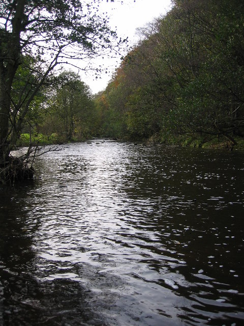
Bridgehill is an area of Consett in County Durham, England. It is situated near Benfieldside, Blackhill, Shotley Grove, and the River Derwent. == References... ==

Shotley Grove

Shotley Grove is a small settlement on the river Derwent, about 1 mile upstream of Shotley Bridge in County Durham, England. Today Shotley Grove is a pleasant...

Shotley Hall

Shotley Hall is a Grade II* listed historic mansion in Shotley Low Quarter, Northumberland, England. It was designed in the Gothic Revival architectural...

Benfieldside

Benfieldside is a parish in County Durham, in England. Although not a village in its own right (ecclesiastically it incorporates Shotley Bridge, Bridgehill...

Shotley Bridge

Shotley Bridge is a village, adjoining the town of Consett to the south in County Durham, England, 15 miles North West of Durham City. It is located on...

Blackhill railway station

Blackhill railway station served the village of Blackhill, County Durham, England from 1867 to 1955 on the Derwent Valley Line. == History == The station...

Consett Power Station

Consett Power Station refers to numerous, now demolished coal-fired power stations situated on various sites around Consett in County Durham, North East...

The Grove, County Durham

The Grove is a village in County Durham, in England. It is situated to the south of Consett. The Grove is a post-World War II housing estate. Originally...

Related Videos

Allensford near Consett

Great place to visit good food from the cafe, nice walks by the river and through the woods. We loved out two days there over the ...

Secret Italian Ice-cream 🍦 Garage!

Subscribe Like Comment Tonight I Visited Londis 24 Hour Garage Located In Blackburn Lancashire. Inside Thier Is A Hidden ...

Allensford Park

Allensford Park a great overnight stop, lovely walks, great cafe.

Nearby Amenities

Located within 500m of 54.859752,-1.8648303
Waterway: weir
Lat/Long: 54.8594339/-1.868848
Barrier: stile
Foot: yes
Lat/Long: 54.8621049/-1.8694858
Bus Stop
Chaytor Road (Bottom)
Bus: yes
Departures Board: timetable
Naptan AtcoCode: 13001682B
Naptan Bearing: NE
Naptan CommonName: Chaytor Road (Bottom)
Naptan Indicator: north east bound
Naptan Landmark: Outside No 24 Pleasant View
Naptan NaptanCode: duragwpt
Naptan Street: Pleasant View
Naptan Verified: no
Public Transport: platform
Source: naptan_import
Lat/Long: 54.8631434/-1.8618861
Bus Stop
Chaytor Road - Bottom
Bench: yes
Bus: yes
Departures Board: timetable
Naptan AtcoCode: 13001682D
Naptan Bearing: SE
Naptan CommonName: Chaytor Road (Bottom)
Naptan Indicator: south east bound
Naptan Landmark: adjacent to No 90 The Crescent
Naptan NaptanCode: duragwpw
Naptan Street: Chaytor Road
Naptan Verified: no
Public Transport: platform
Shelter: yes
Source: naptan_import
Lat/Long: 54.86273/-1.8618719
Bus Stop
Chaytor Road (Middle)
Bus: yes
Naptan AtcoCode: 13001685D
Naptan Bearing: SE
Naptan CommonName: Chaytor Road (Middle)
Naptan Indicator: south east bound
Naptan Landmark: outside no 38
Naptan NaptanCode: duragwtj
Naptan Street: Chaytor Road
Naptan Verified: no
Public Transport: platform
Shelter: yes
Source: naptan_import
Lat/Long: 54.8605694/-1.8585922
Bus Stop
Chaytor Road (Middle)
Bus: yes
Departures Board: timetable
Naptan AtcoCode: 13001685H
Naptan Bearing: NW
Naptan CommonName: Chaytor Road (Middle)
Naptan Indicator: north west bound
Naptan Landmark: opposite No 44
Naptan NaptanCode: duragwtm
Naptan Street: Chaytor Road
Naptan Verified: no
Public Transport: platform
Source: naptan_import
Lat/Long: 54.8606867/-1.8590124
Bus Stop
Pleasant View
Bus: yes
Departures Board: timetable
Naptan AtcoCode: 13001748G
Naptan Bearing: W
Naptan CommonName: Pleasant View
Naptan Indicator: west bound
Naptan Landmark: opposite junction with Valley View
Naptan NaptanCode: durajgdt
Naptan Street: Pleasant View
Naptan Verified: no
Public Transport: platform
Shelter: no
Source: naptan_import
Lat/Long: 54.8633573/-1.8603274
Post Box
Lat/Long: 54.8581527/-1.8588603
Bench
Lat/Long: 54.8567796/-1.867893
Barrier: bollard
Lat/Long: 54.8603221/-1.8618911
Addr City: Consett
Addr Housenumber: 79
Addr Postcode: DH8 8QP
Lat/Long: 54.86165/-1.8609334
Camera Mount: pole
Camera Type: panning
Man Made: surveillance
Surveillance Type: camera
Lat/Long: 54.8630254/-1.8624441
Generator Method: photovoltaic
Generator Source: solar
Generator Type: solar_photovoltaic_panel
Location: roof
Power: generator
Lat/Long: 54.8619577/-1.8615161
Generator Method: photovoltaic
Generator Source: solar
Generator Type: solar_photovoltaic_panel
Location: roof
Power: generator
Lat/Long: 54.8598203/-1.8612143
Generator Method: photovoltaic
Generator Source: solar
Generator Type: solar_photovoltaic_panel
Location: roof
Power: generator
Lat/Long: 54.8594328/-1.8622363
Generator Method: photovoltaic
Generator Source: solar
Generator Type: solar_photovoltaic_panel
Location: roof
Power: generator
Lat/Long: 54.8593301/-1.8620123
Generator Method: photovoltaic
Generator Source: solar
Generator Type: solar_photovoltaic_panel
Location: roof
Power: generator
Lat/Long: 54.8592977/-1.8619345
Generator Method: photovoltaic
Generator Source: solar
Generator Type: solar_photovoltaic_panel
Location: roof
Power: generator
Lat/Long: 54.8585968/-1.8584999
Generator Method: photovoltaic
Generator Source: solar
Generator Type: solar_photovoltaic_panel
Location: roof
Power: generator
Lat/Long: 54.8586663/-1.8586032
Generator Method: photovoltaic
Generator Source: solar
Generator Type: solar_photovoltaic_panel
Location: roof
Power: generator
Lat/Long: 54.8587906/-1.8588366
Generator Method: photovoltaic
Generator Source: solar
Generator Type: solar_photovoltaic_panel
Location: roof
Power: generator
Lat/Long: 54.8590885/-1.8596292
Generator Method: photovoltaic
Generator Source: solar
Generator Type: solar_photovoltaic_panel
Location: roof
Power: generator
Lat/Long: 54.8590434/-1.8595299
Generator Method: photovoltaic
Generator Source: solar
Generator Type: solar_photovoltaic_panel
Location: roof
Power: generator
Lat/Long: 54.8588959/-1.8591712
Generator Method: photovoltaic
Generator Source: solar
Generator Type: solar_photovoltaic_panel
Location: roof
Power: generator
Lat/Long: 54.8623583/-1.8588124
Generator Method: photovoltaic
Generator Source: solar
Generator Type: solar_photovoltaic_panel
Location: roof
Power: generator
Lat/Long: 54.8626894/-1.8632917
Generator Method: photovoltaic
Generator Source: solar
Generator Type: solar_photovoltaic_panel
Location: roof
Power: generator
Lat/Long: 54.862677/-1.8626399
Generator Method: photovoltaic
Generator Source: solar
Generator Type: solar_photovoltaic_panel
Location: roof
Power: generator
Lat/Long: 54.8617215/-1.8639475
Generator Method: photovoltaic
Generator Source: solar
Generator Type: solar_photovoltaic_panel
Location: roof
Power: generator
Lat/Long: 54.8610283/-1.8628746
Generator Method: photovoltaic
Generator Source: solar
Generator Type: solar_photovoltaic_panel
Location: roof
Power: generator
Lat/Long: 54.8613294/-1.8625702
Generator Method: photovoltaic
Generator Source: solar
Generator Type: solar_photovoltaic_panel
Location: roof
Power: generator
Lat/Long: 54.8615065/-1.8629041
Generator Method: photovoltaic
Generator Source: solar
Generator Type: solar_photovoltaic_panel
Location: roof
Power: generator
Lat/Long: 54.8601719/-1.8583813
Generator Method: photovoltaic
Generator Source: solar
Generator Type: solar_photovoltaic_panel
Location: roof
Power: generator
Lat/Long: 54.8604996/-1.8571387
Generator Method: photovoltaic
Generator Source: solar
Generator Type: solar_photovoltaic_panel
Location: roof
Power: generator
Lat/Long: 54.8603888/-1.8641393
Addr Housenumber: 43
Lat/Long: 54.8604527/-1.8590306
Post Box
Brand: Royal Mail
Brand Wikidata: Q638098
Drive Through: no
Operator: Royal Mail
Operator Wikidata: Q638098
Post Box Type: lamp
Royal Cypher: EIIR
Royal Cypher Wikidata: Q33102113
Lat/Long: 54.861068/-1.8597232
Traffic Calming: cushion
Lat/Long: 54.8626061/-1.8617782
Bridgehill
Place: suburb
Wikidata: Q4966513
Lat/Long: 54.8609187/-1.8594468
Bridgehill Mini Market And Off Licence
Shop: convenience
Lat/Long: 54.8628366/-1.8622786
Addr Housenumber: 41
Lat/Long: 54.8604186/-1.8587372
The data included in this document is from www.openstreetmap.org. The data is made available under ODbL.

Have you been to Bridgehill?

Leave your review of Bridgehill below (or comments, questions and feedback).